 Block
Pontiac, Illinois
15 topographic sheets cover this place, the earliest surveyed in 1935 and the latest in 1998. It stands in Pontiac Township. It lies in ZIP code area 61764. It stands on Turtle Creek. The Survey maps it on the Northwest Pontiac quadrangle. 11,150 people lived here at the 2020 count. It stands 663 feet above sea level.
Research this city
On record in Pontiac
Buildings and businesses the archive holds for this place. Each opens its own page, with the source record it came from.
On the National Register 7 records
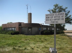 Illinois State Police Office, Pontiaclisted 2007
 Jones Houselisted 1978
 Livingston County Courthouselisted 1986
 Pontiac City Hall and Fire Stationlisted 1990
 Raymond Schultz Round Barnlisted 1982
- Route 66, Cayuga to Chenoalisted 2003
- Strevell Houselisted 2023
Population over time
2 figuresPontiac fell from 11,931 to 11,150 between 2010 and 2020. These are the recorded population figures Wikidata holds for this place, reached through the Geographic Names Information System number this page is keyed on rather than by name, so they belong to this place and not to another of the same name. Most are census counts, but not all are: an early figure may be a founding or settlement estimate, and an estimate published within five years of a census is left out. The change column is computed, and is left blank where more than 20 years separate a figure from the one before it, because a gap that long is not a change between two counts.
| Year | People | Change |
|---|---|---|
| 2010 | 11,931 | |
| 2020 | 11,150 | -781 (-7%) |
Topographic sheets covering this place
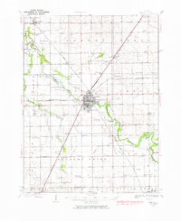
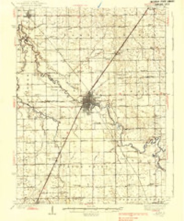
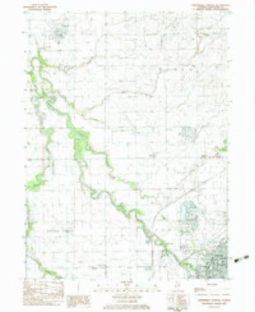
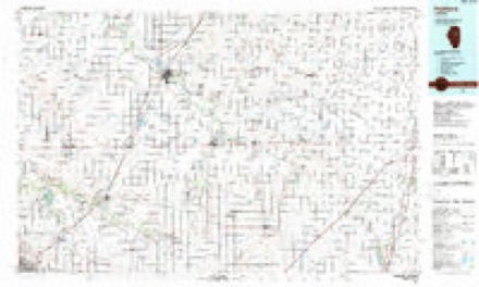
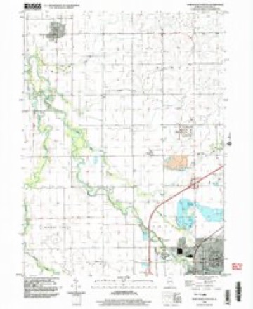
9 surveys from 15 printed sheetsMatched by testing this settlement's coordinate against the published boundary of every sheet in the United States Geological Survey's historical collection. Each opens the scanned sheet at the Survey.
- 1935 USGS Pontiac quadrangle1:62500, 2 printings
- 1939 USGS Pontiac quadrangle1:62500, 2 printings
- 1958 USGS Peoria quadrangle1:250000, 4 printings
- 1961 USGS Peoria quadrangle1:250000
- 1963 USGS Peoria quadrangle1:250000
- 1983 USGS Northwest Pontiac quadrangle1:24000
- 1985 USGS Fairbury quadrangle1:100000, 2 printings
- 1990 USGS Peoria quadrangle1:250000
- 1998 USGS Northwest Pontiac quadrangle1:24000




In the county-history sources
10,896 words on this townshipThe History of Livingston County, Illinois : Containing a History of the County, Its Cities, Towns, &c. .., published 1878 names this settlement in its chapter on Pontiac Township. These are the passages that mention it, exactly as the scans read.
The village of Pontiac was incorporated under the general law of the State, February 12,^ 1856, by the election of a Board of Trustees, consisting of Nelson Buck, J. W. Strevelle, S. C. Ladd, Z. H. Nettleton and H. Jones - the first named being chosen Chairman or President.
Passage source: The History of Livingston County, Illinois : Containing a History of the County, Its Cities, Towns, &c. .., published 1878.
At last, in 1865, an attempt was made, by way of legislation, to set the question at rest by obtaining a special charter, which prohibited, not only the sale of liquors, but restrained the Trustees from granting any authority Avhatever to saloon keepers to vend such article. The charter, however, was satisfactory to its friends only in so far as they were enabled to elect Trusetes who would enforce its provisions in accordance Avith their views of its merits ; and the temperance question was not fully settled.
Passage source: The History of Livingston County, Illinois : Containing a History of the County, Its Cities, Towns, &c. .., published 1878.
In 1870, the people of the State, at a general election, adopted a new Constitution, in which was a clause prohibiting " class legislation ; " and under this Constitution, the Legislature passed a general law in regard to the government of cities and towns, in the Winter of 1870-71.
Passage source: The History of Livingston County, Illinois : Containing a History of the County, Its Cities, Towns, &c. .., published 1878.
Machine-read from a century-old scan, so expect the errors a machine makes: misspelled names, dropped words, stray characters.
Read the whole chapter on Pontiac Township - it names this place 44 more 44 times.
Fires near this place
1 since 2010Regional context, not property-specific evidence. The federal wildfire occurrence database lists 1 fire within 5 miles of Pontiac in 2010, burning about 35 acres in total. None started naturally. None was recorded as arson. Distance is straight-line from the map coordinates, so a fire counted here may appear on a neighbouring settlement's page as well.
| Reported cause | Fires |
|---|---|
| Missing data/not specified/undetermined | 1 |
The most recent of them, most recent first, with the day each was reported and the service that recorded it.
| Date | Cause | Size | Reported by | Name on the report |
|---|---|---|---|---|
| 13 September 2010 | Missing data/not specified/undetermined | 35 acres | Illinois Division of Forestry Resources | PONTIAC |
Settlements close enough to share some of these fires:
Mines and quarries near this place
3 within 5 milesRegional context, not property-specific evidence. The federal mineral resources record lists 3 workings within 5 miles of Pontiac: 2 past producers, 1 producer. 1 still produces. What was taken out: Stone, Crushed/Broken, Stone. Distance is straight-line from the map coordinates, so a quarry counted here may appear on a neighbouring settlement's page as well.
| Where | Site | Commodity | Status | Recorded |
|---|---|---|---|---|
| Livingston Hwy. Pit | Stone | Past Producer | ||
| Pontiac Portable Plant | Stone, Crushed/Broken | Producer | ||
| Raube Quarry | Stone, Crushed/Broken | Past Producer |
Storms near this place
60 of 62 shownRegional context, not property-specific evidence. The National Weather Service names Pontiac in 62 storm reports between 1996 and 2025: 36 thunderstorm wind, 12 hail, 5 flash flood, 3 tornado. The reports record 1 injury. Each account below is quoted exactly as the forecast office filed it, from the NOAA Storm Events Database, and each date opens the federal record of that event.
| When | Event | Place named | Harm | What the report says |
|---|---|---|---|---|
| May 2006 | Thunderstorm Wind | Pontiac | 1 hurt, $25,000 | A semi tractor trailer was blown over on Interstate 55 near Route 116. The driver needed to be cut out of the truck and was taken to the hospital. |
| June 2010 | Thunderstorm Wind | Pontiac | $10,000 | Wind gusts were estimated as high as 80 mph. Multiple tree limbs and power lines were blown down. One tree limb fell onto a house on Timber Street causing damage to the roof. |
| August 2008 | Thunderstorm Wind | Pontiac | $3,000 | Several tree limbs and power lines were blown down. |
| May 2013 | Thunderstorm Wind | Pontiac | $1,000 | Several large trees and power lines were blown down. |
| June 2011 | Thunderstorm Wind | Pontiac | $1,000 | Tree limbs and power lines were blown down. |
| May 2006 | Thunderstorm Wind | Pontiac | $1,000 | A building and trees were damaged. |
| August 2014 | Lightning | Pontiac | $500 | Lightning struck a utility pole which caught fire. |
| July 2025 | Funnel Cloud | Pontiac | - | A funnel cloud was reported halfway to the ground. |
| December 2025 | Thunderstorm Wind | Pontiac | - | A large tree limb was blown down onto North Mill Street. |
| December 2025 | Tornado (EF1) | Pontiac | - | A tornado with peak winds of 90 mph touched down just south of 4H Park Road on the northwest side of Pontiac and immediately moved northeast across the Motorola and Vermillion Estates Subdivisions. The tornado caused roofing and siding damage to a number of houses, apartments and manufactured homes. Two houses had large portions of roofing blown off, leave the attics exposed. The tornado crossed Route 23 and produced additional siding and fascia damage to a few manufactured homes in the Redwood mobile home park before ending north of E 1830 North Road. The tornado also damaged several trees along its path. |
| June 2024 | Thunderstorm Wind | Pontiac | - | A 911 dispatch center reported power lines down, damage to trees, and a downed street lamp in Pontiac. |
| August 2022 | Thunderstorm Wind | Pontiac | - | A tree was snapped. |
| August 2022 | Thunderstorm Wind | Pontiac | - | A utility pole and power lines were blown down blocking roads. |
| July 2022 | Thunderstorm Wind | Pontiac | - | Trees, tree limbs and power lines were blown down in Pontiac. Some trees were uprooted, including 8 trees in Chatauqua Park. At least one car was damaged by a falling tree limb. Several trees were blown down along East Indiana Avenue. |
| September 2022 | Thunderstorm Wind | Pontiac | - | A large pine tree was blown down. |
| June 2021 | Thunderstorm Wind | Pontiac | - | Roofing panels were blown off a lumber company building. |
| May 2020 | Thunderstorm Wind | Pontiac | - | Trees and power lines were blown down in and around the Pontiac area. |
| July 2020 | Thunderstorm Wind | Pontiac | - | Multiple reports of trees blown down in Pontiac were received. |
| July 2020 | Thunderstorm Wind | Pontiac | - | A large tree was blown down which knocked down power lines. |
| June 2019 | Thunderstorm Wind | Pontiac | - | Numerous power lines were blown down throughout Pontiac. |
| July 2019 | Thunderstorm Wind | Pontiac | - | One large tree and several large tree limbs were blown down. |
| September 2019 | Flood | Pontiac | - | A few roadways were barricaded due to standing water in Pontiac. |
| May 2018 | Thunderstorm Wind | Pontiac | - | A few tree limbs were blown down, one on a car. |
| March 2017 | Hail | Pontiac | - | Three reports of nickel to quarter size hail came in from Pontiac. |
| August 2016 | Flood | Pontiac | - | Heavy rain caused road closures at Moulton and Court St in Pontiac, IL. |
| June 2015 | Flash Flood | Pontiac | - | Two to three feet of water was flowing down Division street near Lowell Avenue. |
| August 2014 | Thunderstorm Wind | Pontiac | - | A tree was blown down on Route 116. |
| May 2013 | Thunderstorm Wind | Pontiac | - | Trees were reported snapped. |
| May 2011 | Hail | Pontiac | - | Nickel to quarter size hail was reported in Pontiac. |
| June 2011 | Thunderstorm Wind | Pontiac | - | A wind gust to 71 mph was measured in Pontiac. Several tree limbs were blown down, some onto power lines. |
| June 2010 | Thunderstorm Wind | Pontiac | - | A barn was blown off of its foundation. |
| June 2010 | Thunderstorm Wind | Pontiac | - | A 10 inch diameter tree limb fell on a roof of a house. Wind gusted to 65 mph. |
| August 2009 | Heavy Rain | Pontiac | - | Rainfall of 3.00 inches was reported in the past 12 hours. |
| July 2007 | Flash Flood | Pontiac | - | Water flowing across Route 116. |
| July 2007 | Flash Flood | Pontiac | - | Water covering roadways. Pontiac measured 4.35 inches of rain. |
| July 2007 | Flash Flood | Pontiac | - | Water covering roadways. |
| March 2007 | Flood | Pontiac | - | Roads closed countywide due to high water. Chatsworth measured 3.12 inches of rainfall and Fairbury measured 2.36 inches of rainfall. |
| May 2006 | Thunderstorm Wind | Pontiac | - | A gust to 59 mph was measured at the Pontiac Airport. |
| October 2006 | Thunderstorm Wind | Pontiac | - | Trees and power lines were blown down. |
| May 2004 | Thunderstorm Wind | Pontiac | - | Trees were uprooted. |
| May 2004 | Tornado (F2) | Pontiac | - | A tornado moved into Livingston County from McLean County, 1.7 miles northwest of Chenoa. A farm house was unroofed and a double-wide mobile home, outbuildings and grain bins were destroyed. The tornado ended 8 miles southwest of Pontiac or 2.5 miles southwest of Ocoya. At its strongest point, the tornado was 240 yards wide, with wind speeds between 130 and 140 mph. For additional information on this tornado, see Storm Data for ILLINOIS, Central. |
| May 2004 | Thunderstorm Wind | Pontiac | - | Trees were blown down on Route 116 east of Lafayette Street, and trees were down in various location in Pontiac. |
| May 2004 | Tornado (F1) | Pontiac | - | This event was a series of short tornado segments south of Pontiac. It began 8 miles southwest of Pontiac near County Roads 1400 North and 900 East. A barn roof was torn off and a large tree was snapped near 1000 East. Trees and limbs were blown down and farm outbuildings were damaged along County Road 1400 North. The damage ended at Pike Creek about one half mile west of 1200 East, where doors of a shed were blown out. Additional damage began just east of Interstate 55, north of County Road 1400 North. Trees and limbs were down at County Road 1325 East and near a nursing home on Old Route 66. Damage occurred again near County Road 1700 East, north of County Road 1400 North, where a house had roof damage and trees were blown down. Tree limbs were damaged on County Roads 1775 East and 1800 East. The most intense damage was on Billet Rd., about 1/2 mile north of County Road 1400 North, near the Vermillion River. About 1 dozen large trees were snapped in this area. The damage path was up to 50 yards wide at this point and the tornado was rated F1. The damage ended near County Roads 2000 East and 1500 North, where an old barn was blown down. This is 5 miles southeast of Pontiac. The total path was 12 miles. |
| September 2003 | Hail | Pontiac | - | Quarter size hail covered the ground. |
| June 1999 | Thunderstorm Wind | Pontiac | - | Trees were blown down. |
| May 2020 | Hail | Pontiac | - | no account filed |
| April 2017 | Hail | Pontiac | - | no account filed |
| June 2016 | Thunderstorm Wind | Pontiac | - | no account filed |
| August 2014 | Hail | Pontiac | - | no account filed |
| June 2013 | Thunderstorm Wind | Pontiac | - | no account filed |
| August 2012 | Hail | Pontiac | - | no account filed |
| May 2011 | Thunderstorm Wind | Pontiac | - | no account filed |
| August 2009 | Thunderstorm Wind | Pontiac | - | no account filed |
| July 2009 | Thunderstorm Wind | Pontiac | - | no account filed |
| June 2006 | Hail | Pontiac | - | no account filed |
| May 2003 | Hail | Pontiac | - | no account filed |
| May 2003 | Hail | Pontiac | - | no account filed |
| June 2001 | Flash Flood | Pontiac | - | no account filed |
| October 2001 | Thunderstorm Wind | Pontiac | - | no account filed |
| September 2000 | Hail | Pontiac | - | no account filed |
Nearest settlements
The eight closest, with where each one stands in the county. Distances are straight-line, computed from the Geographic Names Information System coordinates.
Elsewhere
Matched on this settlement's Geographic Names Information System number rather than its name, so it cannot be a different place of the same name in another state.
| Wikipedia article on Pontiac | An encyclopaedic summary. Its text is share-alike, so it is linked here rather than copied. |
| Wikidata item Q574912 | The structured record the population and elevation above come from. Public domain (CC0). |
Provenance
This settlement is recorded in the Geographic Names Information System as feature 416008. The sheet list is computed by point-in-boundary test against the United States Geological Survey's historical topographic inventory. Both are works of the United States government and carry no copyright under 17 U.S.C. 105.
Wildfire. Short, Karen C. 2022. Spatial wildfire occurrence data for the United States, 1992-2020 [FPA_FOD_20221014]. 6th Edition. Fort Collins, CO: Forest Service Research Data Archive. https://doi.org/10.2737/RDS-2013-0009.6 Collected with United States Government funding and usable without additional permissions or fees.
Mines and quarries. USGS Mineral Resources Data System (MRDS) https://mrdata.usgs.gov/mrds/ A work of the United States government, no copyright under 17 U.S.C. 105.
Storms. NOAA National Centers for Environmental Information, Storm Events Database https://www.ncei.noaa.gov/stormevents/ A work of the United States government, no copyright under 17 U.S.C. 105. Narratives are quoted verbatim from the National Weather Service report and are not edited or summarised.