 Block
Quincy, Illinois
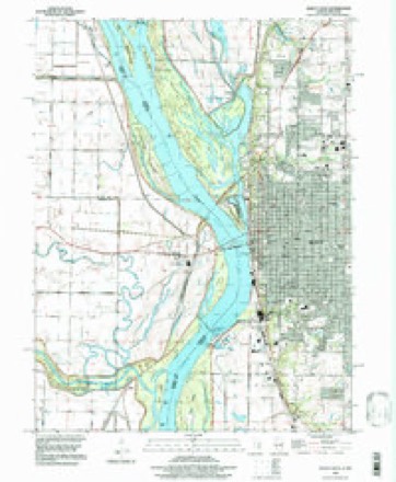
18 topographic sheets cover this place, the earliest surveyed in 1925 and the latest in 1996. It stands in Quincy Township. It lies in ZIP code area 62301. It lies near Alstynes Prairie. The Survey maps it on the Quincy West quadrangle. 39,463 people lived here at the 2020 count. It stands 568 feet above sea level.
Research this city
On record in Quincy
Buildings and businesses the archive holds for this place. Each opens its own page, with the source record it came from.
On the National Register 12 of 20 shown
 Coca-Cola Bottling Company Buildinglisted 1997
 Downtown Quincy Historic Districtlisted 1983
 Robert W. Gardner Houselisted 1979
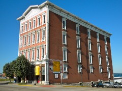 S.J. Lesem Buildinglisted 1999
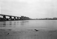 Lock and Dam No. 21 Historic Districtlisted 2004
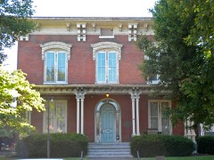 Morgan-Wells Houselisted 1977
 Richard F. Newcomb Houselisted 1982
 One Thirty North Eighth Buildinglisted 1984
 Quincy East End Historic Districtlisted 1985
 Quincy National Cemeterylisted 2011
 Quincy Northwest Historic Districtlisted 2000
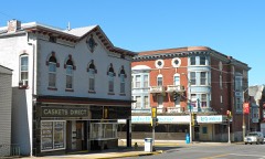 South Side German Historic Districtlisted 1992
Population over time
2 figuresQuincy fell from 40,633 to 39,463 between 2010 and 2020. These are the recorded population figures Wikidata holds for this place, reached through the Geographic Names Information System number this page is keyed on rather than by name, so they belong to this place and not to another of the same name. Most are census counts, but not all are: an early figure may be a founding or settlement estimate, and an estimate published within five years of a census is left out. The change column is computed, and is left blank where more than 20 years separate a figure from the one before it, because a gap that long is not a change between two counts.
| Year | People | Change |
|---|---|---|
| 2010 | 40,633 | |
| 2020 | 39,463 | -1,170 (-3%) |
Topographic sheets covering this place
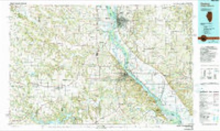
8 surveys from 18 printed sheetsMatched by testing this settlement's coordinate against the published boundary of every sheet in the United States Geological Survey's historical collection. Each opens the scanned sheet at the Survey.
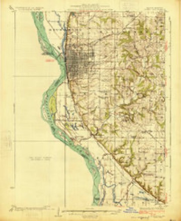
- 1925 USGS Quincy quadrangle1:62500, 2 printings
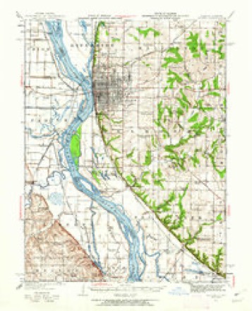
- 1944 USGS Quincy quadrangle1:62500, 5 printings
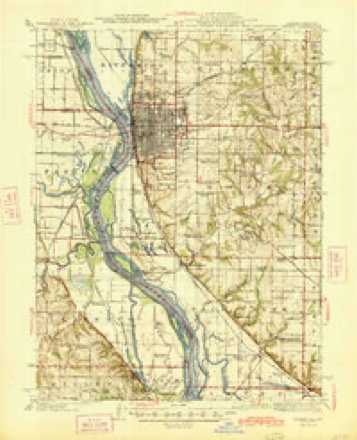
- 1945 USGS Quincy quadrangle1:62500, 2 printings
- 1948 USGS Quincy quadrangle1:250000, 2 printings
- 1956 USGS Quincy quadrangle1:250000, 3 printings
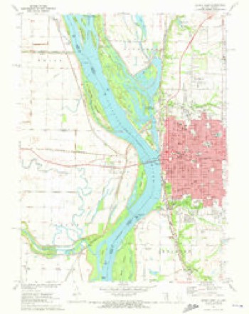
- 1971 USGS Quincy West quadrangle1:24000
- 1986 USGS Quincy quadrangle1:100000, 2 printings
- 1996 USGS Quincy West quadrangle1:24000


What happened here
An account from the chapter on Quincy township. The inset identifies its exact source book and publication year.
Unwersity Of Illinois
It wa.s a tragic loss to the family aud a source of sorrow to the entire community when Charles W. Seymour, the only son of Henry M. Seymour, was accidentallj' killed, at the age of sixteen, while playing ball on the High School grounds at Payson. His young life gave promise of a career of great usefulness, and his father, recognizing that fact and endeavoring to give some memorial to his son, so prematurely taken away, has erected and donated to the village of Payson the present High School building, known as the Charles \V.
Fires near this place
4 since 1995Regional context, not property-specific evidence. The federal wildfire occurrence database lists 4 fires within 5 miles of Quincy between 1995 and 2020, burning about 2 acres in total. None started naturally. None was recorded as arson. Distance is straight-line from the map coordinates, so a fire counted here may appear on a neighbouring settlement's page as well.
| Reported cause | Fires |
|---|---|
| Debris and open burning | 2 |
| Missing data/not specified/undetermined | 1 |
| Equipment and vehicle use | 1 |
The most recent of them, most recent first, with the day each was reported and the service that recorded it.
| Date | Cause | Size | Reported by | Name on the report |
|---|---|---|---|---|
| 6 September 1995 | Debris and open burning | 1.0 acres | Missouri Department of Conservation | not named |
| 8 June 2018 | Debris and open burning | under an acre | Missouri Department of Conservation | 177555-06438-06082018-1519 |
| 4 October 2020 | Equipment and vehicle use | under an acre | Missouri Department of Conservation | 251162-06438-10042020-1715 |
| 13 October 2020 | Missing data/not specified/undetermined | under an acre | Missouri Department of Conservation | 251165-06438-10132020-1125 |
Settlements close enough to share some of these fires:
Mines and quarries near this place
10 of 11 shownRegional context, not property-specific evidence. The federal mineral resources record lists 11 workings within 5 miles of Quincy: 7 past producers, 4 producers. 4 still produce. What was taken out: Stone, Crushed/Broken, Limestone, Dimension, Sand and Gravel, Construction. Distance is straight-line from the map coordinates, so a quarry counted here may appear on a neighbouring settlement's page as well.
| Where | Site | Commodity | Status | Recorded |
|---|---|---|---|---|
| Quarry-3 Calcium Carbonate Co. | Limestone, Dimension | Producer | ||
| Unknown | Sand and Gravel, Construction | Past Producer | ||
| Black White Lime Company | Stone, Crushed/Broken | Past Producer | ||
| Calcium Carbonate Mills | Stone, Crushed/Broken | Producer | ||
| Campbell Quarry | Stone, Crushed/Broken | Past Producer | ||
| Jm Quarry | Stone, Crushed/Broken | Producer | ||
| Menke Quary | Stone, Crushed/Broken | Past Producer | ||
| Quarry-2 Calcium Carbonate Co. | Stone, Crushed/Broken | Past Producer | ||
| Quincy City Public Wks & Bridge Dpt | Stone, Crushed/Broken | Past Producer | ||
| Quincy Mineral Plant | Stone, Crushed/Broken | Producer |
Storms near this place
60 of 140 shownRegional context, not property-specific evidence. The National Weather Service names Quincy in 140 storm reports between 1993 and 2025: 73 thunderstorm wind, 54 hail, 5 tornado, 4 flash flood. The reports record 1 injury. Each account below is quoted exactly as the forecast office filed it, from the NOAA Storm Events Database, and each date opens the federal record of that event.
| When | Event | Place named | Harm | What the report says |
|---|---|---|---|---|
| June 1998 | Tornado (F1) | Quincy | 1 hurt | no account filed |
| May 1996 | Thunderstorm Wind | Quincy | $35,000 | no account filed |
| May 2025 | Flash Flood | Quincy | $25,000 | An emergency manager reported a subject stuck in her car in a foot of flood water between 12th Street and 18th Street on Seminary Road. |
| October 2024 | Tornado (EF0) | Quincy | $25,000 | An EF-0 tornado formed at 1130pm CDT just east of South 24th St. off of Lake Dr. North. As it quickly moved eastward, it produced sporadic tree damage and then minor structural in Payson Heights. From there, it continued eastward, producing sporadic tree damage, including several trees uprooted or snapped, before dissipating at Schildt Ln. The tornado had a path length of 0.35 miles and a max path width of 100 yards. No deaths or injuries were reported. |
| April 2025 | Tornado (EF0) | North Quincy | $20,000 | A weak tornado began near the intersection of Highways 172 and 57, and traveled roughly 4.2 miles to the northeast before dissipating. Damage to trees was most common, with some damage to bleachers as well. The tornado was rated EF-0 with a path length of 4.18 miles and a maximum path width of 25 yards. |
| July 2025 | Thunderstorm Wind | Quincy | $20,000 | Thunderstorm winds caused a large tree limb to snap and fall onto a vehicle. |
| August 2002 | Lightning | Quincy | $20,000 | A lightning strike was responsible for a fire at a home east of Quincy. The lighting struck an enclosed porch on the south side of the house and quickly spread to the kitchen. |
| May 2007 | Thunderstorm Wind | Quincy | $15,000 | Power lines were reported down at 5 locations in Quincy. |
| May 2024 | Thunderstorm Wind | Quincy | $10,000 | Broadcast media relayed reports of medium sized tree branches snapped. There was also a report of power poles broken. Both reports are from the south side of Quincy. |
| April 1994 | Thunderstorm Wind | Quincy | $5,000 | A local television station reported hail 0.75 inch in diameter and wind gusts to 55 mph. Minor damage to a building was reported. |
| June 1994 | Thunderstorm Wind | Quincy | $5,000 | The county sheriff reported numerous trees down north of Quincy. Trees and power lines were also blown down across much of the city of Quincy between 1315 and 1330 CST. |
| August 1993 | Thunderstorm Wind | Quincy | $5,000 | The public and county sheriff reported downed power lines and poles. |
| September 1993 | Thunderstorm Wind | Quincy | $5,000 | no account filed |
| June 1994 | Thunderstorm Wind | Quincy | $500 | The county sheriff reported numerous trees down north of Quincy. Trees and power lines were also blown down across much of the city of Quincy between 1315 and 1330 CST. |
| June 1994 | Thunderstorm Wind | Quincy | $50 | Tree limbs larger than four inches in diameter were broke off. |
| August 2025 | Thunderstorm Wind | Quincy | - | A resident of Adams County reported a 65 mph wind gust. |
| July 2025 | Thunderstorm Wind | Quincy | - | Thunderstorm winds blew down trees and powerlines around Quincy. |
| July 2023 | Thunderstorm Wind | Quincy | - | Thunderstorm winds blew down a couple of trees and numerous tree limbs around the northern half of Quincy. |
| June 2023 | Thunderstorm Wind | Quincy | - | Thunderstorm winds snapped off a large tree in town. Also, numerous tree limbs were blown down. |
| June 2023 | Hail | Quincy | - | Large hail up to two inches in diameter fell across Quincy. |
| June 2020 | Thunderstorm Wind | Quincy | - | Several dozen power lines were blown down around town. |
| June 2020 | Flash Flood | Quincy | - | Up to 4.5 inches of rain fell in a 2 to 3 hour period, causing flash flooding in Quincy. Water levels in some areas was between 3 and 4 feet deep which caused a number of roads to be washed out. Blessing Hospital sustained minor flood damage when water flooded parts of the basement and first floor. Also, numerous basements in other buildings were flooded. Five water rescues were performed after vehicles became trapped in flood waters. No injuries were reported. |
| July 2019 | Thunderstorm Wind | Quincy | - | Thunderstorm winds snapped off a large tree which then fell onto a garage destroying it as well as the car that was parked in it. A nearby home sustained moderate roof damage. The tree also pulled down a nearby power line. |
| June 2019 | Thunderstorm Wind | Quincy | - | Thunderstorm winds blew down a large tree at the intersection of 22nd Street and Washington Street. |
| May 2018 | Thunderstorm Wind | Quincy | - | A large tree was blown down at the intersection of 24th Street and Maine Street. |
| June 2018 | Thunderstorm Wind | Quincy | - | Thunderstorm winds blew down 3 trees between 5th and 8th Streets. Also, a large tree was blown down onto a house near the intersection of South 24th Street and Payson Road. |
| August 2016 | Flash Flood | Quincy | - | Up to 5 inches of rain fell in two and a half hour timeframe causing flash flooding around town. Several water rescues had to be performed but no injuries were reported. |
| July 2016 | Thunderstorm Wind | Quincy | - | Thunderstorm winds blew down numerous trees and tree limbs, especially on the south and southeast side of Quincy. One large tree fell onto a house on the southeast side of town causing moderate damage. Numerous tree limbs were blown down in Coatsburg. |
| December 2015 | Hail | Quincy | - | A wide swath of one to one and a half inch hail fell across Quincy. |
| June 2015 | Thunderstorm Wind | Quincy | - | Thunderstorm winds blew down a couple of trees and tree limbs on the north side of Quincy. One large tree on 6th Street between Spruce and Sycamore Streets fell onto a telephone pole knocking it down as well. |
| July 2015 | Thunderstorm Wind | Quincy | - | A wide swath of damaging winds occurred across the south half of Adams County. Numerous trees, tree limbs, power poles and power lines were blown down in Quincy, Coatsburg, Payson, Plainville and Liberty. In Quincy, several unoccupied vehicles were destroyed by fallen trees. Also, numerous homes and businesses in town sustained minor to major damage from trees falling on them. A couple of older brick facade buildings were damaged or destroyed by the winds. No injuries were reported. |
| June 2014 | Thunderstorm Wind | Quincy | - | Thunderstorm winds blew down numerous large tree limbs and some windows on businesses on the east side of Quincy. |
| June 2013 | Thunderstorm Wind | Quincy | - | Thunderstorm winds blew down several large tree limbs and power lines around town. |
| April 2013 | Thunderstorm Wind | Quincy | - | Thunderstorms winds caused a wide swath of damage extending from downtown Quincy near the Mississippi River eastward to Quincy Regional Airport. Numerous power lines and tree limbs as well several trees were blown down around town. One building had a portion of a wall peeled off at the intersection of Broadway and 48th Street. A bank at the intersection of Koch's Lane and 24th Street had minor roof damage. An 18 foot long construction trailer was blown south through the front wall of a Staples store on Broadway Street across from the mall. A restaurant near the airport sustained moderate damage. |
| July 2012 | Thunderstorm Wind | Quincy | - | Thunderstorm winds blew down several large trees and took some shingles off of a few roofs. |
| June 2011 | Thunderstorm Wind | Quincy | - | Thunderstorm winds blew down a number of large trees and power lines around town. |
| June 2011 | Thunderstorm Wind | Quincy | - | Thunderstorm winds blew down numerous large tree limbs around town. |
| June 2011 | Flash Flood | Quincy | - | Between 3 and 4 inches of rain fell in a short amount of time causing flash flooding. Several roads were flooded including County Road 1900E just south of Illinois Route 104. |
| June 2011 | Thunderstorm Wind | Quincy | - | Thunderstorm winds uprooted a couple of trees and knocked down some power lines in town. On large tree landed on an unoccupied truck destroying it. |
| February 2011 | Hail | Quincy | - | A wide swath of three quarter to one inch hail was reported from Quincy through the Camp Point area to between Golden and Clayton. |
| June 2011 | Thunderstorm Wind | Quincy | - | An intense bow echo moved through Quincy blowing down hundreds of trees, tree limbs and power lines. The fallen trees, tree limbs and power lines blocked a lot of streets in town causing major navigation issues for drivers for several days. It also took several days to restore power throughout town. Numerous trees fell onto homes causing varying degrees of damage. Also, several vehicles sustained varying degrees of damage from fallen trees and limbs. Amazingly no injuries were reported. |
| July 2010 | Thunderstorm Wind | Quincy | - | A large tree was blown down across the southbound lanes of I-172 just north of the city limits. |
| August 2010 | Thunderstorm Wind | Quincy | - | Thunderstorm winds blew down a tree onto a house causing minor to moderate damage. |
| August 2009 | Thunderstorm Wind | Quincy | - | Thunderstorm winds blew down numerous large tree limbs over the southern portions of the county. |
| June 2009 | Thunderstorm Wind | Quincy | - | Thunderstorm winds caused structural damage to a three story brick building in downtown Quincy. The entire brick wall on the back of the building blew down and fell onto cars in the parking lot. No injuries were reported. Also, a retirement community building had several windows blown out and numerous trees, tree limbs and power lines were blown down. |
| June 2009 | Thunderstorm Wind | Quincy | - | Numerous trees, tree limbs and power lines were blown down around Quincy. |
| July 2008 | Thunderstorm Wind | Quincy | - | Thunderstorm winds blew down several trees, numerous tree limbs and power lines throughout town. |
| May 2008 | Hail | Quincy | - | Storm spotters reported hail from nickel size to one inch. |
| March 2007 | Thunderstorm Wind | Quincy | - | Thunderstorm winds blew down several business signs and broke several windows in Quincy, including some at Quincy Mall. |
| June 2007 | Thunderstorm Wind | Quincy | - | Adams County EMA reported a car blown off a road near the eastern city limits of Quincy. |
| August 2007 | Thunderstorm Wind | Quincy | - | Numerous large tree limbs were blown down throughout the city. |
| October 2007 | Tornado (EF0) | North Quincy | - | A tornado briefly touched down in a field just northeast of the intersection of CR 1000E and CR 200N. The corn field was totally flattened. |
| August 2007 | Flood | Quincy | - | Minor flooding occurred along the Mississippi River. The river peaked at about 1 1/2 feet over flood stage. |
| April 2006 | Thunderstorm Wind | Quincy | - | A tractor-trailer was blown over at I-72 and I-172. |
| April 2006 | Thunderstorm Wind | Quincy | - | A local TV station reported several barns damaged. |
| May 2006 | Thunderstorm Wind | Quincy | - | Several large trees and power poles were blown down on the east side of town. |
| May 2005 | Hail | Quincy | - | A local TV station relayed reports of 3/4 inch hail north of Quincy. |
| June 2005 | Hail | Quincy | - | A storm spotter reported 1 inch hail. |
| May 2004 | Thunderstorm Wind | Quincy | - | The local 911 center reported trees and power lines down at several locations. |
| May 2004 | Thunderstorm Wind | Quincy | - | Local law enforcement reported numerous trees and power lines down. |
Nearest settlements
The eight closest, with where each one stands in the county. Distances are straight-line, computed from the Geographic Names Information System coordinates.
| Map | Place | Distance | Sheets |
|---|---|---|---|
| Calftown (historical) | 0.7 miles | 18 | |
| Northridge | 1.9 miles | 18 | |
| Grandview Acres | 2.0 miles | 18 | |
| South Park Terrace | 2.1 miles | 18 | |
| Woodlawn Court | 2.2 miles | 19 | |
| Southern View | 2.2 miles | 18 | |
| Lincoln Hills | 2.3 miles | 19 | |
| Sunnybrook Meadows | 2.3 miles | 18 |
Elsewhere
Matched on this settlement's Geographic Names Information System number rather than its name, so it cannot be a different place of the same name in another state.
| Wikipedia article on Quincy | An encyclopaedic summary. Its text is share-alike, so it is linked here rather than copied. |
| Wikidata item Q575750 | The structured record the population and elevation above come from. Public domain (CC0). |
Provenance
This settlement is recorded in the Geographic Names Information System as feature 416314. The sheet list is computed by point-in-boundary test against the United States Geological Survey's historical topographic inventory. Both are works of the United States government and carry no copyright under 17 U.S.C. 105.
Wildfire. Short, Karen C. 2022. Spatial wildfire occurrence data for the United States, 1992-2020 [FPA_FOD_20221014]. 6th Edition. Fort Collins, CO: Forest Service Research Data Archive. https://doi.org/10.2737/RDS-2013-0009.6 Collected with United States Government funding and usable without additional permissions or fees.
Mines and quarries. USGS Mineral Resources Data System (MRDS) https://mrdata.usgs.gov/mrds/ A work of the United States government, no copyright under 17 U.S.C. 105.
Storms. NOAA National Centers for Environmental Information, Storm Events Database https://www.ncei.noaa.gov/stormevents/ A work of the United States government, no copyright under 17 U.S.C. 105. Narratives are quoted verbatim from the National Weather Service report and are not edited or summarised.