 Block
Ridott, Illinois
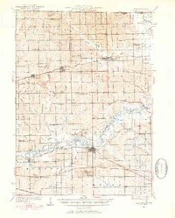
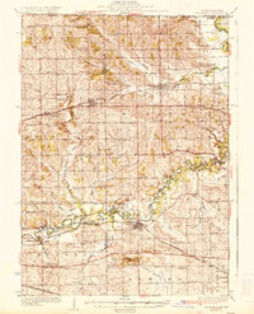
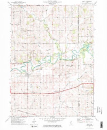
16 topographic sheets cover this place, the earliest surveyed in 1932 and the latest in 1981. It stands in Ridott Township. It lies in ZIP code area 61067. It stands on Wickham Creek. The Survey maps it on the Ridott quadrangle. 124 people lived here at the 2020 count. It stands 758 feet above sea level.
Population over time
2 figuresRidott fell from 164 to 124 between 2010 and 2020. These are the recorded population figures Wikidata holds for this place, reached through the Geographic Names Information System number this page is keyed on rather than by name, so they belong to this place and not to another of the same name. Most are census counts, but not all are: an early figure may be a founding or settlement estimate, and an estimate published within five years of a census is left out. The change column is computed, and is left blank where more than 20 years separate a figure from the one before it, because a gap that long is not a change between two counts.
| Year | People | Change |
|---|---|---|
| 2010 | 164 | |
| 2020 | 124 | -40 (-24%) |
Topographic sheets covering this place
8 surveys from 16 printed sheetsMatched by testing this settlement's coordinate against the published boundary of every sheet in the United States Geological Survey's historical collection. Each opens the scanned sheet at the Survey.
- 1932 USGS Pecatonica quadrangle1:62500, 3 printings
- 1936 USGS Pecatonica quadrangle1:62500, 2 printings
- 1954 USGS Rockford quadrangle1:250000
- 1955 USGS Rockford quadrangle1:250000
- 1958 USGS Rockford quadrangle1:250000, 4 printings
- 1963 USGS Rockford quadrangle1:250000
- 1971 USGS Ridott quadrangle1:24000, 2 printings
- 1981 USGS Rockford quadrangle1:100000, 2 printings





In the county-history sources
21,578 words on this townshipThe History of Stephenson County, Illinois : Containing ... Biographical Sketches ... War Record ... Statistics ... Portraits of Early Settlers ... History of the Northwest, History of Illinois, &c. .., published 1880 names this settlement in its chapter on Ridott Township. These are the passages that mention it, exactly as the scans read.
Occupies the southeastern corner of the county and is nine miles in length by six in width, with an area of 34,400 acres, of which about 30,000 acres are under cultivation. It is well watered in the northern part by the Pecatonica and tributary streams, and heavily timbered in that section also, while the southern portion is mostly rolling prairie.
Passage source: The History of Stephenson County, Illinois : Containing ... Biographical Sketches ... War Record ... Statistics ... Portraits of Early Settlers ... History of the Northwest, History of Illinois, &c. .., published 1880.
The township formed a portion of Silver Creek Precinct until after the passage of the law providing for township organization, when it was laid oif and named, it is said, after a clerk in the Post Office Department at Washington. The first settlement of the town was made in the spring of 1836, by Andrew iTackson and Jeiferson Niles, who claim to have come on the 4th of March of that year, and built a shanty on the east bank of the Pecatonica. During the winter of 1835 or 1836, or early in the spring of the latter year, Harvey P. Waters, accompanied by Lyman Bennett, visited the present territory of Stephenson County, and halted at the mouth of Yellow Creek, now included within the limits of Silver Creek Township. He remained here until spring had become an established fact in this section, when he removed to Ridott, and is still enumerated in the census of that town. That spring, it is said, quite a number of settlers identified themselves with future Ridott, and, besides increasing the number of voters in that portion of the county, contributed materially to the promulgation of its attractions. Among these were Sawyer Forbes, Daniel Wooten, who settled one mile west of the present village of Ridott ; Horace Colburn, where Samuel Moyer now resides ; a man named Wickham, who entered the land upon which the village of Ridott is located ; John Reed and brother, who squatted on the Farwell farm ; Benjamin and Josiah Ostrander, at the mouth of the Creek ; David Niles, on land subsequently owned by Garrett Lloyd ; Asa Nichols, and some others. They, one and all, indulged the same anticipations, experienced the same vicissitudes, conquered the same hardships, and rejoiced in final victory, as did those who came at an early day, and, in other portions of the county, were tried and triumphed gloriously.
Passage source: The History of Stephenson County, Illinois : Containing ... Biographical Sketches ... War Record ... Statistics ... Portraits of Early Settlers ... History of the Northwest, History of Illinois, &c. .., published 1880.
The primary settlements made in Ridott, as elsewhere in portions of the county watered by the Pecatonica, were established along the bank of the river. The land there was more desirable, apparently, for agricultural purposes than the rolling prairies at a distance from the stream, and the water-power sought to be utilized for mechanical and other purposes was deemed as an invaluable adjunct to the building-up of the country. The houses were, of course, primitive beyond description, often being constructed of sod, with thatched roofs and other evidences of the limited resources available in those days. Yet this discouraging outlook attracted rather than dismayed the emigrants, who came in large numbers even after the township had been generally settled, and desirable sites were held at extravagant rates. In 1837, Caleb Tompkins took up land in the timber on what was afterward known as the Bride Farm. G. A. Seth, Isaac and Eldredge Farwell settled adjoining each other, four miles east of the present village. Garrett Lloyd became a settler this year also, as did Norman, Levi, Isaac and Orsemus Brace, Harvey and Jeremiah Webster, Sybil Ann Price, who entered a claim to land three miles east of the present village; Stewart Reynolds, Sanford Niles, etc. These were followed in 1838 by Lewis and David Gitchell, Philo Hammond, Ezekiel and Jacob Forsythe, John Lloyd, a brother of Garrett Lloyd, who came the year previous; Putnam Perley, who entered a claim to the place now known as
Passage source: The History of Stephenson County, Illinois : Containing ... Biographical Sketches ... War Record ... Statistics ... Portraits of Early Settlers ... History of the Northwest, History of Illinois, &c. .., published 1880.
Machine-read from a century-old scan, so expect the errors a machine makes: misspelled names, dropped words, stray characters.
Read the whole chapter on Ridott Township - it names this place 68 more 68 times.
Fires near this place
6 since 2010Regional context, not property-specific evidence. The federal wildfire occurrence database lists 6 fires within 5 miles of Ridott between 2010 and 2017, burning about 2 acres in total. None started naturally. None was recorded as arson. Distance is straight-line from the map coordinates, so a fire counted here may appear on a neighbouring settlement's page as well.
| Reported cause | Fires |
|---|---|
| Missing data/not specified/undetermined | 3 |
| Debris and open burning | 2 |
| Power generation/transmission/distribution | 1 |
The most recent of them, most recent first, with the day each was reported and the service that recorded it.
| Date | Cause | Size | Reported by | Name on the report |
|---|---|---|---|---|
| 27 September 2017 | Debris and open burning | under an acre | Illinois Division of Forestry Resources | 17-0000102 |
| 4 May 2010 | Missing data/not specified/undetermined | under an acre | Illinois Division of Forestry Resources | 1035 |
| 29 May 2010 | Missing data/not specified/undetermined | under an acre | Illinois Division of Forestry Resources | 1046 |
| 26 April 2010 | Missing data/not specified/undetermined | under an acre | Illinois Division of Forestry Resources | 1030 |
| 12 April 2014 | Power generation/transmission/distribution | 1.0 acres | Illinois Division of Forestry Resources | 14-0000035 |
| 8 October 2017 | Debris and open burning | under an acre | Illinois Division of Forestry Resources | 17-0000111 |
Settlements close enough to share some of these fires:
Mines and quarries near this place
10 within 5 milesRegional context, not property-specific evidence. The federal mineral resources record lists 10 workings within 5 miles of Ridott: 10 past producers. None of them still produces. What was taken out: Stone, Crushed/Broken. Distance is straight-line from the map coordinates, so a quarry counted here may appear on a neighbouring settlement's page as well.
| Where | Site | Commodity | Status | Recorded |
|---|---|---|---|---|
| Nieman Quarry | Stone, Crushed/Broken | Past Producer | ||
| Ridott Quarry | Stone, Crushed/Broken | Past Producer | ||
| Terhark Pit | Stone, Crushed/Broken | Past Producer | ||
| Unnamed Limestone Quarry | Stone, Crushed/Broken | Past Producer | ||
| Unnamed Limestone Quarry | Stone, Crushed/Broken | Past Producer | ||
| Unnamed Limestone Quarry | Stone, Crushed/Broken | Past Producer | ||
| Unnamed Limestone Quarry | Stone, Crushed/Broken | Past Producer | ||
| Unnamed Limestone Quarry | Stone, Crushed/Broken | Past Producer | ||
| Unnamed Limestone Quarry | Stone, Crushed/Broken | Past Producer | ||
| Unnamed Limestone Quarry | Stone, Crushed/Broken | Past Producer |
Storms near this place
3 since 2008Regional context, not property-specific evidence. The National Weather Service names Ridott in 3 storm reports between 2008 and 2022: 2 thunderstorm wind, 1 hail. No death or injury is recorded in these reports. Each account below is quoted exactly as the forecast office filed it, from the NOAA Storm Events Database, and each date opens the federal record of that event.
| When | Event | Place named | Harm | What the report says |
|---|---|---|---|---|
| May 2011 | Thunderstorm Wind | Ridott | $25,000 | Wind gusts estimated to be 70 mph snapped some trees in half, blew down some power poles, and damaged a cattle barn and a pole barn near the intersection of Highway 20 and Farwell Bridge Rd about 2 miles east of Ridott, IL around 640 pm CDT May 22. |
| July 2022 | Thunderstorm Wind | Ridott | - | A trained spotter reported an 8 inch diameter tree limb down on Washington Street in Ridott. The time of the event was estimated using radar. |
| June 2008 | Hail | Ridott | - | Tennis ball to baseball-sized hail fell in Ridott, IL at 3:15 pm June 12. This report was relayed by a law enforcement official. |
Nearest settlements
The eight closest, with where each one stands in the county. Distances are straight-line, computed from the Geographic Names Information System coordinates.
| Map | Place | Distance | Sheets |
|---|---|---|---|
| Ridott Corners | 1.5 miles | 16 | |
| Hunt Corners | 1.8 miles | 16 | |
| Browns Mill | 2.6 miles | 15 | |
| Woodruff Corners | 2.9 miles | 16 | |
| Evarts | 3.0 miles | 16 | |
| Winneshiek | 4.3 miles | 15 | |
| Valley Creek (historical) | 4.4 miles | 15 | |
| German Valley | 5.6 miles | 14 |
Elsewhere
Matched on this settlement's Geographic Names Information System number rather than its name, so it cannot be a different place of the same name in another state.
| Wikipedia article on Ridott | An encyclopaedic summary. Its text is share-alike, so it is linked here rather than copied. |
| Wikidata item Q1998022 | The structured record the population and elevation above come from. Public domain (CC0). |
Provenance
This settlement is recorded in the Geographic Names Information System as feature 416660. The sheet list is computed by point-in-boundary test against the United States Geological Survey's historical topographic inventory. Both are works of the United States government and carry no copyright under 17 U.S.C. 105.
Wildfire. Short, Karen C. 2022. Spatial wildfire occurrence data for the United States, 1992-2020 [FPA_FOD_20221014]. 6th Edition. Fort Collins, CO: Forest Service Research Data Archive. https://doi.org/10.2737/RDS-2013-0009.6 Collected with United States Government funding and usable without additional permissions or fees.
Mines and quarries. USGS Mineral Resources Data System (MRDS) https://mrdata.usgs.gov/mrds/ A work of the United States government, no copyright under 17 U.S.C. 105.
Storms. NOAA National Centers for Environmental Information, Storm Events Database https://www.ncei.noaa.gov/stormevents/ A work of the United States government, no copyright under 17 U.S.C. 105. Narratives are quoted verbatim from the National Weather Service report and are not edited or summarised.