 Block
Winneshiek, Illinois
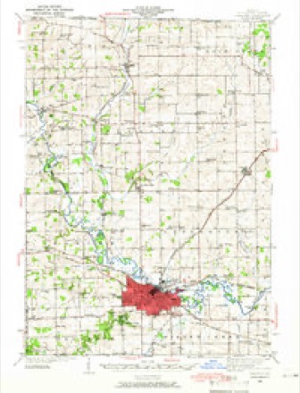
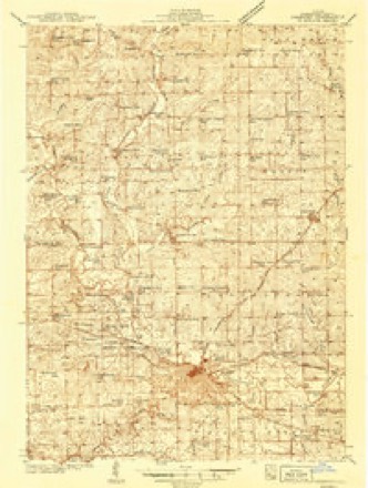
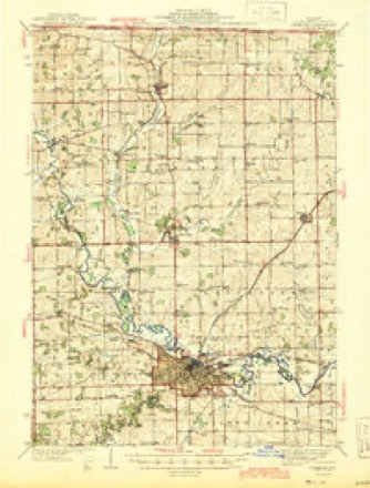
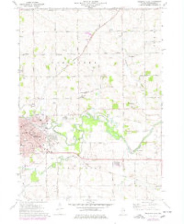
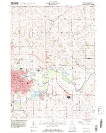
15 topographic sheets cover this place, the earliest surveyed in 1939 and the latest in 1999. It stands in Lancaster Township. It lies in ZIP code area 61032. The Survey maps it on the Freeport East quadrangle. It stands 827 feet above sea level.
Topographic sheets covering this place
10 surveys from 15 printed sheetsMatched by testing this settlement's coordinate against the published boundary of every sheet in the United States Geological Survey's historical collection. Each opens the scanned sheet at the Survey.
- 1939 USGS Freeport quadrangle1:62500
- 1939 USGS Freeport quadrangle1:48000
- 1944 USGS Freeport quadrangle1:62500
- 1954 USGS Rockford quadrangle1:250000
- 1955 USGS Rockford quadrangle1:250000
- 1958 USGS Rockford quadrangle1:250000, 4 printings
- 1963 USGS Rockford quadrangle1:250000
- 1971 USGS Freeport East quadrangle1:24000, 2 printings
- 1981 USGS Rockford quadrangle1:100000, 2 printings
- 1999 USGS Freeport East quadrangle1:24000





In the county-history sources
7,200 words on this townshipThe History of Stephenson County, Illinois : Containing ... Biographical Sketches ... War Record ... Statistics ... Portraits of Early Settlers ... History of the Northwest, History of Illinois, &c. .., published 1880 names this settlement in its chapter on Lancaster Township. These are the passages that mention it, exactly as the scans read.
R. K. MADDEN, teacher. Sec. 10 ; P. 0. Freeport ; born in Pennsylvania Sept. 27, 1834 ; resided in Pennsylvania until 1857, when he removed to Wooster, Wayne Co., Ohio ; remained there five years, removing to Perry Co., in Southern Illinois, in the fall of 1862 ; in 1862, went to Washington Co , 111., where he lived until 1875, when he came to Stephenson Co., where he has resided since that date ; the profession of teaching is the one in which Mr. M. has been chiefly engaged ; he was admitted to the bar in Ohio and re-admitted in this State, but pursues teaching, because to him it is more congenial than the practice of law. He was married in Ohio, in 1861, to Miss Hattie Somers ; she died in 1879 ; three children - Klem, Otto and Edgar.
Passage source: The History of Stephenson County, Illinois : Containing ... Biographical Sketches ... War Record ... Statistics ... Portraits of Early Settlers ... History of the Northwest, History of Illinois, &c. .., published 1880.
Machine-read from a century-old scan, so expect the errors a machine makes: misspelled names, dropped words, stray characters.
Read the whole chapter on Lancaster Township - it names this place 4 more 4 times.
Fires near this place
8 since 2010Regional context, not property-specific evidence. The federal wildfire occurrence database lists 8 fires within 5 miles of Winneshiek between 2010 and 2017, burning about 8 acres in total. None started naturally. None was recorded as arson. Distance is straight-line from the map coordinates, so a fire counted here may appear on a neighbouring settlement's page as well.
| Reported cause | Fires |
|---|---|
| Missing data/not specified/undetermined | 5 |
| Debris and open burning | 3 |
The most recent of them, most recent first, with the day each was reported and the service that recorded it.
| Date | Cause | Size | Reported by | Name on the report |
|---|---|---|---|---|
| 27 September 2017 | Debris and open burning | under an acre | Illinois Division of Forestry Resources | 17-0000102 |
| 4 May 2010 | Missing data/not specified/undetermined | under an acre | Illinois Division of Forestry Resources | 1035 |
| 27 April 2010 | Missing data/not specified/undetermined | under an acre | Illinois Division of Forestry Resources | 1031 |
| 22 April 2014 | Debris and open burning | 4.0 acres | Illinois Division of Forestry Resources | 14-0000039 |
| 8 November 2010 | Missing data/not specified/undetermined | under an acre | Illinois Division of Forestry Resources | 10100 |
| 8 October 2017 | Debris and open burning | under an acre | Illinois Division of Forestry Resources | 17-0000111 |
| 14 October 2010 | Missing data/not specified/undetermined | 3.0 acres | Illinois Division of Forestry Resources | 1091 |
| 14 October 2010 | Missing data/not specified/undetermined | under an acre | Illinois Division of Forestry Resources | 1092 |
Settlements close enough to share some of these fires:
Mines and quarries near this place
10 of 13 shownRegional context, not property-specific evidence. The federal mineral resources record lists 13 workings within 5 miles of Winneshiek: 12 past producers, 1 producer. 1 still produces. What was taken out: Stone, Crushed/Broken. Distance is straight-line from the map coordinates, so a quarry counted here may appear on a neighbouring settlement's page as well.
| Where | Site | Commodity | Status | Recorded |
|---|---|---|---|---|
| Duth Quarry | Stone, Crushed/Broken | Past Producer | ||
| Nieman Quarry | Stone, Crushed/Broken | Past Producer | ||
| Terhark Pit | Stone, Crushed/Broken | Past Producer | ||
| Unnamed Limestone Quarry | Stone, Crushed/Broken | Past Producer | ||
| Unnamed Limestone Quarry | Stone, Crushed/Broken | Past Producer | ||
| Unnamed Limestone Quarry | Stone, Crushed/Broken | Past Producer | ||
| Unnamed Limestone Quarry | Stone, Crushed/Broken | Past Producer | ||
| Unnamed Limestone Quarry | Stone, Crushed/Broken | Past Producer | ||
| Unnamed Limestone Quarry | Stone, Crushed/Broken | Past Producer | ||
| Unnamed Limestone Quarry | Stone, Crushed/Broken | Past Producer |
Storms near this place
14 since 2008Regional context, not property-specific evidence. The National Weather Service names Winneshiek in 14 storm reports between 2008 and 2026: 7 hail, 4 thunderstorm wind, 2 heavy rain, 1 flash flood. No death or injury is recorded in these reports. Each account below is quoted exactly as the forecast office filed it, from the NOAA Storm Events Database, and each date opens the federal record of that event.
| When | Event | Place named | Harm | What the report says |
|---|---|---|---|---|
| July 2010 | Flash Flood | Winneshiek | $500,000 | Heavy rains of about 3 inches in under 3 hours (for a total of about 11 inches in less than 32 hours) resulted in extensive flash flooding during the morning of July 24. The greatest impact was flash flooding of Yellow Creek from Pearl City to Freeport, with additional impacts from flash flooding of the Pecatonica River in and near Freeport. ||Local emergency management officials described the flood damage as the worst damage I've seen in 19 years, and many lifelong residents affected by Yellow Creek described it as worse than anything they had ever experienced in their lifetimes. ||Forty-three roads in Stephenson County were under water and closed to traffic, including Business Highway 20, Highway 20, and Route 75. Streets in downtown Freeport had as much as 5 to 6 feet of water. Some people who were trapped in flooded vehicles were rescued by boat. In the weeks following the flash flood, more than 20 sink holes developed in Freeport roads. The Stephenson County engineer documented about $1 million in damage to county and township roads.||In Pearl City, about 80 homes were damaged in the flooding of Yellow Creek, and an additional 60 homes in unincorporated portions of the county we also damaged. One Pearl City resident awoke around 3 am CDT to the sound of trickling water to discover his possessions floating in 3 feet of water.||More than 700 homes and countless businesses in Freeport were damaged. Numerous stores in the Southgate Market area were flooded and remained closed for at least 2 weeks, some for as long as 6 weeks. Also affected was the Winneshiek Playhouse, the oldest amateur theater in the United States, which suffered 3 feet of water in its basement. Freeport Fire Station 3 was nearly completely under water and was evacuated due to the flooding. Due to repeated rounds of heavy rain (with nearly a foot of rain measured in less than 48 hours), the Freeport wastewater treatment plant sustained about $1.4 million in damages. |
| June 2008 | Thunderstorm Wind | Winneshiek | $15,000 | Winds estimated to be 70 mph blew down several trees onto power lines along North Dakota Road or about 4 miles northeast of Freeport, IL at 10:30 am June 8. A power outage was also reported. |
| April 2026 | Hail | Winneshiek | - | Report received from Mping. |
| April 2026 | Hail | Winneshiek | - | Report received from Mping. |
| April 2026 | Hail | Winneshiek | - | Report received from Mping. |
| July 2024 | Thunderstorm Wind | Winneshiek | - | A public report of multiple downed trees. The time of the event was estimated using radar. |
| April 2014 | Thunderstorm Wind | Winneshiek | - | A trained spotter reported trees down between Freeport and Dakota. Shingles were also off the roof of a church. |
| April 2014 | Hail | Winneshiek | - | A trained spotter dime to quarter sized hail covering the ground on the U.S. 20 Bypass with some covers in the ditches. The hail lasted for 10 minutes. |
| May 2013 | Thunderstorm Wind | Winneshiek | - | The emergency manager reported a 1 foot diameter limb of a maple tree down near town. An adjacent field had a section of oats flattened. |
| August 2011 | Heavy Rain | Winneshiek | - | Rain fell in less than one hour. |
| August 2011 | Heavy Rain | Winneshiek | - | Rain fell over a 90 minute period and ponding of water has been reported in fields. |
| June 2008 | Hail | Winneshiek | - | Golf ball-sized hail fell about 3 miles west northwest of Ridott, IL at 3:17 pm June 12. |
| April 2014 | Hail | Winneshiek | - | no account filed |
| May 2012 | Hail | Winneshiek | - | no account filed |
Nearest settlements
The eight closest, with where each one stands in the county. Distances are straight-line, computed from the Geographic Names Information System coordinates.
| Map | Place | Distance | Sheets |
|---|---|---|---|
| Dakota | 3.0 miles | 13 | |
| Browns Mill | 4.3 miles | 15 | |
| Ridott | 4.3 miles | 16 | |
| Ridott Corners | 5.5 miles | 16 | |
| Rock City | 5.7 miles | 15 | |
| Willow Lake | 5.8 miles | 15 | |
| Valley Creek (historical) | 6.0 miles | 15 | |
| Freeport | 6.0 miles | 15 |
Elsewhere
Matched on this settlement's Geographic Names Information System number rather than its name, so it cannot be a different place of the same name in another state.
| Wikipedia article on Winneshiek | An encyclopaedic summary. Its text is share-alike, so it is linked here rather than copied. |
| Wikidata item Q8025630 | The structured record the population and elevation above come from. Public domain (CC0). |
Provenance
This settlement is recorded in the Geographic Names Information System as feature 423325. The sheet list is computed by point-in-boundary test against the United States Geological Survey's historical topographic inventory. Both are works of the United States government and carry no copyright under 17 U.S.C. 105.
Wildfire. Short, Karen C. 2022. Spatial wildfire occurrence data for the United States, 1992-2020 [FPA_FOD_20221014]. 6th Edition. Fort Collins, CO: Forest Service Research Data Archive. https://doi.org/10.2737/RDS-2013-0009.6 Collected with United States Government funding and usable without additional permissions or fees.
Mines and quarries. USGS Mineral Resources Data System (MRDS) https://mrdata.usgs.gov/mrds/ A work of the United States government, no copyright under 17 U.S.C. 105.
Storms. NOAA National Centers for Environmental Information, Storm Events Database https://www.ncei.noaa.gov/stormevents/ A work of the United States government, no copyright under 17 U.S.C. 105. Narratives are quoted verbatim from the National Weather Service report and are not edited or summarised.