 Block
Rockford, Illinois
20 topographic sheets cover this place, the earliest surveyed in 1918 and the latest in 1993. It stands in Rockford Township. It lies in ZIP code area 61101. It stands on North Fork Kent Creek. The Survey maps it on the Rockford North quadrangle. 148,655 people lived here at the 2020 count. It stands 715 feet above sea level.
Research this city
On record in Rockford
Buildings and businesses the archive holds for this place. Each opens its own page, with the source record it came from.
On the National Register 12 of 36 shown
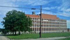 Barber-Colman Company Historic Districtlisted 2006
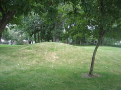 Beattie Park Mound Grouplisted 1991
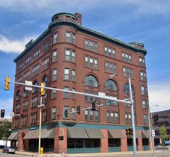 William Brown Buildinglisted 2000
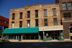 Chick Houselisted 1997
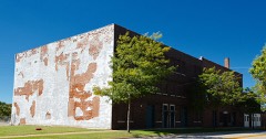 Condon Brothers and R.H. Shumway Buildinglisted 2015
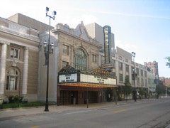 Coronadolisted 1979
 East Rockford Historic Districtlisted 1980
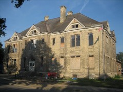 Garrison Schoollisted 2006
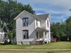 Garrison-Coronado-Haskill Historic Districtlisted 2012
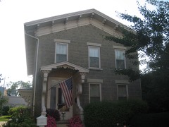 Graham-Ginestra Houselisted 1979
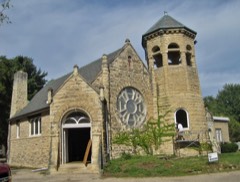 Greenwood Cemetery Chapel and Crematorylisted 2012
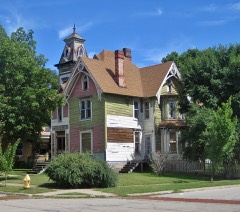 Haight Village Historic Districtlisted 1987
Population over time
2 figuresRockford fell from 152,871 to 148,655 between 2010 and 2020. These are the recorded population figures Wikidata holds for this place, reached through the Geographic Names Information System number this page is keyed on rather than by name, so they belong to this place and not to another of the same name. Most are census counts, but not all are: an early figure may be a founding or settlement estimate, and an estimate published within five years of a census is left out. The change column is computed, and is left blank where more than 20 years separate a figure from the one before it, because a gap that long is not a change between two counts.
| Year | People | Change |
|---|---|---|
| 2010 | 152,871 | |
| 2020 | 148,655 | -4,216 (-3%) |
Topographic sheets covering this place
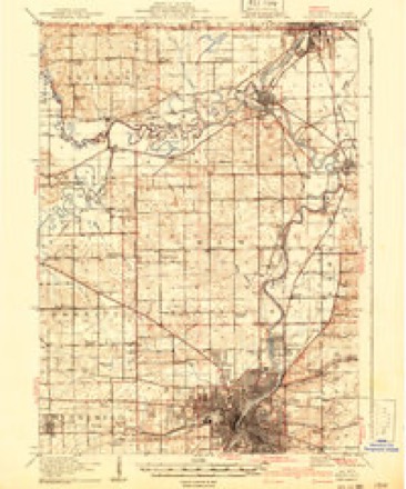
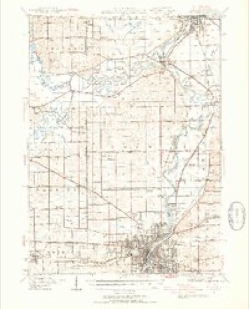
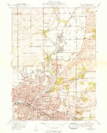
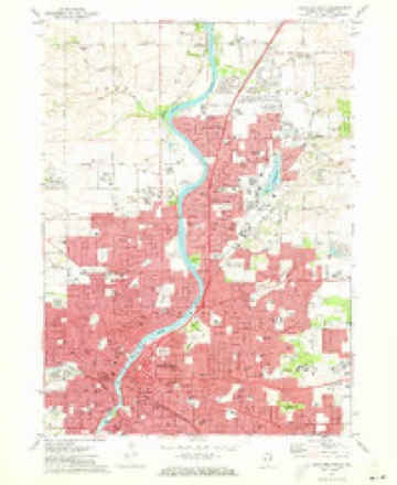
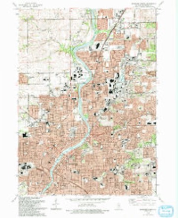
10 surveys from 20 printed sheetsMatched by testing this settlement's coordinate against the published boundary of every sheet in the United States Geological Survey's historical collection. Each opens the scanned sheet at the Survey.
- 1918 USGS Rockford quadrangle1:62500, 3 printings
- 1938 USGS Rockford quadrangle1:62500, 3 printings
- 1949 USGS Rockford quadrangle1:24000, 2 printings
- 1954 USGS Rockford quadrangle1:250000
- 1955 USGS Rockford quadrangle1:250000
- 1958 USGS Rockford quadrangle1:250000, 4 printings
- 1963 USGS Rockford quadrangle1:250000
- 1971 USGS Rockford North quadrangle1:24000, 2 printings
- 1981 USGS Rockford quadrangle1:100000, 2 printings
- 1993 USGS Rockford North quadrangle1:24000





What happened here
An account from the chapter on Rockford township. The inset identifies its exact source book and publication year.
Winnebago Counit Dieectort
ill Putney, Vt., in 1800 ; he emigrated to Chicago in 1832, where he practiced his profession until 1838, when lie came to Rocliford to I'eside; he married Catherine Dunn, in St. Thomas, Canada, in 1822; she died in 1874; Dr. Goodhue was killed from falling into a well, while attending one of his patients, in 1847.
In the county-history sources
166,475 words on this townshipThe History of Winnebago County, Illinois : Its Past and Present, Containing ... a Biographical Directory of Its Citizens, War Record of Its Volunteers in the Late Rebellion, General and Local Statistics ... History of the Northwest, History of Illinois ... Etc, published 1877 names this settlement in its chapter on Rockford Township. These are the passages that mention it, exactly as the scans read.
AOABD JAS. B. Residence 512 Chestnut st. ; senior member of the firm of Agard & Ross, 616 and 618 Cedar st.; wholesale dealers in Grass Seed, Salt and Wool ; orders filled at the lowest market price ; Agents for Wisconsin Butter Tubs ; this house was established in 1856; Mr. Agard was born in Deerfield, Oneida Co., N. Y., Aug. 25,1824; came to Rockford in 1855; he was Alderman of the Third Ward in 10 - ; he is a Director of the Winnebago National Bank ; has been a Director Id the said bank nearly the entire lime since its organization.
Passage source: The History of Winnebago County, Illinois : Its Past and Present, Containing ... a Biographical Directory of Its Citizens, War Record of Its Volunteers in the Late Rebellion, General and Local Statistics ... History of the Northwest, History of Illinois ... Etc, published 1877.
AXGSTRA:^D ALEX. I.. Manufacturer and Dealer in Boots and Shoes, 416 E. State st. ; residence 308 jST. Fourth St. ; born iu Sweden, March 15, 1841 ; came to Rockford in 1869; commenced working at his trade of bootmaker when 11 years of age; married Charlotte Carlson, Feb. 28, 1874 ; she was born iu Sweden ; have one infant child ; Mr. Angstrand manutactures boots and shoes to order upon short notice, and guarantees to give perfect satisfaction ; he also keeps a stock of Men's, Ladies' and Children's Boots and Shoes on hand, which will be sold at bottom prices.
Passage source: The History of Winnebago County, Illinois : Its Past and Present, Containing ... a Biographical Directory of Its Citizens, War Record of Its Volunteers in the Late Rebellion, General and Local Statistics ... History of the Northwest, History of Illinois ... Etc, published 1877.
Rockford ; Mr. A. gives special attention to auction sales of farm stock and property; born in Williams Co.,Va., March 15, 1843; came to this Co. in 1858 ; removed to Rockford in 1875; married Sarah Jane Sweeney, Aug., 1871; she was boru in Penn.; have one child, Guy C. ; Mr. A. served two years and a half during the war of the rebellion, in Co. B, 14th Iowa V. I.
Passage source: The History of Winnebago County, Illinois : Its Past and Present, Containing ... a Biographical Directory of Its Citizens, War Record of Its Volunteers in the Late Rebellion, General and Local Statistics ... History of the Northwest, History of Illinois ... Etc, published 1877.
Machine-read from a century-old scan, so expect the errors a machine makes: misspelled names, dropped words, stray characters.
Read the whole chapter on Rockford Township - it names this place 284 more 284 times.
Fires near this place
3 since 2003Regional context, not property-specific evidence. The federal wildfire occurrence database lists 3 fires within 5 miles of Rockford between 2003 and 2020, burning about 3 acres in total. None started naturally. 1 was recorded as arson. Distance is straight-line from the map coordinates, so a fire counted here may appear on a neighbouring settlement's page as well.
| Reported cause | Fires |
|---|---|
| Missing data/not specified/undetermined | 2 |
| Arson/incendiarism | 1 |
The most recent of them, most recent first, with the day each was reported and the service that recorded it.
| Date | Cause | Size | Reported by | Name on the report |
|---|---|---|---|---|
| 18 September 2004 | Missing data/not specified/undetermined | under an acre | Illinois State Fire Marshal's Office | not named |
| 4 May 2020 | Missing data/not specified/undetermined | under an acre | Illinois Division of Forestry Resources | 20-0000206 |
| 16 February 2003 | Arson/incendiarism | 2.0 acres | Illinois State Fire Marshal's Office | not named |
Settlements close enough to share some of these fires:
Mines and quarries near this place
10 of 25 shownRegional context, not property-specific evidence. The federal mineral resources record lists 25 workings within 5 miles of Rockford: 21 past producers, 4 producers. 4 still produce. What was taken out: Stone, Crushed/Broken, Sand and Gravel, Construction. Distance is straight-line from the map coordinates, so a quarry counted here may appear on a neighbouring settlement's page as well.
| Where | Site | Commodity | Status | Recorded |
|---|---|---|---|---|
| Hoogie Pit | Sand and Gravel, Construction | Past Producer | ||
| Sahlstrom Sand & Gravel | Sand and Gravel, Construction | Past Producer | ||
| South Main Sand & Gravel Pit | Sand and Gravel, Construction | Producer | ||
| Winquist Pit Rein, Schultz & Dahl | Sand and Gravel, Construction | Past Producer | ||
| Brudi Pit | Stone, Crushed/Broken | Past Producer | ||
| Carrico Quarry | Stone, Crushed/Broken | Past Producer | ||
| Cunningham Quarry & Mill | Stone, Crushed/Broken | Producer | ||
| Johns Quarry | Stone, Crushed/Broken | Producer | ||
| Levings Quarry Ga Portable | Stone, Crushed/Broken | Past Producer | ||
| Loves Park City Eng. | Stone, Crushed/Broken | Past Producer |
Storms near this place
60 of 122 shownRegional context, not property-specific evidence. The National Weather Service names Rockford in 122 storm reports between 1995 and 2026: 52 thunderstorm wind, 41 hail, 13 flood, 7 flash flood. The reports record 2 deaths and 3 injuries. Each account below is quoted exactly as the forecast office filed it, from the NOAA Storm Events Database, and each date opens the federal record of that event.
| When | Event | Place named | Harm | What the report says |
|---|---|---|---|---|
| August 2021 | Thunderstorm Wind | Rockford | 1 killed, 2 hurt | A tree fell onto a mobile home in the Riverview Mobile Home Park. Three occupants were rescued. One of the rescued, a 55 year old woman, died from her injuries. |
| July 2024 | Flash Flood | Rockford | 1 killed, 1 hurt | Around 2115 CST, a pickup truck with two people inside attempted to drive through moving flood waters in a parking lot due to flash flooding of Keith Creek near Charles Street and 22nd Street. The pickup truck was swept away by the flood waters. The driver was able to escape but was swept underneath a culvert at 22nd Street before being rescued. A 76 year old passenger became trapped in the pickup truck and drowned. |
| September 2006 | Flash Flood | Rockford | $20,000,000 | Thunderstorms developed over southeast Winnebago County and eastern parts of the City of Rockford during the afternoon and evening of September 4th. The thunderstorms continued to redevelop over the same areas, as they pushed north and weakened. Some areas across parts of eastern Rockford received heavy rain for two to three hours. As a result, massive and severe flooding occured. Most of the flooding occurred in and around the Keith Creek Watershed. Some of the damage included a large section of a concrete drainage ditch that was washed out on Harrison Avenue near 20th Street. Hundreds of basements were flooded. Fifteen of these basements suffered structural damage and were deemed uninhabitable. Numerous streets and parking lots were flooded, some as much as 4 to 6 feet with cars floating or submerged in the flood waters. Flood waters as deep as nine feet were reported on Alpine Park in downtown Rockford. Dozens of people were rescued from the flood waters and hundreds were evacuated from their homes as flood waters rose. Flood waters rose so fast in some areas that motorists were trapped in their cars until help arrived. At least 70 businesses sustained some level of flood damage. The highest rainfall total reported was 7.50 inches near Cherry Valley, 4.30 inches was reported on the east side of Rockford, while only 0.72 inches was recorded at Rockford Airport on the southwest side of the City. No fatalities or injuries were reported. |
| August 2007 | Flash Flood | Rockford | $1,000,000 | Over 6 inches of rain fell over southeast Rockford in a three hour period. The runoff quickly overwhelmed Keith and Madigan Creeks in Rockford as well as other streams across eastern Winnebago County. Hardest hit areas included the Keith Creek watershed in southeast Rockford, the same area that experienced flash flooding on Labor Day 2006. Twenty intersections flooded in Rockford with six cars stranded in flood waters. Illinois Central railroad tracks washed out at Malford Road just south of Harrison. |
| July 1995 | Thunderstorm Wind | Rockford | $50,000 | A wind gust to 81 mph was recorded at the Rockford Airport. One small plane was blown loose and into the grass and another was flipped over. A 727 was spun 90 degrees by the wind. |
| September 2015 | Thunderstorm Wind | Rockford | $10,000 | Tree down on powerlines. |
| March 2009 | Thunderstorm Wind | Rockford | $10,000 | Trees and power lines were blown down. A well built shed was destroyed with debris scattered over 100 yards downstream. |
| July 2017 | Thunderstorm Wind | Rockford | $5,000 | Numerous trees and power lines were blown down throughout Rockford. |
| August 2007 | Thunderstorm Wind | Rockford | $5,000 | Tree branches and power lines blown down. |
| September 2007 | Thunderstorm Wind | Rockford | $5,000 | A large tree was blown down at Brooke and Saner Roads. Several two foot diameter trees were blown down on Clarine Lane. Three utility poles were also blown down. |
| June 2009 | Thunderstorm Wind | Rockford | $1,000 | Trees and power lines were blown down. |
| April 2008 | Lightning | East Rockford | $1,000 | A utility pole was damaged by a bolt of lightning. |
| April 2026 | Flood | Rockford | - | Standing water was reported along Auburn St east of Auburn High School in Rockford. |
| April 2026 | Heavy Rain | Rockford | - | A personal weather station recorded 2.31 inches of rainfall in Rockford between 6:00 and 7:00 PM CST. |
| June 2025 | Flood | Rockford | - | Standing water was reported at the intersection of Burrmont Rd and Verble Pl in Rockford. |
| June 2025 | Thunderstorm Wind | Rockford | - | Broadcast media relayed word of multiple downed wires around Rockford. |
| June 2025 | Heavy Rain | Rockford | - | A private weather station in Rockford recorded 1.81 of rain in less than one hour and 2.45 of between 3 and 5 PM LST. |
| June 2025 | Flood | Rockford | - | Alpine Rd was reported flooded near Broadway in Rockford. |
| May 2024 | Thunderstorm Wind | Rockford | - | A six inch diameter tree limb was blown down on Brendenwood Road. |
| July 2024 | Thunderstorm Wind | Rockford | - | A tree was blown down onto a roadway at Kishwaukee Street and 3rd Avenue. |
| June 2024 | Thunderstorm Wind | Rockford | - | A 5 to 6 inch diameter tree limb was downed near Auburn and Main streets. |
| June 2024 | Flash Flood | Rockford | - | Floodwater was reported on Auburn St near Central Ave in Rockford. |
| March 2023 | Tornado (EF1) | Rockford | - | This tornado touched down about 1 mile southeast of downtown Rockford southwest of the intersection of Railroad Ave and 8th St. It then tracked northeastward through the city of Rockford for about 7 minutes and just under 6 miles before lifting as it approached the intersection of Riverside Blvd and Mulford Rd. The tornado caused widespread tree damage, which was most concentrated at and near the Sinnissippi Golf Course, where the tornado reached its peak width of about 300 yards. Most structural damage was caused by trees that were uprooted and fell onto houses, but the tornado itself did also cause mostly minor roof damage to multiple homes. |
| March 2022 | Thunderstorm Wind | Rockford | - | Scattered tree limbs and power lines were blown down in Rockford, along with a few full trees. |
| August 2022 | Flash Flood | Rockford | - | Numerous intersections were flooded in the Rockford area. Broadway Street and Eastmoreland Avenue was closed due to flooding and Sandy Hollow Road and Alpine Road was closed due to flooding. Several creeks reached at least bankfull including Keith Creek near Charles Street and Hunter Avenue. |
| August 2022 | Lightning | Rockford | - | Lightning struck the St. James Catholic Church at the corner of Prairie Street and 2nd Street. A fire started and caused significant damage to the building. A total of 47 firefighters battled the fire. Three of the firefighters suffered non-life threatening injuries and were taken to local hospitals. |
| April 2022 | Thunderstorm Wind | Rockford | - | After reviewing drone footage and radar data, it was determined that a narrow swath of straight line winds between 70 and 80 mph occurred near the intersection of 9th Street and Broadway Street southeast of downtown Rockford. These winds caused the loss of a roof to a building south of Broadway which subsequently resulted in the collapse of the west and south facing walls. Roofing material from this building was blown in a north and northeast direction. Several utility poles and trees were snapped along 9th Street, with additional minor roof damage noted in the vicinity. The damage orientation was consistent with a divergent area of southerly straight line winds. |
| August 2021 | Thunderstorm Wind | Rockford | - | A tree was blown down onto power lines along Auburn Street near Ridge Avenue. |
| August 2021 | Thunderstorm Wind | Rockford | - | Power lines were blown down on State Street near Palm Avenue. |
| April 2021 | Thunderstorm Wind | Rockford | - | Numerous trees and power lines were blown down near School Street and Central Avenue, west of downtown Rockford, blocking roadways. |
| April 2021 | Thunderstorm Wind | Rockford | - | A tree limb was snapped at the trunk of a tree. |
| August 2021 | Thunderstorm Wind | Rockford | - | Multiple reports of tree damage in Rockford were received. |
| August 2021 | Thunderstorm Wind | Rockford | - | Power lines were blown down in the 1300 block of 9th Street. |
| August 2021 | Thunderstorm Wind | Rockford | - | A photo shared on social media showed small tree limbs blown down near State Street and Kilburn Avenue. |
| August 2021 | Thunderstorm Wind | Rockford | - | Several trees and power lines were blown down on the west side of Rockford. One tree fell onto a house on Albert Avenue. |
| June 2020 | Flood | Rockford | - | Street flooding was reported on the east side of Rockford. |
| November 2020 | Thunderstorm Wind | Rockford | - | One inch diameter tree limbs were broken and shingles were blown off a roof. |
| June 2020 | Thunderstorm Wind | Rockford | - | A tree was blown down onto power lines near Winnebago and Morgan Streets. |
| July 2019 | Thunderstorm Wind | Rockford | - | A 30 foot long, 5 inch diameter tree limb was blown down. |
| May 2018 | Hail | Rockford | - | Hail ranging from 2.5 to 3.0 inches in diameter was reported from multiple locations in far southeast Rockford. |
| August 2018 | Flood | Rockford | - | Several cars were stuck in knee-high flood waters on flood prone Charles Street near the Swedish American Hospital. |
| June 2018 | Flood | Rockford | - | Partial flooding was reported on Route 2, Main Street in Rockford. Storm total rainfall amounts included 2.89 inches in Rockford and 2.59 inches at the Rockford Airport (KRFD). |
| June 2018 | Thunderstorm Wind | East Rockford | - | A tree was uprooted in the 1800 block of South 8th Street causing damage to power lines and an adjacent house. |
| June 2018 | Flood | Rockford | - | Six to ten inches of standing water was reported at the intersection of Charles and 9th Streets. |
| April 2017 | Hail | Rockford | - | Nickel size hail was reported at the intersection of East State Street and Regan Street. |
| July 2017 | Flash Flood | Rockford | - | Multiple streets were impassible due to flooding from heavy rain. |
| August 2014 | Flood | Rockford | - | Minor flooding was reported over many roads in the center of Rockford, generally to around 3 inches deep; however, a few localized spots had up to a foot of standing water. |
| April 2014 | Hail | Rockford | - | Numerous reports of quarter to golf ball size hail came in across Rockford. The hail broke the glass in an outside light fixture northwest of the I-39 and US 20 interchange. Golf ball size hail was reported on Wyoming Street in Rockford. |
| June 2013 | Flood | East Rockford | - | Standing water 4 to 6 inches deep was reported at the intersection of American Road and Alpine Road. |
| March 2012 | Hail | Rockford | - | Penny size hail lasted for about five minutes on the northeast side of Rockford. |
| July 2012 | Flood | Rockford | - | Ten to twelve inches of water was reported at the intersection of Court and West State Streets. |
| July 2012 | Flood | East Rockford | - | Four inches of flowing water was reported near 7th Street and Broadway. |
| July 2012 | Thunderstorm Wind | Rockford | - | Wind gusts were estimated to 60 mph in Rockford. |
| July 2011 | Thunderstorm Wind | Rockford | - | Several large trees were blown down in Sinnissippi Park near North 2nd Street and Ethel Avenue. |
| July 2011 | Thunderstorm Wind | Rockford | - | Wind gusts were estimated to 70 mph two miles north northeast of Rockford. |
| March 2011 | Hail | East Rockford | - | Penny size hail was reported on the southeast side of Rockford. |
| March 2011 | Hail | Rockford | - | Quarter size hail was reported on the south side of Rockford. |
| May 2011 | Hail | Rockford | - | Numerous reports of large hail up to walnut size were received from the city of Rockford as a severe line of thunderstorms moved across the city. Some of the specific reports include: quarter size hail approximately four miles northwest of Rockford; quarter size hail at the intersection of Huffman Boulevard and Auburn street; penny to nickel size hail just east of downtown Rockford; quarter size hail at the intersection of Alpine Road and Harrison Avenue; half dollar size hail at the intersection of John Street and North Court Street. |
| September 2011 | Flood | East Rockford | - | Flowing water was reported up to curbs along parts of Harrison Avenue. Flooding was reported at the intersection of Sandy Hollow and Alpine Roads. Flooding was also reported along 11th Street between Sandy Hollow Road and Harrison Avenue. |
| June 2011 | Thunderstorm Wind | East Rockford | - | A 6 inch diameter tree was snapped near the intersection of Alpine Road and Harrison Avenue. |
Nearest settlements
The eight closest, with where each one stands in the county. Distances are straight-line, computed from the Geographic Names Information System coordinates.
| Map | Place | Distance | Sheets |
|---|---|---|---|
| River Forest | 2.4 miles | 17 | |
| Coreys Bluff | 2.8 miles | 17 | |
| Harrison Avenue Gardens | 2.9 miles | 17 | |
| Factory Addition | 2.9 miles | 17 | |
| Indian Village | 2.9 miles | 17 | |
| Victory Homes | 3.0 miles | 17 | |
| Grant Park | 3.0 miles | 17 | |
| Normandy Heights | 3.1 miles | 17 |
Elsewhere
Matched on this settlement's Geographic Names Information System number rather than its name, so it cannot be a different place of the same name in another state.
| Wikipedia article on Rockford | An encyclopaedic summary. Its text is share-alike, so it is linked here rather than copied. |
| Wikidata item Q233892 | The structured record the population and elevation above come from. Public domain (CC0). |
Provenance
This settlement is recorded in the Geographic Names Information System as feature 416843. The sheet list is computed by point-in-boundary test against the United States Geological Survey's historical topographic inventory. Both are works of the United States government and carry no copyright under 17 U.S.C. 105.
Wildfire. Short, Karen C. 2022. Spatial wildfire occurrence data for the United States, 1992-2020 [FPA_FOD_20221014]. 6th Edition. Fort Collins, CO: Forest Service Research Data Archive. https://doi.org/10.2737/RDS-2013-0009.6 Collected with United States Government funding and usable without additional permissions or fees.
Mines and quarries. USGS Mineral Resources Data System (MRDS) https://mrdata.usgs.gov/mrds/ A work of the United States government, no copyright under 17 U.S.C. 105.
Storms. NOAA National Centers for Environmental Information, Storm Events Database https://www.ncei.noaa.gov/stormevents/ A work of the United States government, no copyright under 17 U.S.C. 105. Narratives are quoted verbatim from the National Weather Service report and are not edited or summarised.