BlockBefore

Winnebago County, Illinois

68 topographic sheets cover 88 settlements here, and 43 properties are on the National Register of Historic Places.

Research this county

From the record

“T HE Sauk or Black Hawk war directed the attention of east¬ ern settlers to the Rock river valley. The history of this outbreak also has a local interest from the fact that this famous Indian warrior, in his flight from Rock Island, followed the general course of Rock river through this county, into Wiscon¬ sin territory, where he was defeated and captured.”

Chapter Iv The Black Hawk Wak - The History of Winnebago County, Illinois : Its Past and Present, Containing ... a Biographical Directory of Its Citizens, War Record of Its Volunteers in the Late Rebellion, General and Local Statistics ... History of the Northwest, History of Illinois ... Etc (1877). Machine-read text.

43 National Register listings published here · the county-history sources tell 15 stories and name 64 people · people the book names include Hoffstaedt Frederick (Durand Township, 1877) · Ri Vexburoh Hiram B. (Cherry Valley Township, 1877) (machine-read).

Sources: the county history on the Internet Archive · the National Register database, National Park Service

Illinois within the United States
Winnebago County within Illinois

What the record shows

  • 1,505 topographic sheet readings cover the county's settlements.
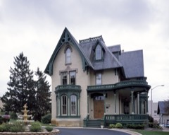
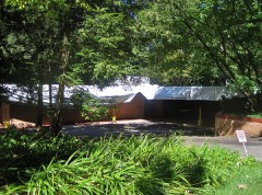
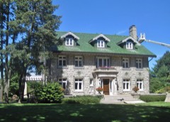
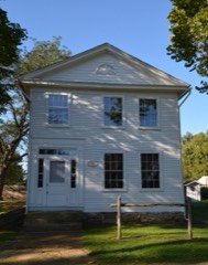
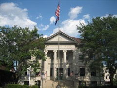
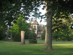
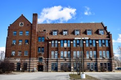
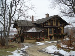
  • 43 properties here are on the National Register of Historic Places: 31 buildings, 10 districts, 1 site and 1 structure.
  • 7 of the 43 listings were added during the 1970s.
  • The Geographic Names Information System records 88 populated places in this county; 88 are covered by at least one topographic sheet.
  • 3 public-domain county histories, 1877 and 1900, supply 294,680 words of narrative reproduced here.

What happened here

15 accounts

Among them: Winnebago Cottntt War Record; Winnebago Counit Dieectort; Chapter Iv The Black Hawk War. These passages come from the identified county-history source books. Each inset names its own source and opens the exact section it comes from.

From The History of Winnebago County, Illinois : Its Past and Present, Containing ... a Biographical Directory of Its Citizens, War Record of Its Volunteers in the Late Rebellion, General and Local Statistics ... History of the Northwest, History of Illinois ... Etc, published 1877 - Durand Township

Winnebago Cottntt War Record

Was organized by Col. Aro Voss, in March, 1862, and mustered into the United States' service Feb. ist, and proceeded immediately to Virginia and immediately participated in several minor engagements, in all of which the Twelfth came out victorious. At Harper's Ferry, when the pbice was entirely surrounded, the Twelfth had permission to cut through the enemy's lines, which it did, and surprised and captured 112 wagons loaded with ammunition and provisions, 100 beef cattle, and 50 prisoners.

Read the rest of this passage

From The History of Winnebago County, Illinois : Its Past and Present, Containing ... a Biographical Directory of Its Citizens, War Record of Its Volunteers in the Late Rebellion, General and Local Statistics ... History of the Northwest, History of Illinois ... Etc, published 1877 - Rockford Township

Winnebago Counit Dieectort

ill Putney, Vt., in 1800 ; he emigrated to Chicago in 1832, where he practiced his profession until 1838, when lie came to Rocliford to I'eside; he married Catherine Dunn, in St. Thomas, Canada, in 1822; she died in 1874; Dr. Goodhue was killed from falling into a well, while attending one of his patients, in 1847.

Read the rest of this passage

From The History of Winnebago County, Illinois : Its Past and Present, Containing ... a Biographical Directory of Its Citizens, War Record of Its Volunteers in the Late Rebellion, General and Local Statistics ... History of the Northwest, History of Illinois ... Etc, published 1877 - Rockford Township

Chapter Iv The Black Hawk War

I HE Sauk or Black Hawk war directed the attention of eastern settlers to the Rock river valley. The history of this outbreak also has a local interest from the fact that this famous Indian warrior, in his flight from Rock Island, followed the general course of Rock river through this county, into Wisconsin territory, where he was defeated and captured.

Read the rest of this passage

From History of Rockford and Winnebago County, Llinois, from the First Settlement in 1834 to the Civil War, published 1900 - Rockford Township

Chapter Xvi

1~"HE first crime brought to light in Winnebago county was committed in the summer of 1835. The body of a murdered man, terribly mutilated, was found in the woods, about two and a half miles south of the settlement. This discovery sent a thrill of horror to the hearts of the pioneers, who began for the first time to feel distrustful.

Read the rest of this passage

From History of Rockford and Winnebago County, Llinois, from the First Settlement in 1834 to the Civil War, published 1900 - Rockford Township

Chapter Xxxvi

THE execution of the Driscolls was only the beginning of the work of extermination ; although it was the sole instance where such desperate measures were considered necessary to accomplish their purpose. Robberies and murders continued, and the people lived for years under a literal reign of terror.

Read the rest of this passage

From History of Rockford and Winnebago County, Llinois, from the First Settlement in 1834 to the Civil War, published 1900 - Rockford Township

Chapter Lxix

TUESDAY, November 11, 1856, John F. Taylor, sheriff of Winnebago county, was instantly killed by Alfred Countryman. On that day Alfred and John Countryman came to Rockford from Ogle county with some cattle, which they offered for sale at such low prices as to arouse suspicion. The cattle were sold for a sum below their market value.

Read the rest of this passage

From History of Rockford and Winnebago County, Llinois, from the First Settlement in 1834 to the Civil War, published 1900 - Rockford Township

Rohbery Of Iickenney And Mulford

The execution of the Driscolls was only the beginning of the work of extermination ; although it was the sole instance where such desperate measures were considered necessary to accomplish their purpose. Robberies and murders continued, and the people lived, for years under a literal reign of terror.

Read the rest of this passage

From History of Rockford and Winnebago County, Llinois, from the First Settlement in 1834 to the Civil War, published 1900 - Rockford Township

Resume Of Record Of Volunteers

November 14. 1863, Rolicrt Ogrilby made an abstract of the record uf Winiicbago county volimteers to that date. The total niunber of enlistments was 2,127. ^^f tli^"^*-' 47 '^-"^' ^'^'^" killed. 160 died, 86 wounded, 24 wounded and died. 49 wounded and discharged. 14 discharged and died, 0 nuistered out and died.

Read the rest of this passage

From The History of Winnebago County, Illinois : Its Past and Present, Containing ... a Biographical Directory of Its Citizens, War Record of Its Volunteers in the Late Rebellion, General and Local Statistics ... History of the Northwest, History of Illinois ... Etc, published 1877 - Rockford Township

Chapter Iv The Black Hawk War

THE Sauk or Black Hawk war directed the attention of eastern settlers to the Rock river valley. The history of this outbreak also has a local interest from the fact that this famous Indian warrior, in his flight from Rock Island, followed the general course of Rock river through this county, into Wisconsin territory, where he was defeated and captured.

Read the rest of this passage

From History of Rockford and Winnebago County, Llinois, from the First Settlement in 1834 to the Civil War, published 1900 - Rockford Township

Chapter Xvi

THE first crime brought to lii^ht in Winnebago county was committed in the summer of 1835. The body of a murdered man, terribly mutilated, was found in the woods, about two and a half miles south of the settlement. This discovery sent a thrill of horror to the hearts of the pioneers, who began for the first time to feel distrustful.

Read the rest of this passage

From History of Rockford and Winnebago County, Llinois, from the First Settlement in 1834 to the Civil War, published 1900 - Rockford Township

Chapter Xxxvi

THE execution of the Driscolls was only the beginning of the work of extermination ; although it was the sole instance where such desperate measures were considered necessary to accomplish their purpose. Robberies and murders continued, and the people lived for years under a literal reign of terror.

Read the rest of this passage

From History of Rockford and Winnebago County, Llinois, from the First Settlement in 1834 to the Civil War, published 1900 - Rockford Township

Chapter Lxix

TUESDAY, November 11, 1856, John F. Taylor, sheriff of Winnebap^o county, was instantly killed by Alfred Countryman. On that day Alfred and John Countryman came to Rockford fromOo^le county with some cattle, which they offered for sale at such low prices as to arouse suspicion. The cattle were sold for a sum below their market value.

Read the rest of this passage

From The History of Winnebago County, Illinois : Its Past and Present, Containing ... a Biographical Directory of Its Citizens, War Record of Its Volunteers in the Late Rebellion, General and Local Statistics ... History of the Northwest, History of Illinois ... Etc, published 1877 - Rockford Township

Chapter Iv The Black Hawk Wak

T HE Sauk or Black Hawk war directed the attention of east¬ ern settlers to the Rock river valley. The history of this outbreak also has a local interest from the fact that this famous Indian warrior, in his flight from Rock Island, followed the general course of Rock river through this county, into Wiscon¬ sin territory, where he was defeated and captured.

Read the rest of this passage

From History of Rockford and Winnebago County, Llinois, from the First Settlement in 1834 to the Civil War, published 1900 - Rockford Township

Chapter Xxxvi

T HE execution of the Driscolls wan only the beginning of the work of extermination; although it was the sole instance where such desperate measures were considered necessary to accomplish their purpose. Robberies and murders continued, and the people lived for years under a literal reign of terror.

Read the rest of this passage

From History of Rockford and Winnebago County, Llinois, from the First Settlement in 1834 to the Civil War, published 1900 - Rockford Township

Chapter Lxix

T UESDAY, November 11, 1856, John F. Taylor, sheriff of Winnebago county, was instantly killed by Alfred Coun¬ tryman. On that day Alfred q,nd John Countryman came to Rockford from Ogle county with some cattle, which they offered for sale at such low prices as to arouse suspicion. The cattle were sold for a sum below their market value.

Read the rest of this passage

Places on the National Register

43

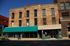
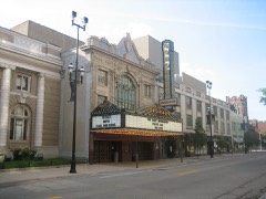
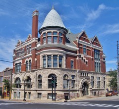
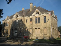
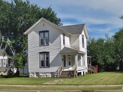
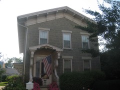
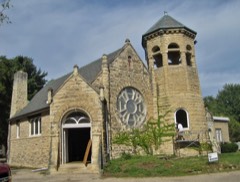
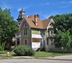
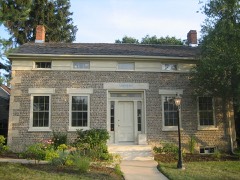
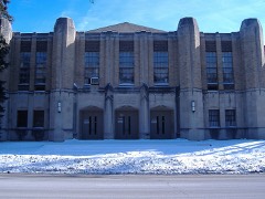
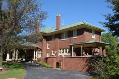
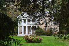
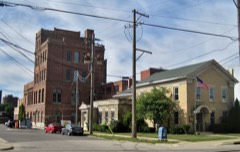
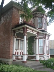
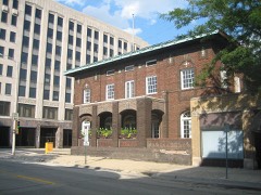
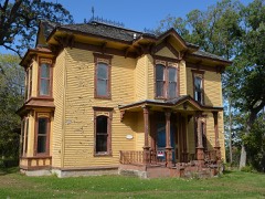
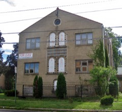
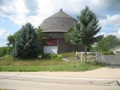
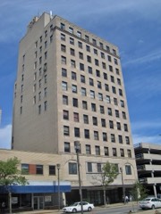
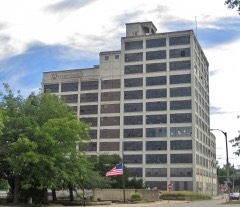
Every property in this county listed on the National Register of Historic Places, with the year it was listed and the federal nomination document.

Photograph PropertyType ListedReference
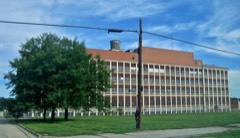
Barber-Colman Company Historic Districtdistrict200606000674
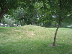
Beattie Park Mound Groupsite199191000084
William Brown Buildingbuilding200000000946
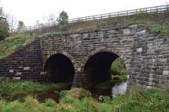
Chicago & North Western Railway Stone Arch Bridgestructure199393000840
Chick Housebuilding199797000031
Christenson-Anderson Farmdistrict2022100007586
Condon Brothers and R.H. Shumway Buildingbuilding201515000524
Coronadobuilding197979000878
East Rockford Historic Districtdistrict198080001422
Emerson-Keith Housebuilding2022100008488
Garrison Schoolbuilding200606000005
Garrison-Coronado-Haskill Historic Districtdistrict201211001030
Graham-Ginestra Housebuilding197979000879
Greenwood Cemetery Chapel and Crematorybuilding201212000554
Haight Village Historic Districtdistrict198787002044
Herrick Cobblestonebuilding198080001423
Illinois National Guard Armorybuilding200000000948
Indian Hill Manor and Farm Historic Districtdistrict200101000667
Lysander Jacoby Housebuilding198282002607
H.D. Jameson Housebuilding200303000915
Lake-Peterson Housebuilding198080001424
Kenneth and Phyllis Laurent Housebuilding201212000555
Charles Lundberg Housebuilding200808001251
Macktown Historic Districtdistrict197878001201
Peacock Brewerybuilding201111000851
William H. Roberts Housebuilding197979000877
Rockford Brass Worksbuilding2022100007583
Rockford Elk's Lodge #64building200505000113
Rockford Gas Light & Coke Fitting and Meter Shops Buildingbuilding2024100010211
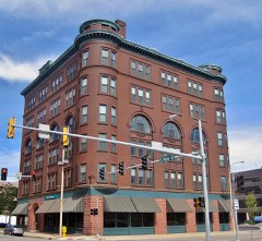
Rockford Morning Star Buildingbuilding199999000972
Rockford Woman's Clubbuilding2020100005971
Rockton Historic Districtdistrict197878001202
Seventh Street Commercial Historic Districtdistrict200504001304
Soldiers and Sailors Memorial Hallbuilding197676000731
Amos Catlin Spafford Housebuilding198080001425
St. Thomas Catholic High School for Boysbuilding2018100002826
Tinker Swiss Cottagebuilding197272000468
Turner Schoolbuilding201515000934
Valencia Court Apartmentsbuilding200909001123
Robert Weber Round Barnbuilding198484001172
West Downtown Rockford Historic Districtdistrict200707000899
Witwer Housebuilding2021100006872
Ziock Buildingbuilding201111000246

Wildfire, 2003 to 2020

23 fires

Every wildfire the federal occurrence database records inside this county: 23 of them, burning about 41 acres. None started naturally and 1 was recorded as arson. Each settlement page carries the fires within five miles of it.

Reported cause Fires
Missing data/not specified/undetermined13
Debris and open burning8
Arson/incendiarism1
Fireworks1

The five largest, by the area the report gives. One of them was set deliberately.

DateCause SizeReported by Name on the report
8 December 2020Debris and open burning20 acresIllinois Division of Forestry Resources20-0000590
31 March 2015Debris and open burning5.0 acresIllinois Division of Forestry Resources15-0000139
22 April 2019Debris and open burning2.0 acresIllinois Division of Forestry Resources2019201
16 February 2003Arson/incendiarism2.0 acresIllinois State Fire Marshal's Officenot named
16 February 2003Missing data/not specified/undetermined2.0 acresIllinois State Fire Marshal's Officenot named
11 March 2018Debris and open burning1.0 acresIllinois Division of Forestry Resources2018-176
13 March 2018Missing data/not specified/undetermined1.0 acresIllinois Division of Forestry Resources18-0230
1 April 2015Missing data/not specified/undetermined1.0 acresIllinois Division of Forestry Resources15-0000144

Every settlement page carries the fires within five miles of it - see the settlement index below.

Storms, 1958 to 2026

60 of 692 shown

The NOAA Storm Events Database holds 692 reports for this county, causing 3 deaths, 12 injuries and about $40,503,500 in recorded property damage. Each settlement page carries the reports that name it.

Kind of event Reports
Thunderstorm Wind342
Hail215
Flood46
Flash Flood36
Tornado25
Heavy Rain12
Lightning10
Funnel Cloud6

The most serious of them, by death, then injury, then recorded damage. The accounts are quoted exactly as the forecast office filed them.

WhenEvent Place namedHarm What the report says
August 2021Thunderstorm WindRockford1 killed, 2 hurtA tree fell onto a mobile home in the Riverview Mobile Home Park. Three occupants were rescued. One of the rescued, a 55 year old woman, died from her injuries.
July 2024Flash FloodRockford1 killed, 1 hurtAround 2115 CST, a pickup truck with two people inside attempted to drive through moving flood waters in a parking lot due to flash flooding of Keith Creek near Charles Street and 22nd Street. The pickup truck was swept away by the flood waters. The driver was able to escape but was swept underneath a culvert at 22nd Street before being rescued. A 76 year old passenger became trapped in the pickup truck and drowned.
November 1988Thunderstorm Windnot stated1 killedno account filed
November 2010Tornado (EF2)Rock Cut State Park6 hurt, $500,000Based on an eyewitness report, a tornado touched down in the backyard of a home just west of Interstate 39, on the eastern edge of a subdivision. The tornado then blew over a school bus near the intersection of Argyle and Harlem Roads. There were six people on the bus, the driver and five children. All six people were taken to the hospital but none of the injuries were serious. The tornado then knocked down eleven electrical high tension towers just southwest of the same intersection. The tornado was likely at EF2 intensity at this time and as it crossed into Boone County.
May 2011Thunderstorm Wind(Rfd)Gtr Rockford Ar1 hurt, $50,000Several high wind and wind damage reports were received across eastern and southeastern Rockford as a line of severe storms moves through. Specific reports include estimated 70 mph gusts near Alpine Road and Harrison Avenue and estimated 75 mph gusts near Interstate 90 and Highway 20. One person was injured on Crosby Street on the near east side of Rockford when a tree fell onto a house. A large tree fell onto a car on Antelope Drive and destroyed the car. Another tree fell onto a car on Fairview Avenue. A pharmacy on Main street lost part of its roof and part of a wall was damaged. Tree limbs and power lines were blown down in many areas.
July 2023LightningWinnebago1 hurtA man was injured when he was struck by lightning while visiting a Rockford cemetery. His condition was reported as unknown, but the man was responsive when paramedics arrived on scene.
September 2010Thunderstorm WindLoves Park1 hurtA man was struck and injured by a falling tree while exercising in his back yard.
September 2006Flash FloodRockford$20,000,000Thunderstorms developed over southeast Winnebago County and eastern parts of the City of Rockford during the afternoon and evening of September 4th. The thunderstorms continued to redevelop over the same areas, as they pushed north and weakened. Some areas across parts of eastern Rockford received heavy rain for two to three hours. As a result, massive and severe flooding occured. Most of the flooding occurred in and around the Keith Creek Watershed. Some of the damage included a large section of a concrete drainage ditch that was washed out on Harrison Avenue near 20th Street. Hundreds of basements were flooded. Fifteen of these basements suffered structural damage and were deemed uninhabitable. Numerous streets and parking lots were flooded, some as much as 4 to 6 feet with cars floating or submerged in the flood waters. Flood waters as deep as nine feet were reported on Alpine Park in downtown Rockford. Dozens of people were rescued from the flood waters and hundreds were evacuated from their homes as flood waters rose. Flood waters rose so fast in some areas that motorists were trapped in their cars until help arrived. At least 70 businesses sustained some level of flood damage. The highest rainfall total reported was 7.50 inches near Cherry Valley, 4.30 inches was reported on the east side of Rockford, while only 0.72 inches was recorded at Rockford Airport on the southwest side of the City. No fatalities or injuries were reported.
June 2008FloodRoscoe$6,000,000no account filed
July 2003Thunderstorm WindPecatonica$5,000,000no account filed
July 2024Flash FloodWoodcrest$2,000,000Thunderstorms producing torrential rainfall moved across southern Winnebago County and Rockford during the late evening of July 13th into the early morning of July 14th producing significant flash flooding and numerous water rescues, though no injuries were reported.||Water rescues were reported near Eastmoreland Avenue and Broadway; Near Auburn Street and Huffman Boulevard; Broadway at Woodruff Avenue; Near Charles Street and 22nd Street; Green Dale Drive and Ashbrook Drive; Spring Creek Road and North 2nd Street; Riverside Boulevard and Latham Street; Near Chelsea Avenue and Arden Court; Near State Street and Trainer Road; At Don Carter Lanes on Street State; Auburn Street and Central Avenue; In the 3400 block of Garfield Drive; Sandy Hollow Road and Alpine Road and several water rescues were reported on the 600 block of St. Louis Avenue. Multiple vehicles were stuck in flood waters along Charles Street including an ambulance. A car was submerged in a parking lot near Charles Street.||Numerous streets were flooded and impassible. Kishwaukee Street was flooded and impassable at 23rd Avenue. A photo showed flowing water over Charles Street at Perryville Road; Video showed several inches of water on State Street just west of Rockford Avenue and a drainage ditch was overflowing near Harrison Avenue and Alpine Road.||Houses were flooded near Javelin Drive and Woodridge Drive. Pavement damage was reported to a nearby parking lot. Water was reported entering a few structures near downtown Rockford including along Benton and State Streets. Numerous homes were surrounded by flood waters along Northwest Drainage Ditch in northwest Rockford where water rescues were done by boat. Flood waters were up to the doorway of houses in the 1000 block of 14th Street where residents were being evacuated. Multiple houses were surrounded by water due to flooding of Keith Creek between 11th Street and 18th Street and a house was flooded near Whitman Street and Rockton Avenue. Several hundred basements were flooded.||Some of the highest storm total rainfall amounts included 6.30 inches three miles west northwest of Rockford; 6.24 inches two miles east northeast of Rockford; 5.69 inches three miles south southeast of Loves Park; 5.66 inches two miles northwest of Cherry Valley; 4.87 inches two miles west northwest of Loves Park and Rockford Airport measured 2.40 inches. Rainfall rates during the heaviest thunderstorms were between 2 to 4 inches per hour. A trained spotter reported 4 inches of rain in one hour in Loves Park between 2130 CST and 2230 CST.
August 2007FloodWinnebago$2,000,000Flooding continued from heavy rains and flash flooding earlier on August 7th. In Rockford, multiple roads closed due to flooding inlcuding Valencia, Avalon, and Churchill Grove from 9th to 20th. City officials in Rockford feared that water flowing over the spillway at the Alpine dam in Rockford would result in structural failure of the 65 year old dam. Residents in a 1200 home area immediately downstream of the dam along Keith Creek were evacuated as a precaution. Flood waters up to the first level of some houses and as many as 12 basement collapses were reported as a result of the flooding. Water came within 2 feet of flowing over the Alpine dam spillway at around 1130 AM. Severe flooding occurred within the Churchill Park area. Significant flooding also occurred along Madigan Creek in the Cherry Valley area. More than 40 residents along the creek were evacuated. About 30 homes along the creek sustained flood damage. Rainfall totals include 6.84 inches 3 miles southeast of Rockford, 6.79 inches northwest of Rockford and 4.70 inches 3 miles northeast of Rockford. The city of Rockford and Winnebago County were declared a state disaster area as a result of the flash flooding and flooding.
August 2007Flash FloodRockford$1,000,000Over 6 inches of rain fell over southeast Rockford in a three hour period. The runoff quickly overwhelmed Keith and Madigan Creeks in Rockford as well as other streams across eastern Winnebago County. Hardest hit areas included the Keith Creek watershed in southeast Rockford, the same area that experienced flash flooding on Labor Day 2006. Twenty intersections flooded in Rockford with six cars stranded in flood waters. Illinois Central railroad tracks washed out at Malford Road just south of Harrison.
July 2010Flash FloodSouth Beloit$632,000Very heavy rain fell across Winnebago County producing widespread flooding and flash flooding, including creek and river flooding. Significant flooding was reported near Keith Creek in the Churchill Park area on the east side of Rockford. Route 2 was flooded and impassible near South Beloit Road.
July 2024Flash FloodWempleton$500,000Thunderstorms producing torrential rainfall moved across southern Winnebago County and Rockford during the evening of July 14th producing significant flash flooding. Street flooding with stalled vehicles were reported all across Rockford. Multiple cars were flooded along roadways near the Alpine Dam where water levels reached two feet below the spillway. Widespread street flooding was reported near Gorham Place and Barrington Road and also near 11th Street and Broadway Street. Significant erosion occurred near roadways and parking lots at the Swedish American Hospital on State Street. Numerous basements were flooded.
June 2018Flash FloodWempleton$500,000Torrential rain caused flash flooding in Rockford. Portions of the Rockford Mercy Health Hospital were flooded with 4 to 5 feet of water in the lowest level of the hospital. The Rockford fire department reported approximately 15 water rescues which included two cars that flipped over with people in them. No injuries were reported. Cars were submerged in flood waters in many locations including near Rockford Mercy Health Hospital; near OSF Saint Anthony Hospital; near the intersection of Brendenwood Road and Chelsea Avenue and near Van Wie Avenue and Hancock Street. Flood waters were several feet deep in many locations including flowing water in some locations. Several homes were flooded.||Storm total rainfall amounts included 5.58 inches 0.7 miles northwest of Rockford; 5.50 inches 1.5 miles east northeast of Rockford; 5.00 inches 1 mile east of Rockford; 4.80 inches 3.3 miles northeast of Rockford; 4.50 inches in Rockford; 3.10 inches 2 miles east of Rockford and 2.89 inches 5.5 miles south of Rockford.
June 2017Flash FloodSeward$500,000Very heavy rain fell across Winnebago County during the evening hours of June 28th. Numerous roads were flooded, closed and impassable due to flash flooding. In Rockford, numerous cars were stranded in flood waters with several water rescues from the stranded vehicles. Kent Creek was out of its banks. A parking lot at a pharmacy was flooded and people were unable to leave the building. Numerous residential roads were flooded and impassable in Loves Park, Machesney Park and Pecatonica. In Winnebago, 4 to 6 inches of flowing water was reported on roads. Storm total rainfall totals included 5.69 inches in Loves Park; 5.48 inches at Rockford International Golf Course; 5.21 inches at Winnebago; 5.00 inches at Pecatonica; 4.11 inches at Rockford Airport; 3.80 inches 3 miles ENE of Machesney Park and 3.46 inches 2 miles southeast of Roscoe.
May 2011LightningHarlem$400,000A two story, eight unit apartment building was struck by lightning. The roof was engulfed in flames and the building was a total loss. All of the 15 occupants were able to exit the building safely and no injuries were reported.
August 2015Flash FloodCamp Grant$300,000Numerous reports of high water and drainage issues across the northeast and southeast portions of Rockford. Cars were stranded in standing water. Areas hit were the intersections of Sandy Hollow and Alpine, as well as streets north of 9th Avenue between 11th and 15th Streets, Churchill Park and the intersection of State and Perryville. Numerous reports of flooded basements.
August 1979Tornado (F2)not stated$250,000no account filed
May 2011Tornado (EF1)Seward$100,000This is a continuation of a tornado that started in Ogle County and crossed into Winnebago County on East Montague Road near South Conger Road. The path was nearly continuous briefly lifting near Kelly Road east of just Alworth Road, then continuing again into the west side of Machesney Park past the Kennedy Middle School which had part of its roof blown off. A persistent path of damage was observed until the end of the tornados life when damage became sporadic. Several damage indicators indicating a persistent EF1 rating were observed throughout the tornados path. There were numerous softwood trees snapped or uprooted, some up to 24-30 inches in diameter. A few hardwood trees up to 18 inches in diameter were also snapped. Many tree limbs were also downed. Structural damage included several collapsed outbuildings, damaged siding and fascia to homes, and shingles blown off roofs. Debris in numerous locations was deposited downstream from its origin, sometimes up to 400 yards. All of the damage suggested winds from 90-110 mph.
August 2014Thunderstorm WindCamp Grant$50,000Trees were blown down at Barry Road and Kishwaukee Street. A tree fell onto a house on 18th Avenue.
May 2011Thunderstorm WindNew Milford$50,000A large tree was blown down onto a building near Route 251 and New Milford School Road. A nearby building suffered significant damage when a 50 foot ash tree fell onto the building.
November 2010Thunderstorm WindHarlem$50,000Thunderstorm wind damage occurred near McFarland and Thomas Drive in Loves Park where shingles were blown off roofs and fascia was damaged on several houses.
July 2010LightningRoscoe$50,000Lightning struck an underground gas line on Wild Deer Trail and a second underground gas line on Huntsboro Lane. Lightning also struck a home on Pin Oak causing a fire to start in the garage.
March 2009Thunderstorm WindRoscoe$50,000Extensive tree damage was reported in Roscoe. The roof of one home was damaged, as well as a fence. A second home sustained roof and siding damage. Power lines were also blown down.
September 2006LightningWinnebago$50,000The roof of a house was struck by lightning. The lightning blew out a television and started a fire which caused significant damage to the house.
July 1995Thunderstorm WindRockford$50,000A wind gust to 81 mph was recorded at the Rockford Airport. One small plane was blown loose and into the grass and another was flipped over. A 727 was spun 90 degrees by the wind.
July 2025Flash FloodLatham Park$30,000Torrential rain fell across portions of Rockford, Cherry Valley and Loves Park in a very short time during the late afternoon of July 10th. Several vehicles were stranded in flood waters a few feet deep in multiple locations and street flooding occurred in many areas. Video showed waist deep water on Argus Drive between Buckley Drive and Sundae Drive where at least two cars and a city transit bus were stuck in flood waters. Six passengers were on the bus when it stopped because of the flood waters and there were no injuries reported. A photo showed 2 to 3 feet of standing water on Golf Hill Road at Putter Place. A photo showed water at least one foot deep on Alpine Road at Charles Street. A photo showed flooding along East State Street. Flood waters entered at least one home and one apartment building. One motorist commented that the flooding developed very quickly as they were driving. At least 17 cars were stalled in flood waters, most just past the bottom of the doors but 2 cars had flood waters over the hoods. Hurricane Harbor, an amusement park, was flooded and was closed for 10 days. Rainfall of 2.62 inches in one hour was reported two miles east southeast of Machesney Park at 1626 CST.||Additional thunderstorms moved across some of the same areas during the early evening with additional flooding reported in Loves Park where flood waters entered the garage of an industrial building on Beacon Street.||Storm total rainfall amounts included 6.50 inches one mile east of Loves Park; 5.05 inches two miles north northwest of Machesney Park; 4.41 inches one mile northwest of Machesney Park; 3.93 inches south southwest of Rockton and 3.78 inches two miles south southeast of Loves Park.
May 2017Thunderstorm WindRockton Wgn Wheel Ar$30,000A large outbuilding was destroyed and another suffered roof damage. Numerous large branches were snapped and a couple large trees were blown down.
June 2014Thunderstorm WindRockton$25,000A garage collapsed due to severe winds.
May 2011Thunderstorm WindSouth Beloit$25,000Several storage buildings sustained roof damage near Route 251 and Rockton Road.
June 2001Thunderstorm WindCountywide$25,000no account filed
August 1990Tornado (F1)not stated$25,000no account filed
June 1967Tornadonot stated$25,000no account filed
August 1958Tornado (F2)not stated$25,000no account filed
November 2010LightningLoves Park$20,000An unoccupied restaurant was struck by lightning near North Second Street and Wood Avenue.
June 2010Thunderstorm WindCherry Vly$20,000Roof damage was reported to a building near Interstate 90 and Route 20.
June 2010Thunderstorm WindNorth Park$20,000Wind damage was reported in a large area of Rockford. Two large trees were blown down and a roof was blown off a house on Spring Lake Road. Four large trees were blown down at Route 2 and Gleasman Road. Trees were blown down and uprooted near Route 251 and Spring Creek Road. Numerous 6 to 12 inch tree limbs were blown near SpringBrook and Hickory Roads. ComEd reported 17,700 customers lost power.
June 2007Thunderstorm WindRockton$20,000Trees and power lines were blown down. Siding blown off a house. A deck was damaged from a grill that was blown over and a hard top cover was blown off a pool.
May 2011Tornado (EF1)South Beloit$15,000A brief tornado touched down in the Rockton area between Route 251 and Interstate 90, just north of Rockton Road. Damage was observed around the Roscoe Fire Station, where a large garage door was blown in. Winds were estimated to be as high as 90-100 mph.
July 2011Thunderstorm WindNorth Park$15,000A semi-truck was overturned in Loves Park on Perryville Road between Harlem Road and Mulford Road. State Street was closed from 9th Street to Division after a large tree was blown down taking down power lines. Rockford Park District reported that 25 parks and facilities sustained some type of storm damage, mostly from fallen trees.
September 2015Thunderstorm WindRockford$10,000Tree down on powerlines.
June 2014Thunderstorm WindRoscoe$10,000A few trees were uprooted and a branch fell through a home.
May 2011LightningSeward$10,000Lightning struck a pig-confined building along Kelley Road in Pecatonica. The damage was confined to the utility room and no livestock was lost.
March 2009Thunderstorm WindRockford$10,000Trees and power lines were blown down. A well built shed was destroyed with debris scattered over 100 yards downstream.
June 2009LightningPecatonica$10,000Lightning struck a two story building on Main Street and caused a fire in the southwest corner of the second level.
July 2017Thunderstorm WindRockford$5,000Numerous trees and power lines were blown down throughout Rockford.
June 2017Thunderstorm WindMachesney Park$5,000Numerous tree limbs and a one foot diameter tree were blown down. A cemented flag pole was bent by the wind. Part of a roof was blown off a house.
July 2012Thunderstorm WindMachesney Park$5,000A 20 to 30 foot long, six inch diameter tree limb fell through the roof of a house on Mildred Road.
May 2011Thunderstorm WindColonial Gardens$5,000Tree limbs, utility poles and power lines were blown down in many areas of Machesney Park.
May 2011Thunderstorm WindRoscoe$5,000Estimated 60 mph wind gusts in the town of Roscoe downed tree branches, bent a Dairy Queen flagpole in half, and caused damage at the Roscoe Fire Department including their training facility.
July 2008Thunderstorm WindRockton$5,000Patio furniture and a barbeque grill were blown around and damaged. Wind damage was reported to siding and gutters of a few houses.
August 2007Thunderstorm WindRockford$5,000Tree branches and power lines blown down.
September 2007Thunderstorm WindRockford$5,000A large tree was blown down at Brooke and Saner Roads. Several two foot diameter trees were blown down on Clarine Lane. Three utility poles were also blown down.
July 2011Thunderstorm WindHarlem$3,000High winds blew down several power lines along Alpine Road just north of East Riverside Boulevard.
June 2017Thunderstorm WindCamp Grant$1,000Tree limbs 8 inches in diameter and power lines were blown down near 11th Street and Sandy Hollow Road.
May 2014Thunderstorm WindAlworth$1,000Two power poles were blown down near Cunningham and Osborne Roads.
May 2013Thunderstorm WindRockton$1,000Power lines were blown down and utility poles were leaning over. Shredded tree branches were reported near Hononegah Road.
May 2011Thunderstorm WindPecatonica$1,000Large tree limbs and power lines were blown down.

Mines and quarries

85 recorded

The Survey's mineral resources record lists 85 workings inside this county. 19 still produce and 66 are closed or unrecorded. Each settlement page carries the workings within five miles of it.

Commodity Workings
Stone, Crushed/Broken63
Sand and Gravel, Construction22

The least common of them first, because a county's hundredth gravel pit says nothing its first ten did not.

Where SiteCommodity StatusRecorded
Airport Pit Dredge & Wash PlantSand and Gravel, ConstructionProducer
Anderson PitSand and Gravel, ConstructionPast Producer
Can-Tex Industries Aggregate PitSand and Gravel, ConstructionPast Producer
Cherry Valley Sand & GravelSand and Gravel, ConstructionProducer
Durgon PitSand and Gravel, ConstructionPast Producer
Ellis PitSand and Gravel, ConstructionPast Producer
General Dynamics PitSand and Gravel, ConstructionPast Producer
Grover PitSand and Gravel, ConstructionPast Producer
Hoogie PitSand and Gravel, ConstructionPast Producer
Illinois Wisconsin Sand & GravelSand and Gravel, ConstructionProducer
Kelley Pit & MillSand and Gravel, ConstructionPlant
Larson Brothers Pit No. 2Sand and Gravel, ConstructionPast Producer
Manley PitSand and Gravel, ConstructionPast Producer
North Shore S & G PitSand and Gravel, ConstructionProducer
Porter PitSand and Gravel, ConstructionPast Producer
Racetrack PitSand and Gravel, ConstructionPast Producer
Rockview PitSand and Gravel, ConstructionPast Producer
Sahlstrom Sand & GravelSand and Gravel, ConstructionPast Producer
South Main Sand & Gravel PitSand and Gravel, ConstructionProducer
Turtle PitSand and Gravel, ConstructionPast Producer
William Howard PitSand and Gravel, ConstructionPast Producer
Winquist Pit Rein, Schultz & DahlSand and Gravel, ConstructionPast Producer
Asche QuarryStone, Crushed/BrokenPast Producer
Austin QuarryStone, Crushed/BrokenPast Producer
B. Baton QuarryStone, Crushed/BrokenPast Producer
Black QuarryStone, Crushed/BrokenProducer
Carrico QuarryStone, Crushed/BrokenPast Producer
Cooling QuarryStone, Crushed/BrokenProducer
Cunningham Quarry & MillStone, Crushed/BrokenProducer
Davis QuarryStone, Crushed/BrokenProducer
E. Sharp QuarryStone, Crushed/BrokenPast Producer
Ed Truman QuarryStone, Crushed/BrokenPast Producer
Faulkner QuarryStone, Crushed/BrokenPast Producer
Foss QuarryStone, Crushed/BrokenPast Producer
Gantzer QuarryStone, Crushed/BrokenPast Producer
Genestra QuarryStone, Crushed/BrokenPast Producer
H. Webster QuarryStone, Crushed/BrokenPast Producer
Johns QuarryStone, Crushed/BrokenProducer
Kelley Quarry Porter & SonsStone, Crushed/BrokenPast Producer
Levings Quarry Ga PortableStone, Crushed/BrokenPast Producer
Loves Park City Eng.Stone, Crushed/BrokenPast Producer
Mill Package 1978Stone, Crushed/BrokenPlant
Morris QuarryStone, Crushed/BrokenPast Producer
Mulford Quarry & MillStone, Crushed/BrokenPlant
Nelson QuarryStone, Crushed/BrokenPast Producer
Netherly QuarryStone, Crushed/BrokenPast Producer
Nimtz Quarry & Mill Portable #2Stone, Crushed/BrokenPlant
Northern Illinois Supply Co QuarryStone, Crushed/BrokenPast Producer
Northern Illinois Supply Co. QuarryStone, Crushed/BrokenPast Producer
Pagel PitStone, Crushed/BrokenPast Producer
Peterson QuarryStone, Crushed/BrokenPast Producer
Porter Bros. Swanson Road QuarryStone, Crushed/BrokenProducer
Porter QuarryStone, Crushed/BrokenPast Producer
R. Black QuarryStone, Crushed/BrokenPast Producer
R. Mcgee QuarryStone, Crushed/BrokenPast Producer
Richardson QuarryStone, Crushed/BrokenPast Producer
Rock View StoneStone, Crushed/BrokenProducer
Rockford City Eng.Stone, Crushed/BrokenPast Producer
Rockford MaterialsStone, Crushed/BrokenProducer
Rockford Township QuarryStone, Crushed/BrokenPast Producer
Saelens QuarryStone, Crushed/BrokenProducer
Sahlstrom QuarryStone, Crushed/BrokenPast Producer
Salem PitStone, Crushed/BrokenPast Producer
Sand Hollow QuarryStone, Crushed/BrokenPast Producer
Schmerse QuarryStone, Crushed/BrokenPast Producer
Schuur QuarryStone, Crushed/BrokenPast Producer
Shiloh QuarryStone, Crushed/BrokenPast Producer
Swanson QuarryStone, Crushed/BrokenPast Producer
Thompson QuarryStone, Crushed/BrokenPast Producer
Trask Bridge QuarryStone, Crushed/BrokenPast Producer
Unnamed Limestone QuarryStone, Crushed/BrokenPast Producer
Wilson & Shipler QuarryStone, Crushed/BrokenProducer
Winnebago Co. Fish Hatchery QuarryStone, Crushed/BrokenPast Producer
Winnebago Co. Forest Presrv. QuarryStone, Crushed/BrokenPast Producer
Winnebago Co. Highway Dept. QuarryStone, Crushed/BrokenPast Producer
Winquist Qry.Rein, Schultz & DahlStone, Crushed/BrokenPast Producer

The townships, in 1877

294,680 words

The History of Winnebago County, Illinois : Its Past and Present, Containing ... a Biographical Directory of Its Citizens, War Record of Its Volunteers in the Late Rebellion, General and Local Statistics ... History of the Northwest, History of Illinois ... Etc devotes a chapter to each township: its boundaries and streams, who settled it and when, the mills, the schools and the churches. All 14 are reproduced here in full. Each row shows the township's own shape and where it lies in the county, drawn from the Census Bureau's boundary. Which settlements belong to which township is computed from that same boundary, not taken from the book.

Shape and position in the county TownshipSettlements in it LengthSections
Burritt TownshipWempletown8,754 words3
Cherry Valley TownshipAtwood Estates, Atwood Park Estates, Blackcrest, Burr Oak Acres, Canyon Ridge, Cherry Valley, Cheyenne Heights, Coventry Creek, Coventry Hills, Coventry Hills East, Greenridge Estates, Hickory View Estates, Kishwaukee Glen, Lindberg Park, Linview, Maywood Manor, Mulford Highlands, Panorama Valley, Perryville, Pine Manor, River Grove, Thorne Ledge, Valley View, Valley View Farm16,109 words10
Durand TownshipDurand11,455 words5
Harlem TownshipForest Hills Village, Harlem, Machesney Park, North Park, Phil-Aire Estates1,362 words2
Harrison TownshipHarrison4,958 words4
Laona TownshipLake Summerset639 words0
Owen TownshipColonial Gardens, Genet, Hutchins Park, Jonesville, Latham Park, Nottingham Manor, Owen Center, Sturbridge Village2,048 words1
Pecatonica TownshipPecatonica, Westlake Village7,339 words2
Rockford TownshipBrewster Heights, Coreys Bluff, Factory Addition, Franklin Gardens, Grant Park, Grant View Heights, Green View Heights, Greendale, Harrison Avenue Gardens, Harrisville, Hickory Creek, Indian Village, Kinseys Little Farms, Kishwaukee, Lonesome Acres, Loves Park, Mancuso Village Park, Morristown, Motor Heights, New Milford, Normandy Heights, Ravinia Park, River Forest, Rockford, Ruby, Samuelson Corners, Silver Hills, Victory Homes, Westmoreland, Winnebago Court, Woodcrest166,475 words152
Rockton TownshipNorthgate Estates, Rockton, South Beloit, South Bluff Homes22,442 words5
Roscoe TownshipMorehaven, Riverdale, Roscoe, Stagecoach Hills2,611 words0
Seward TownshipSeward3,150 words3
Shirland TownshipShirland3,954 words1
Winnebago TownshipAlworth, Westfield Corners, Winnebago43,384 words24

The county's history books

269,092 words

One book written about this county, cut here where the book itself is cut, at its printed chapters: 1 chapter in all. Every chapter is public domain, machine-read from the scan and reproduced complete. A chapter already given under one of the county's towns is not repeated in this list.

The History of Winnebago County, Ill. (1877)

ChapterLength
The whole text269,092 words in 17 parts

The people it describes

64 named

Everyone The History of Winnebago County, Illinois : Its Past and Present, Containing ... a Biographical Directory of Its Citizens, War Record of Its Volunteers in the Late Rebellion, General and Local Statistics ... History of the Northwest, History of Illinois ... Etc stops to write about, with the section that describes them. Among them are the men who founded the place and governed the Territory. Each name opens the passage itself, in the words of 1877.

Every populated place in the county

88

Named settlements recorded in the Geographic Names Information System, each with the topographic sheets covering it. Villages, hamlets and abandoned places alike. Each is shown with the nearest named watercourse or landform and the survey quadrangle it falls on.

Provenance

  • Topographic sheets. USGS Historical Topographic Map Collection, county index, measured from the bulk metadata.
  • Fire insurance maps. Library of Congress Sanborn collection, faceted to this county.
  • Photographs. Each place queried individually against the Library of Congress Prints and Photographs search.
  • Wildfire. Short, Karen C. 2022. Spatial wildfire occurrence data for the United States, 1992-2020 [FPA_FOD_20221014]. 6th Edition. Fort Collins, CO: Forest Service Research Data Archive. https://doi.org/10.2737/RDS-2013-0009.6 Collected with United States Government funding and usable without additional permissions or fees.
  • Mines and quarries. USGS Mineral Resources Data System (MRDS) https://mrdata.usgs.gov/mrds/ A work of the United States government, no copyright under 17 U.S.C. 105.
  • Storms. NOAA National Centers for Environmental Information, Storm Events Database https://www.ncei.noaa.gov/stormevents/ A work of the United States government, no copyright under 17 U.S.C. 105. Narratives are quoted verbatim from the National Weather Service report and are not edited or summarised.