 Block
Rutland, Illinois
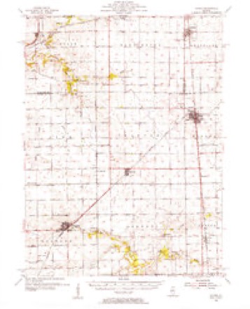
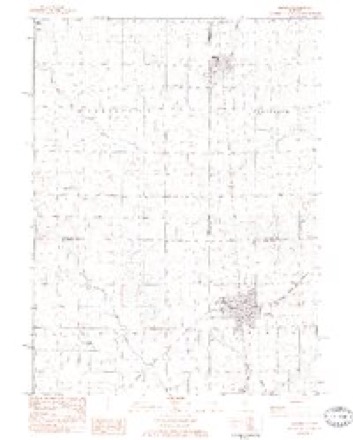
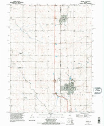
12 topographic sheets cover this place, the earliest surveyed in 1955 and the latest in 1995. It stands in Groveland Township. It lies in ZIP code area 61358. The Survey maps it on the Minonk quadrangle. 259 people lived here at the 2020 count. It stands 699 feet above sea level.
Population over time
2 figuresRutland fell from 318 to 259 between 2010 and 2020. These are the recorded population figures Wikidata holds for this place, reached through the Geographic Names Information System number this page is keyed on rather than by name, so they belong to this place and not to another of the same name. Most are census counts, but not all are: an early figure may be a founding or settlement estimate, and an estimate published within five years of a census is left out. The change column is computed, and is left blank where more than 20 years separate a figure from the one before it, because a gap that long is not a change between two counts.
| Year | People | Change |
|---|---|---|
| 2010 | 318 | |
| 2020 | 259 | -59 (-19%) |
Topographic sheets covering this place
9 surveys from 12 printed sheetsMatched by testing this settlement's coordinate against the published boundary of every sheet in the United States Geological Survey's historical collection. Each opens the scanned sheet at the Survey.
- 1955 USGS Minonk quadrangle1:62500
- 1958 USGS Peoria quadrangle1:250000, 4 printings
- 1961 USGS Peoria quadrangle1:250000
- 1963 USGS Peoria quadrangle1:250000
- 1983 USGS Minonk quadrangle1:24000
- 1985 USGS Peoria quadrangle1:100000
- 1989 USGS Peoria quadrangle1:100000
- 1990 USGS Peoria quadrangle1:250000
- 1995 USGS Minonk quadrangle1:24000






In the county-history sources
964 words on this townshipHistory of LaSalle County, Illinois : Its Topography, Geology, Botany, Natural History, History of the Mound Builders, Indian Tribes, French Explorations, and a Sketch of the Pioneer Settlers of Each Town to 1840, with an Appendix, Giving the Present Status of the County, Its Population, Resources, Manufactures and Institutions, published 1877 names this settlement in its chapter on Groveland Township. These are the passages that mention it, exactly as the scans read.
Township 20, Range 2, constitutes the town of Groveland. It is the southernmost town in the county, and the last settled. With the town of Osage, it lies between the counties of Marshall and Livingston, and when those counties were onganized from territory taken partly from La Salle, both of them refused to take the territory included in those towns. So La Salle from necessity had to keep it. With the present population and wealth they constitute no insignificant portion of the county, The west side of the town is the most elevated. Prairie creek rises near New Rutland and runs to and along the north line. Long Point creek rises néar Minonk, and crosses the town from southwest to northeast, while the southeast portion is drained by Diamond creek. All these ran northeastwardly to the Vermillion, and make effectnal drainage. In 1855 the town was an unbroken prairie, without an inhabitant. The first house in the town was moved on to the present site of New Rutland, and made a section-house on the Illinois Central Railroad. Tt was made a liquor saloon, and destroyed by a mob in 1865. The railroad was built through the town before it was settled, und doubtless was the agency that developed its resources. Abner Shinn built the first house and Oscar Jacobson occupied it in March, 1855, being the first resident in the town. He left i The second resident was Elias Prink, and imily Whitman, from Onondaga County, N. Hisonly child, W. E., marin 1s wife, Y.; he settled on §.
An emigration association was formed in January, 1855, of about two hundred members, residing in the vicinity of Rutland, Vermont, Each member paid ten dollars, and was to have a lotin an embryo city to be located somewhere in the far West. Dr. Allen and W. B. Burns were the locating committee, The present site of New Rutland was selected, being the northwest 40 acres on 8. 18, and southwest 400n 8.7. The railroad gave the members a preference in the selection of thelr lands at 20 per cent. discount. W. B. Burns came on the ground in Augast, 1855 ; built a house and occupied itin 1856; he was the master spirit of the enterprise and in- snred its snecess; bad health induced him to remove to California, whore he died in 1875. Willard Proctor and Rufus Weston were the first to select lands under the arrangement with the railroad. John Wadleigh came to the town in the fall of 1855;
Machine-read from a century-old scan, so expect the errors a machine makes: misspelled names, dropped words, stray characters.
Read the whole chapter on Groveland Township - it names this place 2 more 2 times.
Fires near this place
9 since 2010Regional context, not property-specific evidence. The federal wildfire occurrence database lists 9 fires within 5 miles of Rutland between 2010 and 2020, burning about 17 acres in total. None started naturally. None was recorded as arson. Distance is straight-line from the map coordinates, so a fire counted here may appear on a neighbouring settlement's page as well.
| Reported cause | Fires |
|---|---|
| Debris and open burning | 3 |
| Missing data/not specified/undetermined | 3 |
| Equipment and vehicle use | 3 |
The most recent of them, most recent first, with the day each was reported and the service that recorded it.
| Date | Cause | Size | Reported by | Name on the report |
|---|---|---|---|---|
| 26 September 2016 | Equipment and vehicle use | under an acre | Illinois Division of Forestry Resources | 1600095 |
| 26 September 2016 | Missing data/not specified/undetermined | under an acre | Illinois Division of Forestry Resources | 1600094 |
| 22 September 2018 | Equipment and vehicle use | under an acre | Illinois Division of Forestry Resources | 180083.1 |
| 6 April 2013 | Missing data/not specified/undetermined | under an acre | Illinois Division of Forestry Resources | 1300058 |
| 1 April 2010 | Debris and open burning | under an acre | Illinois Division of Forestry Resources | WEEKS |
| 14 March 2020 | Debris and open burning | under an acre | Illinois Division of Forestry Resources | 200009 |
| 5 December 2020 | Debris and open burning | 3.0 acres | Illinois Division of Forestry Resources | 200063 |
| 21 November 2020 | Missing data/not specified/undetermined | under an acre | Illinois Division of Forestry Resources | 200057 |
Settlements close enough to share some of these fires:
Storms near this place
11 since 1996Regional context, not property-specific evidence. The National Weather Service names Rutland in 11 storm reports between 1996 and 2024: 4 tornado, 3 hail, 2 thunderstorm wind, 1 flash flood. No death or injury is recorded in these reports. Each account below is quoted exactly as the forecast office filed it, from the NOAA Storm Events Database, and each date opens the federal record of that event.
| When | Event | Place named | Harm | What the report says |
|---|---|---|---|---|
| November 2013 | Tornado (EF2) | Rutland | $150,000 | This is a continuation of a tornado that began in Tazewell County (NWS Central Illinois) and tracked across Woodford County, entering NWS Chicago county warning area in La Salle County, and finally ending in Livingston County. The tornado entered La Salle County approximately half a mile east of State Route 251 north of Minonk where several power poles were snapped at the base along County Line Road. On E 7th Road, a home had large portions of the roof removed. Small outbuildings were completely destroyed. More power poles were snapped on E 8th Road and again on N 2nd Road near the intersection of E 10th Road. A machinery shed was completely destroyed on N 2nd Road about half a mile west of Dana. On E 11th Road just north of Dana, an addition to a home was completely leveled with several outbuildings destroyed. This tornado entered Livingston County just northeast of Dana around 11:41 AM CST. Maximum wind speeds were estimated to be up to 135 mph. |
| June 2010 | Thunderstorm Wind | Rutland | $1,000 | Large tree limbs were blown down and shingles were blown off of roofs. Wind gusts were estimated as high as 70 mph. |
| April 2024 | Flood | Rutland | - | Multiple rural roads were closed in the Rutland area due to flooding. The flooding occurred mainly on roads near creeks and at dips in the roads. Fields were also flooded in the area. |
| February 2017 | Tornado (EF0) | Rutland | - | The tornado weakened in southeast Marshall County as it crossed I-39 west of Rutland. As the tornado entered LaSalle County and moved into Rutland, it damaged trees and did minor damage to house roofs, before dissipating 0.4 miles east of Rutland at 5:50 pm. (Tornado #6 of 7). |
| February 2017 | Tornado (EF2) | Rutland | - | A tornado began east of Rutland, producing isolated tree damage.The tornado increased in intensity as it crossed into Livingston County, where it tore the roof off of a house as it was likely at its peak intensity of EF2. |
| April 2013 | Flash Flood | Rutland | - | Approximately six inches of running water was reported a mile east of Route 251 on North 2nd Road making the road impassable. An observer near Seneca reported 5.17 inches of rain while an observer near Streator reported 4.76 inches of rainfall. |
| August 2012 | Hail | Rutland | - | no account filed |
| March 2007 | Thunderstorm Wind | Rutland | - | no account filed |
| April 2001 | Hail | Rutland | - | no account filed |
| September 2000 | Hail | Rutland | - | no account filed |
| April 1996 | Tornado (F1) | Rutland | - | no account filed |
Nearest settlements
The eight closest, with where each one stands in the county. Distances are straight-line, computed from the Geographic Names Information System coordinates.
Elsewhere
Matched on this settlement's Geographic Names Information System number rather than its name, so it cannot be a different place of the same name in another state.
| Wikipedia article on Rutland | An encyclopaedic summary. Its text is share-alike, so it is linked here rather than copied. |
| Wikidata item Q2094166 | The structured record the population and elevation above come from. Public domain (CC0). |
Provenance
This settlement is recorded in the Geographic Names Information System as feature 417078. The sheet list is computed by point-in-boundary test against the United States Geological Survey's historical topographic inventory. Both are works of the United States government and carry no copyright under 17 U.S.C. 105.
Wildfire. Short, Karen C. 2022. Spatial wildfire occurrence data for the United States, 1992-2020 [FPA_FOD_20221014]. 6th Edition. Fort Collins, CO: Forest Service Research Data Archive. https://doi.org/10.2737/RDS-2013-0009.6 Collected with United States Government funding and usable without additional permissions or fees.
Storms. NOAA National Centers for Environmental Information, Storm Events Database https://www.ncei.noaa.gov/stormevents/ A work of the United States government, no copyright under 17 U.S.C. 105. Narratives are quoted verbatim from the National Weather Service report and are not edited or summarised.