 Block
Salisbury, Illinois
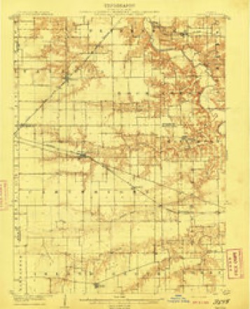
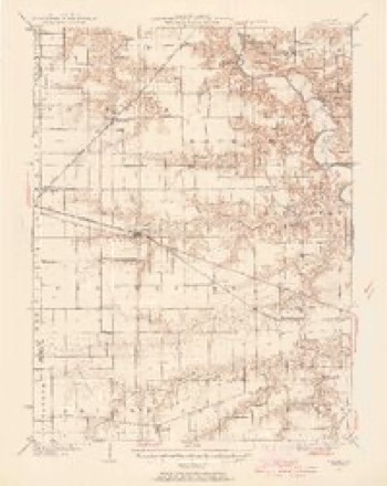
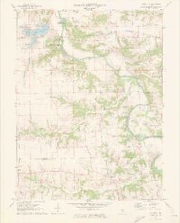
14 topographic sheets cover this place, the earliest surveyed in 1909 and the latest in 1985. It stands in Gardner Township. It lies in ZIP code area 62677. It stands on Prairie Creek. The Survey maps it on the Salisbury quadrangle.
Topographic sheets covering this place
6 surveys from 14 printed sheetsMatched by testing this settlement's coordinate against the published boundary of every sheet in the United States Geological Survey's historical collection. Each opens the scanned sheet at the Survey.
- 1909 USGS Tallula quadrangle1:62500, 3 printings
- 1940 USGS Tallula quadrangle1:62500, 2 printings
- 1958 USGS Decatur quadrangle1:250000, 3 printings
- 1961 USGS Decatur quadrangle1:250000, 2 printings
- 1970 USGS Salisbury quadrangle1:24000, 2 printings
- 1985 USGS Springfield quadrangle1:100000, 2 printings



In the county-history sources
4,009 words on this townshipHistory of Sangamon County, Illinois; Together with Sketches of Its Cities, Villages and Townships ... Portraits of Prominent Persons, and Biographies of Representative Citizens. History of Illinois, published 1881 names this settlement in its chapter on Gardner Township. These are the passages that mention it, exactly as the scans read.
The township of Gardner comprises township sixteen north, range six west, and is bounded on the east by Springfield, on the west by Cartwright, north by Salisbury, and south by Curran townsliip, and was so named in honor of John Gardner, who was for many years, and until his death, one of the principal citizens of the township, and one of the three commissioners appointed by the Board of Justices to divide the county into townships. The surface of the country is mostly rolling prairie, though there is much timber in the southern part. The township is watered by Spring creek and other smaller streams. The soil is extremely well adapted to the raising of all cereals, especially
Passage source: History of Sangamon County, Illinois; Together with Sketches of Its Cities, Villages and Townships ... Portraits of Prominent Persons, and Biographies of Representative Citizens. History of Illinois, published 1881.
Machine-read from a century-old scan, so expect the errors a machine makes: misspelled names, dropped words, stray characters.
Fires near this place
12 since 2010Regional context, not property-specific evidence. The federal wildfire occurrence database lists 12 fires within 5 miles of Salisbury between 2010 and 2017, burning about 18 acres in total. None started naturally. None was recorded as arson. Distance is straight-line from the map coordinates, so a fire counted here may appear on a neighbouring settlement's page as well.
| Reported cause | Fires |
|---|---|
| Missing data/not specified/undetermined | 6 |
| Debris and open burning | 6 |
The most recent of them, most recent first, with the day each was reported and the service that recorded it.
| Date | Cause | Size | Reported by | Name on the report |
|---|---|---|---|---|
| 19 August 2017 | Debris and open burning | under an acre | Illinois Division of Forestry Resources | 2017-000182 |
| 19 June 2017 | Debris and open burning | 1.0 acres | Illinois Division of Forestry Resources | 2017-000137 |
| 7 April 2010 | Missing data/not specified/undetermined | 1.1 acres | Illinois Division of Forestry Resources | BISHOP |
| 6 April 2013 | Debris and open burning | 3.0 acres | Illinois Division of Forestry Resources | 13-0000108 |
| 3 April 2011 | Debris and open burning | 5.0 acres | Illinois Division of Forestry Resources | 11106 |
| 2 April 2010 | Missing data/not specified/undetermined | under an acre | Illinois Division of Forestry Resources | UTTERBACK |
| 19 April 2014 | Debris and open burning | under an acre | Illinois Division of Forestry Resources | 14-0000129 |
| 12 April 2010 | Missing data/not specified/undetermined | under an acre | Illinois Division of Forestry Resources | HURIE |
Settlements close enough to share some of these fires:
Mines and quarries near this place
1 within 5 milesRegional context, not property-specific evidence. The federal mineral resources record lists 1 working within 5 miles of Salisbury: 1 occurrence. None of them still produces. What was taken out: Stone, Crushed/Broken. Distance is straight-line from the map coordinates, so a quarry counted here may appear on a neighbouring settlement's page as well.
| Where | Site | Commodity | Status | Recorded |
|---|---|---|---|---|
| Limestone Prospect | Stone, Crushed/Broken | Occurrence |
Storms near this place
8 since 2005Regional context, not property-specific evidence. The National Weather Service names Salisbury in 8 storm reports between 2005 and 2025: 4 thunderstorm wind, 3 flash flood, 1 hail. No death or injury is recorded in these reports. Each account below is quoted exactly as the forecast office filed it, from the NOAA Storm Events Database, and each date opens the federal record of that event.
| When | Event | Place named | Harm | What the report says |
|---|---|---|---|---|
| March 2025 | Thunderstorm Wind | Salisbury | - | Three power poles were blown down on Horse Barn Road. |
| June 2023 | Thunderstorm Wind | Salisbury | - | A tree was blown over and several 5 to 8-inch diameter tree branches were knocked down near Salisbury. |
| August 2022 | Thunderstorm Wind | Salisbury | - | A tree was blown down across Route 97 south of Salisbury. |
| May 2020 | Flash Flood | Salisbury | - | Numerous roads were flooded in Springfield. |
| August 2016 | Flash Flood | Salisbury | - | Torrential rainfall of 2.50 to 5.00 inches in about three hours during the early morning hours of August 28th resulted in flash flooding across northwest Sangamon County. Prairie Creek flooded out of its banks, inundating Illinois Route 125 near Farmingdale. Parts of Illinois Route 97 toward Salisbury also flooded. Numerous rural roads were flooded from Farmingdale toward New Berlin, and parts of the Spring Creek came out of its banks flooding adjacent farmland. |
| July 2008 | Flash Flood | Salisbury | - | Several county roads were closed across northern Sangamon County due to high water. |
| November 2005 | Thunderstorm Wind | Salisbury | - | Power poles and lines blown down. |
| March 2016 | Hail | Salisbury | - | no account filed |
Nearest settlements
The eight closest, with where each one stands in the county. Distances are straight-line, computed from the Geographic Names Information System coordinates.
| Map | Place | Distance | Sheets |
|---|---|---|---|
| Richland | 4.4 miles | 14 | |
| Farmingdale | 4.6 miles | 14 | |
| Bradfordton | 5.5 miles | 19 | |
| Claysville | 5.6 miles | 13 | |
| Bando | 6.4 miles | 19 | |
| Green Acres | 6.6 miles | 17 | |
| Pleasant Plains | 6.6 miles | 13 | |
| North Wind | 7.2 miles | 17 |
Provenance
This settlement is recorded in the Geographic Names Information System as feature 417892. The sheet list is computed by point-in-boundary test against the United States Geological Survey's historical topographic inventory. Both are works of the United States government and carry no copyright under 17 U.S.C. 105.
Wildfire. Short, Karen C. 2022. Spatial wildfire occurrence data for the United States, 1992-2020 [FPA_FOD_20221014]. 6th Edition. Fort Collins, CO: Forest Service Research Data Archive. https://doi.org/10.2737/RDS-2013-0009.6 Collected with United States Government funding and usable without additional permissions or fees.
Mines and quarries. USGS Mineral Resources Data System (MRDS) https://mrdata.usgs.gov/mrds/ A work of the United States government, no copyright under 17 U.S.C. 105.
Storms. NOAA National Centers for Environmental Information, Storm Events Database https://www.ncei.noaa.gov/stormevents/ A work of the United States government, no copyright under 17 U.S.C. 105. Narratives are quoted verbatim from the National Weather Service report and are not edited or summarised.