 Block
Pleasant Plains, Illinois
13 topographic sheets cover this place, the earliest surveyed in 1909 and the latest in 1985. It stands in Cartwright Township. It lies in ZIP code area 62677. It stands on North Fork Richland Creek. The Survey maps it on the Pleasant Plains quadrangle. 808 people lived here at the 2020 count. It stands 614 feet above sea level.
On record in Pleasant Plains
Buildings and businesses the archive holds for this place. Each opens its own page, with the source record it came from.
On the National Register 1 record
 Clayville Tavernlisted 1973
Population over time
2 figuresPleasant Plains grew from 802 to 808 between 2010 and 2020. These are the recorded population figures Wikidata holds for this place, reached through the Geographic Names Information System number this page is keyed on rather than by name, so they belong to this place and not to another of the same name. Most are census counts, but not all are: an early figure may be a founding or settlement estimate, and an estimate published within five years of a census is left out. The change column is computed, and is left blank where more than 20 years separate a figure from the one before it, because a gap that long is not a change between two counts.
| Year | People | Change |
|---|---|---|
| 2010 | 802 | |
| 2020 | 808 | +6 (+1%) |
Topographic sheets covering this place
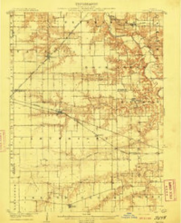
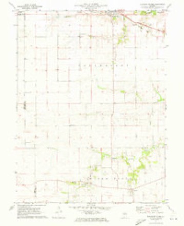
6 surveys from 13 printed sheetsMatched by testing this settlement's coordinate against the published boundary of every sheet in the United States Geological Survey's historical collection. Each opens the scanned sheet at the Survey.
- 1909 USGS Tallula quadrangle1:62500, 3 printings
- 1940 USGS Tallula quadrangle1:62500, 2 printings
- 1958 USGS Decatur quadrangle1:250000, 3 printings
- 1961 USGS Decatur quadrangle1:250000, 2 printings
- 1971 USGS Pleasant Plains quadrangle1:24000
- 1985 USGS Springfield quadrangle1:100000, 2 printings




Fires near this place
5 since 2010Regional context, not property-specific evidence. The federal wildfire occurrence database lists 5 fires within 5 miles of Pleasant Plains in 2010, burning about 1 acre in total. None started naturally. None was recorded as arson. Distance is straight-line from the map coordinates, so a fire counted here may appear on a neighbouring settlement's page as well.
| Reported cause | Fires |
|---|---|
| Missing data/not specified/undetermined | 5 |
The most recent of them, most recent first, with the day each was reported and the service that recorded it.
| Date | Cause | Size | Reported by | Name on the report |
|---|---|---|---|---|
| 14 September 2010 | Missing data/not specified/undetermined | under an acre | Illinois Division of Forestry Resources | WALBAUM |
| 2 April 2010 | Missing data/not specified/undetermined | under an acre | Illinois Division of Forestry Resources | UTTERBACK |
| 12 April 2010 | Missing data/not specified/undetermined | under an acre | Illinois Division of Forestry Resources | HURIE |
| 10 April 2010 | Missing data/not specified/undetermined | under an acre | Illinois Division of Forestry Resources | HARMS |
| 12 November 2010 | Missing data/not specified/undetermined | under an acre | Illinois Division of Forestry Resources | 10363 |
Settlements close enough to share some of these fires:
Storms near this place
36 since 1994Regional context, not property-specific evidence. The National Weather Service names Pleasant Plains in 36 storm reports between 1994 and 2025: 16 thunderstorm wind, 8 flash flood, 7 hail, 3 tornado. The reports record 1 injury. Each account below is quoted exactly as the forecast office filed it, from the NOAA Storm Events Database, and each date opens the federal record of that event.
| When | Event | Place named | Harm | What the report says |
|---|---|---|---|---|
| April 2002 | Thunderstorm Wind | Pleasant Plains | 1 hurt | A bow echo moved through northern portions of Sangamon county, producing widespread damage. West of Pleasant Plains, numerous trees and powerlines were blown down. In Salisbury, two mobile homes sustained minor damage while another one was rolled off its foundation and destroyed. No injuries reported there. Just west of Capital Airport, two mobile homes were destroyed after being rolled off their foundations. One was occupied at the time and the occupant sustained minor cuts and bruises. |
| March 1998 | Thunderstorm Wind | Pleasant Plains | $88,500 | A line of severe thunderstorms moved rapidly across Sangamon county causing scattered reports of damage. Two miles east of Pleasant Plains, a semi was blown over and 3 cars were blown off the road. In Chatham, some siding was blown off of a house. In Springfield, a grain bin was blown over, a large tent was destroyed, and numerous trees, tree limbs, and power lines were blown down. Three miles west of Mechanicsburg, an open side hay shed was destroyed. Also, just south of Mechanicsburg, a large metal storage shed was destroyed and its contents were damaged including a combine, tractor, and a two-ton grain truck. So far, damage has been estimated around $88,500. No injuries were reported. |
| May 2012 | Thunderstorm Wind | Pleasant Plains | $30,000 | Several trees were blown down. The front of a garage was pulled out, and the roof was torn off an outbuilding. |
| August 1999 | Thunderstorm Wind | Pleasant Plains | $10,000 | Several power lines were blown down. |
| August 1999 | Thunderstorm Wind | Pleasant Plains | $10,000 | Large tree limbs and power lines blown down. |
| November 1998 | Thunderstorm Wind | Pleasant Plains | $8,000 | Thunderstorm winds blew down numerous trees and power lines. In Divernon, two trees fell onto two houses, another one fell onto a mobile home and one tree fell onto a pickup truck. No injuries were reported and damage was estimated around $8,000. |
| April 2017 | Thunderstorm Wind | Pleasant Plains | $5,000 | A few trees were damaged east of Pleasant Plains. |
| June 2014 | Thunderstorm Wind | Pleasant Plains | $1,000 | A large tree was snapped off at the base. |
| June 2025 | Tornado (EF1) | Pleasant Plains | - | Sentinel satellite data indicated a tornado began 2.6 miles northwest of Berlin, initially traveling northeast through farm fields. It snapped several large trees at a farmstead along north Pleasant Plains Road. As it continued along its path, it tossed a pair of grain bins across Watts Road and produced tree damage near Claysville. It continued through fields to the northeast, eventually crossing into Menard County where it produced minor damage to trees and structures west and dissipated northwest of Loyd. The tornado had a peak intensity rating of EF-1. |
| May 2021 | Tornado (EFU) | Pleasant Plains | - | A weak tornado touched down in a field about 1.4 miles west-northwest of Pleasant Plains just south of IL-125 at 5:27 PM CDT. The tornado tracked southeastward across Yankee Town Road and quickly dissipated by 5:28 PM CDT. No damage occurred. |
| June 2019 | Flash Flood | Pleasant Plains | - | Heavy rain of 2.00 to 4.00 inches on saturated ground resulted in flash flooding across much of Sangamon County during the morning of June 22nd. Cars were stranded on several streets in Springfield, ramps to I-55 and I-72 around Springfield were impassable, and Illinois Route 97 northwest of Springfield was closed. A motorist 1 mile northwest of Bradfordton was rescued from the top of their car after it was swept from Illinois Route 97 due to the flooding. No injuries were reported. |
| April 2017 | Flash Flood | Pleasant Plains | - | Rain amounts of 2.50 to 3.50 inches in about a two hour period during the evening hours, on already saturated ground, resulted in flash flooding across central and southern Sangamon County. Numerous streets in Springfield were impassable, as were numerous rural roads and highways in the county. The greatest impacts occurred in the far northwest and southern parts of the county, from south of Ashland toward Loami and Auburn. Parts of Illinois Route 4 toward Thayer were closed. |
| April 2017 | Flood | Pleasant Plains | - | Rain amounts of 2.50 to 3.50 inches in about a two hour period during the evening hours, on already saturated ground, resulted in flash flooding across central and southern Sangamon County. Numerous streets in Springfield were impassable, as were numerous rural roads and highways in the county. The greatest impacts occurred in the far northwest and southern parts of the county, from south of Ashland toward Loami and Auburn. Parts of Illinois Route 4 toward Thayer were closed. Additional rain of 0.50 to 1.00 inch during the early morning hours kept many roads flooded. Flood waters subsided by early afternoon on the 30th. |
| February 2014 | Flash Flood | Pleasant Plains | - | Rainfall of 0.50 to 1.00 combined with a frozen ground to produce flash flooding across northern and central Sangamon County. Many streets in Springfield were flooded and most rural roads were impassable. A water rescue of a woman and her child was made from a car stranded in flooding on a rural road near Dawson. |
| June 2011 | Flash Flood | Pleasant Plains | - | Severe thunderstorms during the late evening hours produced 1.50 to 2.50 of rain on extremely saturated ground. In addition, the areas in western Sangamon County near New Berlin and Loami already experienced major flash flooding during the previous week. This resulted in rapid flash flooding of creeks, streams and roads in western and southern Sangamon County including the southern suburbs of Springfield. Lick Creek, which flooded the previous week, and Sugar Creek were both out of their banks. Illinois Route 4 and parts of I-72 had several areas of standing water. Most rural roads were impassable. |
| June 2011 | Flood | Pleasant Plains | - | Heavy rainfall during the late evening hours of the 25th produced flash flooding in western and southern Sangamon County. This area flooded very quickly due to extremely saturated ground and major flash flooding which occurred during the previous week. As a result, the flooding was very slow to recede, and area roads remained inundated into the mid-morning hours of June 26th. |
| September 2010 | Flash Flood | Pleasant Plains | - | Heavy rainfall rates of 1.50 to 2.00 per hour for nearly 90 minutes resulted in flash flooding across northern Sangamon County, including the city of Springfield. Most roads and viaducts were impassable due to the heavy rain. Maximum rainfall totals reached 3.00 inches along the Sangamon River in eastern parts of the county. |
| September 2009 | Flash Flood | Pleasant Plains | - | Slow moving thunderstorms produced rainfall rates of 2.00 inches per hour and flash flooding in western and central Sangamon County, including the western suburbs of Springfield. The heaviest rain was from New Berlin to the west side of Springfield where 2.50 to 3.50 inches was reported. Numerous streets and rural roads were flooded. |
| May 2009 | Flash Flood | Pleasant Plains | - | Heavy rain of 2.00 to 3.00 inches within two hours produced significant flash flooding of most roads in northern Sangamon County, including the city of Springfield. |
| May 2006 | Thunderstorm Wind | Pleasant Plains | - | Power lines were blown down along Route 125. |
| May 2002 | Flash Flood | Pleasant Plains | - | Several roads were briefly flooded due to heavy rains. |
| April 1999 | Thunderstorm Wind | Pleasant Plains | - | Several trees were blown down halfway between Pleasant Plains and Springfield. |
| June 1998 | Thunderstorm Wind | Pleasant Plains | - | Thunderstorm winds blew down several trees in Pleasant Plains and in Chatham. In Chatham, a tree fell onto a van and truck causing minor damage. No injuries were reported and no damage estimate was available. |
| August 1997 | Thunderstorm Wind | Pleasant Plains | - | Thunderstorm winds blew a couple of large trees down onto Route 125 in Pleasant Plains. No injuries or damage were reported. |
| June 1995 | Thunderstorm Wind | Pleasant Plains | - | Several large tree limbs were blown down causing damage to a car. No damage estimate was available. |
| June 1994 | Thunderstorm Wind | Pleasant Plains | - | Thunderstorm winds blew down 11 50-foot high trees near Pleasant Plains. |
| June 1994 | Thunderstorm Wind | Pleasant Plains | - | Thunderstorm winds blew down a large tree and numerous tree limbs in Pleasant Plains. Wind gusts were estimated in excess of 55 mph. |
| July 1994 | Thunderstorm Wind | Pleasant Plains | - | Thunderstorm winds blew down a few trees in Pleasant Plains. |
| July 2020 | Hail | Pleasant Plains | - | no account filed |
| January 2018 | Hail | Pleasant Plains | - | no account filed |
| September 2015 | Hail | Pleasant Plains | - | no account filed |
| March 2006 | Hail | Pleasant Plains | - | no account filed |
| April 2003 | Hail | Pleasant Plains | - | no account filed |
| May 2003 | Hail | Pleasant Plains | - | no account filed |
| April 1999 | Tornado (F0) | Pleasant Plains | - | no account filed |
| March 1997 | Hail | Pleasant Plains | - | no account filed |
Nearest settlements
The eight closest, with where each one stands in the county. Distances are straight-line, computed from the Geographic Names Information System coordinates.
| Map | Place | Distance | Sheets |
|---|---|---|---|
| Claysville | 1.2 miles | 13 | |
| Richland | 3.8 miles | 14 | |
| Salisbury | 6.6 miles | 14 | |
| Farmingdale | 7.0 miles | 14 | |
| Berlin | 7.9 miles | 13 | |
| Pasfield | 8.2 miles | 14 | |
| New Berlin | 10.2 miles | 12 | |
| Riddle Hill | 10.2 miles | 14 |
Elsewhere
Matched on this settlement's Geographic Names Information System number rather than its name, so it cannot be a different place of the same name in another state.
| Wikipedia article on Pleasant Plains | An encyclopaedic summary. Its text is share-alike, so it is linked here rather than copied. |
| Wikidata item Q2129023 | The structured record the population and elevation above come from. Public domain (CC0). |
Provenance
This settlement is recorded in the Geographic Names Information System as feature 415873. The sheet list is computed by point-in-boundary test against the United States Geological Survey's historical topographic inventory. Both are works of the United States government and carry no copyright under 17 U.S.C. 105.
Wildfire. Short, Karen C. 2022. Spatial wildfire occurrence data for the United States, 1992-2020 [FPA_FOD_20221014]. 6th Edition. Fort Collins, CO: Forest Service Research Data Archive. https://doi.org/10.2737/RDS-2013-0009.6 Collected with United States Government funding and usable without additional permissions or fees.
Storms. NOAA National Centers for Environmental Information, Storm Events Database https://www.ncei.noaa.gov/stormevents/ A work of the United States government, no copyright under 17 U.S.C. 105. Narratives are quoted verbatim from the National Weather Service report and are not edited or summarised.