 Block
Stonington, Illinois
11 topographic sheets cover this place, the earliest surveyed in 1952 and the latest in 1985. It stands in Stonington Township. It lies in ZIP code area 62567. The Survey maps it on the Stonington quadrangle. 837 people lived here at the 2020 count. It stands 616 feet above sea level.
Population over time
2 figuresStonington fell from 932 to 837 between 2010 and 2020. These are the recorded population figures Wikidata holds for this place, reached through the Geographic Names Information System number this page is keyed on rather than by name, so they belong to this place and not to another of the same name. Most are census counts, but not all are: an early figure may be a founding or settlement estimate, and an estimate published within five years of a census is left out. The change column is computed, and is left blank where more than 20 years separate a figure from the one before it, because a gap that long is not a change between two counts.
| Year | People | Change |
|---|---|---|
| 2010 | 932 | |
| 2020 | 837 | -95 (-10%) |
Topographic sheets covering this place
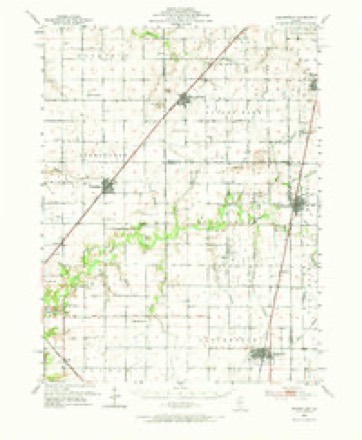
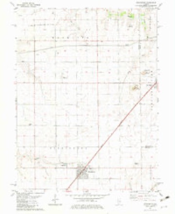
5 surveys from 11 printed sheetsMatched by testing this settlement's coordinate against the published boundary of every sheet in the United States Geological Survey's historical collection. Each opens the scanned sheet at the Survey.
- 1952 USGS Assumption quadrangle1:62500, 2 printings
- 1958 USGS Decatur quadrangle1:250000, 3 printings
- 1961 USGS Decatur quadrangle1:250000, 2 printings
- 1982 USGS Stonington quadrangle1:24000, 2 printings
- 1985 USGS Springfield quadrangle1:100000, 2 printings



In the county-history sources
5,541 words on this townshipHistory of Christian County, Illinois, published 1880 names this settlement in its chapter on Stonington Township. These are the passages that mention it, exactly as the scans read.
HIS township is bounded on the north by Mosquito, east by Macon county and Prairieton township, south by May aud west by Buckhart township ; it comprises the Congressional town 14, range 1 W., is six miles square - and contains a fine body of land - its farmers are among the most enterprising in the county. This towu.ship entered into one of the four original precincts formed on the organization of the county. It then embraced the whole south-western portion of the county. And when curtailed in its boundaries, it has continued to retain its original name. At the first election held August 5, 1839, Peter R. Ketcham and David Simons were elected Justices of the Peace, and William L. Hammer Constable. For the other constable there was a tie between Frederick Fitch and Nicholas Sanders. The latter drew the prize by lot. The Judges of election were Elijah Palmer, David Simons and Peter R. Ketcham. As this returning Board adjudicated in their own cases, it is presumable there was more honesty in "counting" in tho.se days than now. The area of the precinct was then 195 square miles, and cast 48 vtites. The same territory at the election in 1876 cast a vote of 2,400. At the first election there was not a single vote cast in what is now Rosemond, Pana am! Assumjition, then included in Stonington Precinct.
Passage source: History of Christian County, Illinois, published 1880.
The pioueer settlers in Stonington township, were Peter R. Ketcham, Christopher Ketcham, John Biggs, Elijah Palmer, Nicholas Sanders, Deacon Peabody, Thos. P. Chapman, Samuel N. Peabody, William S. Peabody, Frederick Fitch, Allen B. Peabody, Leonard G. Lillie, Andrew B. Chapman ; later came Asa Bowman, J. G. Armstrong. C. Tyler Chapman came in 1849. John T. Slaughter came in 1845. Matilda Compton, 1840. W. S. Spingate, 1834.
Passage source: History of Christian County, Illinois, published 1880.
The annual prairie fires were a great annoyance to the early settlers. Many years ago, some emigrant wagons passed where Stonington is now located, going towards Mt. Auburn. The emigrants at night camped in the tall wild grass that grows so luxuriantly in the low land, of that vast prairie. During the night the prairie was set on fire ; it came sweeping toward them with almost the velocity of the wind, and not knowing how to avoid it they nearly all perished in the flames. Had they burned the grass for some distance around their camp - they would most probably have passed through the danger unscathed. Greeu B. Ketcham, a citizen of Stonington township, was elected as one of the early Coroners of the county. He could neither read or write. There was a time in the country's history, when this seemed to be a necessary qualification. A writ was placed in his hands to be served on the sheriff'. As he could not read it, but was informed as to the nature of its contents, a wag, comprehending the situation, informed him that in order to make a legal service, where the officers could not read it, he was to communicate the nature of it, and at the same time place his hand on the person named in the writ. The sheriff humored the joke; both officers had their horses saddled ; each made for his horse, when 2.40 time was made, sheriff' H. in the lead and the Coroner close in the rear. Round and round the public square, at the county seat, first up one street and down another. At length the writ was served, and the green Coroner made for his cabin well nigh exhausted.
Passage source: History of Christian County, Illinois, published 1880.
Machine-read from a century-old scan, so expect the errors a machine makes: misspelled names, dropped words, stray characters.
Read the whole chapter on Stonington Township - it names this place 10 more 10 times.
Storms near this place
26 since 1995Regional context, not property-specific evidence. The National Weather Service names Stonington in 26 storm reports between 1995 and 2023: 14 thunderstorm wind, 9 hail, 2 tornado, 1 flash flood. No death or injury is recorded in these reports. Each account below is quoted exactly as the forecast office filed it, from the NOAA Storm Events Database, and each date opens the federal record of that event.
| When | Event | Place named | Harm | What the report says |
|---|---|---|---|---|
| December 2018 | Tornado (EF2) | Stonington | $3,300,000 | A tornado touched down along IL Route 48 on the southwest edge of Stonington at 5:34 PM CST. At this time, two circulations aloft merged near the west side of Stonington, causing the tornado to take a sharp turn toward the north. Much of the damage in the town was on the northwest side where house roofs were impacted and several garages and sheds were destroyed. The tornado continued tracking to the north and did significant damage to outbuildings at a farm 4 miles north of Stonington. The tornado then curved toward the northeast, damaging several more outbuildings and sheds before it dissipated near Mosquito Creek, about 5.9 miles east-southeast of Mt. Auburn at 5:52 PM CST. |
| June 2020 | Thunderstorm Wind | Stonington | $15,000 | Several large tree limbs and power lines were blown down on the west side of Stonington, resulting in a power outage. |
| July 2017 | Thunderstorm Wind | Stonington | $15,000 | Numerous large tree branches were blown down, including one that fell on a garage. |
| June 2023 | Thunderstorm Wind | Old Stonington | - | An outbuilding was destroyed, numerous trees and tree branches were blown down, the window of a home was broken, and a vehicle was damaged by a falling tree. |
| August 2021 | Thunderstorm Wind | Stonington | - | A few trees were snapped and several large tree limbs were blown down. |
| July 2020 | Thunderstorm Wind | Stonington | - | Several 4-inch diameter tree branches were blown into power lines. |
| June 2020 | Flash Flood | Stonington | - | Water was flowing across a road on the northwest side of Stonington. The road was barricaded to prevent traffic. |
| August 2019 | Thunderstorm Wind | Stonington | - | Power lines were blown down at North 1800 East and East 1685 North. |
| April 2006 | Tornado (F0) | Stonington | - | A tornado briefly touched down in a field. No injuries or damage were reported. |
| July 2006 | Thunderstorm Wind | Stonington | - | Numerous trees and power lines were blown down. |
| May 2005 | Thunderstorm Wind | Stonington | - | Power lines down. |
| September 2005 | Thunderstorm Wind | Stonington | - | Several trees and power lines blown down. |
| May 2000 | Thunderstorm Wind | Stonington | - | Several large tree limbs were blown down in Stonington. |
| August 2000 | Thunderstorm Wind | Stonington | - | A large tree was blown down onto County Highway 4, with another being blown over onto a car in Stonington. No injuries were reported and no damage estimates were available on the car. |
| July 2000 | Thunderstorm Wind | Stonington | - | Several large tree limbs were blown down, some of which knocked down a couple of power lines in Stonington. |
| June 1998 | Thunderstorm Wind | Stonington | - | Thunderstorm winds blew down two trees onto a mobile home 3 miles south of Stonington causing extensive damage. Also, several power poles were blown down in Stonington. No injuries were reported and no damage estimate was available. |
| May 1995 | Thunderstorm Wind | Stonington | - | A large maple tree was blown over onto County Road 4. |
| March 2023 | Hail | Stonington | - | no account filed |
| August 2018 | Hail | Stonington | - | no account filed |
| December 2018 | Hail | Stonington | - | no account filed |
| December 2018 | Hail | Stonington | - | no account filed |
| August 2014 | Hail | Stonington | - | no account filed |
| April 2011 | Hail | Stonington | - | no account filed |
| May 2009 | Hail | Stonington | - | no account filed |
| June 2006 | Hail | Stonington | - | no account filed |
| June 2000 | Hail | Stonington | - | no account filed |
Nearest settlements
The eight closest, with where each one stands in the county. Distances are straight-line, computed from the Geographic Names Information System coordinates.
| Map | Place | Distance | Sheets |
|---|---|---|---|
| Sandersville | 2.6 miles | 10 | |
| Midway | 2.7 miles | 11 | |
| Old Stonington | 3.1 miles | 10 | |
| Willeys | 3.7 miles | 10 | |
| Grove City | 7.2 miles | 12 | |
| Hewittville | 7.3 miles | 10 | |
| Taylorville | 8.3 miles | 12 | |
| Osbernville | 8.4 miles | 11 |
Elsewhere
Matched on this settlement's Geographic Names Information System number rather than its name, so it cannot be a different place of the same name in another state.
| Wikipedia article on Stonington | An encyclopaedic summary. Its text is share-alike, so it is linked here rather than copied. |
| Wikidata item Q2344051 | The structured record the population and elevation above come from. Public domain (CC0). |
Provenance
This settlement is recorded in the Geographic Names Information System as feature 419181. The sheet list is computed by point-in-boundary test against the United States Geological Survey's historical topographic inventory. Both are works of the United States government and carry no copyright under 17 U.S.C. 105.
Storms. NOAA National Centers for Environmental Information, Storm Events Database https://www.ncei.noaa.gov/stormevents/ A work of the United States government, no copyright under 17 U.S.C. 105. Narratives are quoted verbatim from the National Weather Service report and are not edited or summarised.