 Block
Tower Hill, Illinois
13 topographic sheets cover this place, the earliest surveyed in 1942 and the latest in 1998. It stands in Tower Hill Township. It lies in ZIP code area 62571. The Survey maps it on the Tower Hill quadrangle. 485 people lived here at the 2020 count. It stands 659 feet above sea level.
Population over time
2 figuresTower Hill fell from 611 to 485 between 2010 and 2020. These are the recorded population figures Wikidata holds for this place, reached through the Geographic Names Information System number this page is keyed on rather than by name, so they belong to this place and not to another of the same name. Most are census counts, but not all are: an early figure may be a founding or settlement estimate, and an estimate published within five years of a census is left out. The change column is computed, and is left blank where more than 20 years separate a figure from the one before it, because a gap that long is not a change between two counts.
| Year | People | Change |
|---|---|---|
| 2010 | 611 | |
| 2020 | 485 | -126 (-21%) |
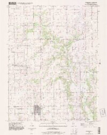
Topographic sheets covering this place
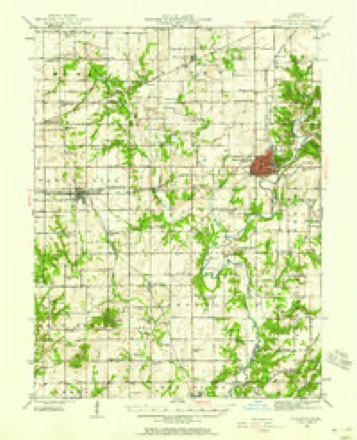
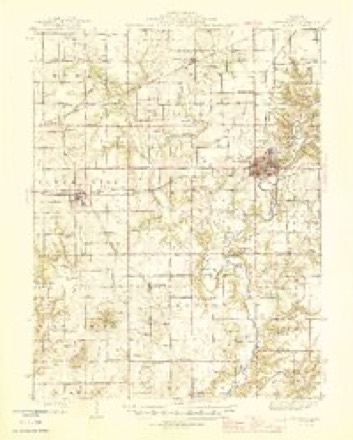
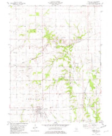
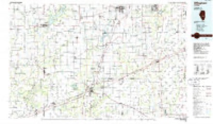
7 surveys from 13 printed sheetsMatched by testing this settlement's coordinate against the published boundary of every sheet in the United States Geological Survey's historical collection. Each opens the scanned sheet at the Survey.
- 1942 USGS Shelbyville quadrangle1:62500, 2 printings
- 1946 USGS Shelbyville quadrangle1:62500, 2 printings
- 1958 USGS Decatur quadrangle1:250000, 3 printings
- 1961 USGS Decatur quadrangle1:250000, 2 printings
- 1981 USGS Tower Hill quadrangle1:24000
- 1986 USGS Effingham quadrangle1:100000, 2 printings
- 1998 USGS Tower Hill quadrangle1:24000


In the county-history sources
4,289 words on this townshipHistoric Sketch and Biographical Album of Shelby County, Illinois, published 1900 names this settlement in its chapter on Tower Hill Township. These are the passages that mention it, exactly as the scans read.
situated near Yantisville, seven miles directly north of Tower Hill, has taught Calvinism in that part of the county. Never a strong organi¬ zation, during its thirty years of existence, averaging about 30 to 40 members. It too, has sent out to the towns and cities various addi¬ tions to their working force. An excellent brick building, erected some years ago. affords a com¬ fortable church home, and a band of devoted members, mostly women, keep up a steady effort for righteousness. Brighter prospects, under the Illinois plan of Home Missions, are in view for this faithful little band of loyal workers.
Passage source: Historic Sketch and Biographical Album of Shelby County, Illinois, published 1900.
Machine-read from a century-old scan, so expect the errors a machine makes: misspelled names, dropped words, stray characters.
Read the whole chapter on Tower Hill Township - it names this place 2 more 2 times.
Fires near this place
11 since 2009Regional context, not property-specific evidence. The federal wildfire occurrence database lists 11 fires within 5 miles of Tower Hill between 2009 and 2015, burning about 22 acres in total. None started naturally. None was recorded as arson. Distance is straight-line from the map coordinates, so a fire counted here may appear on a neighbouring settlement's page as well.
| Reported cause | Fires |
|---|---|
| Debris and open burning | 6 |
| Missing data/not specified/undetermined | 4 |
| Smoking | 1 |
The most recent of them, most recent first, with the day each was reported and the service that recorded it.
| Date | Cause | Size | Reported by | Name on the report |
|---|---|---|---|---|
| 30 September 2015 | Smoking | 4.0 acres | Illinois Division of Forestry Resources | 4CORNAC |
| 16 September 2013 | Missing data/not specified/undetermined | 1.0 acres | Illinois Division of Forestry Resources | STATEPANA1 |
| 7 April 2013 | Debris and open burning | 2.0 acres | Illinois Division of Forestry Resources | 130026 |
| 6 April 2013 | Debris and open burning | 2.0 acres | Illinois Division of Forestry Resources | 130025 |
| 6 April 2013 | Debris and open burning | 3.0 acres | Illinois Division of Forestry Resources | 130025 |
| 6 March 2009 | Debris and open burning | under an acre | Illinois Division of Forestry Resources | UNION |
| 18 March 2009 | Debris and open burning | 1.0 acres | Illinois Division of Forestry Resources | ROSINSKI |
| 18 March 2009 | Debris and open burning | 1.0 acres | Illinois Division of Forestry Resources | ROSINSKI |
Settlements close enough to share some of these fires:
Storms near this place
26 since 1999Regional context, not property-specific evidence. The National Weather Service names Tower Hill in 26 storm reports between 1999 and 2025: 18 thunderstorm wind, 5 hail, 2 tornado, 1 flash flood. The reports record 4 injuries. Each account below is quoted exactly as the forecast office filed it, from the NOAA Storm Events Database, and each date opens the federal record of that event.
| When | Event | Place named | Harm | What the report says |
|---|---|---|---|---|
| June 1999 | Tornado (F2) | Tower Hill | 4 hurt, $2,000,000 | A tornado touched down on the east side of Lake Pana in Shelby County. Four homes and one mobile home were destroyed. A woman in the mobile home was injured and hospitalised for a time. A mile northeast near Route 16, several more homes were damaged or destroyed and two people in one of the destroyed homes were injured. Debris was scattered in the nearby fields. For the next four miles, several homes sustained moderate damage, numerous outbuildings and grain bins were either damaged or destroyed, and one woman sustained minor cuts and bruises. As the tornado moved to the northeast into the Westervelt area, numerous trees were blown down, buildings sustained minor damage, and 9 large grain bins were destroyed. The tornado remained on the ground for another 4.5 miles, knocking down trees and power lines before lifting and dissipating 2 miles southwest of Findlay. Damage was estimated around $2 million. |
| May 2009 | Tornado (EF0) | Tower Hill | $60,000 | A tornado briefly touched down 2 miles south of Tower Hill, then tracked eastward to 2 miles south-southeast of Tower Hill. A shed was severely damaged and front porches were torn off several homes. Shingles were blown off houses and numerous trees were damaged. |
| July 2008 | Thunderstorm Wind | Tower Hill | $55,000 | Numerous trees were blown down in Tower Hill, some onto roofs of houses. |
| April 2014 | Thunderstorm Wind | Tower Hill | $24,000 | The roof of a machine shed and several trees were damaged 2 miles northwest of Tower Hill. |
| October 2010 | Thunderstorm Wind | Tower Hill | $20,000 | A trailer was blown off its foundation. |
| April 2025 | Thunderstorm Wind | Tower Hill | - | A few tree branches were blown down. |
| July 2025 | Thunderstorm Wind | Tower Hill | - | A large tree was split. |
| July 2025 | Thunderstorm Wind | Tower Hill | - | Shingles were blown off a few homes and corn crops were flattened on the south edge of town. |
| August 2023 | Thunderstorm Wind | Tower Hill | - | A pontoon boat was flipped over onto a wooden pier on Lake Pana, and a few 8-inch diameter tree limbs were snapped. |
| June 2022 | Thunderstorm Wind | Tower Hill | - | Power lines were blown down. |
| August 2021 | Thunderstorm Wind | Tower Hill | - | The fire department was damaged, a metal roof was blown off a church, and a tree fell onto a car. |
| June 2019 | Thunderstorm Wind | Tower Hill | - | A large tree branch was snapped. |
| June 2019 | Thunderstorm Wind | Tower Hill | - | A power line was blown onto a house in Tower Hill. |
| August 2012 | Thunderstorm Wind | Tower Hill | - | A 3-foot diameter tree was uprooted. |
| April 2011 | Flash Flood | Tower Hill | - | Several thunderstorms produced heavy rainfall rates of more than one inch per hour for four hours in much of southern and central Shleby County. Most rural roads were water covered and impassable. |
| May 2004 | Thunderstorm Wind | Tower Hill | - | Thunderstorm winds blew down numerous trees, tree limbs and power lines. One tree landed on a garage in the Cowden area causing minor damage. |
| May 2003 | Thunderstorm Wind | Tower Hill | - | Thunderstorm winds blew down numerous trees in Tower Hill, Cowden, Shelbyville, Fancher and Mode. One garage in Fancher was damaged from a fallen tree. Also, numerous power lines were blown down. |
| June 2002 | Thunderstorm Wind | Tower Hill | - | Numerous trees, tree limbs, power poles and power lines were blown down. |
| May 2001 | Thunderstorm Wind | Tower Hill | - | Half of a 12 inch diameter sycamore tree was blown down. No structural damage was reported. |
| July 2001 | Thunderstorm Wind | Tower Hill | - | Numerous trees were blown down, as well as, power lines and several power poles. In Tower Hill, one tree fell onto an unoccupied car, damaging it. |
| May 2000 | Thunderstorm Wind | Tower Hill | - | Thunderstorm winds destroyed a large grain silo, damaged a quonset building's roof, and blew down numerous trees in the area. |
| April 2011 | Hail | Tower Hill | - | no account filed |
| May 2011 | Hail | Tower Hill | - | no account filed |
| May 2002 | Hail | Tower Hill | - | no account filed |
| August 2001 | Hail | Tower Hill | - | no account filed |
| April 2000 | Hail | Tower Hill | - | no account filed |
Nearest settlements
The eight closest, with where each one stands in the county. Distances are straight-line, computed from the Geographic Names Information System coordinates.
| Map | Place | Distance | Sheets |
|---|---|---|---|
| Westminster (historical) | 2.5 miles | 13 | |
| Dollville | 3.8 miles | 13 | |
| Lakewood | 5.4 miles | 13 | |
| Henton | 6.0 miles | 13 | |
| Williamsburg Hill | 6.2 miles | 13 | |
| Williamsburg (historical) | 6.5 miles | 13 | |
| Westervelt | 8.2 miles | 14 | |
| Shelbyville | 9.1 miles | 14 |
Elsewhere
Matched on this settlement's Geographic Names Information System number rather than its name, so it cannot be a different place of the same name in another state.
| Wikipedia article on Tower Hill | An encyclopaedic summary. Its text is share-alike, so it is linked here rather than copied. |
| Wikidata item Q745844 | The structured record the population and elevation above come from. Public domain (CC0). |
Provenance
This settlement is recorded in the Geographic Names Information System as feature 419794. The sheet list is computed by point-in-boundary test against the United States Geological Survey's historical topographic inventory. Both are works of the United States government and carry no copyright under 17 U.S.C. 105.
Wildfire. Short, Karen C. 2022. Spatial wildfire occurrence data for the United States, 1992-2020 [FPA_FOD_20221014]. 6th Edition. Fort Collins, CO: Forest Service Research Data Archive. https://doi.org/10.2737/RDS-2013-0009.6 Collected with United States Government funding and usable without additional permissions or fees.
Storms. NOAA National Centers for Environmental Information, Storm Events Database https://www.ncei.noaa.gov/stormevents/ A work of the United States government, no copyright under 17 U.S.C. 105. Narratives are quoted verbatim from the National Weather Service report and are not edited or summarised.