 Block
Shelbyville, Illinois
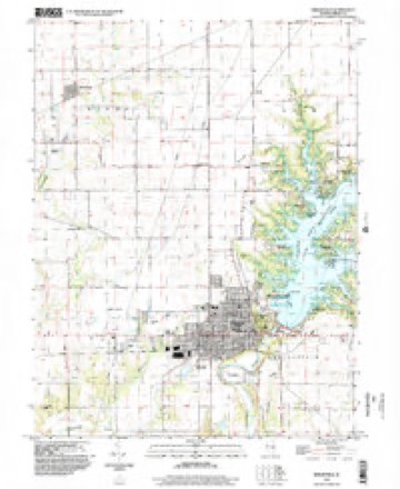
14 topographic sheets cover this place, the earliest surveyed in 1942 and the latest in 1998. It stands in Shelbyville Township. It lies in ZIP code area 62565. The Survey maps it on the Shelbyville quadrangle. 4,674 people lived here at the 2020 count. It stands 623 feet above sea level.
Research this city
On record in Shelbyville
Buildings and businesses the archive holds for this place. Each opens its own page, with the source record it came from.
On the National Register 3 records
 Chautauqua Auditoriumlisted 1978
 Shelbyville Historic Districtlisted 1976
 Horace M. Tallman Houselisted 1988
Population over time
2 figuresShelbyville fell from 4,700 to 4,674 between 2010 and 2020. These are the recorded population figures Wikidata holds for this place, reached through the Geographic Names Information System number this page is keyed on rather than by name, so they belong to this place and not to another of the same name. Most are census counts, but not all are: an early figure may be a founding or settlement estimate, and an estimate published within five years of a census is left out. The change column is computed, and is left blank where more than 20 years separate a figure from the one before it, because a gap that long is not a change between two counts.
| Year | People | Change |
|---|---|---|
| 2010 | 4,700 | |
| 2020 | 4,674 | -26 (-1%) |
Topographic sheets covering this place
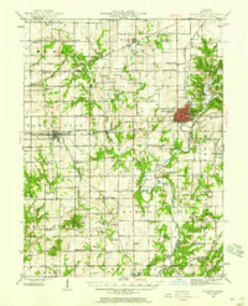
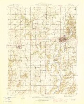
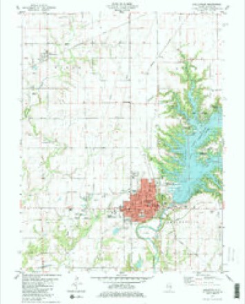
7 surveys from 14 printed sheetsMatched by testing this settlement's coordinate against the published boundary of every sheet in the United States Geological Survey's historical collection. Each opens the scanned sheet at the Survey.
- 1942 USGS Shelbyville quadrangle1:62500, 2 printings
- 1946 USGS Shelbyville quadrangle1:62500, 2 printings
- 1958 USGS Decatur quadrangle1:250000, 3 printings
- 1961 USGS Decatur quadrangle1:250000, 2 printings
- 1981 USGS Shelbyville quadrangle1:24000, 2 printings
- 1986 USGS Effingham quadrangle1:100000, 2 printings
- 1998 USGS Shelbyville quadrangle1:24000


What happened here
An account from the chapter on Shelbyville township. The inset identifies its exact source book and publication year.
Wilber Broughton
Death came to Wilher Broughton, a valiant and patriotic son of Shelby county, on the battlefield in France, where he was serving as a messenger and scout in the United States army. On the night of July 19, 1918, he was wounded, and removed to a hospital at Oise, France. Six days later, or on July 25, he died from the effects of the machine gun bullet.
In the county-history sources
35,144 words on this townshipShelby County in the World War, published 1919 names this settlement in its chapter on Shelbyville Township. These are the passages that mention it, exactly as the scans read.
One avenue through which the work of this committee was done was the Child Welfare Department. Under the general direction of Mrs. S. S. Crook, many children in Shelbyville and throughout the county were weighed and measured, the work being done at different times over a long period. With the weighing and measuring, the parents were given instruction as to the proper care of the children, that the child life of the county might be conserved in harmony with the state- and nation-wide plan. A great deal of literature was distributed, and even the school boys became intensely interested in the subject. Mrs. Joseph T. Bowen, State Chairman, told of one lad who wrote a composition in which he said: "Xow that we are at war, it is everybody's business to have a baby and to save it!"
Passage source: Shelby County in the World War, published 1919.
The making and shipping of clothing to Belgian refugees was undertaken, the work being done principally from three centers - Shelbyville, Findlay and Clarksburg. Mrs. Arthur Birkett of Findlay and the Misses Mel Compton and Verna Ragan of Clarksburg co-operated splendidly with Mrs. Hoover and the women of Shelbyville, and many hundreds of aprons, dresses and boys' waists were shipped to destitute Belgian children.
Passage source: Shelby County in the World War, published 1919.
In addition to the adoption of these children and the making of the garments already mentioned, a special drive was conducted on Dec. 7, 1918, Mrs. Birkett and the Misses Compton and Ragan taking charge in their respective towns. A total of $767.92 was raised - $586.42 in Shelbyville, $109.50 in Findlay and $72.00 in Clarksburg.
Passage source: Shelby County in the World War, published 1919.
Machine-read from a century-old scan, so expect the errors a machine makes: misspelled names, dropped words, stray characters.
Read the whole chapter on Shelbyville Township - it names this place 86 more 86 times.
Fires near this place
4 since 2013Regional context, not property-specific evidence. The federal wildfire occurrence database lists 4 fires within 5 miles of Shelbyville in 2013, burning about 116 acres in total. None started naturally. None was recorded as arson. Distance is straight-line from the map coordinates, so a fire counted here may appear on a neighbouring settlement's page as well.
| Reported cause | Fires |
|---|---|
| Debris and open burning | 3 |
| Missing data/not specified/undetermined | 1 |
The most recent of them, most recent first, with the day each was reported and the service that recorded it.
| Date | Cause | Size | Reported by | Name on the report |
|---|---|---|---|---|
| 5 April 2013 | Debris and open burning | 12 acres | Illinois Division of Forestry Resources | 130023 |
| 4 April 2013 | Debris and open burning | 1.0 acres | Illinois Division of Forestry Resources | 130022 |
| 3 April 2013 | Missing data/not specified/undetermined | 100 acres | Illinois Division of Forestry Resources | 130021 |
| 23 March 2013 | Debris and open burning | 2.5 acres | Illinois Division of Forestry Resources | 130016 |
Settlements close enough to share some of these fires:
Mines and quarries near this place
2 within 5 milesRegional context, not property-specific evidence. The federal mineral resources record lists 2 workings within 5 miles of Shelbyville: 1 producer, 1 past producer. 1 still produces. What was taken out: Sand and Gravel, Construction, Stone, Crushed/Broken. Distance is straight-line from the map coordinates, so a quarry counted here may appear on a neighbouring settlement's page as well.
| Where | Site | Commodity | Status | Recorded |
|---|---|---|---|---|
| Prosser Gravel | Sand and Gravel, Construction | Producer | ||
| Shelby County Hiwy Dept Pit | Stone, Crushed/Broken | Past Producer |
Storms near this place
47 since 1994Regional context, not property-specific evidence. The National Weather Service names Shelbyville in 47 storm reports between 1994 and 2026: 32 thunderstorm wind, 9 hail, 3 flash flood, 2 lightning. The reports record 1 death and 2 injuries. Each account below is quoted exactly as the forecast office filed it, from the NOAA Storm Events Database, and each date opens the federal record of that event.
| When | Event | Place named | Harm | What the report says |
|---|---|---|---|---|
| May 2013 | Lightning | Shelbyville | 1 killed | A 29 year-old fisherman was struck by lightning on the Kaskaskia River near the Lake Shelbyville Dam at around 3:50 PM CDT on Sunday, May 26th. The man later died at Shelby Memorial Hospital in Shelbyville. |
| September 1996 | Lightning | Shelbyville | 2 hurt | no account filed |
| February 2017 | Hail | Shelbyville | $800,000 | no account filed |
| January 2005 | Flash Flood | Shelbyville | $165,000 | Illinois Route 128 had water flowing across it. |
| July 2016 | Thunderstorm Wind | Shelbyville | $100,000 | The roof was torn off a building in downtown Shelbyville. Numerous trees and tree branches were blown down, and two homes were damaged by falling branches. |
| May 2009 | Thunderstorm Wind | Shelbyville | $80,000 | Numerous trees and power poles were blown down along a path from 4 miles southwest of Shelbyville to the far western edge of Shelbyville. Damage path was 1/2 mile wide and 3 miles long. Damage was caused by downburst winds as determined by an NWS Survey. |
| May 2009 | Tornado (EF0) | Shelbyville | $45,000 | A tornado touched down 1 mile southwest of Shelbyville, then tracked eastward to 1/2 mile southeast of Shelbyville. Numerous shallow-rooted trees were torn or uprooted. The tornado tracked through a campground, where several unoccupied trailers were damaged by falling trees and limbs. A carport was destroyed and porches were torn away from a few trailers. In addition, 2 unanchored metal sheds were destroyed. |
| July 2007 | Thunderstorm Wind | Shelbyville | $40,000 | Numerous trees, power lines and power poles were blown down on the south side of Shelbyville. |
| December 2015 | Thunderstorm Wind | Shelbyville | $30,000 | Several small trees were blown over. |
| December 2015 | Thunderstorm Wind | Shelbyville | $30,000 | A shed was blown down. |
| May 2018 | Thunderstorm Wind | Shelbyville | $24,000 | Power lines were blown down in Shelbyville. |
| June 2008 | Thunderstorm Wind | Shelbyville | $15,000 | Tree limbs and power lines were blown down. |
| July 2012 | Thunderstorm Wind | Shelbyville | $10,000 | Several tree branches were blown down. |
| June 2010 | Thunderstorm Wind | Shelbyville | $2,000 | A tree was blown onto Copeland Road 3 miles south of Shelbyville. |
| May 2007 | Thunderstorm Wind | Shelbyville | $2,000 | A few large tree limbs were blown down.| |
| June 1998 | Hail | Shelbyville | $200 | no account filed |
| March 2026 | Thunderstorm Wind | Shelbyville | - | A large tree limb, about eight inches in diameter, was blown down in Shelbyville. |
| March 2026 | Thunderstorm Wind | Shelbyville | - | A member of the public measured a 60 mph wind gust in Shelbyville. |
| May 2025 | Thunderstorm Wind | Shelbyville | - | Several large tree branches were blown down. |
| July 2025 | Thunderstorm Wind | Shelbyville | - | A tree was blown onto power lines. |
| March 2022 | Thunderstorm Wind | Shelbyville | - | A tree was blown onto a car traveling on a road. |
| June 2022 | Thunderstorm Wind | Shelbyville | - | A tree was split in two and damaged power lines. |
| August 2021 | Thunderstorm Wind | Shelbyville | - | A power pole was blown down. |
| June 2018 | Thunderstorm Wind | Shelbyville | - | A large tree was split in Shelbyville. |
| June 2009 | Thunderstorm Wind | Shelbyville | - | A tree was blown down in Shelbyville. |
| February 2008 | Flash Flood | Shelbyville | - | Many roads were flooded in Shelby county. Two vehicles drove into flooded roadways and were swept into ditches. |
| August 2007 | Thunderstorm Wind | Shelbyville | - | Several power lines were blown down.| |
| March 2006 | Hail | Shelbyville | - | Hail covered the ground. |
| July 2005 | Thunderstorm Wind | Shelbyville | - | Several large tree limbs blown down. |
| May 2002 | Flash Flood | Shelbyville | - | Illinois Route 128 north of Shelbyville was flooded briefly. Also, Illinois Route 16 was flooded in spots near its intersection with Illinois Route 32. |
| February 2001 | Thunderstorm Wind | Shelbyville | - | 3 ft by 10 ft sign on telephone pole blown down by high winds. |
| May 2001 | Thunderstorm Wind | Shelbyville | - | Several trees and tree limbs were blown down. In Shelbyville, a window at a car dealership was blown out. |
| June 2000 | Thunderstorm Wind | Shelbyville | - | Numerous large trees were blown over at a country club. |
| May 2000 | Thunderstorm Wind | Shelbyville | - | Several large trees were blown down in Shelbyville. No structural damage was reported. |
| June 2000 | Thunderstorm Wind | Shelbyville | - | Several trees and tree limbs were blown down. Also, a section of tin was blown off of an old barn in town. |
| June 2000 | Thunderstorm Wind | Shelbyville | - | A twenty-two foot sail boat, that was being stored with its keel up, was blown over. Two house boats and a ten foot section of docks sustained minor damage at a marina on Lake Shelbyville. |
| February 1999 | Thunderstorm Wind | Shelbyville | - | In Shelbyville, numerous power poles were blown down. In Stewardson, one roof of a home was completely ripped off as well as several porch roofs. No injuries were reported. |
| June 1995 | Thunderstorm Wind | Shelbyville | - | Numerous large trees, tree limbs, and power lines were blown down. One large tree fell onto a house and a truck. The house had minor damage and the truck was smashed. One camper was damaged by a fallen tree at a Lake Shelbyville Recreation site two miles northeast of Shelbyville. No injuries were reported. An electrical wind generator tower was damaged just north of Shelbyville near Route 128, where a farmer was struck by lightning while working on a metal shed. He was uninjured by the strike. |
| June 1994 | Thunderstorm Wind | Shelbyville | - | Several large tree limbs were blown down on the north side of Shelbyville. A few of the limbs fell onto several cars. No damage estimate was available. |
| May 2020 | Hail | Shelbyville | - | no account filed |
| August 2018 | Hail | Shelbyville | - | no account filed |
| May 2014 | Hail | Shelbyville | - | no account filed |
| March 2012 | Hail | Shelbyville | - | no account filed |
| June 2010 | Hail | Shelbyville | - | no account filed |
| June 2005 | Thunderstorm Wind | Shelbyville | - | no account filed |
| June 1999 | Hail | Shelbyville | - | no account filed |
| January 1996 | Thunderstorm Wind | Shelbyville | - | no account filed |
Nearest settlements
The eight closest, with where each one stands in the county. Distances are straight-line, computed from the Geographic Names Information System coordinates.
| Map | Place | Distance | Sheets |
|---|---|---|---|
| Rennerville | 3.6 miles | 14 | |
| Middlesworth | 4.0 miles | 14 | |
| Lithia | 4.1 miles | 14 | |
| Duvall | 5.0 miles | 14 | |
| Clarksburg | 6.2 miles | 13 | |
| Westervelt | 6.3 miles | 14 | |
| Henton | 7.2 miles | 13 | |
| Lakewood | 8.1 miles | 13 |
Elsewhere
Matched on this settlement's Geographic Names Information System number rather than its name, so it cannot be a different place of the same name in another state.
| Wikipedia article on Shelbyville | An encyclopaedic summary. Its text is share-alike, so it is linked here rather than copied. |
| Wikidata item Q575659 | The structured record the population and elevation above come from. Public domain (CC0). |
Provenance
This settlement is recorded in the Geographic Names Information System as feature 418336. The sheet list is computed by point-in-boundary test against the United States Geological Survey's historical topographic inventory. Both are works of the United States government and carry no copyright under 17 U.S.C. 105.
Wildfire. Short, Karen C. 2022. Spatial wildfire occurrence data for the United States, 1992-2020 [FPA_FOD_20221014]. 6th Edition. Fort Collins, CO: Forest Service Research Data Archive. https://doi.org/10.2737/RDS-2013-0009.6 Collected with United States Government funding and usable without additional permissions or fees.
Mines and quarries. USGS Mineral Resources Data System (MRDS) https://mrdata.usgs.gov/mrds/ A work of the United States government, no copyright under 17 U.S.C. 105.
Storms. NOAA National Centers for Environmental Information, Storm Events Database https://www.ncei.noaa.gov/stormevents/ A work of the United States government, no copyright under 17 U.S.C. 105. Narratives are quoted verbatim from the National Weather Service report and are not edited or summarised.