 Block
Tuscola, Illinois
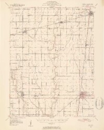
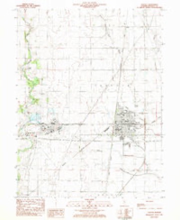
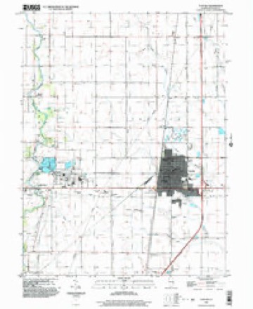
14 topographic sheets cover this place, the earliest surveyed in 1950 and the latest in 1999. It stands in Tuscola Township. It lies in ZIP code area 61953. The Survey maps it on the Tuscola quadrangle. 4,636 people lived here at the 2020 count. It stands 650 feet above sea level.
Research this city
Population over time
2 figuresTuscola grew from 4,480 to 4,636 between 2010 and 2020. These are the recorded population figures Wikidata holds for this place, reached through the Geographic Names Information System number this page is keyed on rather than by name, so they belong to this place and not to another of the same name. Most are census counts, but not all are: an early figure may be a founding or settlement estimate, and an estimate published within five years of a census is left out. The change column is computed, and is left blank where more than 20 years separate a figure from the one before it, because a gap that long is not a change between two counts.
| Year | People | Change |
|---|---|---|
| 2010 | 4,480 | |
| 2020 | 4,636 | +156 (+3%) |
Topographic sheets covering this place
7 surveys from 14 printed sheetsMatched by testing this settlement's coordinate against the published boundary of every sheet in the United States Geological Survey's historical collection. Each opens the scanned sheet at the Survey.
- 1950 USGS Tuscola quadrangle1:62500, 4 printings
- 1958 USGS Decatur quadrangle1:250000, 3 printings
- 1961 USGS Decatur quadrangle1:250000, 2 printings
- 1975 USGS Tuscola SE quadrangle1:24000
- 1983 USGS Tuscola quadrangle1:24000
- 1985 USGS Decatur quadrangle1:100000, 2 printings
- 1999 USGS Tuscola quadrangle1:24000




In the county-history sources
2,739 words on this townshipHistory of Douglas County, Illinois, published 1876 names this settlement in its chapter on Tuscola Township. These are the passages that mention it, exactly as the scans read.
Tuscola, the county seat, is situated in section 34, township 16, north, of range S east, of the third Principal Meridian. The original town was laid out by a company, who also instituted the city of Newman at the same time, in 1857, an<^ tne projectors of the enterprise predicted that a new county wculd be soon formed, that the east and west railroad would be built, and that Tuscola would be l he county seat of the new county. The new county was made in two years, Tuscola became the county seat about the same time, and the railroad was built through the county fifteen years after.
Passage source: History of Douglas County, Illinois, published 1876.
The Charter is dated March 11, 18.^9. The first Mayor was James H. Martin, with a Council consisting of I. L. Jordan, E. Price, M. Pugh, W. Taggart. Mayor Martin resigned in June, 1S70, and dying November 15, 1S71, was buried at Camargo with Masonic honors. He was from Indiana and had resided in Tuscola about six years in the practice of the law. Tuscola is, doubtless, the first city in the State that was organized under the general incorporation act, which took effect July, 1, 1S72. Various additions have been made to the area of the original town plat, which now covers an area of one square mile.
Passage source: History of Douglas County, Illinois, published 1876.
Tuscola was, and is, destitute of a fire company or fireman's organization of any kind whatsoever, and the great fire was only checked by tearing out buildings in its course, which energetic action probably saved Union Block on Sale street, a building of conside able value. Other fires have occurred from time to time, resulting mostly in loss, but in many instances valuable buildings have been saved by the well directed efforts of volunteer firemen, with no other apparatus than a dull axe or two and a few ropes. A fire limit has been fixed within the bounds of which it is unlawful to erect a wooden building.
Passage source: History of Douglas County, Illinois, published 1876.
Machine-read from a century-old scan, so expect the errors a machine makes: misspelled names, dropped words, stray characters.
Read the whole chapter on Tuscola Township - it names this place 12 more 12 times.
Fires near this place
5 since 2019Regional context, not property-specific evidence. The federal wildfire occurrence database lists 5 fires within 5 miles of Tuscola between 2019 and 2020, burning about 3 acres in total. None started naturally. None was recorded as arson. Distance is straight-line from the map coordinates, so a fire counted here may appear on a neighbouring settlement's page as well.
| Reported cause | Fires |
|---|---|
| Missing data/not specified/undetermined | 2 |
| Smoking | 1 |
| Power generation/transmission/distribution | 1 |
| Railroad operations and maintenance | 1 |
The most recent of them, most recent first, with the day each was reported and the service that recorded it.
| Date | Cause | Size | Reported by | Name on the report |
|---|---|---|---|---|
| 20 July 2020 | Power generation/transmission/distribution | under an acre | Illinois Division of Forestry Resources | 20-0000108 |
| 20 July 2020 | Railroad operations and maintenance | under an acre | Illinois Division of Forestry Resources | 20-0000046 |
| 25 October 2019 | Smoking | under an acre | Illinois Division of Forestry Resources | 19-180 |
| 7 January 2019 | Missing data/not specified/undetermined | under an acre | Illinois Division of Forestry Resources | 19-006 |
| 11 January 2019 | Missing data/not specified/undetermined | under an acre | Illinois Division of Forestry Resources | 19-0010 |
Settlements close enough to share some of these fires:
Mines and quarries near this place
2 within 5 milesRegional context, not property-specific evidence. The federal mineral resources record lists 2 workings within 5 miles of Tuscola: 1 past producer, 1 producer. 1 still produces. What was taken out: Stone, Stone, Crushed/Broken. Distance is straight-line from the map coordinates, so a quarry counted here may appear on a neighbouring settlement's page as well.
| Where | Site | Commodity | Status | Recorded |
|---|---|---|---|---|
| Douglas City Hwy Dept Pit | Stone | Past Producer | ||
| Tuscola Quarry | Stone, Crushed/Broken | Producer |
Storms near this place
60 of 69 shownRegional context, not property-specific evidence. The National Weather Service names Tuscola in 69 storm reports between 1995 and 2025: 35 thunderstorm wind, 23 hail, 6 tornado, 4 flash flood. The reports record 8 injuries. Each account below is quoted exactly as the forecast office filed it, from the NOAA Storm Events Database, and each date opens the federal record of that event.
| When | Event | Place named | Harm | What the report says |
|---|---|---|---|---|
| August 2001 | Thunderstorm Wind | Tuscola | 6 hurt | Six people were injured at a local festival in Atwood from flying debris, which is west of Tuscola on the Douglas/Piatt county line. One of the people injured was taken to a local hospital. Several power lines were reported down as well as a number of trees falling onto cars and houses in Atwood. Also, numerous power lines were blown down in Tuscola, Arthur and Arcola. Several large trees were blown down in Tuscola. |
| May 2014 | Hail | Tuscola | 2 hurt, $100,000,000 | Hail caused significant damage to the roofs, windows, and siding of numerous houses in Tuscola. Hundreds of vehicles sustained major window and body damage. Two men were injured when they were struck in the head by large hailstones. |
| November 2013 | Tornado (EF1) | Tuscola | $220,000 | A tornado touched down in a field just west of mile marker 216 along I-57 at 12:46 PM CST, then tracked northeastward before dissipating 2 miles WNW of Villa Grove at 12:51 PM CST. The tornado crossed the interstate, then destroyed 3 outbuildings and damaged the roofs of 2 homes. For the next 4 miles, it moved through mainly open fields, damaging trees and power lines. The tornado dissipated about 2 miles WNW of Villa Grove when it merged with a larger tornado that was moving ENE across north-central Douglas County. |
| June 2009 | Lightning | Tuscola | $50,000 | Lightning struck an auto repair shop in Tuscola and started a fire. There was no one present in the building when the fire began. |
| April 2004 | Tornado (F1) | Tuscola | $50,000 | A tornado touched down at the intersection of 1300N and 750E in northwestern Douglas County. In this location it damaged the front porch of a home, destroyed the garage, damaged a couple of sheds and blew down several large trees. When the garage collapsed it damaged a 1975 Corvette, as well as another car and two antique tractors. The tornado then traveled to the north northeast damaging an abandoned home, before crossing from Douglas County into Champaign County, 5.7 miles north northwest of Tuscola. No injuries were reported. |
| May 2009 | Thunderstorm Wind | Tuscola | $40,000 | Numerous trees and powerlines down across Douglas County. Wind damaged a gas station and 2 hardware stores in Tuscola. |
| June 2009 | Thunderstorm Wind | Tuscola | $40,000 | A tree was blown onto a house in Tuscola. Numerous power lines were downed around town as well. |
| May 2018 | Thunderstorm Wind | Tuscola | $30,000 | Power poles were snapped off and fell onto a car at Eagle Mountain Church. |
| October 2010 | Thunderstorm Wind | Tuscola | $30,000 | A shed was blown down 1 mile east of Tuscola on US 36. |
| June 2009 | Thunderstorm Wind | Tuscola | $30,000 | Several trees were blown down between Tuscola and Arcola. |
| July 2008 | Thunderstorm Wind | Tuscola | $30,000 | Numerous trees and tree limbs down across Douglas County. |
| June 2011 | Thunderstorm Wind | Tuscola | $25,000 | Tree limbs and power lines were blown down near the mall in Tuscola. |
| April 2017 | Thunderstorm Wind | Tuscola | $20,000 | Powerlines were blown down in Tuscola. |
| September 2015 | Thunderstorm Wind | Tuscola | $20,000 | Several trees were blown down in Tuscola. |
| June 2008 | Thunderstorm Wind | Tuscola | $15,000 | A few trees, tree limbs and power lines were blown down. One tree fell onto a house and damaged a portion of the roof. |
| June 2011 | Thunderstorm Wind | Tuscola | $12,000 | Several 3-inch diameter tree branches were blown down in Tuscola. |
| May 2020 | Thunderstorm Wind | Tuscola | $10,000 | Several large tree limbs were blown down on Scott Street, damaging a porch. |
| May 2018 | Thunderstorm Wind | Tuscola | $10,000 | A semi was blown over on I-57 between mile markers 212 and 213 north of Tuscola. |
| August 1999 | Thunderstorm Wind | Tuscola | $10,000 | Several large tree limbs blown down, some of which knocked down a couple of power lines. |
| July 2014 | Thunderstorm Wind | Tuscola | $9,000 | A tree was blown onto a home on Overton Street. |
| May 2018 | Thunderstorm Wind | Tuscola | $4,000 | Two power lines were blown down in Tuscola. |
| July 2008 | Thunderstorm Wind | Tuscola | $2,000 | A two-foot diameter tree was snapped off. |
| June 2025 | Thunderstorm Wind | Tuscola | - | Tree limbs of 3 to 6 inches in diameter were blown down. A photo of the damage was provided via social media. |
| June 2025 | Thunderstorm Wind | Tuscola | - | Gravity wagons were flipped and tree limbs were blown down. |
| May 2024 | Thunderstorm Wind | Tuscola | - | Several large tree branches were blown down, including a large section of a maple tree leaning on an 80-foot sycamore tree. |
| July 2024 | Thunderstorm Wind | Tuscola | - | A large tree branch was blown down. |
| June 2023 | Thunderstorm Wind | Tuscola | - | Widespread tree damage occurred across Tuscola, with numerous trees falling onto houses and cars. |
| June 2023 | Thunderstorm Wind | Tuscola | - | A large tree was blown down, causing structural damage to a garage. 12 to 18-inch diameter tree limbs fell through the roof of a house. |
| June 2019 | Thunderstorm Wind | Tuscola | - | A tree was blown down. |
| November 2016 | Thunderstorm Wind | Tuscola | - | A large tree limb was blown down in Tuscola. |
| May 2014 | Hail | Tuscola | - | Hail fell for 10 minutes with the largest stones the size of golf balls. |
| June 2009 | Thunderstorm Wind | Tuscola | - | Several 4-inch tree limbs were blown down. |
| May 2006 | Tornado (F0) | Tuscola | - | The tornado continued from Champaign County. No damage or injuries were reported. |
| May 2006 | Tornado (F0) | Tuscola | - | The tornado briefly touched down in a field. No damage or injuries were reported. |
| May 2006 | Tornado (F0) | Tuscola | - | The tornado briefly touched down in a field. No damage or injuries were reported. |
| May 2006 | Tornado (F0) | Tuscola | - | The tornado briefly touched down in a field. No damage or injuries were reported. |
| March 2005 | Thunderstorm Wind | Tuscola | - | Trees and power lines down. |
| August 2005 | Thunderstorm Wind | Tuscola | - | Numerous trees and power lines blown down. Two trees were blown down onto parked cars and damaged them. No injuries were reported. Some crop damage was caused by nickel size hail. |
| November 2005 | Thunderstorm Wind | Tuscola | - | Several trees, tree limbs, and power lines were blown down. |
| July 2004 | Thunderstorm Wind | Tuscola | - | A large tree limb was blown down, as well as several trees. |
| May 2003 | Flash Flood | Tuscola | - | Very heavy rain fell over Douglas county, causing several roads to be flooded in the Tuscola area. |
| April 2002 | Flash Flood | Tuscola | - | Numerous roads were flooded in Tuscola, Camargo, and Villa Grove, including Illinois Route 130. Several basements were flooded as well. No injuries were reported. |
| July 2001 | Thunderstorm Wind | Tuscola | - | Several trees, large tree limbs, and power lines were blown down. |
| July 2001 | Flash Flood | Tuscola | - | At 155 am, flooding was reported under a viaduct 1mile west of Tuscola. A vehicle was caught in the water and stalled out. The driver escaped unharmed. By 220 am CST, several streets were reported flooded in Tuscola. |
| July 2001 | Thunderstorm Wind | Tuscola | - | Several trees and tree limbs were blown down. |
| July 2000 | Flash Flood | Tuscola | - | An area of thunderstorms moved through the county during the early morning hours of the 11th. Recently saturated ground allowed for the rainfall, totaling over 2 inches in some areas, to cause flash flooding mainly in the Tuscola area. County roads were reported underwater for several hours. No injuries were reported and no damage estimates were available. |
| July 1998 | Thunderstorm Wind | Tuscola | - | As a severe thunderstorm moved across Douglas County, several trees were blown down in Tuscola and Camargo. One tree fell through the roof of a home in Camargo. Some tree limbs and power lines were blown down as well. No injuries were reported and no damage estimate was available. |
| June 1995 | Thunderstorm Wind | Tuscola | - | Numerous power lines and tree limbs were blown down throughout Douglas County. Also, a tool shed was destroyed and a tractor-semitractor was blown over in Tuscola. The driver of the semi was not injured. |
| June 2023 | Hail | Tuscola | - | no account filed |
| June 2023 | Hail | Tuscola | - | no account filed |
| May 2018 | Hail | Tuscola | - | no account filed |
| May 2018 | Hail | Tuscola | - | no account filed |
| April 2016 | Hail | Tuscola | - | no account filed |
| May 2014 | Hail | Tuscola | - | no account filed |
| May 2014 | Hail | Tuscola | - | no account filed |
| May 2014 | Hail | Tuscola | - | no account filed |
| May 2014 | Hail | Tuscola | - | no account filed |
| May 2014 | Hail | Tuscola | - | no account filed |
| July 2012 | Hail | Tuscola | - | no account filed |
| August 2012 | Hail | Tuscola | - | no account filed |
Nearest settlements
The eight closest, with where each one stands in the county. Distances are straight-line, computed from the Geographic Names Information System coordinates.
| Map | Place | Distance | Sheets |
|---|---|---|---|
| Yoder Addition | 0.6 miles | 14 | |
| Northgate | 0.6 miles | 14 | |
| Southland Acres | 0.7 miles | 14 | |
| Parkview | 0.7 miles | 14 | |
| Meadowview | 0.8 miles | 14 | |
| Hillcrest | 1.0 miles | 14 | |
| North Prairie Acres | 1.0 miles | 14 | |
| Ficklin | 3.8 miles | 14 |
Elsewhere
Matched on this settlement's Geographic Names Information System number rather than its name, so it cannot be a different place of the same name in another state.
| Wikipedia article on Tuscola | An encyclopaedic summary. Its text is share-alike, so it is linked here rather than copied. |
| Wikidata item Q577139 | The structured record the population and elevation above come from. Public domain (CC0). |
Provenance
This settlement is recorded in the Geographic Names Information System as feature 419965. The sheet list is computed by point-in-boundary test against the United States Geological Survey's historical topographic inventory. Both are works of the United States government and carry no copyright under 17 U.S.C. 105.
Wildfire. Short, Karen C. 2022. Spatial wildfire occurrence data for the United States, 1992-2020 [FPA_FOD_20221014]. 6th Edition. Fort Collins, CO: Forest Service Research Data Archive. https://doi.org/10.2737/RDS-2013-0009.6 Collected with United States Government funding and usable without additional permissions or fees.
Mines and quarries. USGS Mineral Resources Data System (MRDS) https://mrdata.usgs.gov/mrds/ A work of the United States government, no copyright under 17 U.S.C. 105.
Storms. NOAA National Centers for Environmental Information, Storm Events Database https://www.ncei.noaa.gov/stormevents/ A work of the United States government, no copyright under 17 U.S.C. 105. Narratives are quoted verbatim from the National Weather Service report and are not edited or summarised.