 Block
Van Orin, Illinois
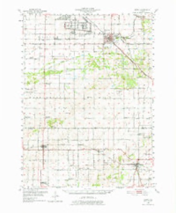
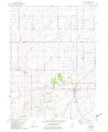
10 topographic sheets cover this place, the earliest surveyed in 1951 and the latest in 1985. It stands in La Moille Township. It lies in ZIP code area 61374. The Survey maps it on the La Moille quadrangle. It stands 801 feet above sea level.
Topographic sheets covering this place
5 surveys from 10 printed sheetsMatched by testing this settlement's coordinate against the published boundary of every sheet in the United States Geological Survey's historical collection. Each opens the scanned sheet at the Survey.
- 1951 USGS Amboy quadrangle1:62500, 3 printings
- 1958 USGS Aurora quadrangle1:250000, 3 printings
- 1961 USGS Aurora quadrangle1:250000
- 1982 USGS La Moille quadrangle1:24000
- 1985 USGS Dixon quadrangle1:100000, 2 printings



In the county-history sources
617 words on this townshipPast and Present of Bureau County, Illinois, published 1906 has no passage naming this settlement, which was common for smaller places. Its township is covered in full.
The chapter on La Moille Township covers the township.
Read the chapter on La Moille Township - 617 words.
Storms near this place
13 since 2004Regional context, not property-specific evidence. The National Weather Service names Van Orin in 13 storm reports between 2004 and 2023: 5 tornado, 4 hail, 4 thunderstorm wind. No death or injury is recorded in these reports. Each account below is quoted exactly as the forecast office filed it, from the NOAA Storm Events Database, and each date opens the federal record of that event.
| When | Event | Place named | Harm | What the report says |
|---|---|---|---|---|
| July 2004 | Thunderstorm Wind | Van Orin | $75,000 | Mesocyclone passed right over the town with the first tornado dissipating just north of town. The second tornado developed almost immediately just south of town. Damage to several buildings occurred with many trees and power lines downed. |
| July 2004 | Tornado (F0) | Van Orin | $20,000 | Rated high F0 |
| June 2013 | Tornado (EF0) | Van Orin | $10,000 | Over a dozen large pine trees were downed, including several that had been snapped across two farmsteads. There was minor damage to one of the homes from a tree falling on it. In addition, the corn crop was severely bent between the two properties. |
| July 2004 | Tornado (F0) | Van Orin | $10,000 | Rated high F0 |
| July 2004 | Hail | Van Orin | $4,000 | Also reported by DOT; Hailstones of 1 to 1.75 inches. |
| July 2004 | Hail | Van Orin | $4,000 | no account filed |
| June 2022 | Hail | Van Orin | - | Social media public report of significant hail damage to crops and a farmhouse which has numerous holes punched in the siding. Home location near intersection of 2400th and Highway 92. Time estimated from radar data. |
| August 2021 | Tornado (EFU) | Van Orin | - | A brief touchdown occurred with no visible damage. |
| April 2020 | Thunderstorm Wind | Van Orin | - | The public reported an estimated 60 mph wind gust. |
| July 2020 | Thunderstorm Wind | Van Orin | - | Several 4 inch diameter tree branches broken by thunderstorm winds. |
| June 2016 | Tornado (EF0) | Van Orin | - | National Weather Service survey found a path of minor damage in fields from a weak tornado that touched down about 4 miles west of La Moille Illinois. Storm chaser video of this tornado was seen touching down live on The Weather Channel. |
| June 2013 | Thunderstorm Wind | Van Orin | - | A trained spotter reported a large elm tree was down along with numerous branches. There was also a sheet of plywood blown across the road. |
| March 2023 | Hail | Van Orin | - | no account filed |
Nearest settlements
The eight closest, with where each one stands in the county. Distances are straight-line, computed from the Geographic Names Information System coordinates.
Elsewhere
Matched on this settlement's Geographic Names Information System number rather than its name, so it cannot be a different place of the same name in another state.
| Wikipedia article on Van Orin | An encyclopaedic summary. Its text is share-alike, so it is linked here rather than copied. |
| Wikidata item Q7913570 | The structured record the population and elevation above come from. Public domain (CC0). |
Provenance
This settlement is recorded in the Geographic Names Information System as feature 420219. The sheet list is computed by point-in-boundary test against the United States Geological Survey's historical topographic inventory. Both are works of the United States government and carry no copyright under 17 U.S.C. 105.
Storms. NOAA National Centers for Environmental Information, Storm Events Database https://www.ncei.noaa.gov/stormevents/ A work of the United States government, no copyright under 17 U.S.C. 105. Narratives are quoted verbatim from the National Weather Service report and are not edited or summarised.