 Block
Vermont, Illinois
19 topographic sheets cover this place, the earliest surveyed in 1918 and the latest in 1990. It stands in Vermont Township. It lies in ZIP code area 61484. The Survey maps it on the Vermont quadrangle. 570 people lived here at the 2020 count. It stands 697 feet above sea level.
On record in Vermont
Buildings and businesses the archive holds for this place. Each opens its own page, with the source record it came from.
On the National Register 12 of 16 shown
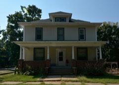 Edith Chipman Houselisted 1996
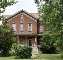 Robert Dilworth Houselisted 1993
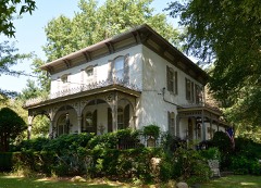 William Franklin and Rebecca Durell Houselisted 1996
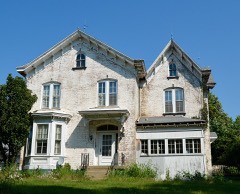 Edward Hamer Houselisted 1996
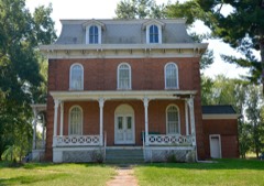 Patterson Hamer Houselisted 1996
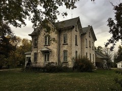 William Hoopes Houselisted 1996
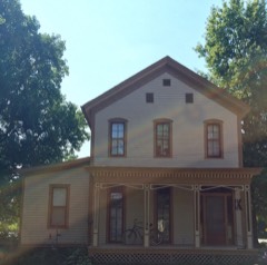 Lucinda Hunter Houselisted 1996
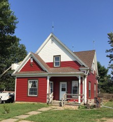 Charles Emmor McCormick Houselisted 1996
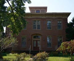 Joab Mershon Houselisted 1996
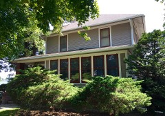 Daniel O'Connell Houselisted 1996
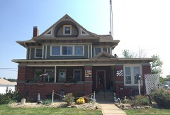 Henry H. Page Houselisted 1996
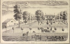 Harvey Lee Ross Houselisted 1996
Population over time
2 figuresVermont fell from 667 to 570 between 2010 and 2020. These are the recorded population figures Wikidata holds for this place, reached through the Geographic Names Information System number this page is keyed on rather than by name, so they belong to this place and not to another of the same name. Most are census counts, but not all are: an early figure may be a founding or settlement estimate, and an estimate published within five years of a census is left out. The change column is computed, and is left blank where more than 20 years separate a figure from the one before it, because a gap that long is not a change between two counts.
| Year | People | Change |
|---|---|---|
| 2010 | 667 | |
| 2020 | 570 | -97 (-15%) |
Topographic sheets covering this place
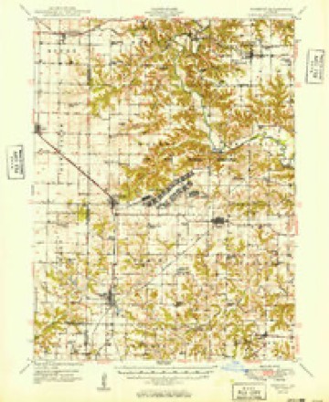
11 surveys from 19 printed sheetsMatched by testing this settlement's coordinate against the published boundary of every sheet in the United States Geological Survey's historical collection. Each opens the scanned sheet at the Survey.
- 1918 USGS Vermont quadrangle1:62500, 2 printings
- 1921 USGS Vermont quadrangle1:62500, 2 printings
- 1947 USGS Vermont quadrangle1:24000
- 1948 USGS Vermont quadrangle1:24000, 2 printings
- 1949 USGS Vermont quadrangle1:62500, 2 printings
- 1958 USGS Burlington quadrangle1:250000, 4 printings
- 1961 USGS Burlington quadrangle1:250000
- 1963 USGS Burlington quadrangle1:250000
- 1985 USGS Macomb quadrangle1:100000
- 1989 USGS Macomb quadrangle1:100000
- 1990 USGS Burlington quadrangle1:250000, 2 printings




What happened here
An account from the chapter on Vermont township. The inset identifies its exact source book and publication year.
The Cholera Of 1851
It will be remembered that this scourge appeared in New Orleans in the fiill of 1848, and raged there during the following winter. It made its appearance in St. Louis in February, 1849. The first case was attended by Prof. Barber, of McDowell's Medical College. The faculty laughed at him for pronouncing it cholera; but in a few days after Dr.
In the county-history sources
19,696 words on this townshipHistory of Fulton County, Illinois;, published 1879 names this settlement in its chapter on Vermont Township. These are the passages that mention it, exactly as the scans read.
One of the best improved townships in Fulton county is the one the history of which we now write; yet to attempt a history of the township separate and distinct from that of the town woukl be to recapituhite or repeat in a great measure what is to be said of the town of Vermont. Hence witli a few references to some of the leading historical items of the township, we will pass to the history of the town.
Passage source: History of Fulton County, Illinois;, published 1879.
It is probable that Moses Davis was the first settler to locate in the township, who came as early as 1832 and erected his cabin onehalf mile southwest of where the town of Vermont is located. The first Church was that of the Protestant Methodist denomination, and was organized in 1843. The society erected a building the same year. The first school-house was built in 183G on the Public Square in Vermont. It was constructed of hewn logs. James Spicer taught the first school in the same year. The first saw-mill in the township was built by Job Bogue in 1838 or '39. The first grist-mill was built by Rhodes Dilwortii in Vermont in 1840. The first tannery was erected by James Boyle in 1843. On the farm of Jonathan Bogue stands the first barn that was ever erected in the township. It was built by Jesse Cox about the time of Job Bogue's settlement in this township.
Passage source: History of Fulton County, Illinois;, published 1879.
As immigration set in rapidly westward, the township soon became thickly settled by an industrious, energetic people whose enterprise has brought Vermont to the front rank among the townships of the county. Among the leading farmers of Vermont township outside the town wiio have contributed most largely to the development of the resources of the county, we mention the names of Jonathan Bogue, T. C. Robinson, Joseph Robinson, J. W. Robin- son, J. H. Marshall, John Fleming, Samuel Etnier, Isaac Cadwallader, Abraham Kost, Granville Wright, Nicholas Hipslcy, J. D. and Geo. W. Powell, Reuben Kinsey (who planted the first vineyard), Charles Russell, Evan Fremont, Thos. Holmes and others.
Passage source: History of Fulton County, Illinois;, published 1879.
Machine-read from a century-old scan, so expect the errors a machine makes: misspelled names, dropped words, stray characters.
Read the whole chapter on Vermont Township - it names this place 113 more 113 times.
Storms near this place
15 since 1998Regional context, not property-specific evidence. The National Weather Service names Vermont in 15 storm reports between 1998 and 2024: 7 hail, 5 thunderstorm wind, 2 tornado, 1 flash flood. The reports record 1 injury. Each account below is quoted exactly as the forecast office filed it, from the NOAA Storm Events Database, and each date opens the federal record of that event.
| When | Event | Place named | Harm | What the report says |
|---|---|---|---|---|
| August 2009 | Thunderstorm Wind | Vermont | 1 hurt, $100,000 | Approximately 3/4 of the town of Vermont had tree damage, with numerous trees snapped off at the base or uprooted. One person was injured when a tree was blown down onto them. |
| August 2017 | Thunderstorm Wind | Vermont | $5,000 | A tree was blown down, taking out a power line. |
| May 2024 | Hail | Vermont | - | Hail ranged between a half inch and half dollar, with most being around one inch. |
| July 2024 | Thunderstorm Wind | Vermont | - | Several 3 to 6-inch diameter tree branches were blown down. |
| April 2023 | Thunderstorm Wind | Vermont | - | Several power lines were blown down in Vermont. |
| April 2023 | Hail | Vermont | - | Multiple storm-chasers experienced baseball-sized hail which shattered their car windshields near Vermont. |
| July 2010 | Flash Flood | Vermont | - | Clusters of training thunderstorms produced excessive amounts of rainfall in southern Fulton County during the late evening hours of July 19th. Rainfall rates of 2.00 per hour for more than 3 hours produced widespread flash flooding, which closed nearly every rural road and stranded motorists in southern parts of the county. Total rainfall accumulations reached nearly 6.00 around Astoria. |
| May 1998 | Thunderstorm Wind | Vermont | - | Thunderstorm winds blew down a large tree limb onto a car in Vermont. No one was in the car at the time and damage was minor. |
| April 1998 | Tornado (F0) | Vermont | - | A tornado briefly touched down in a field on the outskirts of Vermont. No injuries or damage were reported. |
| May 1998 | Tornado (F0) | Vermont | - | A tornado briefly touched down in a field one mile south of Vermont. No injuries or damage were reported. |
| April 2023 | Hail | Vermont | - | no account filed |
| May 2023 | Hail | Vermont | - | no account filed |
| May 2019 | Hail | Vermont | - | no account filed |
| May 2015 | Hail | Vermont | - | no account filed |
| June 2014 | Hail | Vermont | - | no account filed |
Nearest settlements
The eight closest, with where each one stands in the county. Distances are straight-line, computed from the Geographic Names Information System coordinates.
| Map | Place | Distance | Sheets |
|---|---|---|---|
| Table Grove | 4.8 miles | 19 | |
| Astoria | 5.9 miles | 15 | |
| Leesburg | 6.7 miles | 15 | |
| Ipava | 6.8 miles | 19 | |
| Summum | 8.1 miles | 19 | |
| Howard | 8.9 miles | 19 | |
| Bernadotte (historical) | 9.4 miles | 18 | |
| Beaty | 9.7 miles | 19 |
Elsewhere
Matched on this settlement's Geographic Names Information System number rather than its name, so it cannot be a different place of the same name in another state.
| Wikipedia article on Vermont | An encyclopaedic summary. Its text is share-alike, so it is linked here rather than copied. |
| Wikidata item Q2187579 | The structured record the population and elevation above come from. Public domain (CC0). |
Provenance
This settlement is recorded in the Geographic Names Information System as feature 420265. The sheet list is computed by point-in-boundary test against the United States Geological Survey's historical topographic inventory. Both are works of the United States government and carry no copyright under 17 U.S.C. 105.
Storms. NOAA National Centers for Environmental Information, Storm Events Database https://www.ncei.noaa.gov/stormevents/ A work of the United States government, no copyright under 17 U.S.C. 105. Narratives are quoted verbatim from the National Weather Service report and are not edited or summarised.