 Block
Astoria, Illinois
15 topographic sheets cover this place, the earliest surveyed in 1926 and the latest in 1990. It stands in Astoria Township. It lies in ZIP code area 61501. The Survey maps it on the Astoria quadrangle. 929 people lived here at the 2020 count. It stands 710 feet above sea level.
On record in Astoria
Buildings and businesses the archive holds for this place. Each opens its own page, with the source record it came from.
On the National Register 1 record
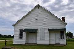 South Fulton Churchhouselisted 1994
Population over time
2 figuresAstoria fell from 1,141 to 929 between 2010 and 2020. These are the recorded population figures Wikidata holds for this place, reached through the Geographic Names Information System number this page is keyed on rather than by name, so they belong to this place and not to another of the same name. Most are census counts, but not all are: an early figure may be a founding or settlement estimate, and an estimate published within five years of a census is left out. The change column is computed, and is left blank where more than 20 years separate a figure from the one before it, because a gap that long is not a change between two counts.
| Year | People | Change |
|---|---|---|
| 2010 | 1,141 | |
| 2020 | 929 | -212 (-19%) |
Topographic sheets covering this place
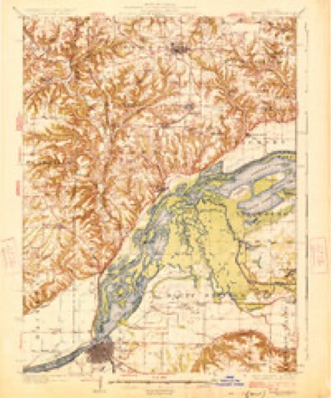
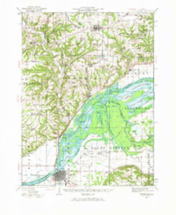
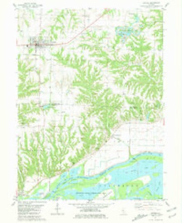
9 surveys from 15 printed sheetsMatched by testing this settlement's coordinate against the published boundary of every sheet in the United States Geological Survey's historical collection. Each opens the scanned sheet at the Survey.
- 1926 USGS Beardstown quadrangle1:62500, 2 printings
- 1944 USGS Beardstown quadrangle1:62500, 2 printings
- 1958 USGS Burlington quadrangle1:250000, 4 printings
- 1961 USGS Burlington quadrangle1:250000
- 1963 USGS Burlington quadrangle1:250000
- 1981 USGS Astoria quadrangle1:24000
- 1985 USGS Macomb quadrangle1:100000
- 1989 USGS Macomb quadrangle1:100000
- 1990 USGS Burlington quadrangle1:250000, 2 printings




In the county-history sources
25,340 words on this townshipHistory of Fulton County, Illinois;, published 1879 names this settlement in its chapter on Astoria Township. These are the passages that mention it, exactly as the scans read.
Astoria may truly be said to be one of the most flourishing towns in Central Illinois, and only few in the State of the same number of inhabitants excel it in the display of enterprise. In detailing the history of Astoria we shall begin at a very early date in pioneer history.
Passage source: History of Fulton County, Illinois;, published 1879.
Louis, in 1837, moved a quarter of a mile westward, where they laid out the present town of Astoria. Mr. Gilbert moved his storebuilding; and located it upon the site now occupied by the store of Lovell & Smith, grocers. In a short time the new village boasted of a postmaster. This gentleman was a Dr. James Owen, who came from Ohio. The postoffico was kept in a small frame building that stood upon the west side of the square. This town was more fortunate than most frontier towns, i'or it was on the line of the daily four-horse stage-coach from Peoria to Quincy, from 1836 till 1843, and was the point at which dinner was taken.
Passage source: History of Fulton County, Illinois;, published 1879.
The town grew verv slowlv for a number of vears. Vermont was bitterly opposed to the infant village struggling for an existence, and proved a formidable rival for many years. The first log cabin upon the town site was built by B. W. Lutz. Zachrriah Gilbert, as we have before stated, erected the first store building in the town of Washington, but at the platting and organization of Astoria a Mr. Morland erected the first business building in the town. Mr. Gilbert, however, moved his store building from Washington to Astoria, and on the way carried on his regular trade. Jacob Sharp, who previously sold goods about a mile and a half from town on the road to the river, bought Morland's building and moved his stock of goods to Astoria. John Bane built the second store building, in which he kept a stock of general merchandise. He also had a tavern, which, doubtless, was the first tavern opened in the town, Wm. H. Scripps came in 1840 from Rushville. His means were limited at that time, but he rented a building from Dr. Owen, and began his successful career as a merchant, grain-buyer and porkpacker. Zachariah Gilbert was the first Justice of the Peace after each Congressional township had been formed into an election precinct. The first physicians were Drs. James and Carrolton Owens, Dr. G. V. Hopkins, Dr. Montgomery and Dr. W^alker.
Passage source: History of Fulton County, Illinois;, published 1879.
Machine-read from a century-old scan, so expect the errors a machine makes: misspelled names, dropped words, stray characters.
Read the whole chapter on Astoria Township - it names this place 125 more 125 times.
Storms near this place
31 since 1996Regional context, not property-specific evidence. The National Weather Service names Astoria in 31 storm reports between 1996 and 2025: 15 thunderstorm wind, 11 hail, 4 flash flood, 1 tornado. No death or injury is recorded in these reports. Each account below is quoted exactly as the forecast office filed it, from the NOAA Storm Events Database, and each date opens the federal record of that event.
| When | Event | Place named | Harm | What the report says |
|---|---|---|---|---|
| July 2010 | Flash Flood | Astoria | $100,000 | Slow moving thunderstorms produced copious amounts of rainfall in the southern third of Fulton County late in the evening of July 28th. Rainfall amounts of 4.00 to 5.00 were measured in 90 minutes which produced more than two feet of water on many rural roads. A few vehicles were submerged in flooded viaducts, and several water rescues of stranded motorists were made. There were no injuries reported. |
| August 1999 | Thunderstorm Wind | Astoria | $50,000 | Numerous power lines and tree limbs blown down. |
| August 2012 | Thunderstorm Wind | Astoria | $25,000 | Numerous trees and tree branches were blown down in Astoria. In addition, two light-weight open-ended vehicle shelters were flipped. |
| March 2025 | Thunderstorm Wind | Astoria | - | A power line was blown down. |
| June 2019 | Thunderstorm Wind | Astoria | - | A large tree limb was blown down. |
| June 2015 | Flash Flood | Astoria | - | Thunderstorms produced 3.00 to 5.00 of rain on extremely saturated ground in southern Fulton County during the evening of June 15th. The biggest impact was the flooding of rural roads from the town of Vermont south to U.S. Highway 24. Parts of U.S. Highway 24 were also flooded from Astoria to the Schuyler County line. |
| September 2014 | Flash Flood | Astoria | - | Slow moving thunderstorms with very heavy rainfall produced an average of 3.00 of rain in less than two hours in extreme southern Fulton County. Rural roads within one to two miles of the Schuyler County line were impassable. U.S. Highway 24 from two miles west-southwest of Astoria to the Schuyler County line was closed. The flooding subsided within about three hours by mid-afternoon. |
| May 2011 | Thunderstorm Wind | Astoria | - | Several trees were blown down southeast of Astoria. |
| August 2010 | Flash Flood | Astoria | - | Thunderstorms produced heavy rainfall, with rates of 1.50 inches per hour for at least two hours during the late evening of August 10th in southwest Fulton County. U.S. Route 136 from Ipava to the county line was covered with two to three feet of water in spots and was closed for a few hours. |
| May 2007 | Thunderstorm Wind | Astoria | - | Numerous reports of tree limbs down across southern Fulton county. The tree limbs were up to 10 inches in diameter. |
| August 2005 | Thunderstorm Wind | Astoria | - | A few trees and power lines were blown down. Also, a roof was blown off a shed. |
| September 2005 | Thunderstorm Wind | Astoria | - | A few large tree limbs blown down. |
| May 2004 | Thunderstorm Wind | Astoria | - | Several trees and a TV antenna on a house were blown down. |
| May 2003 | Tornado (F1) | Astoria | - | A tornado touched down half a mile south of town then traveled east northeast. It destroyed several sheds and damaged a business. Numerous trees, tree limbs, power lines and power poles were blown down. No injuries were reported. |
| July 2001 | Thunderstorm Wind | Astoria | - | Thunderstorm winds blew down numerous trees, including some that were over two feet in diameter at the Anderson Lake State Fish and Wildlife Area. Some buildings sustained minor damage due to the fallen trees. |
| September 2000 | Thunderstorm Wind | Astoria | - | Straight line winds blew down a few trees in the area, as well as bending over a stop sign pole 45 degrees. |
| June 1999 | Thunderstorm Wind | Astoria | - | Numerous trees and tree limbs were blown down in the Astoria area. Some of the trees fell over onto US 24 two miles east northeast of Astoria. As the storms approached the Sepo area, several large trees were blown down across US Route 136 three miles south of Sepo. Several more trees were blown down onto Route 78 one mile south of US Route 24. No injuries were reported. |
| March 1998 | Thunderstorm Wind | Astoria | - | A line of severe thunderstorms moved through Fulton county. In Astoria, a couple of mobile homes were damaged, several business signs, trees, tree limbs, and power lines were blown down. At the same time in Avon, numerous power lines and tree limbs were blown down and the township garage sustained some damage. Numerous trees, tree limbs, and power lines were blown down throughout the county. No injuries were reported and no damage estimate was available. |
| May 2023 | Hail | Astoria | - | no account filed |
| June 2014 | Hail | Astoria | - | no account filed |
| June 2014 | Hail | Astoria | - | no account filed |
| June 2014 | Hail | Astoria | - | no account filed |
| June 2013 | Hail | Astoria | - | no account filed |
| June 2011 | Hail | Astoria | - | no account filed |
| July 2010 | Hail | Astoria | - | no account filed |
| September 2006 | Hail | Astoria | - | no account filed |
| June 2000 | Hail | Astoria | - | no account filed |
| April 1998 | Hail | Astoria | - | no account filed |
| April 1996 | Hail | Astoria | - | no account filed |
| October 1996 | Thunderstorm Wind | Astoria | - | no account filed |
| August 1996 | Thunderstorm Wind | Astoria | - | no account filed |
Nearest settlements
The eight closest, with where each one stands in the county. Distances are straight-line, computed from the Geographic Names Information System coordinates.
| Map | Place | Distance | Sheets |
|---|---|---|---|
| Leesburg | 2.6 miles | 15 | |
| Summum | 5.1 miles | 19 | |
| Vermont | 5.9 miles | 19 | |
| Beaty | 6.9 miles | 19 | |
| Howard | 8.5 miles | 19 | |
| Marbletown | 8.6 miles | 16 | |
| Ipava | 8.7 miles | 19 | |
| Otto (historical) | 9.5 miles | 19 |
Elsewhere
Matched on this settlement's Geographic Names Information System number rather than its name, so it cannot be a different place of the same name in another state.
| Wikipedia article on Astoria | An encyclopaedic summary. Its text is share-alike, so it is linked here rather than copied. |
| Wikidata item Q2073812 | The structured record the population and elevation above come from. Public domain (CC0). |
Provenance
This settlement is recorded in the Geographic Names Information System as feature 403689. The sheet list is computed by point-in-boundary test against the United States Geological Survey's historical topographic inventory. Both are works of the United States government and carry no copyright under 17 U.S.C. 105.
Storms. NOAA National Centers for Environmental Information, Storm Events Database https://www.ncei.noaa.gov/stormevents/ A work of the United States government, no copyright under 17 U.S.C. 105. Narratives are quoted verbatim from the National Weather Service report and are not edited or summarised.