 Block
Walnut, Illinois
10 topographic sheets cover this place, the earliest surveyed in 1949 and the latest in 1985. It stands in Walnut Township. It lies in ZIP code area 61376. The Survey maps it on the Walnut quadrangle. 1,311 people lived here at the 2020 count. It stands 705 feet above sea level.
Population over time
2 figuresWalnut fell from 1,416 to 1,311 between 2010 and 2020. These are the recorded population figures Wikidata holds for this place, reached through the Geographic Names Information System number this page is keyed on rather than by name, so they belong to this place and not to another of the same name. Most are census counts, but not all are: an early figure may be a founding or settlement estimate, and an estimate published within five years of a census is left out. The change column is computed, and is left blank where more than 20 years separate a figure from the one before it, because a gap that long is not a change between two counts.
| Year | People | Change |
|---|---|---|
| 2010 | 1,416 | |
| 2020 | 1,311 | -105 (-7%) |
Topographic sheets covering this place
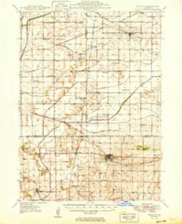
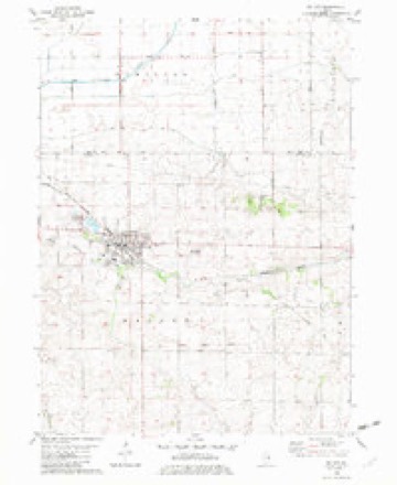
5 surveys from 10 printed sheetsMatched by testing this settlement's coordinate against the published boundary of every sheet in the United States Geological Survey's historical collection. Each opens the scanned sheet at the Survey.
- 1949 USGS Walnut quadrangle1:62500, 3 printings
- 1958 USGS Aurora quadrangle1:250000, 3 printings
- 1961 USGS Aurora quadrangle1:250000
- 1982 USGS Walnut quadrangle1:24000
- 1985 USGS Dixon quadrangle1:100000, 2 printings



In the county-history sources
509 words on this townshipPast and Present of Bureau County, Illinois, published 1906 names this settlement in its chapter on Walnut Township. These are the passages that mention it, exactly as the scans read.
The first house in Walnut was built at Red Oak Grove in 1828, by the Anient brothers. There was no other settlement in the township for about ten years. This old landmark was like an oasis in the desert, for it furnished shelter, food and rest for the weary traveler on the old Peoria and Galena stage road, when there was no other house within a radius of many miles. This property was afterwards owned by 0. I)enhnm and in 1831 by JamesjMagby. In 1833 James Clay])oll became the owner and in 1836 sold it to Lutlier Denham, who lived there for a term of years.
Passage source: Past and Present of Bureau County, Illinois, published 1906.
This is the history of that early claim, which was the only sign of civilization in that part of the country until about 1837. In this last named year a claim was made just south of Walnut Grove and (Jreenbury Triplett and A. H. Jaynes "jumped" it. They afterwards sold it to Truman Culver. In 1843 Oliver Jaynes settled on the south side of the grove; Richard Brewer, on the north side and Peter McNitt on the' east side. Soon after T?icliard Lancfford.
Passage source: Past and Present of Bureau County, Illinois, published 1906.
On July 31, 1890, a very destructive fire swept over the village and a large part of the business portion was destroyed. Again in August, 1900, the llames spread over the fated village, both of the fires left Walnut in a desolate condition; the accumulations and improvements of years were swept away in a few short b.ours. People from the adjoining country flocked there to see the ruins and many predicted that Walnut would never recover from her misfortune. Not so with her citizens. While the loss was keenly felt, there was but one tiiought among the citizens and that thought was the slogan, "'Walnut shall rise again, better, safer and fairer than before," and with this determination in mind they heroically went to work and Phoenix-like Walnut rose from her ashes and stood out before the world, newer and richer than ever before, and is today an example of what grit and push can do. Walnut is one of the best business points in the county. It is noted for its large shipments of grain and live-stock. Her business enterprise is worthy of imitation. The population by the census of 1900, including the village of Walnut, was one thousand five hundred and one. Walnut village was seven hundred and ninety-one. The following named gentlemen have served as supervisors :
Passage source: Past and Present of Bureau County, Illinois, published 1906.
Machine-read from a century-old scan, so expect the errors a machine makes: misspelled names, dropped words, stray characters.
Read the whole chapter on Walnut Township - it names this place 1 more 1 time.
Mines and quarries near this place
2 within 5 milesRegional context, not property-specific evidence. The federal mineral resources record lists 2 workings within 5 miles of Walnut: 2 producers. All of them still produce. What was taken out: Sand and Gravel, Construction. Distance is straight-line from the map coordinates, so a quarry counted here may appear on a neighbouring settlement's page as well.
| Where | Site | Commodity | Status | Recorded |
|---|---|---|---|---|
| Quality Sand & Gravel Pit | Sand and Gravel, Construction | Producer | ||
| Walnut Pit #2 | Sand and Gravel, Construction | Producer |
Storms near this place
25 since 1995Regional context, not property-specific evidence. The National Weather Service names Walnut in 25 storm reports between 1995 and 2023: 13 hail, 12 thunderstorm wind. No death or injury is recorded in these reports. Each account below is quoted exactly as the forecast office filed it, from the NOAA Storm Events Database, and each date opens the federal record of that event.
| When | Event | Place named | Harm | What the report says |
|---|---|---|---|---|
| May 2008 | Hail | Walnut | $10,000 | Golf ball-sized hail fell in Walnut, IL around 10:20 pm May 31 damaging the roof and siding of the water treatment plant and stripping leaves off of some nearby trees. Delayed report. Time estimated. |
| March 2006 | Thunderstorm Wind | Walnut | $3,000 | branches a couple of inches in diameter down across the town |
| July 2006 | Thunderstorm Wind | Walnut | $2,000 | From cooperative observer. Many big branches up to 6 inches in diameter down around village. |
| March 2006 | Thunderstorm Wind | Walnut | $1,000 | A door was blown off a barn. Time estimated based on radar. |
| May 2000 | Thunderstorm Wind | Walnut | $1,000 | no account filed |
| March 2023 | Thunderstorm Wind | Walnut | - | This survey was completed by the NWS in Chicago. The survey team found snapped tree trunks at his location. |
| March 2023 | Thunderstorm Wind | Walnut | - | This survey was completed by the NWS in Chicago. The survey team found roof removed from a manufactured home. |
| March 2023 | Thunderstorm Wind | Walnut | - | This survey was completed by the NWS in Chicago. The survey team found loss of a portion of the roof on a farm outbuilding. |
| March 2023 | Thunderstorm Wind | Walnut | - | This survey was completed by the NWS in Chicago. The survey team found damage to the roof of a farm outbuilding. South of this location there was damage to trees. |
| July 2023 | Thunderstorm Wind | Walnut | - | Large tree limbs blown down by thunderstorm winds. |
| August 2011 | Hail | Walnut | - | Dime to nickel sized hail was reported. |
| June 2009 | Thunderstorm Wind | Walnut | - | Wind gusts estimated to be 65 mph blew a 12 inch diameter tree limb down in Walnut, IL around 637 pm June 27. |
| May 2008 | Hail | Walnut | - | Pea to quarter-sized hail fell in Walnut, IL around 10:23 pm May 31 completely covering the streets. |
| May 2008 | Hail | Walnut | - | Quarter-sized hail fell about two miles north northwest of Walnut, IL around 10:16 pm May 31. |
| May 2008 | Hail | Walnut | - | Quarter-sized hail fell in Walnut, IL around 10:21 pm May 31. |
| July 2008 | Hail | Walnut | - | Quarter-sized hail fell on Baseline Road about 2 miles north of Walnut, IL at 917 pm July 10. |
| July 2008 | Thunderstorm Wind | Walnut | - | Wind gusts estimated to be 50 to 60 mph were observed near a funeral home just east of Walnut, IL at 925 pm July 10. |
| July 2008 | Hail | Walnut | - | Quarter-sized hail fell 1 mile northeast of Walnut, IL at 928 pm July 10. |
| June 2001 | Thunderstorm Wind | Walnut | - | Thunderstorm winds downed large tree limbs and power lines. Reported by trained spotter. |
| July 2015 | Hail | Walnut | - | no account filed |
| May 2003 | Hail | Walnut | - | no account filed |
| May 2003 | Hail | Walnut | - | no account filed |
| May 2000 | Hail | Walnut | - | no account filed |
| April 1999 | Hail | Walnut | - | no account filed |
| May 1995 | Hail | Walnut | - | no account filed |
Nearest settlements
The eight closest, with where each one stands in the county. Distances are straight-line, computed from the Geographic Names Information System coordinates.
Elsewhere
Matched on this settlement's Geographic Names Information System number rather than its name, so it cannot be a different place of the same name in another state.
| Wikipedia article on Walnut | An encyclopaedic summary. Its text is share-alike, so it is linked here rather than copied. |
| Wikidata item Q2133297 | The structured record the population and elevation above come from. Public domain (CC0). |
Provenance
This settlement is recorded in the Geographic Names Information System as feature 420437. The sheet list is computed by point-in-boundary test against the United States Geological Survey's historical topographic inventory. Both are works of the United States government and carry no copyright under 17 U.S.C. 105.
Mines and quarries. USGS Mineral Resources Data System (MRDS) https://mrdata.usgs.gov/mrds/ A work of the United States government, no copyright under 17 U.S.C. 105.
Storms. NOAA National Centers for Environmental Information, Storm Events Database https://www.ncei.noaa.gov/stormevents/ A work of the United States government, no copyright under 17 U.S.C. 105. Narratives are quoted verbatim from the National Weather Service report and are not edited or summarised.