 Block
Wataga, Illinois
9 topographic sheets cover this place, the earliest surveyed in 1947 and the latest in 1989. It stands in Sparta Township. It lies in ZIP code area 61488. The Survey maps it on the Wataga quadrangle. 744 people lived here at the 2020 count. It stands 830 feet above sea level.
Population over time
2 figuresWataga fell from 843 to 744 between 2010 and 2020. These are the recorded population figures Wikidata holds for this place, reached through the Geographic Names Information System number this page is keyed on rather than by name, so they belong to this place and not to another of the same name. Most are census counts, but not all are: an early figure may be a founding or settlement estimate, and an estimate published within five years of a census is left out. The change column is computed, and is left blank where more than 20 years separate a figure from the one before it, because a gap that long is not a change between two counts.
| Year | People | Change |
|---|---|---|
| 2010 | 843 | |
| 2020 | 744 | -99 (-12%) |
Topographic sheets covering this place
7 surveys from 9 printed sheetsMatched by testing this settlement's coordinate against the published boundary of every sheet in the United States Geological Survey's historical collection. Each opens the scanned sheet at the Survey.
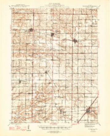
- 1947 USGS Woodhull quadrangle1:62500, 2 printings
- 1958 USGS Davenport quadrangle1:250000, 2 printings
- 1961 USGS Davenport quadrangle1:250000
- 1962 USGS Davenport quadrangle1:250000
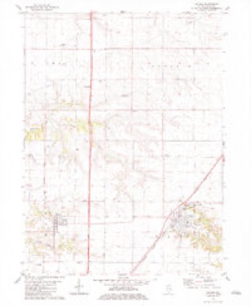
- 1982 USGS Wataga quadrangle1:24000
- 1984 USGS Aledo quadrangle1:100000
- 1989 USGS Aledo quadrangle1:100000





In the county-history sources
8,133 words on this townshipHistory of Knox County, Illinois : Together with Sketches of the Cities, Villages and Townships; Record of Its Volunteers in the Late War; Educational, Religious, Civil and Political History; Portraits of Prominent Persons and Biographical Sketches of the Subscribers; History of Illinois; Abstracts of the State Laws, Etc., Etc., Etc. ; Illustrated, published 1878 names this settlement in its chapter on Sparta Township. These are the passages that mention it, exactly as the scans read.
Asaph DeLong and Luman Field, from Vermont, and Wm. M. Heath from New York, settled on section 31 in 1836. Julius DeLong came from Vermont in January, 1838, and settled on the south half of the southwest quarter of section 31, the present home of his son, Hon. M. P. DeLong, who has represented his township at different times in various offices from the very first organization. He has been an active member of the Knox County Agricultural Society for fifteen years; was its president three years during that time; has served as Justice of the Peace three terms of four years each, and is now in the fourth term; was elected and served as Supervisor of his township in 1874, when the farmers were organizing into farmers' clubs and granges throughout the Northwest, which in time became national, for the purpose of counter-balancing the influence of the giant monopolies of the railroads which existed ax, that time. We will refer to these organizations again farther along in the history of this township. The prairie fires in the early settlement of the township were something to be dreaded. The broad, wide-spreading prairies for untold years had lain beneath the sun and the showers, gathering richness, until the vegetable growth was something marvelous, and the tall native grasses would in places hide man and beast. And when a fire chanced to start in this waving ocean of dried and inflammable material, it was a sure messenger of death to every living thing or creature in its relentless course, unless due precaution had been previously exercised to guard against it. The roar of the flames when driven by a strong wind could be heard two and three miles away, as was the case one night when these early settlers were awakened by Miss Maria Field, daughter of Luman Field, and sister of the late Hon. Loyal C. Field, of Galesburg. She, living with her parents near where Center Point now is, awakened about midnight, and discovering the danger of the settlement, ran from house to house, and gave the alarm. A fire had started at Red Oak, in Henry Co., 111., and now was rushing southward, two miles wide, before a furious wind from the north, with a terrible roar that will never be forgotten by those who heard it. Fortunately the citizens in this township being forewarned, were fore-armed and prepared to give battle when the fire came. Trenches and " back fire " and wet blankets were used to save the buildings, fences and stocks; and even then the heavy wind would carry wisps of burning grass so far that a continual effort was required until the billow of fire had passed.
Mr. Robson, the present supervisor, owns 500 acres of land. The Robson Bros, have been extensive shippers of stock. William Robson came to his present home in Sparta township in 1863, and he has made single shipments from Wataga station amounting to $35,000. He has also introduced short-horn cattle, Poland China and Berkshire hogs.
Niles Bros., whose residences are located on sections 21 and 19, are from Chatham, Columbia county, New York. They were proprietors of the Wataga mill for seven years before turning their attention to farming. They introduced the short-horn cattle on their farms in the spring of 1874 - 30 head that year - at a cost of from $100 to $500 each.
Machine-read from a century-old scan, so expect the errors a machine makes: misspelled names, dropped words, stray characters.
Read the whole chapter on Sparta Township - it names this place 5 more 5 times.
Storms near this place
3 since 2006Regional context, not property-specific evidence. The National Weather Service names Wataga in 3 storm reports between 2006 and 2023: 2 hail, 1 thunderstorm wind. No death or injury is recorded in these reports. Each account below is quoted exactly as the forecast office filed it, from the NOAA Storm Events Database, and each date opens the federal record of that event.
| When | Event | Place named | Harm | What the report says |
|---|---|---|---|---|
| July 2023 | Thunderstorm Wind | Wataga | - | A large tree branch was broken off. |
| April 2014 | Hail | Wataga | - | no account filed |
| March 2006 | Hail | Wataga | - | no account filed |
Nearest settlements
The eight closest, with where each one stands in the county. Distances are straight-line, computed from the Geographic Names Information System coordinates.
| Map | Place | Distance | Sheets |
|---|---|---|---|
| Ontario | 4.0 miles | 9 | |
| Henderson | 4.0 miles | 9 | |
| Oneida | 4.3 miles | 12 | |
| East Galesburg | 5.6 miles | 17 | |
| Soperville | 6.4 miles | 9 | |
| Knox | 6.4 miles | 17 | |
| Henderson Grove | 7.0 miles | 9 | |
| Galesburg | 7.2 miles | 17 |
Elsewhere
Matched on this settlement's Geographic Names Information System number rather than its name, so it cannot be a different place of the same name in another state.
| Wikipedia article on Wataga | An encyclopaedic summary. Its text is share-alike, so it is linked here rather than copied. |
| Wikidata item Q2672179 | The structured record the population and elevation above come from. Public domain (CC0). |
Provenance
This settlement is recorded in the Geographic Names Information System as feature 420630. The sheet list is computed by point-in-boundary test against the United States Geological Survey's historical topographic inventory. Both are works of the United States government and carry no copyright under 17 U.S.C. 105.
Storms. NOAA National Centers for Environmental Information, Storm Events Database https://www.ncei.noaa.gov/stormevents/ A work of the United States government, no copyright under 17 U.S.C. 105. Narratives are quoted verbatim from the National Weather Service report and are not edited or summarised.