 Block
Wayne City, Illinois
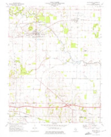
9 topographic sheets cover this place, the earliest surveyed in 1947 and the latest in 1982. It stands in Orel Township. It lies in ZIP code area 62895. It stands on Shoe Creek. The Survey maps it on the Wayne City quadrangle. 994 people lived here at the 2020 count. It stands 433 feet above sea level.
Population over time
2 figuresWayne City fell from 1,032 to 994 between 2010 and 2020. These are the recorded population figures Wikidata holds for this place, reached through the Geographic Names Information System number this page is keyed on rather than by name, so they belong to this place and not to another of the same name. Most are census counts, but not all are: an early figure may be a founding or settlement estimate, and an estimate published within five years of a census is left out. The change column is computed, and is left blank where more than 20 years separate a figure from the one before it, because a gap that long is not a change between two counts.
| Year | People | Change |
|---|---|---|
| 2010 | 1,032 | |
| 2020 | 994 | -38 (-4%) |
Topographic sheets covering this place
5 surveys from 9 printed sheetsMatched by testing this settlement's coordinate against the published boundary of every sheet in the United States Geological Survey's historical collection. Each opens the scanned sheet at the Survey.
- 1947 USGS Wayne City quadrangle1:62500, 3 printings
- 1958 USGS Belleville quadrangle1:250000, 3 printings
- 1962 USGS Belleville quadrangle1:250000
- 1973 USGS Wayne City quadrangle1:24000
- 1982 USGS Mount Vernon quadrangle1:100000



Storms near this place
60 of 61 shownRegional context, not property-specific evidence. The National Weather Service names Wayne City in 61 storm reports between 1995 and 2024: 30 flood, 13 thunderstorm wind, 11 hail, 4 flash flood. The reports record 1 death and 44 injuries. Each account below is quoted exactly as the forecast office filed it, from the NOAA Storm Events Database, and each date opens the federal record of that event.
| When | Event | Place named | Harm | What the report says |
|---|---|---|---|---|
| April 2002 | Tornado (F3) | Wayne City | 1 killed, 42 hurt, $4,000,000 | The tornado entered Wayne County about a half mile north of Illinois Route 15, then proceeded to move northeast to a point about 1.5 miles north of Wayne City. The tornado then paralleled Route 15 just north of Sims. The tornado continued moving east toward Fairfield, and passed through the southern part of Fairfield with F-3 intensity winds. The tornado then travelled slightly south of east toward Golden Gate. The tornado weakened east of Golden Gate and finally dissipated in extreme eastern Wayne County near Ellery. The sole fatality occurred 4 miles west of Wayne City, when a 47-year-old man was killed inside his mobile home. Of the 42 hospital-treated injuries, 13 were critical. A total of 35 homes were destroyed, and 16 received major damage. The average wind speed in the tornado was 130 to 170 MPH, with peak winds at or approaching 200 MPH. The F-3 damage was located near Sims, southern sections of Fairfield, near Merriam, and areas west and north of Wayne City. Vehicles were picked up and deposited in houses. Well-constructed houses lost roofs and some walls. Weaker structures, including a tavern near Sims, were demolished. |
| March 2009 | Tornado (EF1) | Wayne City | 1 hurt, $40,000 | Intermittent damage was observed along the path of this tornado, which contained peak winds near 100 mph. Most of the damage was tree damage. Some trees were snapped and uprooted. Two structures were damaged, including a mobile home that was not tied down. The mobile home was rolled while a man was inside. He suffered broken ribs. The other damaged structure was a 40-by-60 foot storage shed. About one third of the shed was blown over a storage barn into a house, causing significant damage to the house. Debris was blown into a field across the street. A power pole was blown down. The tornado was witnessed about four miles north of Sims in the middle of a field. It was described as a black rotating cloud. |
| April 2006 | Thunderstorm Wind | Wayne City | 1 hurt, $40,000 | In Wayne City, several trees were down, and a church sustained extensive damage to siding and shingles. A portion of a trailer roof was torn off and deposited in power lines. Peak winds were estimated near 70 MPH. Near the Interstate 64 junction with State Route 242 (exit 100), trees were down and a mobile home was overturned and destroyed. A baby in the home received a bump on the head but no serious injuries. About a mile north of Sims, a barn was blown down. An unoccupied mobile home south of Boyleston was blown off its foundation and wrapped around a tree. |
| July 2023 | Thunderstorm Wind | Wayne City | $250,000 | Nearly all of the damage was in the south and west parts of Wayne City. There were dozens of trees and large tree branches down, several of which landed on homes and cars. Some light structure damage occurred to a mobile home. A large tree fell onto a barn. Roofing from an open, lean-to style machine shed was torn off. Power poles and lines were down. |
| May 2017 | Flood | Wayne City | $80,000 | Major flooding occurred on the Skillet Fork River. At the Wayne City river gage, the river crested at 22.81 feet early on the 1st. Flood stage is 15 feet. This crest was within a couple inches of the April, 2011 flood crest. At least one home was sandbagged east of Route 45 in the Mill Shoals area. There was widespread flooding of lowlands, including county roads and bridges. |
| May 2016 | Hail | Wayne City | $30,000 | A slow-moving severe thunderstorm moved into western Wayne County, dumping quarter to ping-pong ball size hail between Wayne City and Orchardville. |
| May 2018 | Thunderstorm Wind | Wayne City | $20,000 | Emergency management personnel estimated sustained winds were 40 to 45 mph with gusts above 60 mph. Trees and power lines were down across the county. Generators were being utilized in Fairfield, where the doors were blown open at the health department. |
| April 2014 | Flood | Wayne City | $10,000 | Major flooding occurred along the Skillet Fork River. At the Wayne City river gage, the river crested at 20.28 feet on the 5th. This crest was about one-half foot above the January, 2013 flood crest. Flood stage there is 15 feet, and major flooding begins at 20 feet. Numerous roads were flooded, a few of which were impassable. There was widespread flooding of low-lying fields and woodlands. |
| May 1995 | Thunderstorm Wind | Wayne City | $10,000 | Several trees and large limbs were blown down in Wayne City. |
| January 2013 | Thunderstorm Wind | Wayne City | $8,000 | Several large trees were uprooted. Two 20-inch diameter trees were snapped off about three feet above the ground. |
| March 2020 | Flood | Wayne City | $5,000 | Major flooding occurred on the Skillet Fork River. The river crested at 20.12 feet at the Wayne City gage on the evening of the 20th. Major flooding begins at 20 feet. Numerous county roads were flooded, a few of which were impassable. There was widespread flooding of low-lying fields and woodlands. |
| December 2015 | Flood | Wayne City | $5,000 | Major flooding occurred along the Skillet Fork River near Wayne City. Considerable flooding of low-lying fields occurred. Some homes threatened by the floodwaters were sandbagged, and rural roads were closed. At the Wayne City gage, the river crested at 24.1 feet on the morning of the 29th. Flood stage there is 15 feet. Compared to the flood of June, 2015, the river crested about a half foot lower. |
| June 2013 | Flood | Wayne City | $5,000 | Minor flooding occurred along the Skillet Fork River in the Wayne City area. Low-lying fields, woodlands, and river access roads were flooded. |
| July 2011 | Thunderstorm Wind | Wayne City | $5,000 | A trained spotter estimated a wind gust to 65 mph in Wayne City. Shingles were blown off a roof south of Wayne City. |
| July 1997 | Thunderstorm Wind | Wayne City | $5,000 | Trees and power lines were blown down. |
| June 2017 | Thunderstorm Wind | Wayne City | $4,000 | A tree was snapped. Several tree limbs were blown down. |
| June 2015 | Flood | Wayne City | $3,000 | The Skillet Fork River crested at its fourth highest level on record, inches above the floods of 2011 and 2008. Major flooding of the Skillet Fork River occurred. At the Wayne City gage, the river crested at 23.55 feet on the evening of June 20. Flood stage there is 15 feet, and major flooding begins at 20 feet. Considerable flooding of low-lying fields occurred. Some homes threatened by the floodwaters were sandbagged, and rural roads were closed. |
| April 2005 | Thunderstorm Wind | Wayne City | $3,000 | Two houses on the south edge of town sustained roof damage. A third house received antenna damage. |
| May 1999 | Thunderstorm Wind | Wayne City | $3,000 | Wind gusts estimated around 60 MPH blew down power lines. |
| March 2021 | Flood | Wayne City | $2,000 | Minor flooding of the Skillet Fork River caused fields and farmland to go underwater. |
| December 2015 | Thunderstorm Wind | Wayne City | $2,000 | A trained spotter measured a wind gust to 62 mph just northwest of Wayne City. Shingles were blown off a roof near Cisne. |
| May 2024 | Thunderstorm Wind | Wayne City | $1,000 | A spotter estimated 60 mph winds in Sims. Shortly after, a measured wind gust of 62 mph was reported by a trained spotter 2 miles north of Wayne City. These wind gusts came from a developing cell in a line progressing east-northeast. |
| May 2023 | Funnel Cloud | Wayne City | - | There were several reports of funnel clouds in the Wayne City area. A trained spotter photographed a rope-like funnel that was short-lived. |
| March 2023 | Flood | Wayne City | - | Minor flooding occurred on the Skillet Fork River, inundating some low-lying bottomland woods and fields. |
| March 2023 | Flood | Wayne City | - | Moderate flooding occurred on the Skillet Fork River. There was considerable flooding of low-lying fields and woodlands. At the Wayne City river gage, the river crested early on the morning of the 26th at 17.23 feet. Flood stage is 15 feet. |
| February 2022 | Flood | Wayne City | - | Minor flooding occurred on the Skillet Fork River. Low-lying woods and fields near the river were under water. |
| January 2020 | Flood | Wayne City | - | Major flooding occurred on the Skillet Fork River. The river crested at 20.91 feet on the evening of the 12th at the Wayne City river gage. Major flooding begins at 20 feet. Numerous county roads were flooded, some of which were impassable. There was widespread flooding of low-lying fields and woodlands. |
| February 2019 | Flood | Wayne City | - | Minor flooding occurred on the Skillet Fork River. Low-lying woods and fields near the river were inundated. |
| June 2019 | Flash Flood | Wayne City | - | Flash flooding was reported across much of northern and central Wayne County, including the Cisne area. Many places with no history of flooding experienced flooding. Flooding was reported on Highway 161 and U.S. Highway 45, as well as numerous county roads. A creek near Cisne approached record levels. A trained spotter measured 3.20 inches of rain in a few hours. |
| June 2019 | Flash Flood | Wayne City | - | Water was flowing over Illinois Highway 15 in multiple places near Wayne City. A mesonet site at Fairfield measured 3.45 inches of rain in 24 hours. |
| February 2018 | Flood | Wayne City | - | Moderate flooding of the Skillet Fork River occurred. At the Wayne City river gage, the river crested at 18.33 feet early on the 26th. Flood stage is 15 feet. Considerable flooding of low-lying agricultural land took place. |
| March 2018 | Flood | Wayne City | - | Moderate flooding occurred along the Skillet Fork River. At the river gage near Wayne City, the river crested at 18.58 feet. Flood stage is 15 feet. There was considerable flooding of low-lying woods, fields, and cropland. A few low-lying county roads were affected. The cropland was mostly dormant and unplanted. The river remained above flood stage at the end of the month. |
| September 2018 | Flood | Wayne City | - | Minor flooding occurred along the Skillet Fork River. Mainly wooded and agricultural low-lying areas were inundated. |
| April 2017 | Flood | Wayne City | - | Major flooding occurred on the Skillet Fork River. The river rose rapidly above flood stage on the 30th, climbing about 20 feet in 24 hours. The river continued rising beyond the end of the month. |
| August 2017 | Hail | Wayne City | - | A few of the hailstones were estimated to be the size of golf balls. Most of them were quarter-size. Photos of the hail were relayed by emergency management officials. |
| August 2016 | Flood | Wayne City | - | Moderate flooding occurred along the Skillet Fork River. There was considerable flooding of low-lying fields and woodlands. At the Wayne City gage, the river crested at 19.19 feet on the 17th. Flood stage is 15 feet. |
| June 2015 | Flood | Wayne City | - | Minor flooding occurred along the Skillet Fork River. Some low-lying fields and woodlands were inundated. The flooding was the result of heavy rain on the 8th. |
| March 2015 | Flood | Wayne City | - | Minor flooding occurred on the Skillet Fork River. At the Wayne City river gage, the river crested at 16.79 feet on the 14th. Flood stage is 15 feet. Low-lying woods and fields were flooded. |
| April 2013 | Flood | Wayne City | - | Minor flooding occurred along the Skillet Fork River near Wayne City. Low-lying fields and woodlands were inundated. |
| January 2013 | Flood | Wayne City | - | Minor flooding occurred along the Skillet Fork River near Wayne City. Some low-lying fields and woodlands near the river were underwater. |
| July 2013 | Flood | Wayne City | - | Minor flooding occurred along the Skillet Fork River. Low-lying fields, woodlands, and county roads were inundated. |
| February 2011 | Hail | Wayne City | - | Nickel-size hail fell in Fairfield. Dime-size hail fell in southwest portions of the county. |
| February 2011 | Hail | Wayne City | - | Dime-size hail fell east of the community of Wayne City. |
| April 2011 | Flood | Wayne City | - | Major flooding occurred on the Skillet Fork River. At the Wayne City gage, the river crested at 22.88 feet on April 28. This was the fifth highest reading on record. At least one home was sandbagged east of Route 45 in the Mill Shoals area. |
| July 2011 | Flood | Wayne City | - | There was minor flooding of the Skillet Fork River. Some low-lying fields near the river were underwater. Some corn and soybean acreage was lost. |
| December 2009 | Flood | Wayne City | - | Minor flooding of the Skillet Fork River occurred. At the Wayne City gage, the river crested at 17.68 feet on the 26th. Flood stage there is 15 feet. Minor flooding of low-lying fields and pastureland occurred. |
| March 2008 | Flood | Wayne City | - | Major flooding of the Skillet Fork River occurred. At the Wayne City gage, the river crested at 23.29 feet on March 20. Flood stage there is 15 feet, and major flooding begins at 20 feet. Considerable flooding of low-lying fields occurred. |
| May 2008 | Flood | Wayne City | - | Moderate flooding of the Skillet Fork River occurred. At the Wayne City gage, the river crested at 19.12 feet on the 10th. Flood stage there is 15 feet. Considerable flooding of low-lying fields occurred. |
| June 2008 | Hail | Wayne City | - | Penny size hail was reported between Wayne City and Sims. |
| June 2008 | Flood | Wayne City | - | Moderate flooding of the Skillet Fork River occurred. At the Wayne City gage, the river crested at 19.12 feet on the 10th. Flood stage there is 15 feet. Bottomland and surrounding low-lying areas were flooded. |
| March 2006 | Flood | Wayne City | - | Major flooding of the Skillet Fork River occurred after repeated episodes of widespread thunderstorms. At Wayne City, where flood stage is 15 feet, the river crested at 22.51 feet on March 12. |
| June 2003 | Thunderstorm Wind | Wayne City | - | A couple of trees were blown down near the Hamilton County line. |
| April 2002 | Hail | Wayne City | - | Dime to quarter size hail fell across southern portions of the county. |
| December 2019 | Flood | Wayne City | - | no account filed |
| April 2006 | Hail | Wayne City | - | no account filed |
| May 2004 | Flash Flood | Wayne City | - | no account filed |
| May 2003 | Hail | Wayne City | - | no account filed |
| March 2002 | Hail | Wayne City | - | no account filed |
| August 2001 | Hail | Wayne City | - | no account filed |
| May 1998 | Hail | Wayne City | - | no account filed |
Nearest settlements
The eight closest, with where each one stands in the county. Distances are straight-line, computed from the Geographic Names Information System coordinates.
| Map | Place | Distance | Sheets |
|---|---|---|---|
| Keenes | 3.0 miles | 10 | |
| Sims | 3.2 miles | 9 | |
| Keenesville | 5.1 miles | 9 | |
| Smithville | 5.2 miles | 9 | |
| Cincinnati | 5.6 miles | 9 | |
| Mayberry | 5.6 miles | 9 | |
| Middleton | 5.6 miles | 10 | |
| Covington | 6.2 miles | 8 |
Elsewhere
Matched on this settlement's Geographic Names Information System number rather than its name, so it cannot be a different place of the same name in another state.
| Wikipedia article on Wayne City | An encyclopaedic summary. Its text is share-alike, so it is linked here rather than copied. |
| Wikidata item Q2671951 | The structured record the population and elevation above come from. Public domain (CC0). |
Provenance
This settlement is recorded in the Geographic Names Information System as feature 420662. The sheet list is computed by point-in-boundary test against the United States Geological Survey's historical topographic inventory. Both are works of the United States government and carry no copyright under 17 U.S.C. 105.
Storms. NOAA National Centers for Environmental Information, Storm Events Database https://www.ncei.noaa.gov/stormevents/ A work of the United States government, no copyright under 17 U.S.C. 105. Narratives are quoted verbatim from the National Weather Service report and are not edited or summarised.