 Block
West Brooklyn, Illinois
10 topographic sheets cover this place, the earliest surveyed in 1952 and the latest in 1985. It stands in Brooklyn Township. It lies in ZIP code area 61378. The Survey maps it on the Sublette quadrangle. 131 people lived here at the 2020 count. It stands 945 feet above sea level.
Population over time
2 figuresWest Brooklyn fell from 142 to 131 between 2010 and 2020. These are the recorded population figures Wikidata holds for this place, reached through the Geographic Names Information System number this page is keyed on rather than by name, so they belong to this place and not to another of the same name. Most are census counts, but not all are: an early figure may be a founding or settlement estimate, and an estimate published within five years of a census is left out. The change column is computed, and is left blank where more than 20 years separate a figure from the one before it, because a gap that long is not a change between two counts.
| Year | People | Change |
|---|---|---|
| 2010 | 142 | |
| 2020 | 131 | -11 (-8%) |
Topographic sheets covering this place
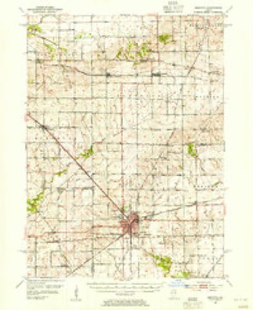
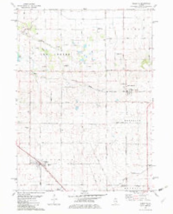
5 surveys from 10 printed sheetsMatched by testing this settlement's coordinate against the published boundary of every sheet in the United States Geological Survey's historical collection. Each opens the scanned sheet at the Survey.
- 1952 USGS Mendota quadrangle1:62500, 3 printings
- 1958 USGS Aurora quadrangle1:250000, 3 printings
- 1961 USGS Aurora quadrangle1:250000
- 1982 USGS Sublette quadrangle1:24000
- 1985 USGS Dixon quadrangle1:100000, 2 printings



In the county-history sources
4,456 words on this townshipHistory of Lee County, Together with Biographical Matter, Statistics, Etc. .., published 1881 names this settlement in its chapter on Brooklyn Township. These are the passages that mention it, exactly as the scans read.
West Brooklyn, situated on the Chicago, Burlington & Qnincy railroad in the western part of the township, was laid out in 1873 on land owned by Messrs. O. P. Johnston, D. L. Harris and R. N. Woods. The school-house at that place was erected in 1874, at a cost of $1,200. First teacher, F. M. Yocum. For the past two years the school has been under the supervision of Prof M. M. Young, a teacher of marked ability, under whose care the school is in a prosperous eonditioTi.
Passage source: History of Lee County, Together with Biographical Matter, Statistics, Etc. .., published 1881.
There are two churches in West Brooklyn, a Roman Catholic and one Methodist Episcopal church. The latter named society was organized in 1878, and the building occupied by them was erected in the same year. The first pastor was the Rev. C. H. Hoffman ; present one is the Rev. B. H. Dickens, a young gentleman who is just beginning liis labors in the field of Christianity, and for whom we predict a life of usefulness. Membership of this organization, forty-nine.
Passage source: History of Lee County, Together with Biographical Matter, Statistics, Etc. .., published 1881.
Carnahan station is situated on an eminence about equidistant between West Brooklyn and Compton ; is the result of the labors of A. J. Carnahan. The expense of the side-track, station-liouse, and other improvements, were all borne by iiim. And whatever of convenience the neighbors in the community may enjoy in the future must be credited to his determination. When the project of the Canada Southern railroad was started he entered into it with enthusiasm and received assurances of having a station located on his farm. To get possession of certain lands, it is said, the company located the station at Compton. But Mr. Carnahan, nothing daunted by this defeat, laid his claim before the Chicago, Burlington & Quincj Railroad Company when they became owners of tiie road. After some effort on his part a station was granted him, which was to be made at his own expense.
Passage source: History of Lee County, Together with Biographical Matter, Statistics, Etc. .., published 1881.
Machine-read from a century-old scan, so expect the errors a machine makes: misspelled names, dropped words, stray characters.
Read the whole chapter on Brooklyn Township - it names this place 4 more 4 times.
Storms near this place
16 since 1996Regional context, not property-specific evidence. The National Weather Service names West Brooklyn in 16 storm reports between 1996 and 2025: 10 thunderstorm wind, 4 hail, 2 tornado. No death or injury is recorded in these reports. Each account below is quoted exactly as the forecast office filed it, from the NOAA Storm Events Database, and each date opens the federal record of that event.
| When | Event | Place named | Harm | What the report says |
|---|---|---|---|---|
| June 2010 | Thunderstorm Wind | West Brooklyn | $5,000 | A large tree was blown down onto an above ground pool. The pool was destroyed. |
| July 2025 | Thunderstorm Wind | West Brooklyn | - | Tree limbs up to 6 inches in diameter were blown down near Brooklyn Road and Route 30. Corn was blown over at 35 to 40 degree angles. |
| April 2023 | Thunderstorm Wind | West Brooklyn | - | Three utility poles were snapped in the vicinity of Shaw and Brooklyn Roads. |
| April 2023 | Thunderstorm Wind | West Brooklyn | - | Debris from a farm outbuilding roof was blown into a field. |
| April 2023 | Thunderstorm Wind | West Brooklyn | - | A garage and house suffered roof damage consisting of shingles being torn off. A grain structure also collapsed. |
| April 2023 | Thunderstorm Wind | West Brooklyn | - | A utility pole was snapped at its base. |
| April 2023 | Thunderstorm Wind | West Brooklyn | - | A wall of a large farm shed collapsed. |
| September 2021 | Hail | West Brooklyn | - | A photo shared on social media showed hail two inches in diameter. Small dents on vehicles were reported. |
| May 2018 | Hail | West Brooklyn | - | Hail was mainly dime to nickel size with one quarter size stone. |
| June 2016 | Tornado (EF1) | West Brooklyn | - | The tornado started near 787 Meridian Rd and moved northeast crossing Highway 10 (Shaw Rd). Along the way, a house lost a portion of the roof and there were trees snapped and corn flattened. After crossing Highway 10 and continuing northeast for another one half mile, the tornado changed direction and then started moving southeast, crossing Highway 10 again. There was a wide swatch of uprooted and snapped trees, and the tornado was confirmed by a storm chaser. Peak winds were estimated at 110 mph, and max width was 300 yards. (Tornado 1 of 15). |
| June 2016 | Tornado (EF0) | West Brooklyn | - | This tornado was determined form ground survey and video documentation. (Tornado 2 of 15). |
| July 2011 | Thunderstorm Wind | West Brooklyn | - | Route 251 was blocked by downed power lines near Spur Road. |
| July 2007 | Thunderstorm Wind | West Brooklyn | - | A tree was blown down at Route 251 and Cottage Hill. |
| September 2006 | Hail | West Brooklyn | - | A large swath of hail fell over southeast Lee County. The hail began near Old Chicago Road and Brooklyn Road near West Brooklyn and ended near Paw Paw around 4pm CDT. Hail was up to one inch in diameter and piled up to five inches deep in some spots. Corn and bean crops were severely damaged. |
| July 2003 | Thunderstorm Wind | West Brooklyn | - | no account filed |
| July 1996 | Hail | West Brooklyn | - | no account filed |
Nearest settlements
The eight closest, with where each one stands in the county. Distances are straight-line, computed from the Geographic Names Information System coordinates.
| Map | Place | Distance | Sheets |
|---|---|---|---|
| Melugin Grove (historical) | 2.1 miles | 11 | |
| The Burg | 2.7 miles | 11 | |
| Compton | 3.5 miles | 11 | |
| Shaws | 4.8 miles | 10 | |
| Sublette | 5.5 miles | 10 | |
| Twelvemile Corner | 5.7 miles | 11 | |
| Roxbury | 5.7 miles | 11 | |
| Inlet | 5.7 miles | 10 |
Elsewhere
Matched on this settlement's Geographic Names Information System number rather than its name, so it cannot be a different place of the same name in another state.
| Wikipedia article on West Brooklyn | An encyclopaedic summary. Its text is share-alike, so it is linked here rather than copied. |
| Wikidata item Q1985641 | The structured record the population and elevation above come from. Public domain (CC0). |
Provenance
This settlement is recorded in the Geographic Names Information System as feature 420799. The sheet list is computed by point-in-boundary test against the United States Geological Survey's historical topographic inventory. Both are works of the United States government and carry no copyright under 17 U.S.C. 105.
Storms. NOAA National Centers for Environmental Information, Storm Events Database https://www.ncei.noaa.gov/stormevents/ A work of the United States government, no copyright under 17 U.S.C. 105. Narratives are quoted verbatim from the National Weather Service report and are not edited or summarised.