BlockBefore
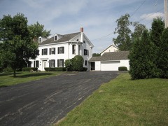
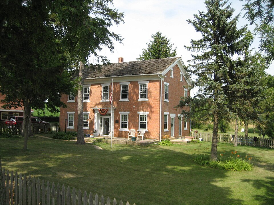
Photograph of William Ritzman House
Photograph by IvoShandor, CC BY 2.5. Via Wikimedia Commons.

William Ritzman House

Listed on the National Register of Historic Places in 2000.

From the record

“The William Ritzman House is a historic house just outside the corporate village limits of Orangeville, Illinois. The house was built around 1847 and is of brick construction in the Greek Revival style.”

Wikipedia article William Ritzman House, CC BY-SA 4.0.

One of 16 National Register listings published here for Stephenson County · listed in 2000 · category: Building.

Sources: the Wikipedia article · the case file at the National Archives · the National Register database, National Park Service
The listing

  • What is counted as historic. The nomination lists 1 building as contributing to the listing.
  • Listed as. Ritzman, William, House - the National Register files a house under its owner's surname.
  • Address. 10715 IL 26 N, Orangeville, 61060
  • When was it listed? October 2000
  • Category. building
  • Township. Buckeye township
  • Architectural style. Greek Revival architecture
  • National Register reference number. 00000949 - the number the National Park Service assigned this property when it was listed, and the key its nomination file is catalogued under at the National Archives.

The ground it stands on

18,391 words

The chapter on Buckeye Township in The History of Stephenson County, Illinois : Containing ... Biographical Sketches ... War Record ... Statistics ... Portraits of Early Settlers ... History of the Northwest, History of Illinois, &c. .., published 1880 names Orangeville. This is what it says, exactly as the scans read.

REUBEN BOBB, farmer. Sec. 3; P. 0. Orangeville ; born in Union Co., Penn., Aug, 25, 1841 ; came West with his father's family in 1845; went to Orange- ville first, then here on to the homestead in 1846 ; now owns 93 acres ; was engaged at farming till 1864, when he enlisted in the 32d I. V. I. ; he was taken prisoner at Tunnel Hill, and nearly starved to death in Florence, S. C, and saw Gov. Dick Oglesby at Camp Butler reprove the commissary for issuing bones for the boys' rations ; came home, and in Sept. 24, 1865, married Miss Amanda Reager, of Pennsylvania ; his children are - Melly E., Ida M. and Boyd W. ; has held school office ; belongs to the M. B. Church.

Passage source: The History of Stephenson County, Illinois : Containing ... Biographical Sketches ... War Record ... Statistics ... Portraits of Early Settlers ... History of the Northwest, History of Illinois, &c. .., published 1880.

WILIilAM D. HARTMAN, farmer. Sec. 11 ; P. 0. Orangeville; born in Union Co., Penn., Oct. 22, 1836 ; came to Stephenson Co., in 1857 ; father's family were Magdalena, deceased ; Mary A., now Mrs. Robendoll; Elizabeth, now Mrs. Young; Franklin, and Rebecca, now Mrs. Beair ; he owns 170 acre-'. In 1869, March 7, married Miss Caroline Epley ; their children are Madrona S., deceased; Frank W. Perry 0., Beatta E., William W., Anna C. William D.'s brother Franklin was shot through the leg at Ft. Donelson, and bled to death; Republican in politics.

Passage source: The History of Stephenson County, Illinois : Containing ... Biographical Sketches ... War Record ... Statistics ... Portraits of Early Settlers ... History of the Northwest, History of Illinois, &c. .., published 1880.

Machine-read from a century-old scan, so expect the errors a machine makes: misspelled names, dropped words, stray characters.

Read the whole chapter on Buckeye Township - 18,391 words on its settlement, mills, schools and churches.

Mines and quarries near this property

10 of 11 shown

Regional context, not property-specific evidence. The federal mineral resources record lists 11 workings within 5 miles of William Ritzman House: 8 past producers, 2 producers, 1 occurrence. 2 still produce. What was taken out: Stone, Crushed/Broken. Distance is straight-line from the map coordinates, so a quarry counted here may appear on a neighbouring settlement's page as well.

Where SiteCommodity StatusRecorded
Clark QuarryStone, Crushed/BrokenProducer
J. Wagner QuarryStone, Crushed/BrokenPast Producer
Jaeger PitStone, Crushed/BrokenPast Producer
Limestone ProspectStone, Crushed/BrokenOccurrence
Monte QuarryStone, Crushed/BrokenProducer
Unnamed Limestone QuarryStone, Crushed/BrokenPast Producer

Every working recorded in Stephenson County

Storms near this property

17 since 1999

Regional context, not property-specific evidence. The National Weather Service names Orangeville, the town this property stands in, in 17 storm reports between 1999 and 2023: 9 thunderstorm wind, 6 hail, 1 lightning, 1 funnel cloud. The reports record 1 injury. Each account below is quoted exactly as the forecast office filed it, from the NOAA Storm Events Database, and each date opens the federal record of that event.

WhenEvent Place namedHarm What the report says
May 1999Thunderstorm WindOrangeville1 hurt, $40,000Severe thunderstorm winds rolled a mobile home trailer over and destroyed it. The occupant of the trailer suffered 2 dislocated shoulders, cuts, and abrasions.
June 2005Thunderstorm WindOrangeville$5,000Trees down
August 2005Thunderstorm WindOrangeville$5,000Power lines down
June 2023Thunderstorm WindOrangeville-County dispatch reported a few trees blown down north of Freeport through Orangeville.
August 2022Thunderstorm WindOrangeville-Law enforcement reported a tree down on Rock Grove Road. The time of the event was estimated using radar.
July 2022Thunderstorm WindOrangeville-A trained spotter reported 8 to 12 inch diameter based on a photo shared on social media. The time of the event was estimated using radar.
May 2020Thunderstorm WindOrangeville-Power poles blown down near Orangeville.
August 2018Funnel CloudOrangeville-A public report of a funnel cloud. A photo of the funnel cloud was relayed by local broadcast media.
July 2017Thunderstorm WindOrangeville-An amateur radio operator reported winds estimated up to 70 mph with tree branches blowing across the road.
June 2011HailOrangeville-Quarter sized hail fell in Orangeville, IL at 932 pm CDT June 8.
June 2008HailOrangeville-Nickel-sized hail fell near Orangeville, IL at 2:30 pm June 20.
June 2008HailOrangeville-Golf ball-sized hail fell in Orangeville, IL around 2:30 pm June 20. This report was relayed by WREX-TV in Rockford.
September 2001Thunderstorm WindOrangeville-60 mph thunderstorm wind gust estimated by trained spotter.
July 1999LightningOrangeville-A NWS spotter reported trees downed by lightning in Orangeville.
April 2020HailOrangeville-no account filed
April 2013HailOrangeville-no account filed
May 2000HailOrangeville-no account filed

Every storm recorded in Stephenson County

Map coverage status

No historic map-sheet match is published for this property yet. That does not mean no map exists. This record needs a coordinate-quality review before it can be joined to a sheet boundary. Browse the county's mapped places while that work is pending.

Listed places nearby

6 within 8 miles

Other National Register properties close enough to walk or drive between, ordered by distance from this one. Both positions come from the same geocoding pass that matched these properties to their map sheets.

Photograph PropertyDistance Listed
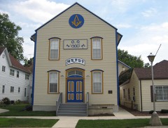
AF and AM Lodge 687, Orangeville0.7 miles2003
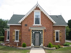
Union House0.7 miles2000
Central House0.7 miles1999
People's State Bank0.9 miles2004
John H. Addams Homestead4.7 miles1979
Charles Fehr Round Barn6.6 miles1984

Sources for this property

National Archives recordThe nomination case file for reference 00000949 in Record Group 79.
Wikipedia articleCommunity-written account of this property, licensed CC BY-SA.
Stephenson CountyAll 16 listed properties in this county.

Provenance

  • Listing record. National Park Service National Register of Historic Places, listed-properties dataset, current to 2026-05-22.
  • Map join. Address geocoded through the United States Census geocoder, then tested against the published boundary of every sheet in the USGS Historical Topographic Map Collection.
  • How this page is made. Listing fields come from federal records; map-sheet coverage is a labelled coordinate-to-boundary calculation, not a source-field claim.
  • Mines and quarries. USGS Mineral Resources Data System (MRDS) https://mrdata.usgs.gov/mrds/ A work of the United States government, no copyright under 17 U.S.C. 105.
  • Storms. NOAA National Centers for Environmental Information, Storm Events Database https://www.ncei.noaa.gov/stormevents/ A work of the United States government, no copyright under 17 U.S.C. 105. Narratives are quoted verbatim from the National Weather Service report and are not edited or summarised.