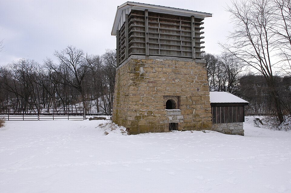
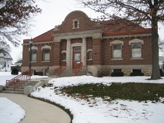
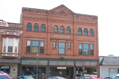
Listed on the National Register of Historic Places in 2002.
From the record
“Buffalo Grove Lime Kiln is one of two old lime kilns in Illinois listed on the National Register of Historic Places. The other is the Griggsville Landing Lime Kiln in Pike County.”
Wikipedia article Buffalo Grove Lime Kiln, CC BY-SA 4.0.
One of 29 National Register listings published here for Ogle County · listed in 2002 · category: Structure.
National Register reference number.02001348- the number the National Park Service assigned this property when it was listed, and the key its nomination file is catalogued under at the National Archives.
What happened here
An account from the chapter on Buffalo township. The inset identifies its exact
source book and publication year.
Farmer ; Sec. 24 ; P. 0. Polo ; son of John and Martha Kauffman ; born in Huntingdon Co., Pa., March 14, 1840 ; in Sept., 1861, he enlisted in Co. H. 87th Pa. Y. I. ; served three years ; wounded and taken prisoner at the battle of Bunker Hill, Va., June 13. 1863; was prisoner 108 days at Belle Isle, Richmond ; when he was paroled he went to Annapolis, and rejoined his regiment at Brandy Station ; was in the battles of the Wilderness, Cold Harbor and all the principal engagements of the Army of the Potomac under General Grant, until July 6, 1864 ; from Petersburg he then went to Baltimore and Frederick City; was at the battle of Monocacy Junction, July 9, 1864; after being stationed at various places, was in the battles under Gen.
AI.DRICII TILSON, Druggist and dealer in Paints, Oils, Fancy Goods, etc.. Mason st. near Railroad ; residence, corner Division and Dixon sts.; born in Douglass, Worcester Co., Mass., June 6, 1816 ; came to Elkhorn Grove, Carroll Co., in the Spring of 1839 ; during his residence there, he was for twenty years Postmaster, Supervisor three terms, Township School Treasurer, etc.; came to Polo in 1868; engaged in the drug business ever since he came here ; a portion of the time dealing in leather also ; he was one of the incorporators of the Polo Harvester Co., and is President of the Company now ; Mr. A. married Hepsibah Morgan in 1837 ; she was born in Canton, Hartford Co., Conn.; i they have one child living ; one son, Myron, died at the age of three years ; Mr. and Mrs. A. are Congregationalists.
AXDERSOX AROIiD T. Farmer and Stock Raiser ; Polo ; son of George A., of Virginia, and Elizabeth Freeman, of New Jersey ; was born in Crawford Co., Pa., in 1825 ; came to Buffalo Grove in the Spring of 1848 ; commenced farming on forty acres, on Sec. 22 ; at the present time, he has the following real estate : 320 acres on Sec. 27, 160 acres on Sec. 3, 320 acres on Sec. 20, 280 acres on Sec. 26, besides 1,120 acres in Lee Co., 111.; has dealt in stock extensively; commenced the
Regional context, not property-specific
evidence. The federal mineral resources record lists
7 workings within 5 miles of Buffalo Grove Lime Kiln: 6 past producers, 1 producer.
1 still produces. What was taken out: Stone, Crushed/Broken, Limestone, General. Distance is straight-line from the
map coordinates, so a quarry counted here may appear on a neighbouring
settlement's page as well.
Regional context, not property-specific
evidence. The National Weather Service names
Polo, the town this property stands in, in 55 storm reports between 1994 and 2026: 35 thunderstorm wind, 15 hail, 2 flash flood, 1 flood.
No death or injury is recorded in these reports. Each account below is quoted exactly as the forecast office
filed it, from the NOAA Storm Events Database, and each date
opens the federal record of that event.
Three to four trees were blown down with numerous tree limbs blown down. One soft wood maple tree one foot in diameter had its top twisted off, ten to twelve feet above the ground.
No historic map-sheet match is published
for this property yet. That does not mean no map exists. This record needs
a coordinate-quality review before it can be joined to a sheet boundary.
Browse the county's mapped places while that work is
pending.
Listed places nearby
6 within 8 miles
Other National Register properties close
enough to walk or drive between, ordered by distance from this one. Both
positions come from the same geocoding pass that matched these properties
to their map sheets.
Listing record. National Park Service National Register of Historic Places, listed-properties dataset, current to 2026-05-22.
Map join. Address geocoded through the United States Census geocoder, then tested against the published boundary of every sheet in the USGS Historical Topographic Map Collection.
How this page is made. Listing fields come from federal records; map-sheet coverage is a labelled coordinate-to-boundary calculation, not a source-field claim.
Mines and quarries. USGS Mineral Resources Data System (MRDS) https://mrdata.usgs.gov/mrds/ A work of the United States government, no copyright under 17 U.S.C. 105.
Storms. NOAA National Centers for Environmental Information, Storm Events Database https://www.ncei.noaa.gov/stormevents/ A work of the United States government, no copyright under 17 U.S.C. 105. Narratives are quoted verbatim from the National Weather Service report and are not edited or summarised.
 Block