| April 2003 | Hail | New Boston | $500,000 | no account filed |
| April 2003 | Hail | New Boston | $500,000 | no account filed |
| April 2003 | Hail | New Boston | $150,000 | no account filed |
| September 2016 | Flood | New Boston | $100,000 | Heavy rainfall of 4 to over 10 inches over significant areas from 21 to 23 September in extreme North Central and Northeast Iowa moved downstream causing the Mississippi River to rise above major flood stage levels. ||Keithsburg rose above its major flood stage level of 17.0 feet on September 30th, 2016 around 10 AM CST. It crested around 17.8 feet on October 2nd, 2016. It fell below major flood stage on October 4th around 4 AM CST. |
| September 2016 | Flood | New Boston | $100,000 | Heavy rainfall of 4 to over 10 inches over significant areas from 21 to 23 September in extreme North Central and Northeast Iowa moved downstream causing the Mississippi River to rise above major flood stage levels. ||New Boston rose above its major flood stage level of 18.5 feet on September 30th, 2016. It crested around 19.23 feet at approximately 1 PM CDT on October 2nd, 2016.|It fell below major flood stage on October 4th around 6 pm CST. |
| May 2003 | Tornado (F0) | New Boston | $100,000 | no account filed |
| June 1998 | Tornado (F1) | New Boston | $5,000 | no account filed |
| August 2003 | Hail | New Boston | $3,000 | no account filed |
| April 2026 | Thunderstorm Wind | New Boston | - | Multiple downed tree branches, up to 3 inches in diameter. Porta-potty blown over. The time was estimated from radar data. |
| June 2025 | Tornado (EF1) | New Boston | - | This EF1 tornado with peak estimated wind speed of 100 MPH developed over New Boston and persisted for a short time after departing town to the northeast. Concentrated damage in town included a roof blown off a downtown masonry building and numerous trees uprooted or snapped. |
| April 2025 | Tornado (EF0) | New Boston | - | This short-lived EF-0 tornado brought tree damage, including a large uprooted tree, and a small outbuilding damaged. The peak estimated winds were 85 mph. |
| July 2024 | Flood | New Boston | - | The Mississippi River at New Boston rose above its major flood stage of 18.5 feet around 5 PM on July 2 and crested at 20.82 feet on July 11th. The river fell back below flood stage 3 Pm on July 20th. |
| July 2024 | Thunderstorm Wind | New Boston | - | A public report of a a large section of a tree snapped off and fell on a car. |
| April 2023 | Flood | New Boston | - | The Mississippi River at New Boston rose above its major flood stage of 18.5 feet during the early morning hours of April 26th, The river continued to rise to 20.6 feet late in the day on April 30th.|The Mississippi River at Keithsburg rose above its major flood stage of 17.0 feet during the early morning hours of April 26th and continued to rise to 18.88 feet by the end of the month. |
| July 2022 | Thunderstorm Wind | New Boston | - | Law enforcement passed along a report of trees down along 76th Street. The time of the event was estimated using radar. |
| August 2021 | Thunderstorm Wind | New Boston | - | Roof damaged and power is out. |
| March 2019 | Flood | New Boston | - | Heavy rain and snow melt across the region caused the Mississippi River at Lock and Dam 16 near Illinois City to to rise above major flood stage of 18 feet on March 22nd. The Mississippi River at Keithsburg rose above major flood stage on the same day and remained there through the end of the month. The river remained above major flood stage through the end of the month. The river crested around 20.8 feet during the early morning hours of the 24th, into the early morning hours of the 25th. |
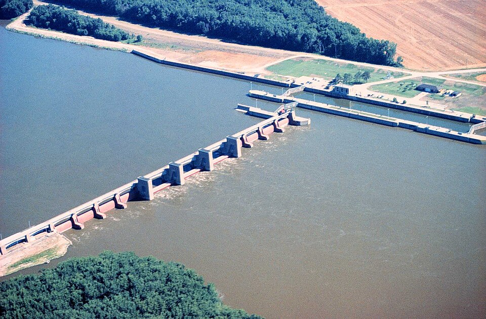
| May 2019 | Flood | New Boston | - | The Mississippi River at New Boston Lock and Dam 17 began the month above its major flood stage of 18.5 feet. The river stage at the beginning of the month was 22.39 feet. The river would rise to a crest of 23.59 feet beginning on May 3rd. This crest is preliminary the 4th highest crest. The river fell below major flood stage around 1 AM on May 14th. |
| May 2019 | Flood | New Boston | - | The Mississippi River at Keithsburg (KHBI2) began the month above its major flood stage of 17 feet. The river stage at the beginning of the month was 20.6 feet. The river would rise to a crest of 21.97 feet May 3rd. This crest is preliminary the 4th highest crest. The river fell below major flood stage around the morning of May 14th. |
| May 2019 | Flood | New Boston | - | The Mississippi River at New Boston Lock and Dam 17 hovered near major flood stage from around May 21st to the 24th, then rose above its major flood stage of 18.5 feet during the morning of May 25th and continued into June. The river crested in June, with the stage rising to 24.1 feet at the end of May 31st. |
| April 2019 | Flood | New Boston | - | River levels continued to run high during the month of April. Heavy rain across the area caused the Mississippi River at New Boston, Illinois to rise above its major flood stage of 18.5 feet early in the evening of the 25th, and the rise continued through the end of the month. |
| July 2017 | Thunderstorm Wind | New Boston | - | Local law enforcement reported a tree was down. |
| October 2016 | Flood | New Boston | - | Heavy rainfall of 4 to over 10 inches over significant areas from 21 to 23 September in extreme North Central and Northeast Iowa moved downstream|causing the Mississippi River to rise above major flood stage levels.|Keithsburg rose above its major flood stage level of 17.0 feet on September 30th, 2016 around 10 AM CST. It crested around 17.8 feet on October 2nd,|2016. It fell below major flood stage on October 4th around 4 AM CST. For damage information please see September Storm Data. |
| April 2014 | Hail | New Boston | - | A public report of quarter to golf ball sized hail that lasted for 10 minutes. This report was delayed. |
| June 2013 | Flood | New Boston | - | Heavy rain across the region late in the month of May led to rises along the Mississippi River above major flood stage at New Boston and Keithsburg. The Mississippi River at New Boston rose above the major flood stage of 18.5 feet during the early afternoon of the 2nd and fell below 18.5 feet late in the day of the 9th. The Mississippi River at Keithsburg rose above the major flood stage of 17 feet during the afternoon of the 2nd and fell below 17 feet early in the morning of the 10th. |
| June 2013 | Flood | New Boston | - | Heavy rains farther to the north during the last two of June led to rises on the Mississippi River to above major flood stage at both New Boston and Keithsburg. Both New Boston and Keithsburg rose above their major flood stages of 18.5 feet and 17 feet respectively during the early morning hours of the 28th and remained there through the end of the month. |
| April 2010 | Hail | New Boston | - | Non-severe hail (<1.0) fell in New Boston, IL around 615 pm April 4. |
| October 2010 | Flood | New Boston | - | The river rose above flood stage at New Boston LD17 on October 2 at 806 pm cst and fell below flood stage on October 14 at 300 am cst. Moderate flooding occurred with the crest reaching 17.02 feet on October 7 at 700 am cst. Flood stage is 15 feet. |
| May 2008 | Flood | New Boston | - | The Mississippi River at New Boston was over its major flood stage level from 12:00 am May 1 until 1:00 pm May 7. |
| May 2008 | Flood | New Boston | - | The Mississippi River at Keithsburg was over its major flood stage level from 12:00 am May 1 until 10:00 am May 8. |
| June 2008 | Hail | New Boston | - | Nickel-sized hail fell in New Boston, IL at 7:40 pm June 12. |
| June 2007 | Hail | New Boston | - | Nickel size hail covered the ground. |
| May 2001 | Flood | New Boston | - | Heavy rain of near 3 inches brought Edwards river out of it's bank near New Boston. |
| March 2016 | Hail | New Boston | - | no account filed |
| April 2013 | Hail | New Boston | - | no account filed |
| April 2008 | Flood | New Boston | - | no account filed |
| April 2003 | Hail | New Boston | - | no account filed |
| July 2003 | Funnel Cloud | New Boston | - | no account filed |
 Block