12 National Register listings published here · the county-history sources tell 1 story and name 10 people · people the book names include Mrs Martin Bear (Perryton Township, 1882) · Eighty-Third Regiment, Company D. (Rivoli Township, 1882) (machine-read).
Illinois within the United StatesMercer County within Illinois
What the record shows
476 topographic sheet readings cover the county's settlements.
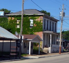
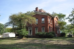
12 properties here are on the National Register of Historic Places: 8 buildings and 4 districts.
The Geographic Names Information System records 34 populated places in this county; 34 are covered by at least one topographic sheet.
2 public-domain county histories, 1882 and 1914, supply 400,447 words of narrative reproduced here.
What happened here
1 accounts
Among them: Iay Island Lilie. These passages come from the
identified county-history source books. Each inset names its own source
and opens the exact section it comes from.
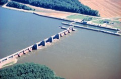
In 1 88 1 during the flood Bay Island was seriously damaged. William Drury of this township owned a large park, in which he kept elk, deer and buffalo. On one occasion an elk killed one of his valuable colts, estimated to be worth about five hundred dollars. Ballard's Hall was finished and ready for use in December, 1 88 1 .
Every wildfire the federal occurrence
database records inside this county: 31 of them, burning
about 4,608 acres. None started naturally and 2 were recorded as arson. Each settlement page carries the fires within
five miles of it.
Reported cause
Fires
Missing data/not specified/undetermined
24
Recreation and ceremony
4
Arson/incendiarism
2
Debris and open burning
1
The five largest, by the area the report
gives. One of them was set deliberately.
Date
Cause
Size
Reported by
Name on the report
23 March 2003
Recreation and ceremony
1,200 acres
Port Louisa National Wildlife Refuge
CORNLAND
9 March 2000
Missing data/not specified/undetermined
832 acres
Port Louisa National Wildlife Refuge
DESTRUST A
12 April 2003
Missing data/not specified/undetermined
820 acres
Port Louisa National Wildlife Refuge
DUFFUS
26 March 2003
Arson/incendiarism
630 acres
Port Louisa National Wildlife Refuge
HEATH
9 March 2000
Missing data/not specified/undetermined
282 acres
Port Louisa National Wildlife Refuge
KUCERA
9 March 2000
Missing data/not specified/undetermined
232 acres
Port Louisa National Wildlife Refuge
DSETRUST B
9 March 2000
Missing data/not specified/undetermined
174 acres
Port Louisa National Wildlife Refuge
BECK
31 March 1999
Missing data/not specified/undetermined
100 acres
Port Louisa National Wildlife Refuge
GRANT
Every settlement page carries the fires within five
miles of it - see the settlement index below.
Storms,
1952 to 2026
60 of 341 shown
The
NOAA Storm Events Database holds
341 reports for this county, causing 1 death, 6 injuries and about $34,731,600 in recorded property damage.
Each settlement page carries the reports that name it.
Kind of event
Reports
Thunderstorm Wind
135
Hail
96
Tornado
45
Flood
35
Flash Flood
13
Funnel Cloud
8
Heavy Rain
6
Lightning
3
The most serious of them, by death, then
injury, then recorded damage. The accounts are quoted exactly as the
forecast office filed them.
Also reported by spotters. Considerable damage in Viola, Hamlet, North Henderson, and Aledo with numerous trees and power lines down. Large areas of corn flattened.
Heavy rains resulted in widespread flash flooding of roads and highways across all of Mercer County, especially the eastern half during the morning of May 13.
Numerous trees and power lines were downed in Joy. Westmer High School had considerable roof damage done to the gymnasium. The outer roof of the Frontier Communications Building was peeled off. A mobile home just north of Joy was destroyed.
The tornado damaged several rural home sites. Northeast of Seaton damage was noted to farm buildings and a silo. South of Aledo seven power lines poles were snapped, and a farmhouse 4 miles west of Aledo was destroyed. The tornado also damaged or destroyed farm buildings, roofs and chimneys south of Aledo.
Heavy rainfall of 4 to over 10 inches over significant areas from 21 to 23 September in extreme North Central and Northeast Iowa moved downstream causing the Mississippi River to rise above major flood stage levels. ||Keithsburg rose above its major flood stage level of 17.0 feet on September 30th, 2016 around 10 AM CST. It crested around 17.8 feet on October 2nd, 2016. It fell below major flood stage on October 4th around 4 AM CST.
Heavy rainfall of 4 to over 10 inches over significant areas from 21 to 23 September in extreme North Central and Northeast Iowa moved downstream causing the Mississippi River to rise above major flood stage levels. ||New Boston rose above its major flood stage level of 18.5 feet on September 30th, 2016. It crested around 19.23 feet at approximately 1 PM CDT on October 2nd, 2016.|It fell below major flood stage on October 4th around 6 pm CST.
Several supercell storms slowed down and transformed into high precipitation supercells across Mercer county. Widespread reports of damage to trees and power lines were received. Illinois Highway 17 was closed between Aledo and Joy due to the number of power lines, poles, and trees down across the road. The road did not open until the following afternoon. Specific locations of severe damage will be given as separate entries.
Official NWS storm survey team found that the tornado moved northeast with peak winds around 115 mph. It damaged mainly trees and outbuildings along its path. The worst damage was near the beginning of the path, where a large machine shed was completely destroyed, 2 garages were destroyed, and a house partially un-roofed. Witnesses described a blinding rain accompanied the tornado.
Tornado was rated a higher end EF-1 with peak winds 105 mph, a path length of 5.73 miles with a max path width of 150 yards. This higher end EF-1 tornado caused damage to numerous farm outbuildings, a few homes and trees across Mercer and Henry counties. One house partially lost a roof while another was impelled by flying debris. Approximately 30 to 40 trees were snapped at the trunks, a couple of dozen were uprooted, with about 50 trees experiencing limb damage. This tornado continued into Henry county.
Wind gusts estimated to be 70 mph uprooted three mature trees, snapped 6 to 12 inch diameter tree limbs off of healthy trees, and ripped shingles off of some roofs about 2 miles north of New Windsor, IL at 610 am July 21. In addition, the outer rows of some area corn fields were leaning over at a 45 degree angle.
Bow echo crossed the Mississippi River and affected mainly the southern part of Mercer County. The squall line had weakened from earlier so damage was much more sporatic with mainly trees and power lines down. Based on radar data, the following times have been established (all CST); Keithsburg 1153-1203, Seaton 1212-1219, and 1W of New Windsor 1244-1254.
The Survey's mineral resources record
lists 8 workings inside this county. 2 still produce and 6 are closed or unrecorded. Each
settlement page carries the workings within five miles of it.
Commodity
Workings
Stone, Crushed/Broken
7
Stone
1
The least common of them first, because a
county's hundredth gravel pit says nothing its first ten did not.
Past and Present of Mercer County, Illinois devotes a chapter to each township:
its boundaries and streams, who settled it and when, the mills, the
schools and the churches. All 15 are reproduced here in full. Each row
shows the township's own shape and where it lies in the county, drawn from
the Census Bureau's boundary. Which settlements belong to which township
is computed from that same boundary, not taken from the book.
One book written about this county, cut here
where the book itself is cut, at its printed chapters: 18 chapters in all.
Every chapter is public domain, machine-read from the scan and
reproduced complete. A chapter already given under one of the county's
towns is not repeated in this list.
Past and Present of Mercer County, Illinois (1914)
Everyone Past and Present of Mercer County, Illinois stops to write about, with
the section that describes them. Among them are the men who founded the
place and governed the Territory. Each name opens the passage itself, in
the words of 1914.
Named settlements recorded in the Geographic Names
Information System, each with the topographic sheets covering it. Villages,
hamlets and abandoned places alike. Each is shown with the nearest named
watercourse or landform and the survey quadrangle it falls on.
Topographic sheets. USGS Historical Topographic Map Collection, county index, measured from the bulk metadata.
Fire insurance maps. Library of Congress Sanborn collection, faceted to this county.
Photographs. Each place queried individually against the Library of Congress Prints and Photographs search.
Wildfire. Short, Karen C. 2022. Spatial wildfire occurrence data for the United States, 1992-2020 [FPA_FOD_20221014]. 6th Edition. Fort Collins, CO: Forest Service Research Data Archive. https://doi.org/10.2737/RDS-2013-0009.6 Collected with United States Government funding and usable without additional permissions or fees.
Mines and quarries. USGS Mineral Resources Data System (MRDS) https://mrdata.usgs.gov/mrds/ A work of the United States government, no copyright under 17 U.S.C. 105.
Storms. NOAA National Centers for Environmental Information, Storm Events Database https://www.ncei.noaa.gov/stormevents/ A work of the United States government, no copyright under 17 U.S.C. 105. Narratives are quoted verbatim from the National Weather Service report and are not edited or summarised.
 Block