Listed on the National Register of Historic Places in 2009.
From the record
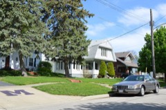
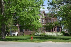
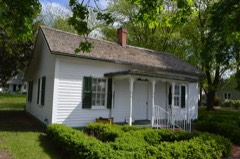
“The Monticello Courthouse Square Historic District is a historic district in downtown Monticello, Illinois. The district includes the historic commercial center of the city, the county seat of Piatt County, and is centered on the Piatt County Courthouse. 80 buildings are included in the district, 73 of which are considered contributing to its historic character.”
Wikipedia article Monticello Courthouse Square Historic District, CC BY-SA 4.0.
One of 6 National Register listings published here for Piatt County · listed in 2009 · category: District.
National Register reference number.08000400- the number the National Park Service assigned this property when it was listed, and the key its nomination file is catalogued under at the National Archives.
The location of Monticello is almost an ideal place for a town. The country is rolling and affords excellent drainage; it is near the river and is in the center of a very fine farming and stock country. It is the oldest town in the county, having been laid out in
The original plat of Monticello did not include the Heyworth house, erected on what is now the Lodge place. The first house in the limits of the city was a small store house which stood on the northwest corner of the square, where the First National Bank is now located. It was built in 1837 by Mr. Cass, the first merchant in the town. The first dwelling house was built in 1839 by Mr. Nicholas Devore. The house was several years in building and went by the name of "Old Fort" for a number of years. The second dwelling house in the town was built by John Tenbrooke. It was a log house and served for a hotel. The third house was erected by James Outten just opposite the jail. The fourth house was a little blacksmith shop near the Honselman House, one block south of the square. In 1839 this was the extent of Monticello.
Regional context, not property-specific
evidence. The federal mineral resources record lists
4 workings within 5 miles of Monticello Courthouse Square Historic District: 2 producers, 2 past producers.
2 still produce. What was taken out: Sand and Gravel, Construction, Stone, Crushed/Broken. Distance is straight-line from the
map coordinates, so a quarry counted here may appear on a neighbouring
settlement's page as well.
Regional context, not property-specific
evidence. The National Weather Service names
Monticello, the town this property stands in, in 46 storm reports between 1993 and 2025: 21 thunderstorm wind, 17 hail, 6 tornado, 1 flash flood.
The reports record 1 injury. Each account below is quoted exactly as the forecast office
filed it, from the NOAA Storm Events Database, and each date
opens the federal record of that event.
An eyewitness reported that the tornado touched down on the southwest side of Monticello and traveled to the north northeast across town. It blew down numerous trees near the golf course then destroyed a storage building. In this area the tornado intensified to F2 Intensity (wind speeds of 120 to 130 mph) taking the roof of a church completely off and blew it into the roof of a nearby 2 story apartment building. The apartment building suffered severe damage and has been deemed uninhabitable. A farm implement building/business, which was close to 200 feet in length, had roughly three quarters of the building destroyed. Damage for this building was estimated at nearly $2 million, as several combines inside were severely damaged or destroyed. Debris from the building was thrown into a nearby power substation, causing a complete power outage to the town of 5,000 residents as well as neighboring communities. The tornado appeared to have lifted off the ground and stayed at tree top level for the remainder of its life through the town producing F0 damage. Numerous trees had the tops broken off and several large trees were uprooted. Once outside of town it did touch down briefly once more, damaging the roof of one home and destroying several outbuildings and a garage of another homestead about a mile north northeast of town. In this location, several 2 inch by 6 inch pieces of lumber from one of the machine sheds had shot through patio doors into the home. No injuries were reported due to the tornado. Damage is estimated around $2.2 million.
Large hail damaged siding, gutters, roofs, and windows to numerous homes in the Long Grove subdivision west of Monticello. Hail up to 2.75 inches in diameter was also reported on the east side of Monticello, where several cars were damaged.
Lightning struck a power pole on the east side of Monticello. The lightning strike caused damage to electrical systems and appliances in several homes. There were no injuries.
Numerous trees were blown down, as well as, large areas of corn and soybean crops extending from Monticello south to the county line along US 36. In Bement, a large tree limb fell onto a house breaking a window and tearing down some guttering. Also, some homes suffered siding damage.
Thunderstorm winds blew off the doors of a shed and a barn 5 miles northwest of Monticello. No injuries were reported and no damage estimate was available.
No historic map-sheet match is published
for this property yet. That does not mean no map exists. This record needs
a coordinate-quality review before it can be joined to a sheet boundary.
Browse the county's mapped places while that work is
pending.
Listed places nearby
4 within 8 miles
Other National Register properties close
enough to walk or drive between, ordered by distance from this one. Both
positions come from the same geocoding pass that matched these properties
to their map sheets.
Listing record. National Park Service National Register of Historic Places, listed-properties dataset, current to 2026-05-22.
Map join. Address geocoded through the United States Census geocoder, then tested against the published boundary of every sheet in the USGS Historical Topographic Map Collection.
How this page is made. Listing fields come from federal records; map-sheet coverage is a labelled coordinate-to-boundary calculation, not a source-field claim.
Mines and quarries. USGS Mineral Resources Data System (MRDS) https://mrdata.usgs.gov/mrds/ A work of the United States government, no copyright under 17 U.S.C. 105.
Storms. NOAA National Centers for Environmental Information, Storm Events Database https://www.ncei.noaa.gov/stormevents/ A work of the United States government, no copyright under 17 U.S.C. 105. Narratives are quoted verbatim from the National Weather Service report and are not edited or summarised.
 Block