 Block
From the record
One of 68 National Register listings published here for Sangamon County · listed in 2009 · category: Structure.
Sources: the case file at the National Archives · the National Register database, National Park Service
Listed on the National Register of Historic Places in 2009.
One of 68 National Register listings published here for Sangamon County · listed in 2009 · category: Structure.
Sources: the case file at the National Archives · the National Register database, National Park Service
The chapter on Capital Township in History of Sangamon County, Illinois; Together with Sketches of Its Cities, Villages and Townships ... Portraits of Prominent Persons, and Biographies of Representative Citizens. History of Illinois, published 1881 names Springfield. This is what it says, exactly as the scans read.
The village of Cantrall is an outgrowth of the Springfield & Northwestern Railroad, and was laid out on its completion to that point, its plat being recorded under date of October, 1872. Joseph Cantrall, Oliver Canterbury, W. H. H. Holland, Thomas Glasscock, Thomas Claypool, B. F. Holland, John T. Canterbury, and James M. Sewell were the original proprietors, in whose names the plat was recorded. It embraced the whole of the northeast quarter of the southeast quarter, part of the west half of the north part of the southeast quarter of the southeast quarter, the south part of the southeast quarter of the northeast quarter, and the southeast part of the southwest quarter of the northeast quarter of section eight; also the southwest part of the northwest quartei", and part of the west half of the southwest quarter of section nine, township seventeen, range five.
Passage source: History of Sangamon County, Illinois; Together with Sketches of Its Cities, Villages and Townships ... Portraits of Prominent Persons, and Biographies of Representative Citizens. History of Illinois, published 1881.
The village is pleasantly situated, but its proximity to Springfield has tended to prevent its growth to any great extent. It has now two church edifices, a school house, four business houses, and a number of dwelling houses.
Passage source: History of Sangamon County, Illinois; Together with Sketches of Its Cities, Villages and Townships ... Portraits of Prominent Persons, and Biographies of Representative Citizens. History of Illinois, published 1881.
Machine-read from a century-old scan, so expect the errors a machine makes: misspelled names, dropped words, stray characters.
Read the whole chapter on Capital Township - 9,795 words on its settlement, mills, schools and churches.
Regional context, not property-specific evidence. The federal mineral resources record lists 1 working within 5 miles of Route 66 South of Lake Springfield: 1 past producer. None of them still produces. What was taken out: Fire Clay (Refractory). Distance is straight-line from the map coordinates, so a quarry counted here may appear on a neighbouring settlement's page as well.
| Where | Site | Commodity | Status | Recorded |
|---|---|---|---|---|
| Springfield Clay Prod.Co.Pitclay | Fire Clay (Refractory) | Past Producer |
Regional context, not property-specific evidence. The National Weather Service names Springfield, the town this property stands in, in 124 storm reports between 1994 and 2026: 60 thunderstorm wind, 46 hail, 7 flash flood, 6 lightning. The reports record 2 injuries. Each account below is quoted exactly as the forecast office filed it, from the NOAA Storm Events Database, and each date opens the federal record of that event.
| When | Event | Place named | Harm | What the report says |
|---|---|---|---|---|
| June 2000 | Thunderstorm Wind | Springfield | 1 hurt, $11,000 | Numerous trees and tree limbs were blown down in the Springfield, Williamsville, Chatham, Riverton and Divernon areas. In Divernon, a large tree was blown down onto a mobile home, causing minor injuries to a women who lived there. |
| February 1996 | Lightning | Springfield | 1 hurt | no account filed |
| April 2011 | Lightning | Springfield | $1,800,000 | Lightning struck the steeple of a church at 16th and South Grand Avenue in Springfield, starting a fire which quickly engulfed the building. The church was no longer being used, but still contained pews, books and an organ. The building and its contents were a total loss. |
| May 2013 | Thunderstorm Wind | Springfield | $250,000 | Shingles were damaged on several homes. |
| July 2001 | Thunderstorm Wind | Springfield | $250,000 | Two empty semis were blown over on I-72 one mile north of Curran. Neither driver was injured. Also, fourteen power poles on the southwest side of Springfield were blown over, trapping several cars and their occupants for half an hour. |
| March 2009 | Thunderstorm Wind | Springfield | $110,000 | The roof was blown off an apartment complex, a trailer was rolled and destroyed, and numerous trees were snapped on the northwest side of Springfield near West Jefferson Street and Bruns Lane. |
| June 2018 | Lightning | Springfield | $100,000 | Lightning struck the roof of Grace Lutheran Church in Springfield at around 3am CDT on June 13th. The lightning struck one of the church's four spires, causing a chunk of stone to dislodge and crash through the roof. |
| October 2010 | Thunderstorm Wind | Springfield | $80,000 | Numerous trees and power lines were blown down in the center of Springfield. |
| March 2009 | Thunderstorm Wind | Springfield | $50,000 | High winds caused numerous power outages and traffic lights to be knocked out near the intersection of Jones and Veterans. Several roads were blocked by downed tree limbs, and the Archer grain elevator was damaged. |
| June 2008 | Thunderstorm Wind | Springfield | $45,000 | Numerous trees were blown down between Springfield, Rochester, and Berry. A large tree fell on a home in Berry and damaged it. |
| July 2017 | Thunderstorm Wind | Springfield | $40,000 | Power lines were blown down. |
| May 2009 | Thunderstorm Wind | Springfield | $40,000 | Trees and powerlines were blown down in several locations across Springfield. |
| December 2008 | Thunderstorm Wind | Springfield | $40,000 | A farmstead west of Springfield on McQueen Road sustained significant wind damage. |
| December 2008 | Thunderstorm Wind | Springfield | $35,000 | High winds damaged the roofs of three large barns and the grandstand overhang at the State Fairgrounds. |
| May 2020 | Thunderstorm Wind | Springfield | $25,000 | The siding was damaged on an apartment. |
| May 2017 | Thunderstorm Wind | Springfield | $25,000 | Several trees were blown down in Washington Park. |
| December 2008 | Thunderstorm Wind | Springfield | $25,000 | A large section of the roof was blown off the U.S. Grant School at the intersection of Monroe and Stage. |
| April 2011 | Thunderstorm Wind | Springfield | $24,000 | Eight power poles were snapped and several power lines were blown down on South Second Street at Southwind Park. |
| April 2013 | Thunderstorm Wind | Springfield | $20,000 | The roof was blown off a building on Cook Street. |
| June 2010 | Thunderstorm Wind | Springfield | $20,000 | The roof and walls of a storage shed were damaged near MacArthur and Jeffereson Streets in Springfield. |
| December 2008 | Thunderstorm Wind | Springfield | $15,000 | Winds damaged the roof of the District 186 School Administration building. |
| May 2011 | Thunderstorm Wind | Springfield | $12,000 | Several large tree limbs were blown down. |
| August 2019 | Lightning | Springfield | $10,000 | A transmission line feeding into a factory substation was damaged by a lightning strike, causing multiple power outages across Springfield. |
| August 2015 | Lightning | Springfield | $10,000 | Lightning struck a house causing a fire in Springfield. |
| April 2013 | Lightning | Springfield | $10,000 | Lightning struck a home in Springfield, creating a hole in the roof. |
| June 2010 | Thunderstorm Wind | Springfield | $10,000 | A few trees were blown down. |
| August 2018 | Thunderstorm Wind | Springfield | $6,000 | A few trees were blown down in Springfield near the intersections of Lincoln and Washington Streets and North Grant and Shenandoah Streets. |
| August 2009 | Thunderstorm Wind | Springfield | $4,000 | Power lines were blown down onto a vehicle, trapping two people. |
| May 2015 | Thunderstorm Wind | Springfield | $3,000 | A tree was uprooted at Poplar Avenue and Livingston Street. A large tree limb was blown down and damaged a stop sign at Fourth Street and Ash Street. |
| May 2013 | Thunderstorm Wind | Springfield | $2,000 | A tree was blown down near Brenden Gardens Retirement Home. |
| October 2007 | Thunderstorm Wind | Springfield | $1,000 | A power line was blown down. |
| April 2025 | Flash Flood | Springfield | - | Water was flowing across Cook Street between Eastdale Drive and Dirksen Parkway. |
| July 2024 | Thunderstorm Wind | Springfield | - | Several tree branches and powerlines were blown down throughout Springfield. |
| June 2024 | Thunderstorm Wind | Springfield | - | A falling tree brought down a power pole near the intersection of East Kansas Street and South Wheeler Avenue. |
| March 2023 | Thunderstorm Wind | Springfield | - | A large tree was blown down near Washington Park. |
| June 2023 | Thunderstorm Wind | Springfield | - | A trash dumpster was blown into a window, causing it to shatter. |
| June 2023 | Thunderstorm Wind | Springfield | - | Several large tree limbs were blown down at the intersection of West Edwards Street and South Spring Street in Springfield. |
| June 2023 | Thunderstorm Wind | Springfield | - | A large tree was blown down and destroyed a chain link fence. |
| May 2022 | Thunderstorm Wind | Springfield | - | A tree was blown down. |
| September 2022 | Thunderstorm Wind | Springfield | - | Several 6-inch diameter tree limbs were broken off. |
| July 2022 | Flash Flood | Springfield | - | Flooded streets in Springfield from heavy rain that fell between 0530 AM and 0630 AM CST. |
| April 2021 | Thunderstorm Wind | Springfield | - | A tree was snapped. |
| June 2021 | Thunderstorm Wind | Springfield | - | Numerous large tree limbs were blown down around Springfield. |
| August 2020 | Thunderstorm Wind | Springfield | - | Power lines were blown down at 9th Street and Carpenter Street. |
| May 2019 | Thunderstorm Wind | Springfield | - | A 2-foot diameter tree was blown down. |
| August 2019 | Thunderstorm Wind | Springfield | - | A large tree limb was blown down near the Post Office on Cook Street. |
| June 2018 | Thunderstorm Wind | Springfield | - | A 12-inch diameter tree branch was blown onto a passing car. |
| May 2017 | Flash Flood | Springfield | - | Heavy rain of 2.00 to 4.00 inches from the late evening of May 18th through the early morning of May 19th produced flash flooding across Sangamon County, mainly along and just south of I-72. The heaviest rain was southwest of New Berlin, near the Morgan County line, and from the east side of Springfield toward Mechanicsburg. Numerous rural roads were closed and several city streets in Springfield were flooded. Heavy rain and ponded water on I-55 on the east edge of Springfield resulted in numerous car accidents during the early morning commute. |
| May 2016 | Thunderstorm Wind | Springfield | - | A large tree branch was blown down in Enos Park. |
| May 2010 | Hail | Springfield | - | Golfball sized hail was reported on the west side of Springfield on Old Jacksonville Road. |
| May 2010 | Hail | Springfield | - | Hail lasted for 20 minutes. |
| July 2009 | Hail | Springfield | - | Oval-shaped hail was reported, with the largest portion of the hailstones measuring 1.50 inches in diameter. |
| December 2008 | Thunderstorm Wind | Springfield | - | Unanchored outdoor displays were blown off a hardware store parking lot. |
| December 2008 | Thunderstorm Wind | Springfield | - | Loose debris from the State Fairgrounds was blown across Peoria Road and struck a nearby gas station. |
| March 2006 | Tornado (F2) | Springfield | - | The tornado touched down about 1/4 mile north of the Bunn Park golf course, and tracked to the northeast. The strongest damage was bounded by 15th Street, Cornell Avenue, South Grand Avenue, and Pope Avenue. Several homes had roofs torn off, with extensive damage to power poles and lines, along with numerous downed trees. The tornado continued to track northeast across Old Rochester Road, Singer Avenue, and Cook Street from White City Blvd. to a block east of Dirksen Parkway. The tornado crossed I-55 at the Clear Lake Avenue interchange, and overturned a semi truck. This tornado dissipated near Old Route 36, about 3/4 mile southwest of the Village of Clear Lake.No injuries or fatalities were reported. |
| April 2006 | Tornado (F1) | Springfield | - | The tornado caused minor roof and structural damage to several businesses on the southwest side of Springfield. |
| April 2006 | Thunderstorm Wind | Springfield | - | Seven trees were broken off, damaging the roof of a house. |
| April 2006 | Thunderstorm Wind | Springfield | - | Numerous trees and power poles were blown down. A barn collapsed northeast of Riverton and another barn was damaged two miles northwest of Springfield. In addition, 1 inch diameter hail was reported in Sherman. |
| April 2006 | Tornado (F1) | Springfield | - | The tornado caused damage to the roof of the Illinois Department of Transportation building. |
| May 2006 | Flash Flood | Springfield | - | Very heavy rain fell in a short period of time over portions of Springfield. Two feet of water was reported over the intersection of MacArthur and Williams Boulevards. Sections of Koke Mill road were closed on the west side of town due to water flowing over the road. Numerous viaducts in town were reported flooded. |
No historic map-sheet match is published for this property yet. That does not mean no map exists. This record needs a coordinate-quality review before it can be joined to a sheet boundary. Browse the county's mapped places while that work is pending.
Other National Register properties close enough to walk or drive between, ordered by distance from this one. Both positions come from the same geocoding pass that matched these properties to their map sheets.
| Photograph | Property | Distance | Listed |
|---|---|---|---|
 | Abraham Lincoln Memorial Garden | 1.6 miles | 1992 |
 | Strawbridge-Shepherd House | 2.0 miles | 2015 |
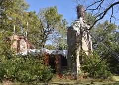 | Brunk Farmstead | 2.0 miles | 1999 |
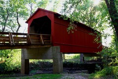 | Sugar Creek Covered Bridge | 4.3 miles | 1978 |
 | Caldwell Farmstead | 4.4 miles | 1984 |
 | Taft Farmstead | 5.3 miles | 1980 |
| National Archives record | The nomination case file for reference 09000296 in Record Group 79. |
| Sangamon County | All 68 listed properties in this county. |