 Block
From the record
One of 50 National Register listings published here for DuPage County · listed in 2020 · category: District.
Sources: the National Register database, National Park Service
Listed on the National Register of Historic Places in 2020.
One of 50 National Register listings published here for DuPage County · listed in 2020 · category: District.
Sources: the National Register database, National Park Service
Regional context, not property-specific evidence. The federal mineral resources record lists 5 workings within 5 miles of Chicago Golf Club: 3 past producers, 2 producers. 2 still produce. What was taken out: Stone, Sand and Gravel, Construction. Distance is straight-line from the map coordinates, so a quarry counted here may appear on a neighbouring settlement's page as well.
| Where | Site | Commodity | Status | Recorded |
|---|---|---|---|---|
| M M Erb Gravel Pit | Sand and Gravel, Construction | Producer | ||
| Warrenville Plant & Pit | Sand and Gravel, Construction | Producer | ||
| Dupage City Hwy. Dept. Pit | Stone | Past Producer | ||
| Glen Ellyn City Pit | Stone | Past Producer | ||
| Wheaton City Pit | Stone | Past Producer |
Regional context, not property-specific evidence. The National Weather Service names Wheaton, the town this property stands in, in 48 storm reports between 1997 and 2025: 27 thunderstorm wind, 12 hail, 4 flood, 2 tornado. The reports record 1 injury. Each account below is quoted exactly as the forecast office filed it, from the NOAA Storm Events Database, and each date opens the federal record of that event.
| When | Event | Place named | Harm | What the report says |
|---|---|---|---|---|
| July 2025 | Thunderstorm Wind | Wheaton | 1 hurt | A tree fell onto a moving car with a tree limb breaking through the windsheild and injuring a passenger who was transported to a hospital with minor injuries. |
| June 2007 | Lightning | Wheaton | $100,000 | A multi-family apartment was damaged by fire after a lightning strike near Naperville and Butterfield Roads. |
| June 2011 | Thunderstorm Wind | Wheaton | $30,000 | The top of a huge tree was snapped off and crashed through part of a bedroom of a house causing significant damage. |
| July 2012 | Thunderstorm Wind | Wheaton | $15,000 | A large tree fell onto two cars. |
| July 2006 | Thunderstorm Wind | Wheaton | $10,000 | A tree and power lines were blown down onto a car. |
| August 2008 | Thunderstorm Wind | Wheaton | $3,000 | Ten to twelve trees on the north side of Wheaton were damaged. Power lines were also blown down. |
| December 2007 | Thunderstorm Wind | Wheaton | $2,000 | Numerous tree limbs and power lines were blown down. |
| July 2012 | Thunderstorm Wind | Wheaton | $1,000 | Trees and power lines were blown down near County Farm Road and Route 38. |
| July 2025 | Thunderstorm Wind | Wheaton | - | A wooden utilitly pole with a tornado siren was blown down. |
| July 2024 | Flash Flood | Wheaton | - | Main Street was impassable with approximately 10 inches of water between Indiana Street and Roosevelt Road. |
| July 2023 | Thunderstorm Wind | Wheaton | - | A report came in of multiple trees downed in Wheaton. Time and wind speed were estimated using radar. |
| July 2023 | Hail | Wheaton | - | One inch hail was reported near the College Avenue Metra station in Wheaton. Time was estimated using radar. |
| May 2022 | Flood | Wheaton | - | Multiple photos shared on social media showed street flooding in Wheaton. A few locations were flooded up to a couple of feet in depth. |
| September 2022 | Thunderstorm Wind | Wheaton | - | A photo shared on social media showed a large tree blown down on a house. |
| September 2022 | Thunderstorm Wind | Wheaton | - | A tree and a power line were blown down near President and Chase Streets. |
| May 2020 | Flash Flood | Wheaton | - | Several feet of water was reported in a park near downtown Wheaton. |
| August 2020 | Tornado (EF1) | Wheaton | - | A brief tornado with peak winds of 90 mph touched down near Seminary Avenue and Scott Street and moved northeast where it knocked a roughly 50 foot steeple around to the north side of the College Church of Wheaton. The tornado then produced minor tree damage before lifting near Collage Avenue and Howard Street. |
| July 2019 | Thunderstorm Wind | Wheaton | - | A five foot diameter tree was uprooted and trees were blown down onto houses in the vicinity of Roosevelt and County Farm Roads. |
| July 2019 | Thunderstorm Wind | Wheaton | - | The top half of a large tree limb was snapped. |
| May 2019 | Flood | Wheaton | - | Numerous roads were closed in Wheaton due to standing water. |
| June 2011 | Thunderstorm Wind | Wheaton | - | Emergency managers in DuPage County measured 62 mph wind gusts in Wheaton while a mesonet just north of Wheaton measured 59 mph wind gusts. |
| August 2011 | Thunderstorm Wind | Wheaton | - | Winds were estimated to 60 mph. |
| June 2011 | Thunderstorm Wind | Wheaton | - | Transformers exploded when an estimated 75 mph gust occurred near the intersection of Roosevelt Road and County Farm Road. |
| June 2010 | Thunderstorm Wind | Wheaton | - | A tree was blown down on Manchester Road. |
| June 2010 | Thunderstorm Wind | Wheaton | - | Tree limbs and power lines were blown down. |
| July 2010 | Flood | Wheaton | - | A creek between Gables Boulevard and Woodlawn Street quickly rose one foot out of its banks with four to six inches of water on nearby streets. |
| May 2009 | Thunderstorm Wind | Wheaton | - | An eighteen inch diameter tree limb fell onto the roof of house on North Cross Street. |
| July 2008 | Thunderstorm Wind | Wheaton | - | A tree was blown down. |
| June 2008 | Thunderstorm Wind | Wheaton | - | Trees were blown down at Wheaton College. |
| August 2007 | Thunderstorm Wind | Wheaton | - | Estimated gust to 70 mph. |
| August 2007 | Thunderstorm Wind | Wheaton | - | Numerous trees uprooted with an estimated wind gust to 90 mph at Dupage County EOC at Gary Avenue and Jewel Road. |
| August 2007 | Thunderstorm Wind | Wheaton | - | Estimated gust to 65 mph. |
| July 2006 | Thunderstorm Wind | Wheaton | - | Numerous small to medium sized branches blown down. |
| July 2006 | Hail | Wheaton | - | Nickel size hail was reported at North Avenue and County Farm Road. |
| October 2006 | Thunderstorm Wind | Wheaton | - | Power lines blown down across all of Dupage County. |
| October 2005 | Hail | Wheaton | - | Quarter size hail reported near Butterfield and Naperville Roads. |
| August 2003 | Hail | Wheaton | - | Reported at Gary Avenue and Geneva Street. |
| July 1997 | Tornado (F1) | Wheaton | - | The tornado path started near Cantigny at Roosevelt Road and ended just southeast of the Danada Shopping Center at Naperville Road and Butterfield Road.Extensive damage occurred at the Danada Square West shopping center, where windows were blown out. Many large trees were downed and a large tree was uprooted. A few houses sustained some structural damage, with one house condemned because of major structural damage. Several houses also incurred damage to fences, decks, roofs and windows. One house lost its garage door and part of the wall to the storm. |
| April 2023 | Hail | Wheaton | - | no account filed |
| May 2019 | Hail | Wheaton | - | no account filed |
| August 2014 | Hail | Wheaton | - | no account filed |
| July 2012 | Hail | Wheaton | - | no account filed |
| July 2012 | Hail | Wheaton | - | no account filed |
| April 2003 | Hail | Wheaton | - | no account filed |
| July 2003 | Hail | Wheaton | - | no account filed |
| July 2003 | Hail | Wheaton | - | no account filed |
| June 2002 | Thunderstorm Wind | Wheaton | - | no account filed |
| July 2001 | Flood | Wheaton | - | no account filed |
No historic map-sheet match is published for this property yet. That does not mean no map exists. This record needs a coordinate-quality review before it can be joined to a sheet boundary. Browse the county's mapped places while that work is pending.
Other National Register properties close enough to walk or drive between, ordered by distance from this one. Both positions come from the same geocoding pass that matched these properties to their map sheets.
| Photograph | Property | Distance | Listed |
|---|---|---|---|
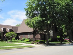 | Trinity Episcopal Church | 1.2 miles | 1978 |
 | Du Page County Courthouse | 1.2 miles | 1978 |
 | Grand Theater | 1.3 miles | 2005 |
 | Blanchard Hall | 1.6 miles | 1979 |
 | Adams Memorial Library | 1.9 miles | 1981 |
| Theosophical Society in America Headquarters | 2.6 miles | 2025 |
| National Archives record | The nomination case file for reference 100005231 in Record Group 79. |
| DuPage County | All 50 listed properties in this county. |