 Block
From the record
One of 98 National Register listings published here for Lake County · listed in 2022 · category: Building.
Sources: the National Register database, National Park Service
Listed on the National Register of Historic Places in 2022.
One of 98 National Register listings published here for Lake County · listed in 2022 · category: Building.
Sources: the National Register database, National Park Service
The chapter on Libertyville Township in The Past and Present of Lake County, Illinois, published 1877 names Libertyville. This is what it says, exactly as the scans read.
In this connection, it may be here mentioned that Liberty ville, in the early his¬ tory of the county, has produced more marked men and notable characters than Any other town in this county. Among the number, Tobias Wynkoop, before mentioned, is entitled to a passing notice. He settled in the Fall of 1835, at the point where the Milwaukee road crosses the creek, north of Libertyville, afterward known as Wynkoop'* Creek; He had expansive ideas as to the size of a farm he required. He declared that a quarter-section of land would only answer him for a garden spot. He claimed nearly the entire breadth of prai¬ rie on the west, extending westward about three miles. His boundaries were defined by laying down a single rail around it, in the form of a Virginia fence. When the land sale came, he was unable to purchase the land, and it passed into other hands.
Passage source: The Past and Present of Lake County, Illinois, published 1877.
Horace Butler, who settled at Libertyville in 1837, was the second lawyer who came to the county, but was really the first who practiced his profession. He was a man of ability, and one of the main supporters of the interests of Libertyville in all its early contests. He was a member of the Constitutional Convention of this State in 1847, and was, for one term, a Representative in the Legislature 'from Lake County.
Passage source: The Past and Present of Lake County, Illinois, published 1877.
Machine-read from a century-old scan, so expect the errors a machine makes: misspelled names, dropped words, stray characters.
Read the whole chapter on Libertyville Township - 2,542 words on its settlement, mills, schools and churches.
Regional context, not property-specific evidence. The federal wildfire occurrence database lists 15 fires within 5 miles of Libertyville Town Hall between 2012 and 2019, burning about 26 acres in total. None started naturally. None was recorded as arson. Distance is straight-line from the map coordinates, so a fire counted here may appear on a neighbouring settlement's page as well.
| Reported cause | Fires |
|---|---|
| Missing data/not specified/undetermined | 10 |
| Debris and open burning | 3 |
| Power generation/transmission/distribution | 1 |
| Equipment and vehicle use | 1 |
The most recent of them, most recent first, with the day each was reported and the service that recorded it.
| Date | Cause | Size | Reported by | Name on the report |
|---|---|---|---|---|
| 1 September 2018 | Missing data/not specified/undetermined | under an acre | Illinois Division of Forestry Resources | 9118 |
| 1 August 2018 | Missing data/not specified/undetermined | under an acre | Illinois Division of Forestry Resources | 8118 |
| 9 July 2012 | Equipment and vehicle use | under an acre | Illinois Division of Forestry Resources | DEC-79 |
| 8 July 2018 | Missing data/not specified/undetermined | under an acre | Illinois Division of Forestry Resources | 18-2269 |
| 26 June 2012 | Missing data/not specified/undetermined | 1.0 acres | Illinois Division of Forestry Resources | 12-0482 |
| 1 June 2018 | Debris and open burning | under an acre | Illinois Division of Forestry Resources | 60118 |
| 8 May 2018 | Debris and open burning | under an acre | Illinois Division of Forestry Resources | 18-1522 |
| 9 April 2019 | Missing data/not specified/undetermined | 15 acres | Illinois Division of Forestry Resources | 19-971 |
Regional context, not property-specific evidence. The federal mineral resources record lists 5 workings within 5 miles of Libertyville Town Hall: 4 past producers, 1 producer. 1 still produces. What was taken out: Sand and Gravel, Construction, Stone, Stone, Crushed/Broken. Distance is straight-line from the map coordinates, so a quarry counted here may appear on a neighbouring settlement's page as well.
| Where | Site | Commodity | Status | Recorded |
|---|---|---|---|---|
| Mundelein Pit | Stone | Past Producer | ||
| Unamed Limestone Quarry | Stone, Crushed/Broken | Past Producer | ||
| Lake County Pit No. 1 | Sand and Gravel, Construction | Producer | ||
| Lake County Pit No. 2 | Sand and Gravel, Construction | Past Producer | ||
| Peterson Pit | Sand and Gravel, Construction | Past Producer |
Regional context, not property-specific evidence. The National Weather Service names Libertyville, the town this property stands in, in 30 storm reports between 1996 and 2025: 16 thunderstorm wind, 6 hail, 4 flood, 3 heavy rain. No death or injury is recorded in these reports. Each account below is quoted exactly as the forecast office filed it, from the NOAA Storm Events Database, and each date opens the federal record of that event.
| When | Event | Place named | Harm | What the report says |
|---|---|---|---|---|
| September 2000 | Lightning | Libertyville | $25,000 | Several lightning strikes reported throughout the city, with only one fire reported. |
| July 2011 | Thunderstorm Wind | Libertyville | $10,000 | Telephone lines were blown down along with large trees in Prairie View. A roof was blown off. |
| June 2025 | Thunderstorm Wind | Libertyville | - | A microburst impacted portions of Libertyville. A large tree fell onto a townhouse on Country Club Dr, rendering it uninhabitable, and power poles were downed near Liberty Lake. Tree damage was also noted in the same general area. |
| February 2024 | Thunderstorm Wind | Libertyville | - | A photo shared via social media showed fence panels blown over in Libertyville. Time was estimated using radar. |
| June 2024 | Heavy Rain | Libertyville | - | Mesonet station FW4338 recorded 5.33 of rain. |
| June 2024 | Heavy Rain | Libertyville | - | Storm total rainfall of 6.86 was recorded in Libertyville. |
| July 2023 | Thunderstorm Wind | Libertyville | - | Multiple trees between 8 and 12 inches in diameter were reported down off of Lake Street in Libertyville. |
| August 2021 | Thunderstorm Wind | Libertyville | - | Multiple large tree limbs were blown down. |
| September 2021 | Thunderstorm Wind | Libertyville | - | Tree limbs were blown down. |
| May 2020 | Flood | Libertyville | - | Appley Avenue was flooded near Oak Spring Road. |
| July 2020 | Thunderstorm Wind | Libertyville | - | Wind gusts were estimated to 60 mph and 2 inch diameter tree limbs were blown down. |
| June 2018 | Flood | Libertyville | - | Numerous local roads had several inches of standing flood water along with some flowing water. Rainfall of 0.56 inches occurred in a ten minute period from 403 pm CST to 413 pm CST. |
| September 2014 | Thunderstorm Wind | Libertyville | - | A large tree was blown down onto Butterfield Road just north of IL-176. |
| June 2011 | Thunderstorm Wind | Libertyville | - | Wind gusts were estimated to 60 mph. |
| July 2011 | Thunderstorm Wind | Libertyville | - | A portion of a roof was peeled off by strong winds on Church Street. |
| March 2007 | Flood | Libertyville | - | Eight to twelve inches of standing water reported on Route 176, 1/8 mile west of St. Mary's Road. Six inches of standing water on Bradley Road at Interstate 94. |
| July 2006 | Flood | Libertyville | - | One foot of standing water reported at Route 21 and Maple Avenue. |
| July 2006 | Thunderstorm Wind | Libertyville | - | Two medium sized trees blown down and several tree limbs blown down. |
| July 2005 | Thunderstorm Wind | Libertyville | - | Trees and power lines were blown down. |
| May 2004 | Thunderstorm Wind | Libertyville | - | Trees were blown down near Milwaukee and Peterson Roads and north along Route 21. |
| April 2017 | Hail | Libertyville | - | no account filed |
| March 2011 | Hail | Libertyville | - | no account filed |
| April 2007 | Hail | Libertyville | - | no account filed |
| May 2003 | Heavy Rain | Libertyville | - | no account filed |
| July 2003 | Thunderstorm Wind | Libertyville | - | no account filed |
| May 2000 | Hail | Libertyville | - | no account filed |
| May 2000 | Hail | Libertyville | - | no account filed |
| May 1998 | Hail | Libertyville | - | no account filed |
| September 1996 | Thunderstorm Wind | Libertyville | - | no account filed |
| April 1996 | Thunderstorm Wind | Libertyville | - | no account filed |
No historic map-sheet match is published for this property yet. That does not mean no map exists. This record needs a coordinate-quality review before it can be joined to a sheet boundary. Browse the county's mapped places while that work is pending.
Other National Register properties close enough to walk or drive between, ordered by distance from this one. Both positions come from the same geocoding pass that matched these properties to their map sheets.
| Photograph | Property | Distance | Listed |
|---|---|---|---|
| Libertyville Downtown Historic District | 0.1 miles | 2025 | |
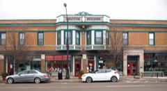 | Proctor Building | 0.2 miles | 1998 |
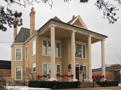 | Cook Memorial Library | 0.2 miles | 2001 |
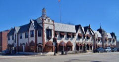 | Public Service Building | 0.2 miles | 1983 |
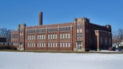 | Libertyville High School Brainerd Building | 0.3 miles | 2008 |
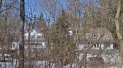 | Mrs. Isaac D. Adler House | 0.8 miles | 2002 |
| National Archives record | The nomination case file for reference 100007992 in Record Group 79. |
| Lake County | All 98 listed properties in this county. |