 Block
From the record
One of 621 National Register listings published here for Cook County · listed in 2023 · category: Building.
Sources: the National Register database, National Park Service
Listed on the National Register of Historic Places in 2023.
One of 621 National Register listings published here for Cook County · listed in 2023 · category: Building.
Sources: the National Register database, National Park Service
This property stands in Barrington Township. History of Cook County, Illinois. From the Earliest Period to the Present Time, published 1884 gives that township a chapter of its own.
The chapter covers the township.
Machine-read from a century-old scan, so expect the errors a machine makes: misspelled names, dropped words, stray characters.
Read the whole chapter on Barrington Township - 44,928 words on its settlement, mills, schools and churches.
Regional context, not property-specific evidence. The federal mineral resources record lists 5 workings within 5 miles of The Richard E. and Charlotte Henrich House: 4 producers, 1 past producer. 4 still produce. What was taken out: Sand and Gravel, Construction. Distance is straight-line from the map coordinates, so a quarry counted here may appear on a neighbouring settlement's page as well.
| Where | Site | Commodity | Status | Recorded |
|---|---|---|---|---|
| Algonquin Plant | Sand and Gravel, Construction | Past Producer | ||
| Carpentersville Pit #25 | Sand and Gravel, Construction | Producer | ||
| Dundee North Road Mat'Ls Corp | Sand and Gravel, Construction | Producer | ||
| Dundee Pit Meyer Material | Sand and Gravel, Construction | Producer | ||
| Dundee Pit Road Mat'Ls Corp | Sand and Gravel, Construction | Producer |
Regional context, not property-specific evidence. The National Weather Service names Barrington Hills, the town this property stands in, in 7 storm reports between 2000 and 2019: 4 thunderstorm wind, 1 hail, 1 funnel cloud, 1 flash flood. No death or injury is recorded in these reports. Each account below is quoted exactly as the forecast office filed it, from the NOAA Storm Events Database, and each date opens the federal record of that event.
| When | Event | Place named | Harm | What the report says |
|---|---|---|---|---|
| June 2009 | Flash Flood | Barrington Hills | $500,000 | Heavy rain fell during the morning hours of June 19th causing flooding and flash flooding across parts of northern and central Cook County. Street flooding was reported at Devon and Kedsie. Significant flooding was reported in the Jefferson Park Neighborhood with flooding at St. Louis and Bryn Mawr on the Northeast Illinois University Campus. Basement flooding was reported in Rogers Park. Flooding was reported on Algonquin Road in Chicago. The exit from Interstate 90 to Arlington Road was barely passable due to flooding. Foster underpass on Lakeshore Drive was flooded and closed due to three feet of standing water and a van was submerged in the flood water. Several streets, intersections and parking lots were flooded in Elk Grove Village with numerous cars submerged in a parking lot. Six inches of flowing water was reported on Golf Road near New Wilke Road. Significant and widespread street flooding was reported in the southeast part of Elgin in Cook County near Poplar Creek. Street flooding was reported in Norridge and Harwood Heights where Oketo Avenue and Octavia Avenue were closed. Several streets were flooded and closed in Park Ridge along with flooded yards and basements. Several roads and some basements were flooded in Des Plaines. Many roads were flooded in Schaumburg. The City of Chicago reported 452 calls regarding water in basments; 572 reports of water in streets and 17 flooded viaducts. Most of these reports were on the north side of Chicago. Rainfall amounts included 3.87 inches 3 miles east southeast of Des Plaines; 3.54 inches at O'Hare Airport; 3.48 inches 3 miles southwest of Evanston and 3.07 inches in Elk Grove Village. |
| July 2019 | Thunderstorm Wind | Barrington Hills | - | Trees were blown down. |
| September 2012 | Thunderstorm Wind | Barrington Hills | - | Gust front winds ahead of a line of thunderstorms were estimated to 60 mph near Palatine and Barrington Roads. |
| June 2010 | Thunderstorm Wind | Barrington Hills | - | Six inch diameter tree limbs were blown down. |
| June 2010 | Thunderstorm Wind | Barrington Hills | - | A one foot diameter tree was snapped off at its base near Route 14 and Pepper Road. |
| August 2007 | Funnel Cloud | Barrington Hills | - | Funnel cloud reported over Barrington Hills. |
| March 2000 | Hail | Barrington Hills | - | no account filed |
No historic map-sheet match is published for this property yet. That does not mean no map exists. This record needs a coordinate-quality review before it can be joined to a sheet boundary. Browse the county's mapped places while that work is pending.
Other National Register properties close enough to walk or drive between, ordered by distance from this one. Both positions come from the same geocoding pass that matched these properties to their map sheets.
| Photograph | Property | Distance | Listed |
|---|---|---|---|
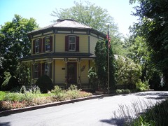 | Octagon House | 2.4 miles | 1979 |
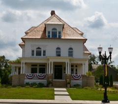 | John Robertson Jr. House | 2.4 miles | 2014 |
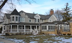 | Barrington Historic District | 2.4 miles | 1986 |
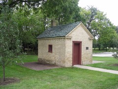 | Sunderlage Farm Smokehouse | 7.2 miles | 1990 |
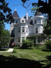 | Charles H. Patten House | 7.7 miles | 2006 |
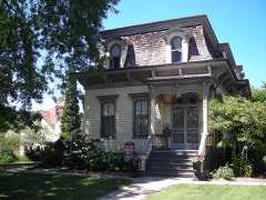 | George Clayson House | 7.8 miles | 1979 |
| National Archives record | The nomination case file for reference 100009685 in Record Group 79. |
| Cook County | All 621 listed properties in this county. |