BlockBefore
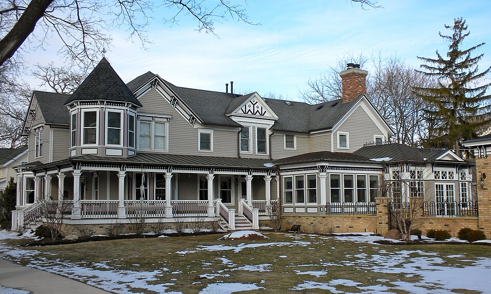
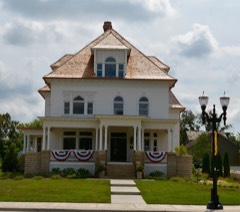
Photograph of Barrington Historic District
Photograph by Smallbones, Public domain. Via Wikimedia Commons.

Barrington Historic District

Listed on the National Register of Historic Places in 1986.

From the record

“The Barrington Historic District is a 92-acre (37 ha) historic district in Barrington, Illinois. The district encompasses a residential area in southwest Barrington and is roughly bounded by the Chicago and Northwestern Railway tracks to the north, Dundee Avenue to the west, E.”

Wikipedia article Barrington Historic District, CC BY-SA 4.0.

One of 621 National Register listings published here for Cook County · listed in 1986 · category: District.

Sources: the Wikipedia article · the case file at the National Archives · the National Register database, National Park Service
The listing

The ground it stands on

44,928 words

The chapter on Barrington Township in History of Cook County, Illinois. From the Earliest Period to the Present Time, published 1884 names Barrington. This is what it says, exactly as the scans read.

Tlie school district of which the village of Barrington rorn.s a part is Cnion District No. 10. A school house was built in 1846 or 1847. on what is now the site of L. H. Bute's house. School was kept here until 18.13. but the name of the first teacher, as well as those of subsequent ones, have escaped the memory of the oldest inhabitant. In the year last mentioned the scbool house was moved and converted into Laptain Sabin's saloon. Two school-houses were 'hen used, one on the Harrington side, erected in UU,»1 the other on the Cuba side, erected in 1806. The two schools were conducted independently until 1868. when the districts were consolidated, aud now include a portion of each of three towns Barnngton, Cnba and FJa-the latter two in Lake County lho Cuba Soo|.h0U« was sold in August. 1883 and a new house erected in Barriugtou that year. It lltw- Story building with six rooms, and was first occumed September 17. A list of the principal teachers

Passage source: History of Cook County, Illinois. From the Earliest Period to the Present Time, published 1884.

The Mdhodist Church at Burrimjhn ('cuter was organized in 1840, with six members. John C. Allen was class leader. Phillip N. Gould was steward. The Other members were Mi s. Allen and Mrs. Gould, and Mrs. Sarah Miller, wife of Ahah Miller, and her sou, E. N. Miller. They worshiped in a school. house about thirteen years, when a church was built, u plain, neat frame edifice, thirty-four by fifty-two feet, with a short steeple and a bell, the whole costing $2,200. This society grew to be quite nourishing, so much so that ill 185S it was considered the strongest Church on the Dundee circuit. At this time it hud eighty-live members. Subsequently its numbers gradually diminished, and now it has only six members, the same as the original number. K. N. Miller is the only one of the original six that is still a member. Since 1801 this Church has been connected with and supplied from the Church at Barrington Station. The building up of Barrington Village drew many of the people thither from the central part of the township, which at tho same time reduced the membership of the Church at the Center and increased that of the Church at the village of Barrington. In 1872 their numbers here had so increased that a new church building was required. One was therefore erected in this year and dedicated December 22. 1873. It is a two-story frame, with spire, and eost,iucluditig furnishing and a'liue five hundred dollar organ, about $4,50u. The ministers hero since the erection of this building have been: Rov. Robert Bcatty in 1872; Rev. John T, Cooper, 1*73; llev. George K. Hoover, 1874-75: Rev." John Hitchcock, 18*6-77-78: Rev. Samuel H, Straits, 1879-80: Rov. Joseph Caldwell, 1861i and Rev. John Nate, 1882.83.

Passage source: History of Cook County, Illinois. From the Earliest Period to the Present Time, published 1884.

Machine-read from a century-old scan, so expect the errors a machine makes: misspelled names, dropped words, stray characters.

Read the whole chapter on Barrington Township - 44,928 words on its settlement, mills, schools and churches.

Mines and quarries near this property

2 within 5 miles

Regional context, not property-specific evidence. The federal mineral resources record lists 2 workings within 5 miles of Barrington Historic District: 2 producers. All of them still produce. What was taken out: Sand and Gravel, Construction, Perlite. Distance is straight-line from the map coordinates, so a quarry counted here may appear on a neighbouring settlement's page as well.

Where SiteCommodity StatusRecorded
Dundee North Road Mat'Ls CorpSand and Gravel, ConstructionProducer
Filter Materials Perlite PlantPerliteProducer

Every working recorded in Cook County

Storms near this property

20 since 2001

Regional context, not property-specific evidence. The National Weather Service names Barrington, the town this property stands in, in 20 storm reports between 2001 and 2024: 9 thunderstorm wind, 8 hail, 1 lightning, 1 flash flood. No death or injury is recorded in these reports. Each account below is quoted exactly as the forecast office filed it, from the NOAA Storm Events Database, and each date opens the federal record of that event.

WhenEvent Place namedHarm What the report says
May 2010LightningBarrington$200,000A house in Barrington was struck by lightning. A fire started in the attic and caused significant damage. Two people in the home at the time got out safely with no injuries reported.
May 2018Flash FloodBarrington$50,000Very heavy rain caused widespread flooding across parts of northern Cook County. In Rolling Meadows, people were stuck on the roofs of cars at an apartment complex on Arbor Drive. Standing water 12 to 18 inches deep was reported on Rohlwing Road between Kirchoff and Euclid and also between Industrial Highway and Route 14. Flowing water at least 6 inches deep was reported on Euclid Road near Rohlwing Road. Water up to one foot deep was reported in the curb lanes of Industrial Avenue, west of Route 53. In Schaumburg, several cars were underwater in a flooded parking lot. A vehicle was stuck in flood waters on National Parkway and the occupants needed to be rescued. Storm total rainfall amounts included 4.48 inches in Barrington; 3.07 inches two miles east of Schaumburg and 2.72 inches two miles west southwest of Elk Grove Village.
June 2001Thunderstorm WindBarrington$15,000no account filed
August 2007Thunderstorm WindBarrington$3,000Tree limbs and power lines blown down.
February 2024Tornado (EF1)South Barrington-This tornado formed near Studio Drive in South Barrington, with the first damage observed at the South Barrington Tennis Club. The tornado moved northeastward through eastern sections of The Glen subdivision, producing sporadic tree damage. As the tornado crossed Barrington Road near Mundhank Road, significant tree damage occurred, with numerous branches and trunks snapped. The tornado continued northeast toward Willow Creek Church, where it uprooted at least one tree and damaged metal bus shelters. Damage became less severe as the tornado neared Algonquin Road, but increased again as the tornado turned to the east toward Whispering Trails Drive and Huntington Boulevard in Hoffman Estates. Damage was noted to residences along Chesapeake Court, Fir Court, and Crimson Drive with two residences losing a significant amount of roofing material. Other homes in the neighborhood had shingle damage, and a window was damaged at another residence. Tree damage, including broken limbs, was also observed. Roofing material removed from a home on Fir Court was deposited to the northwest, with plywood impaled into the ground and other debris penetrating the wall of a house, ending up in its living room. The tornado dissipated near Crimson Drive in Hoffman Estates.
May 2024Thunderstorm WindSouth Barrington-Wind gusts were estimated between 50 and 60 mph. Small tree limbs were blown down.
August 2021Thunderstorm WindSouth Barrington-Large trees were blown down.
April 2014HailBarrington-Multiple reports of one to two inch hail came in from Barrington.
June 2010Thunderstorm WindBarrington-Five trees were blown down.
July 2006Thunderstorm WindBarrington-Trees were blown down.
September 2005Thunderstorm WindBarrington-Tree limbs were blown down.
April 2023HailBarrington-no account filed
February 2022HailBarrington-no account filed
August 2015HailBarrington-no account filed
June 2009HailBarrington-no account filed
May 2005HailBarrington-no account filed
September 2005HailBarrington-no account filed
August 2001Thunderstorm WindBarrington-no account filed
July 2001Thunderstorm WindBarrington-no account filed

Every storm recorded in Cook County

Map coverage status

No historic map-sheet match is published for this property yet. That does not mean no map exists. This record needs a coordinate-quality review before it can be joined to a sheet boundary. Browse the county's mapped places while that work is pending.

Listed places nearby

6 within 8 miles

Other National Register properties close enough to walk or drive between, ordered by distance from this one. Both positions come from the same geocoding pass that matched these properties to their map sheets.

Photograph PropertyDistance Listed
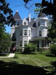
John Robertson Jr. House0.2 miles2014
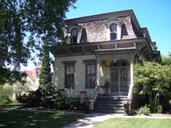
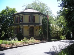
Octagon House0.2 miles1979
The Richard E. and Charlotte Henrich House2.4 miles2023
Charles H. Patten House5.6 miles2006
George Clayson House5.8 miles1979
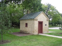
Sunderlage Farm Smokehouse6.9 miles1990

Sources for this property

National Archives recordThe nomination case file for reference 86001047 in Record Group 79.
Wikipedia articleCommunity-written account of this property, licensed CC BY-SA.
Cook CountyAll 621 listed properties in this county.

Provenance

  • Listing record. National Park Service National Register of Historic Places, listed-properties dataset, current to 2026-05-22.
  • Map join. Address geocoded through the United States Census geocoder, then tested against the published boundary of every sheet in the USGS Historical Topographic Map Collection.
  • How this page is made. Listing fields come from federal records; map-sheet coverage is a labelled coordinate-to-boundary calculation, not a source-field claim.
  • Mines and quarries. USGS Mineral Resources Data System (MRDS) https://mrdata.usgs.gov/mrds/ A work of the United States government, no copyright under 17 U.S.C. 105.
  • Storms. NOAA National Centers for Environmental Information, Storm Events Database https://www.ncei.noaa.gov/stormevents/ A work of the United States government, no copyright under 17 U.S.C. 105. Narratives are quoted verbatim from the National Weather Service report and are not edited or summarised.