 Block
From the record
One of 19 National Register listings published here for DeKalb County · listed in 2025 · category: Building.
Sources: the National Register database, National Park Service
Listed on the National Register of Historic Places in 2025.
One of 19 National Register listings published here for DeKalb County · listed in 2025 · category: Building.
Sources: the National Register database, National Park Service
The chapter on DeKalb Township in Past and Present of DeKalb County, Illinois, published 1907 names DeKalb. This is what it says, exactly as the scans read.
By way of explanation we will state thai the timber land of DeKalb township naturally divided itself into three parts. 'Flic South Grove, or Huntley's Grove, was separated from the Central Grove, later called Union Grove, by a gap extending east and west over the present site of the Norma] bridge. Another gap was found on the land owned by Phineas Stevens and extending westward, and for a long time these settlements were known by the names Huntley's Grove, Union Grove and Coltonville. The latter became the more populous settlement and had a village that was aspiring to be the county seat and in fact the first court, held in the county after its organization was held at that place.
Passage source: Past and Present of DeKalb County, Illinois, published 1907.
In the summer of 1836, the first election held in the county was at the home of Captain Eli Barnes, on land now owned by Henry Groves. Voters came from all parts of the county- It was an election for justice of the peace and we must remember at this time that the available settlements of what is now DeKalb county were known as the Kishwaukee district and were a part of La Salle count}''. Stephen Mowry and Captain Collier were elected justices and received their commission from the governor, countersigned by a county officer from La Salle county. Mr. Samuel Miller of Squaw Grove, relates that ten dollars was sent down to him by one of the candidates to pay him for bringing up ten voters and that these voti re carried his election. Mr. Boies says, in his history, that this was probably the first $10 spent to cany an election in this county, but not the last by thousands.
Passage source: Past and Present of DeKalb County, Illinois, published 1907.
Machine-read from a century-old scan, so expect the errors a machine makes: misspelled names, dropped words, stray characters.
Read the whole chapter on DeKalb Township - 5,161 words on its settlement, mills, schools and churches.
Regional context, not property-specific evidence. The federal mineral resources record lists 2 workings within 5 miles of President John Williston Cook Mansion: 2 producers. All of them still produce. What was taken out: Vermiculite, Perlite. Distance is straight-line from the map coordinates, so a quarry counted here may appear on a neighbouring settlement's page as well.
| Where | Site | Commodity | Status | Recorded |
|---|---|---|---|---|
| Mica Pellets Inc. Plant | Perlite, Vermiculite | Producer | ||
| Mica Pellets Inc. Vermiculite Plant | Vermiculite | Producer |
Regional context, not property-specific evidence. The National Weather Service names DeKalb, the town this property stands in, in 26 storm reports between 1996 and 2026: 15 thunderstorm wind, 8 hail, 2 flash flood, 1 flood. No death or injury is recorded in these reports. Each account below is quoted exactly as the forecast office filed it, from the NOAA Storm Events Database, and each date opens the federal record of that event.
| When | Event | Place named | Harm | What the report says |
|---|---|---|---|---|
| May 2025 | Thunderstorm Wind | Dekalb | - | Several photos relayed on social media showed tree damage in and around DeKalb. A one foot diameter tree was snapped midway up the trunk. Live web cameras at the time the storm moved through showed considerable blowing dust as well as several gustnadoes. |
| August 2025 | Flash Flood | Dekalb | - | A report of flooding was received from the northwest side of DeKalb via mPing. |
| August 2025 | Thunderstorm Wind | Dekalb | - | A softwood tree was uprooted and an 8 to 12 inch diameter limb was snapped in the vicinity of Greenbrier Rd in DeKalb. |
| July 2024 | Thunderstorm Wind | Dekalb | - | A reasonably healthy 12 inch diameter tree was blown down just south of 1st Street and Bethany Road. |
| June 2024 | Thunderstorm Wind | Dekalb | - | An approximately 8 inch diameter tree was uprooted in DeKalb. |
| June 2024 | Thunderstorm Wind | Dekalb | - | Numerous tree branches were down on the 1700 block of N 1st St. A tall tree had also snapped and another tree had fallen onto a house in the area. |
| July 2024 | Thunderstorm Wind | Dekalb | - | Numerous trees and tree limbs were blown down between 1st Street and the railroad tracks, just north of Taylor Street. |
| March 2023 | Thunderstorm Wind | Dekalb | - | A handheld anemometer measured a 74 mph gust. Tree damage and minor roof damage were also reported. |
| July 2022 | Thunderstorm Wind | Dekalb | - | A couple of tree limbs about 3 to 6 inches in diameter were blown down near the Northern Illinois University coop station. |
| August 2022 | Thunderstorm Wind | Dekalb | - | A large tree limb was blown down on the campus of Northern Illinois University. |
| August 2022 | Flash Flood | Dekalb | - | Multiple reports of street flooding were received from Sycamore and DeKalb. |
| August 2022 | Flood | Dekalb | - | Video shared on social media showed water over a roadway in downtown DeKalb. Several roads were covered by flood waters of varying depths. The DeKalb Airport measured 1.42 inches of rain in one hour. A spotter 3 miles northeast of DeKalb measured a storm total of 3.30 inches of rain. |
| August 2021 | Thunderstorm Wind | Dekalb | - | A photo shared on social media showed a tree snapped near its base near Northern Illinois University. |
| August 2021 | Thunderstorm Wind | Dekalb | - | A photo shared on social media showed multiple tree limbs up to 8 inches in diameter blown down near Hillcrest Drive and Blackhawk Road. |
| November 2020 | Thunderstorm Wind | Dekalb | - | Multiple utility poles and power lines were blown down in the 1400 block of 4th Street. |
| June 2017 | Thunderstorm Wind | Dekalb | - | A wind gust to 64 mph was measured at the De Kalb Airport (KDKB). Tree limbs were blown down in De Kalb. |
| August 2015 | Hail | Dekalb | - | There were multiple reports of quarter to golf ball size hail in and around De Kalb. Golf ball size hail fell at 1st Street and Taylor. Half dollar size hail fell near Annie Glidden Road. |
| April 2026 | Hail | Dekalb | - | no account filed |
| April 2026 | Hail | Dekalb | - | no account filed |
| April 2026 | Hail | Dekalb | - | no account filed |
| April 2026 | Hail | Dekalb | - | no account filed |
| April 2023 | Thunderstorm Wind | Dekalb | - | no account filed |
| April 2019 | Hail | Dekalb | - | no account filed |
| June 2014 | Hail | Dekalb | - | no account filed |
| June 1996 | Thunderstorm Wind | Dekalb | - | no account filed |
| April 1996 | Hail | Dekalb | - | no account filed |
No historic map-sheet match is published for this property yet. That does not mean no map exists. This record needs a coordinate-quality review before it can be joined to a sheet boundary. Browse the county's mapped places while that work is pending.
Other National Register properties close enough to walk or drive between, ordered by distance from this one. Both positions come from the same geocoding pass that matched these properties to their map sheets.
| Photograph | Property | Distance | Listed |
|---|---|---|---|
 | Ellwood Mansion | 0.3 miles | 1975 |
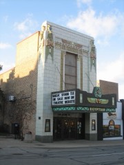 | Egyptian Theatre | 0.3 miles | 1978 |
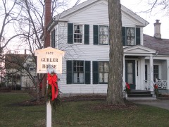 | George H. Gurler House | 0.3 miles | 1979 |
 | Haish Memorial Library | 0.4 miles | 1980 |
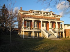 | Joseph F. Glidden House | 0.8 miles | 1973 |
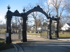 | Elmwood Cemetery Gates | 4.5 miles | 1978 |
| National Archives record | The nomination case file for reference 100012171 in Record Group 79. |
| DeKalb County | All 19 listed properties in this county. |