
BlockBefore
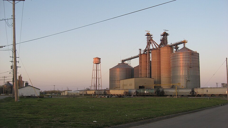
Photograph of Mound City Civil War Naval Hospital
Photograph by Nyttend, Public domain. Via Wikimedia Commons.

Mound City Civil War Naval Hospital

Built in 1861. Listed on the National Register of Historic Places in 1974.

From the record

“The Mound City Civil War Naval Hospital was a naval hospital in Mound City, Illinois, used by the United States Navy during the Civil War. The hospital was established in 1861 in an existing brick building claimed by the U.S. government.”

Wikipedia article Mound City Civil War Naval Hospital, CC BY-SA 4.0.

One of 4 National Register listings published here for Pulaski County · listed in 1974 · category: Building · built in 1861.

Sources: the Wikipedia article · the case file at the National Archives · the National Register database, National Park Service


The listing

  • Listing status. The Park Service records this property as Removed.
  • What is counted as historic. The nomination lists 1 building as contributing to the listing.
  • Address. Commercial Ave. and Central St., Mound City, 62963
  • When was it listed? October 1974
  • Category. building
  • Precinct. Mound City precinct
  • When was it built? 1861
  • National Register reference number. 74002285 - the number the National Park Service assigned this property when it was listed, and the key its nomination file is catalogued under at the National Archives.

Fires near this property

1 since 2012

Regional context, not property-specific evidence. The federal wildfire occurrence database lists 1 fire within 5 miles of Mound City Civil War Naval Hospital in 2012, burning under an acre in total. None started naturally. None was recorded as arson. Distance is straight-line from the map coordinates, so a fire counted here may appear on a neighbouring settlement's page as well.

Reported cause Fires
Missing data/not specified/undetermined1

The most recent of them, most recent first, with the day each was reported and the service that recorded it.

DateCause SizeReported by Name on the report
27 April 2012Missing data/not specified/undeterminedunder an acreKentucky Division of ForestryACROSS DIS

Every fire recorded in Pulaski County

Mines and quarries near this property

2 within 5 miles

Regional context, not property-specific evidence. The federal mineral resources record lists 2 workings within 5 miles of Mound City Civil War Naval Hospital: 1 past producer, 1 plant. 1 still produces. What was taken out: Stone, Crushed/Broken, Sand and Gravel, Construction. Distance is straight-line from the map coordinates, so a quarry counted here may appear on a neighbouring settlement's page as well.

Where SiteCommodity StatusRecorded
Mound City Dredge & MillSand and Gravel, ConstructionPlant
Mound City PitStone, Crushed/BrokenPast Producer

Every working recorded in Pulaski County

Storms near this property

26 since 1998

Regional context, not property-specific evidence. The National Weather Service names Mound City, the town this property stands in, in 26 storm reports between 1998 and 2025: 10 flood, 8 hail, 4 thunderstorm wind, 2 flash flood. No death or injury is recorded in these reports. Each account below is quoted exactly as the forecast office filed it, from the NOAA Storm Events Database, and each date opens the federal record of that event.

WhenEvent Place namedHarm What the report says
May 2011FloodMound City$200,000Major flooding continued on the Ohio River from April. At the Grand Chain river gage, the flood crest of 62.20 feet on the evening of May 2 came within two feet of the record of 64.00 feet set in 1937. The activation of the New Madrid Floodway by the U.S. Army Corps of Engineers spared Pulaski County from an even higher crest. With the detonation of the Mississippi River levee at Birds Point, Missouri, the Ohio River dropped suddenly at Grand Chain.
July 2023Flash FloodMound City$150,000no account filed
May 2011Tornado (EF1)Mound City$50,000The tornado moved northeast across Mound City, where much of the damage occurred. One small mobile home was picked up and thrown into a power pole. There was roof damage to several homes, mainly shingles. Numerous trees were uprooted and snapped. The tornado damage path ended at the Ohio River. Peak winds were estimated near 105 mph. The average path width was 200 yards.
July 2019FloodMound City$30,000The Ohio River finally fell below flood stage after spending five months above flood stage, which is the longest duration on record at the Cairo river gage. Much of this time, the river was above flood stage due to backwater from the swollen Mississippi River. Although crops were never planted in many parts of the flood plain, the agricultural impacts were still significant. Flooding of low-lying woods, fields, and public parks finally ended by mid month.
February 2019FloodMound City$20,000Major flooding occurred on the Ohio River. There was extensive flooding of low-lying woods, fields, and parks. Through February, the impacts were very similar to the March, 1997 flood. Areas not protected by levees were inundated. Since the crop season was not underway, agricultural losses were insignificant. The Ohio River did not crest until March at the Cairo river gage.
June 2019FloodMound City$20,000Moderate flooding of the Ohio River continued through the month of June. Much of the flooding was due to backwater from the swollen Mississippi River. Considerable flooding of low-lying woods, fields, and parks persisted. Typically, this scale of flooding has a large impact on farming operations. Due to the lack of planted crops during this long-term flood, there were little in the way of crop losses.
June 1998Thunderstorm WindMound City$4,000Several trees were blown down.
September 2006Thunderstorm WindMound City$2,000Numerous medium-size tree limbs were down. A tree limb went through the roof of a house.
May 2025Thunderstorm WindMound City$1,000Moderate tree limb damage occurred at Mound City as a supercell thunderstorm moved eastward through southern Pulaski County.
May 2025HailMound City-Spotter reports of half-dollar to golf ball size hail were measured in Mound City as a supercell storm progressed eastward through southern Pulaski County.
April 2021FloodMound City-Moderate flooding occurred on the Ohio River. At the Olmsted river gage, the river crested at 42.38 feet on the evening of the 3rd. Flood stage is 36 feet. There was considerable flooding of fields and woods in the flood plain. A few county roads were impacted.
March 2021FloodMound City-Moderate flooding occurred on the Ohio River. At the Olmsted river gage, the river crested at 43.33 feet. Flood stage is 36 feet. There was considerable flooding of fields and woods in the flood plain. A few county roads were impacted.
March 2019FloodMound City-Major flooding continued on the Ohio River from February into March. There was extensive flooding of low-lying woods, fields, and parks. The impacts were very similar to the March, 1997 flood. The river crested just a few inches above the flood crest of March, 1997 at the Cairo river gage. The exact crest at Cairo was 56.51 feet on the 1st. Areas not protected by levees were inundated. Since the crop season was not underway, agricultural losses were insignificant. Total property damage estimates can be found in the February report.
May 2019FloodMound City-Moderate flooding of the Ohio River continued through the month of May. Much of the flooding was due to backwater from the swollen Mississippi River. Considerable flooding of low-lying woods, fields, and parks persisted. Typically, this scale of flooding has a large impact on farming in the flood plain. Due to the lack of planted crops during this extended flood, there was little in the way of direct crop losses.
March 2015FloodMound City-Moderate flooding occurred on the Ohio River. At the Grand Chain river gage, the river crested at 51.50 feet on the 17th. Flood stage is 42 feet. This flood crest was nearly identical to the flood in May of 2010. Water reached the power house at old Lock and Dam 53. Low-lying woods, fields, and bottomlands were affected.
November 2013Funnel CloudMound City-The funnel cloud was reported to be moving eastward.
May 2008Flash FloodMound City-Standing water was reported on several low-lying roads. The highway department was called for traffic control.
June 2004Thunderstorm WindMound City-Large tree limbs were downed.
April 1998HailMound City-Nickel size hail occurred near the Alexander County line.
April 2019FloodMound City-no account filed
June 2018HailMound City-no account filed
October 2013HailMound City-no account filed
April 2011HailMound City-no account filed
June 2011HailMound City-no account filed
January 2000HailMound City-no account filed
April 2000HailMound City-no account filed

Every storm recorded in Pulaski County

Map coverage status

No historic map-sheet match is published for this property yet. That does not mean no map exists. This record needs a coordinate-quality review before it can be joined to a sheet boundary. Browse the county's mapped places while that work is pending.

Listed places nearby

2 within 8 miles

Other National Register properties close enough to walk or drive between, ordered by distance from this one. Both positions come from the same geocoding pass that matched these properties to their map sheets.

Photograph PropertyDistance Listed
Mound City National Cemetery1.0 miles1997
Olmstead Depot7.8 miles1989

Sources for this property

National Archives recordThe nomination case file for reference 74002285 in Record Group 79.
Wikipedia articleCommunity-written account of this property, licensed CC BY-SA.
Pulaski CountyAll 4 listed properties in this county.

Provenance

  • Listing record. National Park Service National Register of Historic Places, listed-properties dataset, current to 2026-05-22.
  • Map join. Address geocoded through the United States Census geocoder, then tested against the published boundary of every sheet in the USGS Historical Topographic Map Collection.
  • How this page is made. Listing fields come from federal records; map-sheet coverage is a labelled coordinate-to-boundary calculation, not a source-field claim.
  • Wildfire. Short, Karen C. 2022. Spatial wildfire occurrence data for the United States, 1992-2020 [FPA_FOD_20221014]. 6th Edition. Fort Collins, CO: Forest Service Research Data Archive. https://doi.org/10.2737/RDS-2013-0009.6 Collected with United States Government funding and usable without additional permissions or fees.
  • Mines and quarries. USGS Mineral Resources Data System (MRDS) https://mrdata.usgs.gov/mrds/ A work of the United States government, no copyright under 17 U.S.C. 105.
  • Storms. NOAA National Centers for Environmental Information, Storm Events Database https://www.ncei.noaa.gov/stormevents/ A work of the United States government, no copyright under 17 U.S.C. 105. Narratives are quoted verbatim from the National Weather Service report and are not edited or summarised.