| March 2007 | Lightning | Carbondale | 1 killed | An 18-year-old high school student was struck and killed by lightning at a track meet. The lightning strike occurred on the school's campus just before the start of the track meet. Witnesses stated there was little rain, thunder, or lightning prior to the fatal strike. The student was declared dead on arrival at the hospital. |
| June 2010 | Lightning | Carbondale | 1 hurt | A 32-year-old woman was struck by lightning in the parking lot of a Wal-Mart store. The main injury was to her leg, which may have sustained muscle damage. She was knocked to the ground when lightning struck the shopping cart she was holding. She lost some hair. |
| April 2011 | Thunderstorm Wind | Carbondale | $1,200,000 | About one-third of the roof was blown off a brand new police station, landing on three nearby homes. The police station suffered water damage, and the nearby homes were heavily damaged. There were numerous trees and power lines blown down in the city. On the Southern Illinois University campus, windows were broken at an academic building, and a tree landed on a residence hall. Carbondale city schools were closed the following day since thousands of utility customers remained without power. |
| January 2000 | Thunderstorm Wind | Carbondale | $150,000 | Thunderstorm winds estimated over 100 MPH destroyed a brick home and numerous outbuildings. Several homes were partially damaged from fallen trees. The path of this thunderstorm downburst extended into nearby northwest Williamson County near Cambria. |
| April 2017 | Flash Flood | Carbondale | $100,000 | More than 150 students on the campus of Southern Illinois University were evacuated to other buildings after a dormitory was flooded. Another campus building sustained minor basement flooding. Widespread street flooding occurred, especially in the more densely populated sections of Carbondale. The eastbound lanes of Route 13 were closed in Carbondale due to high water. Nearly every road in one large neighborhood was impassable. Much of the community of Makanda was flooded, where a newly constructed bridge in the middle of town was completely underwater. |
| June 1998 | Flash Flood | Carbondale | $100,000 | no account filed |
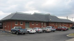
| September 2012 | Flash Flood | Carbondale | $30,000 | Flash flooding occurred throughout much of the city. Street flooding was reported throughout downtown Carbondale. Highway 13 was closed through the middle of the city due to stranded vehicles in the road. Flash flooding occurred in front of the train station on U.S. Highway 51, where two cars were stalled out. A nearby theater was damaged by floodwater. The automated observing system at the Carbondale airport measured 4.72 inches of rain from the remnants of Hurricane Isaac. Of that amount, 2.38 inches fell in a two-hour period. |
| June 2008 | Thunderstorm Wind | Carbondale | $30,000 | Trees were blown down, mostly south of downtown Carbondale. Several small trees were down on the Southern Illinois University campus. A couple of roads were blocked two to four miles south of Carbondale, including Old U.S. 51. Elsewhere in the area, a roof was damaged, a tree was down, and canoes were thrown 100 feet. |
| July 2015 | Thunderstorm Wind | Carbondale | $20,000 | A large tree fell through a house. The house was uninhabitable due to major structural damage. |
| May 2011 | Thunderstorm Wind | Carbondale | $20,000 | Numerous large tree limbs were blown down onto streets and power lines. |
| June 2000 | Flash Flood | Carbondale | $20,000 | no account filed |
| June 2015 | Flash Flood | Carbondale | $10,000 | Widespread street flooding was reported in the cities of Carbondale and Murphysboro. The daily rainfall total at the Carbondale airport was 3.17 inches. |
| September 2006 | Hail | Carbondale | $10,000 | Nickel to quarter-size hail occurred in a swath mainly to the south and east of Carbondale. Vehicles were damaged. |
| February 2023 | Thunderstorm Wind | Carbondale | $8,000 | Tree damage was reported in the Carbondale area due to strong winds with a passing line of showers. A wind gust to 62 mph was measured at the Carbondale airport by the automated weather observation system. |
| February 2023 | Thunderstorm Wind | Carbondale | $8,000 | The automated weather observation system at the Carbondale airport measured a wind gust to 61 mph. A power pole was leaning on Old Highway 13 a few miles west of Carbondale. |
| July 2016 | Thunderstorm Wind | Carbondale | $8,000 | Three miles northwest of Carbondale, a large tree and some tree limbs were blown down along Highway 13. In Carbondale, a tree was blown onto a house. Several large tree limbs and a few small trees were down in Carbondale. At least one street was partially blocked. |
| July 2008 | Thunderstorm Wind | Carbondale | $8,000 | Several trees and power lines were down around Carbondale, especially on the north side. |
| July 2021 | Thunderstorm Wind | Carbondale | $7,000 | A downburst with estimated peak winds of 75 mph struck the east side of downtown Carbondale. The damage fanned out from the beginning point to a max width of about 3/4 mile. The damage was almost entirely limited to tree damage, including a few whole trees down. |
| June 2018 | Thunderstorm Wind | Carbondale | $7,000 | A tree blocked old U.S. Highway 51 south near Makanda. A few miles south of Carbondale, a chimney of a house was damaged. Large tree limbs were blown down throughout the area. |
| February 2014 | Thunderstorm Wind | Carbondale | $7,000 | In Carbondale, a trained spotter measured a wind gust to 60 mph. Two six-foot sections of a fence were blown down. The awning on a second home detached from the building. Near the Carbondale Reservoir, tree limbs were blown down at scattered locations. |
| July 2010 | Thunderstorm Wind | Carbondale | $7,000 | Trees up to eight inches in diameter were blown down. Power lines were down. |
| May 2016 | Thunderstorm Wind | Carbondale | $5,000 | Several large tree limbs were blown down in the southwest part of the city. |
| December 1998 | Thunderstorm Wind | Carbondale | $5,000 | Five to eight trees were down along Country Club Road. |
| May 1995 | Thunderstorm Wind | Carbondale | $5,000 | no account filed |
| April 1999 | Flash Flood | Carbondale | $4,000 | Thunderstorms with prolonged periods of heavy rain forced a creek out of its banks in Carbondale. North Oakland Street was closed due to high water. |
| November 2017 | Thunderstorm Wind | Carbondale | $3,000 | An old metal storage shed was destroyed. Some of the wooden posts in the frame of the shed were partially rotted. Scattered tree damage was reported in the vicinity of the destroyed shed. A few of the trees landed on fence lines. The damage occurred on a farm operated by Southern Illinois University. |
| October 2004 | Flash Flood | Carbondale | $3,000 | Major street flooding occurred in downtown Carbondale. The most serious flooding was on the Southern Illinois University campus, where a car was submerged in floodwaters. |
| May 1999 | Thunderstorm Wind | Carbondale | $3,000 | Wind gusts estimated near 60 MPH downed tree limbs. |
| July 2016 | Flash Flood | Carbondale | $2,000 | On the east side of Carbondale, Route 13 eastbound was covered by several inches of water. Two cars were stranded. Manhole covers were blown off by gushing water. A few miles north of Murphysboro, there was flash flooding of roads and yards. The driveway of a home was completely flooded, and ditches were overflowing into the street. The daily rainfall total for the 6th was 4.26 inches at the Carbondale airport. |
| September 2006 | Thunderstorm Wind | Carbondale | $2,000 | A tent was blown down at a car dealership. Power lines were blown down. |
| May 2024 | Flash Flood | Carbondale | - | A report was submitted via mPING of flooding in Carbondale. Hourly rainfall rates peaked at a radar estimated 1 to 1.75 inches within an hour in the Carbondale area between 1340-1440CST with MRMS unit flow values peaking around 1430CST. |
| July 2024 | Flood | Carbondale | - | An mPING report was submitted for minor street flooding in Carbondale. Rainfall rates were estimated at half to three quarters of an inch in an hour. |
| January 2023 | Flood | Carbondale | - | Minor street and yard flooding occurred. |
| May 2023 | Hail | Carbondale | - | Quarter-size hail occurred in the Carbondale-Murphysboro area. |
| May 2022 | Thunderstorm Wind | Carbondale | - | Pea-size hail was also observed by the trained spotter. |
| May 2022 | Hail | Carbondale | - | A trained spotter reported one-inch hail over downtown Carbondale. There was a public report of half-dollar size hail in the city. The total length of the hailstorm was two minutes. |
| February 2019 | Flood | Carbondale | - | Water was over a few roads on the southwest side of Carbondale. The daily rainfall at the Carbondale airport was 3.29 inches. |
| February 2018 | Flash Flood | Carbondale | - | Several streets were flooded in the city of Carbondale. A couple of them were barricaded. Close to an inch of rain fell in an hour during a thunderstorm. This rain occurred on ground that was saturated by nearly 5 inches of rain in the previous four days. |
| April 2017 | Hail | Carbondale | - | Penny-size hail was reported along Highway 13. |
| September 2017 | Hail | Carbondale | - | A report of golf ball size hail in west Carbondale was relayed by a local television station. |
| April 2015 | Flash Flood | Carbondale | - | Eastbound Route 13 was closed due to flooding. Another intersection along Route 13 was under water. Storm total rainfall of 2.15 inches was reported. |
| September 2015 | Heavy Rain | Carbondale | - | A broadcast media station reported 3.35 inches of rainfall from thunderstorms during the night. |
| March 2012 | Hail | Carbondale | - | Dime size hail was reported at the Southern Illinois University Airport. |
| June 2011 | Heavy Rain | Carbondale | - | Emergency management personnel reported 3.19 inches fell within 90 minutes. There was standing water along some roadways. Many creeks and streams were at bankful or overflowing. |
| May 2011 | Thunderstorm Wind | Carbondale | - | An amateur radio operator estimated winds gusted up to 60 mph. |
| April 2011 | Flash Flood | Carbondale | - | One and one-half feet of water was over a city street a block east of U.S. Highway 51. The street was closed to all traffic. The flash flooding was caused by a slow-moving line of storms with torrential rainfall rates of two to three inches per hour. |
| May 2010 | Heavy Rain | Carbondale | - | A CoCoRahs observer measured 1.8 inches of rainfall within one hour. |
| July 2009 | Flash Flood | Carbondale | - | Route 13, the main east to west thoroughfare through Carbondale, was under several feet of water at a downtown intersection. A co-operative observer reported 4.5 inches of rain over a three-hour period. Ditches were overflowing between 2.5 and 3 feet deep onto sidewalks. In DeSoto, a spotter measured 3.95 inches of rain during the morning. |
| April 2007 | Heavy Rain | Carbondale | - | Rainfall of 1.68 inches occurred within one hour at the Carbondale airport. Street flooding was common in Carbondale and Murphysboro. |
| June 2007 | Heavy Rain | Carbondale | - | Street flooding occurred due to heavy thunderstorm rains. Along one section of Illinois Route 13, water was up to the bumpers of cars. More than three-quarters of an inch of rain fell within an hour. |
| April 2006 | Hail | Carbondale | - | Nickel to quarter size hail occurred in Carbondale. Dime size hail occurred 6 miles south of the city. |
| July 2006 | Heavy Rain | Carbondale | - | Standing water was found in many places as a result of thunderstorm downpours. Many intersections and parking lots were flooded. The water level was generally lower than the bottoms of automobiles. Rainfall in Carbondale was measured at 3.17 inches. |
| October 2004 | Thunderstorm Wind | Carbondale | - | Numerous trees were blown down. |
| April 2002 | Thunderstorm Wind | Carbondale | - | Trees were blown down on Willow, North McKinley, and West Sycamore Streets. |
| June 2001 | Thunderstorm Wind | Carbondale | - | Numerous large tree limbs, along with a few whole trees, were blown down. |
| July 2001 | Thunderstorm Wind | Carbondale | - | Two trees and one power line were down. |
| July 2001 | Thunderstorm Wind | Carbondale | - | Five trees were down on Old Route 13. |
| April 1994 | Thunderstorm Wind | Carbondale | - | Several trees were blown down on Route 13 east of Carbondale. |
| April 2023 | Hail | Carbondale | - | no account filed |
| May 2023 | Hail | Carbondale | - | no account filed |
 Block