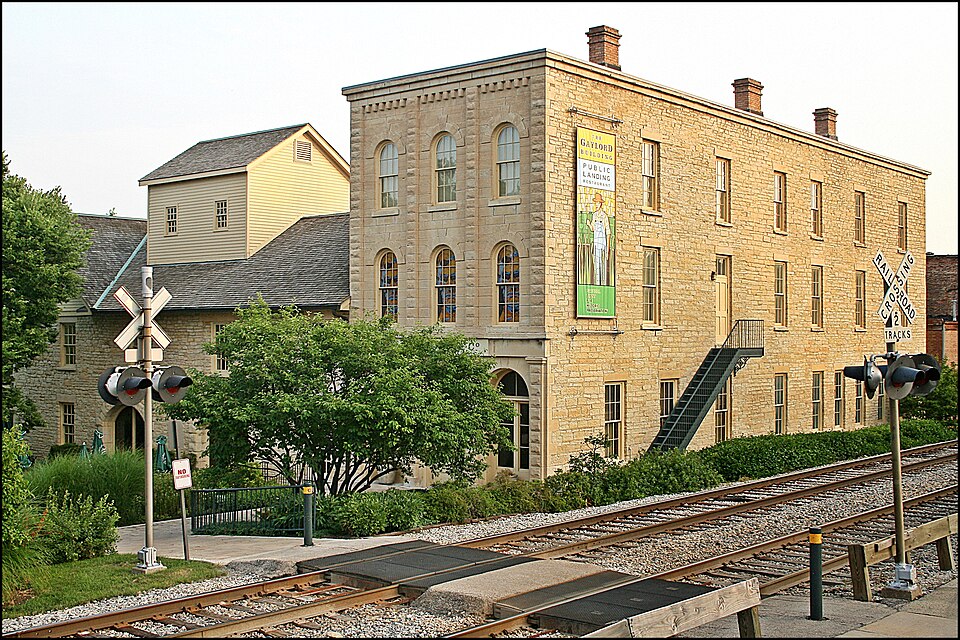
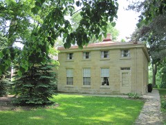
Listed on the National Register of Historic Places in 1975.
From the record
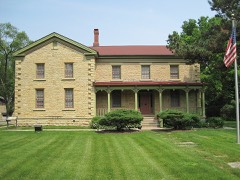
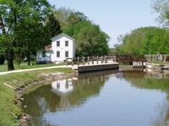
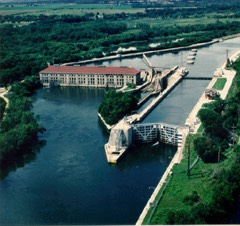
“The Lockport Historic District, also known as the Canal and Downtown Area, is a set of fifty-nine buildings in Lockport, Illinois. Of these, fifty-six contribute to the historical integrity of the area.”
Wikipedia article Lockport Historic District, CC BY-SA 4.0.
One of 38 National Register listings published here for Will County · listed in 1975 · category: District.
National Register reference number.75000676- the number the National Park Service assigned this property when it was listed, and the key its nomination file is catalogued under at the National Archives.
The first store was established in Runyontown town (now North Lockport) by a man named Kellogg, and was but a sort of grocery store, a rather small affair. Goss & Parks kept the first dry goods store at the same place, and at the layingout of Lockport proper, removed within its limits, Goss and Stephen Gooding opening a store in partnership, and Parks likewise opening one on his own hook. After the retirement of Stephen Gooding, Oliver P. Gooding took charge of this, and soon other mercantile establishments were opened, and Lockport grew rapidly. The first building of any pretensions erected, was the Canal office, as already stated. There were, however, several cabins and huts put up within the present limits of the village, by the early settlers, long before it was laid out as a village. The first tavern was built by Horace Morse, but Mr. Runyon, we believe, kept travelers before this tavern was built, though he did not pretend to keep a regular hotel. The first post office was established in 1836, over on the west side of the river, at the stone mill, and Edward P. Bush was the first Postmaster. The office remained at the mill until 1839, when it was removed across the river to the East Side, where it has ever since remained. While at the mill, the mail came once a week, and was brought on horseback. In 1839, coaches were put on the Chicago and Ottawa route, and the mail then came that way, which was considered, in that early day, quite an improvement, and a considerable advance toward civilization. The first representatives of the legal profession were Gen. James Turney and John W. Paddock, both long since dead. At present Messrs. L. S. Parker and W. S. Myers, men of ability, constitute the "learned in the law" of Lockport. The first village schoolhouse was built in 1839 ; a small frame building, about 18x32 feet, and cost perhaps $200. It was used for schools, religious services, townhall, and anything else that happened to come along. The present handsome stone building, with its fine clock, was erected a few years ago at a cost of $30,000 - quite a contrast to the little shanty built for school purposes forty years ago. The present building would be an ornament to any town. The following is the record of the school for the present year : Prof. D. H. Darling, Principal ; Misses Paxson, Gooding, Devine, Parker and Herron, Teachers.
Before Lockport proper was laid out, and as early as 1836, Armstead Runyon laid out North Lockport, or what was long known as Runyontown, but now called Runyon's Addition to Lockport. West Lockport was laid out by William Gooding, Lyman Hawley, William Rogers and Eli Prescott, the parties that built the stone mill. At one time this was the most flourishing part of Lockport, but both it and Runyontown have been merged into the village proper. Lockport was incorporated under especial act of the Legislature, approved February 12, 1853, and signed by J. A. Matteson, Governor. At the election for adopting the village charter, the vote was 86 in favor of and 55 against the charter. The first Board of Trustees elected were Isaac H. Steward, Henry Torrey, S. S. Chamberlain, D. C. Baldwin and Chauncy Doud. Henry Torrey was chosen President of the Board, I. H. Stewart appointed Secretary, and Chauncy Doud, Treasurer. The following is the present Board : David C. Baldwin, William Shields, Samuel Matthews, John Ryan and Jacob Lotz. D. C. Baldwin is President of the Board ; William Shields, Clerk ; F. F. Stowe, Police Magistrate ; William A. Johnson, Police Constable, and James Wright, Jr., Street Commissioner.
Regional context, not property-specific
evidence. The
federal wildfire occurrence database
lists 5 fires within 5 miles of Lockport Historic District
in 2020, burning about 3 acres in total. None started naturally. None was recorded as arson.
Distance is straight-line from the map coordinates, so a fire counted
here may appear on a neighbouring settlement's page as well.
Reported cause
Fires
Debris and open burning
2
Smoking
1
Missing data/not specified/undetermined
1
Equipment and vehicle use
1
The most recent of
them, most recent first, with the day each was reported and the service
that recorded it.
Regional context, not property-specific
evidence. The federal mineral resources record lists
7 workings within 5 miles of Lockport Historic District: 3 past producers, 3 plants, 1 producer.
4 still produce. What was taken out: Stone, Crushed/Broken, Sulfur, Sand and Gravel, Construction. Distance is straight-line from the
map coordinates, so a quarry counted here may appear on a neighbouring
settlement's page as well.
Regional context, not property-specific
evidence. The National Weather Service names
Lockport, the town this property stands in, in 39 storm reports between 1996 and 2026: 18 thunderstorm wind, 17 hail, 1 flash flood, 1 lightning.
No death or injury is recorded in these reports. Each account below is quoted exactly as the forecast office
filed it, from the NOAA Storm Events Database, and each date
opens the federal record of that event.
A microburst hit the Cedar Glen Subdivision in Homer Glen, east of Lockport. This is just northwest of the intersection of 159th Street and Cedar Road. There was scattered damage to trees throughout the neighborhood. Objects such as trampolines and lawn furniture were blown over as well. The most concentrated damage was in the east end of the subdivision along Cedar Glen Drive where several mature spruce trees were uprooted and some hardwood trees had large limbs or trunks snapped. A large portion of a roof of a house was torn off. Most of the damage was blown down from the northwest to southeast. In the west end of the neighborhood, some of the limbs were blown more to the south and southwest, in a downburst pattern. More than 30 trees were blown down at Old Oak Country Club.
No historic map-sheet match is published
for this property yet. That does not mean no map exists. This record needs
a coordinate-quality review before it can be joined to a sheet boundary.
Browse the county's mapped places while that work is
pending.
Listed places nearby
6 within 8 miles
Other National Register properties close
enough to walk or drive between, ordered by distance from this one. Both
positions come from the same geocoding pass that matched these properties
to their map sheets.
Listing record. National Park Service National Register of Historic Places, listed-properties dataset, current to 2026-05-22.
Map join. Address geocoded through the United States Census geocoder, then tested against the published boundary of every sheet in the USGS Historical Topographic Map Collection.
How this page is made. Listing fields come from federal records; map-sheet coverage is a labelled coordinate-to-boundary calculation, not a source-field claim.
Wildfire. Short, Karen C. 2022. Spatial wildfire occurrence data for the United States, 1992-2020 [FPA_FOD_20221014]. 6th Edition. Fort Collins, CO: Forest Service Research Data Archive. https://doi.org/10.2737/RDS-2013-0009.6 Collected with United States Government funding and usable without additional permissions or fees.
Mines and quarries. USGS Mineral Resources Data System (MRDS) https://mrdata.usgs.gov/mrds/ A work of the United States government, no copyright under 17 U.S.C. 105.
Storms. NOAA National Centers for Environmental Information, Storm Events Database https://www.ncei.noaa.gov/stormevents/ A work of the United States government, no copyright under 17 U.S.C. 105. Narratives are quoted verbatim from the National Weather Service report and are not edited or summarised.
 Block