BlockBefore
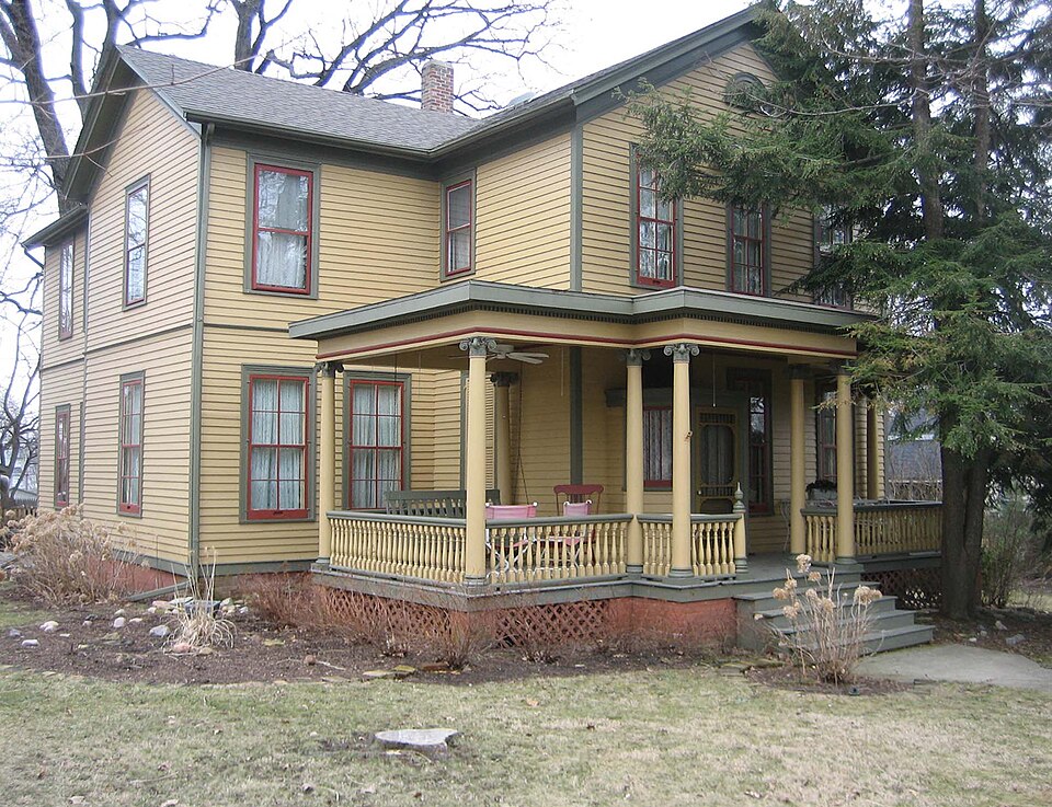
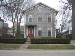
Photograph of John M. Hamilton House
Photograph by IvoShandor, CC BY 2.5. Via Wikimedia Commons.

John M. Hamilton House

Listed on the National Register of Historic Places in 1978.

From the record

“Hamilton House is a historic house located at 502 South Clayton Street in Bloomington, Illinois. John Marshall Hamilton, who served as governor of Illinois from 1883 to 1885, lived in the house prior to becoming governor.”

Wikipedia article John M. Hamilton House, CC BY-SA 4.0.

One of 35 National Register listings published here for McLean County · listed in 1978 · category: Building.

Sources: the Wikipedia article · the case file at the National Archives · the National Register database, National Park Service

The listing

  • What is counted as historic. The nomination lists 1 building as contributing to the listing.
  • Listed as. Hamilton, John M., House - the National Register files a house under its owner's surname.
  • Address. 502 S. Clayton St., Bloomington, 61701
  • When was it listed? September 1978
  • Category. building
  • Township. Bloomington City township
  • National Register reference number. 78003110 - the number the National Park Service assigned this property when it was listed, and the key its nomination file is catalogued under at the National Archives.

What happened here

An account from the chapter on Bloomington City township. The inset identifies its exact source book and publication year.

From History of Bloomington and Normal, in McLean County, Illinois, published 1879 - Bloomington City Township

Political History

Our city has always claimed that the great Republican party of the nation had its "birth at Major's Hall in 1856. At the risk of being attacked for our audacity, we will undertake to declare this a spurious claim. In the fall of 1854, the opposition to the Nebraska bill all over the country fought its battles under different names, generally as Free-Soilers, Anti-Nebraska Democrats, the Whig or American party; though in Massa- -chusetts the Free-Soilers and Anti-Nebraska Democrats had declared theoaselves to be Republicans.

Read the rest of this passage

The ground it stands on

72,613 words

The chapter on Bloomington City Township in History of Bloomington and Normal, in McLean County, Illinois, published 1879 names Bloomington. This is what it says, exactly as the scans read.

The territorry now included in the township of Bloomington is a part of our common county, and as such entitled to its share in the interest attaching to the general history of our State and nation ; but when we take it upon ourselves to learn the history of the six miles square called Bloomington, we find it almost impossible to divest general history from the local interest of the tract of land under consideration. It would be pleasant to go back to the time when all the country, north of the Ohio, was a French possession ; to glance at its first American baptism, in the year 1778, when Gen. Clarke with his Virginians captured the whole region from the British, who had taken it all from the French in 1763 ; to learn something of its early history as a portion of Virginia after Gren. Clarke returned from his expedition, at which time the whole tract was a dependency of Virginia, called Illinois County ; to look at the same country jiears later, when it was called the Northwest Territory, and to follow its fortunes as the Territory of Indiana, then as the Territory of Illinois from 1809 down to 1818, when the State of Illinois entered upon its independent career. In all these varying changes, the little spot of land we are now examining had a territorial share, but was peopled only by wild and savage Indians, who may have been intelligent enough to know the French from the English, but who were not citizens of whatever power for the time being was in possession of the land. It was not till 1822 that the territory now known as McLean County possessed a single white inhabitant ; and when, in that year, the families of John Hendrix and John W. Dawson made a selection of sites for homes, they were the first permanent settlers in the county, and were also the first in Bloomington Township, of which we now propose^to give an historical sketch. We have a right to suppose that long previous to the date we have mentioned important events transpired here, in which white people took important parts. It was here in this very region that Gen Hopkins' army was embarrassed in 1813, ia his fruitless expedition from the Wabash toward the fort which was then standing at Peoria. It is probable that many a party of French and friendly Indians have camped in our old woods when on their way from Lake Michigan to Cahokia and Kaskaskia. Possibly the early Indian traders and hunters may have built trading-stations and occupied them for long periods, at points where our first settlers found partial clearings in the original forests. But perhaps it is not best to indulge ourselves in much speculation or supposition on these topics, as we shall find our path obscure enough, following as we go the best authenticated records that are now available.

Passage source: History of Bloomington and Normal, in McLean County, Illinois, published 1879.

All this region of country now known as McLean County, east of the Third Principal Meridian, was situated in the county of Fayette, and thus remained until the development of the country several years later rendered it absolutely necessary that this immense tract should be subdivided into several counties. We will attempt to give the names of only a few of the first settlers of this township, mentioning some of the most prominent, but may, through inadvertence, omit others equally deserving. In 1822, John Hendrix and John W. Dawson, with their families, settled in the southern portion of Blooming Grove. There was with them in the same year a single man of the name of Segur, who, however, did not stay long in the settlement, he having sold his claim in 1823 to Mr. William Orendorfi". Mr. Dawson remained four years, when he removed to near the site of the old Indian town in Old Town Timber. During these four years, while his family lived at the Grove, there were no less than fifteen difi"erent families who made their homes here, so that Blooming Grove very soon became a wellsettled community. Mr. Hendrix is entitled to the honor of being the first settler, as Mr. Dawson's family did not arrive till after Mr. H. had been here some weeks. Of the family of John W. Dawson, who came in 1822, we will here remark that two are now living in the city of Bloomington, having moved from Old Town many years ago. The oldest is Mrs. William Paist, whose first husband was Maj. Owen Cheney. She was about eight years old when her father moved to the Indian town. She was a great favorite with the Indian squaws, who often carried her to their homes, keeping her for days at a time, where the little girl was greatly pleased and interested. Mrs. P. does not even yet appear aged - scarcely elderly. She takes a great interest in society, and it seems hardly possible that this active lady has seen the full growth and development of Blooming Grove, of Bloomington City and of McLean County. Her brother, John Dawson, is the next oldest pioneer now living in our city.

Passage source: History of Bloomington and Normal, in McLean County, Illinois, published 1879.

Machine-read from a century-old scan, so expect the errors a machine makes: misspelled names, dropped words, stray characters.

Read the whole chapter on Bloomington City Township - 72,613 words on its settlement, mills, schools and churches.

Fires near this property

1 since 2013

Regional context, not property-specific evidence. The federal wildfire occurrence database lists 1 fire within 5 miles of John M. Hamilton House in 2013, burning about 2 acres in total. None started naturally. None was recorded as arson. Distance is straight-line from the map coordinates, so a fire counted here may appear on a neighbouring settlement's page as well.

Reported cause Fires
Missing data/not specified/undetermined1

The most recent of them, most recent first, with the day each was reported and the service that recorded it.

DateCause SizeReported by Name on the report
3 April 2013Missing data/not specified/undetermined2.0 acresIllinois Division of Forestry ResourcesTALASKI

Every fire recorded in McLean County

Mines and quarries near this property

5 within 5 miles

Regional context, not property-specific evidence. The federal mineral resources record lists 5 workings within 5 miles of John M. Hamilton House: 3 past producers, 1 plant, 1 producer. 2 still produce. What was taken out: Sand and Gravel, Construction, Stone. Distance is straight-line from the map coordinates, so a quarry counted here may appear on a neighbouring settlement's page as well.

Where SiteCommodity StatusRecorded
Normal City PitStonePast Producer
Baugh Pit & MillSand and Gravel, ConstructionPlant
Market Street PitSand and Gravel, ConstructionPast Producer
Rowe Pit No. 3Sand and Gravel, ConstructionProducer
Rowe Pit No.2Sand and Gravel, ConstructionPast Producer

Every working recorded in McLean County

Storms near this property

60 of 102 shown

Regional context, not property-specific evidence. The National Weather Service names Bloomington, the town this property stands in, in 102 storm reports between 1993 and 2026: 57 thunderstorm wind, 39 hail, 2 tornado, 2 flash flood. No death or injury is recorded in these reports. Each account below is quoted exactly as the forecast office filed it, from the NOAA Storm Events Database, and each date opens the federal record of that event.

WhenEvent Place namedHarm What the report says
July 2008LightningBloomington$200,000Lightning struck the roof of Bent Elementary School in Bloomington causing extensive damage to the roof and chimney. There were no injuries.
September 2010LightningBloomington$50,000A lightning strike occurred in the 300 block of St. Joseph Drive in Bloomington. The resulting fire caused approximately $50,000 in damages to the roof of a physician's office building.
December 2008Thunderstorm WindBloomington$50,000Strong winds damaged three to four buildings at a farmstead near Ireland Grove Road and Towanda Barnes Road. A machine shed was also destroyed.
December 2008Thunderstorm WindBloomington$40,000Four semi trucks were blown over on I-55 and I-74 on the west side of Bloomington.
September 2019Thunderstorm WindBloomington$30,000Numerous trees and tree branches were blown down across Bloomington including at: Poplar and Linden, Washington and Prospect, Airport and Towanda, and Meadows Trailer Court.
July 2008Thunderstorm WindBloomington$30,000Numerous tree limbs and power lines were blown down from Bloomington to Lexington.
June 2018Thunderstorm WindBloomington$25,000Numerous large tree limbs were blown down, including one that damaged a car.
September 2010Thunderstorm WindBloomington$25,000Numerous powerlines were blown down in the city of Bloomington.
June 2011Thunderstorm WindBloomington$21,000A large tree was blown down onto a van, severely damaging it. Another large tree fell onto a fence.
July 2008Thunderstorm WindBloomington$20,000Several trees and tree limbs were blown down.
August 2008Thunderstorm WindBloomington$20,000Several trees were blown down onto powerlines.
June 2011Thunderstorm WindBloomington$2,000A 10-inch diameter tree was blown down at Alexander Rd. and Six Points Rd. in Bloomington.
July 2025Thunderstorm WindBloomington-Several large tree limbs were blown down at the corner of West Mulberry Street and North Catherine Street.
July 2025Thunderstorm WindBloomington-A tree was blown down at North Western Avenue near West Seminary Avenue blocking the cul-de-sac to Nicole Court.
July 2025Thunderstorm WindBloomington-A large tree was blown over on Emerson Street.
July 2025Thunderstorm WindBloomington-Several tree branches were blown down at Illinois Wesleyan University.
July 2025Thunderstorm WindBloomington-A few tree branches were blown down on North Mason Street.
May 2024Thunderstorm WindBloomington-A large tree limb was blown onto the roof of a home near the intersection of South Main Street and Hamilton Road.
July 2024Thunderstorm WindBloomington-Several large tree limbs were blown down onto Morris Street a half mile north of Miller Park.
July 2024Thunderstorm WindBloomington-A large tree limb was blown down on South Linden Street near its intersection with Jersey Avenue.
July 2024Thunderstorm WindBloomington-Widespread tree damage occurred at Forrest and Miller Parks, including three large trees (larger than 2 feet in diameter) snapped and numerous large tree limbs downed.
March 2023Thunderstorm WindBloomington-Large trees were blown down on West Olive Street.
May 2023Thunderstorm WindBloomington-A large tree was blown down.
June 2023Thunderstorm WindBloomington-Several large tree branches were blown down.
June 2023Thunderstorm WindBloomington-Several 4 to 5-inch diameter tree branches were blown down.
October 2021Thunderstorm WindBloomington-A large tree was blown onto a metal shed.
August 2020Thunderstorm WindBloomington-A large tree limb was blown down.
May 2019Thunderstorm WindBloomington-A large tree was snapped at the base at Highland Park Golf Course. Several large tree limbs were blown down near Miller Park.
May 2019Thunderstorm WindBloomington-A large tree was blown onto an apartment building.
May 2019Thunderstorm WindBloomington-Several trees and tree branches were blown down.
June 2019Thunderstorm WindBloomington-A tree was blown down at the intersection of Market and Lee Streets.
June 2018Thunderstorm WindBloomington-Several large tree limbs were blown down.
July 2016Thunderstorm WindBloomington-A large tree branch was blown down in Bloomington.
March 2007Thunderstorm WindBloomington-Two trees were blown down.
April 2006Thunderstorm WindBloomington-Mobile homes destroyed on south side of town.
June 2006Thunderstorm WindBloomington-A few trees were blown down at Miller Park. In addition, several power lines were blown down on the south side of town.
June 2006Thunderstorm WindBloomington-A wood frame building under construction was severely damaged when portions of the frame were blown down.
May 2006Thunderstorm WindBloomington-Part of a roof sustained minor damage. An apple tree was uprooted.
June 2006Thunderstorm WindBloomington-Several large tree limbs were blown down in Miller Park. In addition, a large tree was blown down at the Highland Park Golf Course.
June 2006HailBloomington-A farm sustained severe crop damage from hail. Leaves were stripped off corn stalks and soybean plants were cut off near the ground. In addition, six large trees were damaged.
July 2006Thunderstorm WindBloomington-Trees and power lines were blown down all across town.
July 2005Thunderstorm WindBloomington-Power lines blown down.
September 2005Thunderstorm WindBloomington-Several trees and large tree limbs blown down.
May 2004Tornado (F0)Bloomington-A tornado briefly touched down in a field near the intersection of I-74 and US-51. No damage or injuries were reported.
May 2004Flash FloodBloomington-Several roads in Bloomington were flooded due to heavy rains.
August 2004Flash FloodBloomington-Several streets were flooded in Bloomington and Normal.
May 2001Thunderstorm WindBloomington-A large tree limb was blown down in town, as well as several power lines.
May 2000Thunderstorm WindBloomington-Several large tree limbs were blown down.
June 2000Thunderstorm WindBloomington-Several large trees, tree limbs and power lines were blown down.
February 1999Thunderstorm WindBloomington-A semi was blown over at the I-55/I-74 interchange on the southwest side of Bloomington. No injuries were reported. Also, a large tree was blown over across Veterans Parkway.
June 1999Tornado (F0)Bloomington-A tornado briefly touched down on Stringtown Road 4 miles southwest of Bloomington. No injuries or damage were reported.
June 1998Thunderstorm WindBloomington-A large tree was snapped off 4 to 5 feet above the ground one mile west of Bloomington, next to I-55. No structural damage or injuries were reported.
May 1998Thunderstorm WindBloomington-Thunderstorm winds blew down numerous power and cable lines in Bloomington, as well as, numerous tree limbs. No injuries were reported.
March 1998Thunderstorm WindBloomington-Numerous large tree limbs were blown down. One fell down onto an unoccupied car, causing the roof to cave in. No injuries were reported and no damage estimate was available.
April 1997Thunderstorm WindBloomington-Thunderstorm winds blew down a billboard on Veteran's Parkway in Bloomington then knocked down roof trusses of a house under construction 1 mile northwest of Downs. No injuries were reported and no damage estimate was available.
June 1995Thunderstorm WindBloomington-Numerous tree limbs and power lines were blown down with some minor damage to a few roofs.
August 1993Thunderstorm WindBloomington-Wind gusts to 60 mph were measured by Mclean County ESDA officials.
March 2026HailBloomington-no account filed

Every storm recorded in McLean County

Map coverage status

No historic map-sheet match is published for this property yet. That does not mean no map exists. This record needs a coordinate-quality review before it can be joined to a sheet boundary. Browse the county's mapped places while that work is pending.

Listed places nearby

6 within 8 miles

Other National Register properties close enough to walk or drive between, ordered by distance from this one. Both positions come from the same geocoding pass that matched these properties to their map sheets.

Photograph PropertyDistance Listed
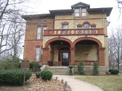
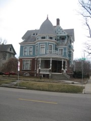
Scott-Vrooman Houseunder 500 feet1983
George H. Cox House0.1 miles1985
East Grove Street District-Bloomington0.1 miles1987
Ruben M. Benjamin House0.2 miles1978
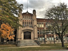
Bloomington High School0.3 miles2018
McLean County Courthouse and Square0.5 miles1973

Sources for this property

National Archives recordThe nomination case file for reference 78003110 in Record Group 79.
Wikipedia articleCommunity-written account of this property, licensed CC BY-SA.
McLean CountyAll 35 listed properties in this county.

Provenance

  • Listing record. National Park Service National Register of Historic Places, listed-properties dataset, current to 2026-05-22.
  • Map join. Address geocoded through the United States Census geocoder, then tested against the published boundary of every sheet in the USGS Historical Topographic Map Collection.
  • How this page is made. Listing fields come from federal records; map-sheet coverage is a labelled coordinate-to-boundary calculation, not a source-field claim.
  • Wildfire. Short, Karen C. 2022. Spatial wildfire occurrence data for the United States, 1992-2020 [FPA_FOD_20221014]. 6th Edition. Fort Collins, CO: Forest Service Research Data Archive. https://doi.org/10.2737/RDS-2013-0009.6 Collected with United States Government funding and usable without additional permissions or fees.
  • Mines and quarries. USGS Mineral Resources Data System (MRDS) https://mrdata.usgs.gov/mrds/ A work of the United States government, no copyright under 17 U.S.C. 105.
  • Storms. NOAA National Centers for Environmental Information, Storm Events Database https://www.ncei.noaa.gov/stormevents/ A work of the United States government, no copyright under 17 U.S.C. 105. Narratives are quoted verbatim from the National Weather Service report and are not edited or summarised.