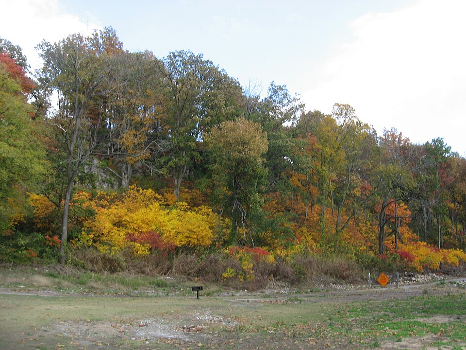
Grand Tower Mining, Manufacturing and Transportation Company Site
Listed on the National Register of Historic Places in 1979.
From the record
“The Grand Tower Mining, Manufacturing and Transportation Company Site is a 23-acre (9.3 ha) industrial site located in Devil's Backbone Park in Grand Tower, Illinois. The site was operated by the Grand Tower Mining, Manufacturing and Transportation Company, a mining and industrial company which operated in Illinois in the 1860s and 1870s.”
Wikipedia article Grand Tower Mining, Manufacturing and Transportation Company Site, CC BY-SA 4.0.
One of 19 National Register listings published here for Jackson County · listed in 1979 · category: Site.
National Register reference number.79000839- the number the National Park Service assigned this property when it was listed, and the key its nomination file is catalogued under at the National Archives.
Fires near this property
52 since 1992
Regional context, not property-specific
evidence. The
federal wildfire occurrence database
lists 52 fires within 5 miles of Grand Tower Mining, Manufacturing and Transportation Company Site
between 1992 and 2019, burning about 989 acres in total. 3 started naturally. 16 were recorded as arson.
Distance is straight-line from the map coordinates, so a fire counted
here may appear on a neighbouring settlement's page as well.
Reported cause
Fires
Missing data/not specified/undetermined
17
Arson/incendiarism
16
Debris and open burning
9
Railroad operations and maintenance
4
Natural
3
Recreation and ceremony
1
Misuse of fire by a minor
1
Power generation/transmission/distribution
1
The most recent of
them, most recent first, with the day each was reported and the service
that recorded it.
Regional context, not property-specific
evidence. The federal mineral resources record lists
10 workings within 5 miles of Grand Tower Mining, Manufacturing and Transportation Company Site: 7 past producers, 2 prospects, 1 occurrence.
None of them still produces. What was taken out: Iron, Stone, Crushed/Broken, Sand and Gravel, Construction, Lead, Zinc. Distance is straight-line from the
map coordinates, so a quarry counted here may appear on a neighbouring
settlement's page as well.
Regional context, not property-specific
evidence. The National Weather Service names
Grand Tower, the town this property stands in, in 28 storm reports between 1995 and 2025: 11 flood, 10 thunderstorm wind, 4 hail, 1 funnel cloud.
No death or injury is recorded in these reports. Each account below is quoted exactly as the forecast office
filed it, from the NOAA Storm Events Database, and each date
opens the federal record of that event.
Mississippi River levels continued their climb from December, and record or near-record flooding occurred early in the month. The river gage at Thebes downriver in Alexander County crested at a new record of 47.74 feet on the 2nd. However, the river gage upriver at Chester in Randolph County did not break a record. A voluntary evacuation of the community of Grand Tower was requested, partly due to weaknesses in the levees along the Mississippi and Big Muddy Rivers. Grand Tower sits at the confluence of the Big Muddy and Mississippi Rivers. A Red Cross shelter was opened at Murphysboro. Illinois state highway department crews transported 50,000 sandbags and 100 rolls of plastic for stabilization of slides on a levee. Four state trucks were used to haul rock to low places that needed to be raised up. Illinois Route 3 was closed at the Randolph County line due to flooding. County leaders signed a disaster declaration for the county.
Major flooding of the Big Muddy River continued into January. At the Murphysboro river gage, the river crested at 36.11 feet before dawn on the 2nd. Flood stage there is 22 feet. At Murphysboro, floodwaters approached the flood level of 2008, when the river crested at 37.19 ft on March 23. A mobile home park, a few houses, and a church were flooded or threatened. Sandbagging was done around some affected structures. A Murphysboro couple was rescued by police and firefighters after they were trapped in their home by high water. Extensive flooding of low-lying fields occurred. The intersection of 3rd and Plum Streets in Murphysboro was closed. Floodwater covered the ground below an electrical substation. Slides or slumps developed along a portion of the levee near Grand Tower, prompting concerns about levee failure. Residents were asked to voluntarily evacuate a large area behind the levee. The situation around Grand Tower was heavily affected by backwater from the Mississippi River, which was near record high levels.
Major flooding of the Mississippi River continued through the month of June. The county was included in a disaster proclamation issued by the governor. There was extensive flooding of low-lying farmland and woods. Numerous county roads were inundated. Levees began to show signs of stress due to the extended duration of the flood, which began in March. Sinkholes and sand boils developed along the levee protecting Grand Tower, which prompted emergency repairs.
Major flooding of the Mississippi River gradually ended by late July. Flood-fighting efforts in the Grand Tower area were completed after the levees were fortified. Low-lying woods, farmland, and county roads remained underwater early in the month. More detailed damage assessments began after the river fell within its banks late in the month.
The Mississippi River remained above flood stage through the month of May. There was considerable flooding of low-lying farmland and woods. Some county roads were inundated. Due to the extended duration of the flooding, levees began to show signs of stress. There was concern about the stability of the levees, and seepage became a problem. Some roads nearest the levees began to buckle.
Major flooding continued on the Mississippi River from April. Based on data from a river gage in Alexander County, the flood crest of 2011 was among the five highest crests on record. A voluntary evacuation of the community of Grand Tower was requested, partly due to a leak in a levee along the Big Muddy River. Grand Tower sits at the confluence of the Big Muddy and Mississippi Rivers.
The Mississippi River flooding in June was relatively minor compared to the April and May flooding. Several homes remained flooded, along with at least 10,000 acres of farmland. Standing water was observed on both sides of Route 3 in many areas. Several county roads remained closed. The Mississippi River remained too high to raise any of the locks and gates along the levees. As a result, the water from recent heavy rains as well as lingering floodwater from May remained trapped inland.
Moderate flooding occurred along the Mississippi River. Parts of Devil's Backbone Park in Grand Tower were underwater. The flooding continued into July.
A brief touchdown occurred in a field. No damage was observed. An eyewitness documented the tornado briefly touching down in a farm field east of Highway 3. The tornado was associated with a rapidly strengthening thunderstorm cell that moved east-southeast.
There was major flooding along the Mississippi River early in the month. Extensive flooding of low-lying agricultural land and county roads in the flood plain was observed.
Major flooding occurred along the Mississippi River. A voluntary evacuation of the community of Grand Tower was requested, partly due to a leak in a levee along the Big Muddy River. Grand Tower sits at the confluence of the Big Muddy and Mississippi Rivers.
Multiple reports of a funnel cloud were received with a supercell thunderstorm as it crossed the Mississippi River near Grand Tower. This storm had a history of funnel clouds and a tornado in Cape Girardeau County, Missouri.
No historic map-sheet match is published
for this property yet. That does not mean no map exists. This record needs
a coordinate-quality review before it can be joined to a sheet boundary.
Browse the county's mapped places while that work is
pending.
Listing record. National Park Service National Register of Historic Places, listed-properties dataset, current to 2026-05-22.
Map join. Address geocoded through the United States Census geocoder, then tested against the published boundary of every sheet in the USGS Historical Topographic Map Collection.
How this page is made. Listing fields come from federal records; map-sheet coverage is a labelled coordinate-to-boundary calculation, not a source-field claim.
Wildfire. Short, Karen C. 2022. Spatial wildfire occurrence data for the United States, 1992-2020 [FPA_FOD_20221014]. 6th Edition. Fort Collins, CO: Forest Service Research Data Archive. https://doi.org/10.2737/RDS-2013-0009.6 Collected with United States Government funding and usable without additional permissions or fees.
Mines and quarries. USGS Mineral Resources Data System (MRDS) https://mrdata.usgs.gov/mrds/ A work of the United States government, no copyright under 17 U.S.C. 105.
Storms. NOAA National Centers for Environmental Information, Storm Events Database https://www.ncei.noaa.gov/stormevents/ A work of the United States government, no copyright under 17 U.S.C. 105. Narratives are quoted verbatim from the National Weather Service report and are not edited or summarised.
 Block