BlockBefore
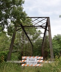
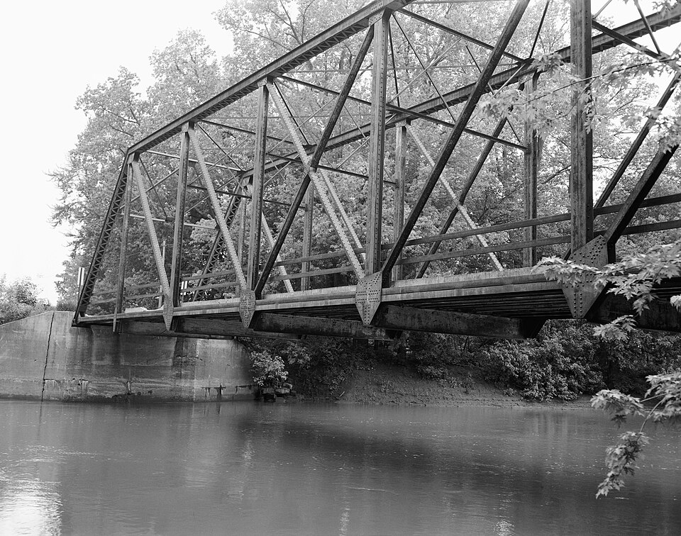
Photograph of Indian Ford Bridge
Photograph by Thomas J. Foley, Public domain. Via Wikimedia Commons.

Indian Ford Bridge

Listed on the National Register of Historic Places in 1980.

From the record

“The Indian Ford Bridge was one of nine metal highway bridges in Fulton County, Illinois listed on the National Register of Historic Places. This particular one was located along County Highway 20 as spans the Spoon River, 1.5 miles (2.4 km) southwest of London Mills.”

Wikipedia article Indian Ford Bridge, CC BY-SA 4.0.

One of 38 National Register listings published here for Fulton County · listed in 1980 · category: Structure.

Sources: the Wikipedia article · the case file at the National Archives · the National Register database, National Park Service
The listing

  • What is counted as historic. The nomination lists 1 structure as contributing to the listing.
  • Address. SR 20, London Mills, 61544
  • When was it listed? October 1980
  • Category. structure
  • Also known as. Metal Highway Bridges of Fulton County TR
  • Township. Young Hickory township
  • National Register reference number. 80001357 - the number the National Park Service assigned this property when it was listed, and the key its nomination file is catalogued under at the National Archives.

The ground it stands on

2,168 words

The chapter on Young Hickory Township in History of Fulton County, Illinois;, published 1879 names London Mills. This is what it says, exactly as the scans read.

The first school-house in the township was upon section 36 in 1835, and the first teacher was Mr. Barnes. There is no regularly surveyed town in Young Hickory, yet Midway is a little village of about forty inhabitants, and is situated upon sections 2 and 11. It contains a store, blacksmith-shop and pdsttjffice. London Mills is also another ])ostotiice in this township. It is located upon the northwest quarter of section 3. In it are two stores and a blacksmith-shop.

Passage source: History of Fulton County, Illinois;, published 1879.

Machine-read from a century-old scan, so expect the errors a machine makes: misspelled names, dropped words, stray characters.

Read the whole chapter on Young Hickory Township - 2,168 words on its settlement, mills, schools and churches.

Mines and quarries near this property

2 within 5 miles

Regional context, not property-specific evidence. The federal mineral resources record lists 2 workings within 5 miles of Indian Ford Bridge: 2 past producers. None of them still produces. What was taken out: Sand and Gravel, Construction. Distance is straight-line from the map coordinates, so a quarry counted here may appear on a neighbouring settlement's page as well.

Where SiteCommodity StatusRecorded
Glaser PitSand and Gravel, ConstructionPast Producer
Lawrence Downing Gravel PitSand and Gravel, ConstructionPast Producer

Every working recorded in Fulton County

Storms near this property

12 since 2004

Regional context, not property-specific evidence. The National Weather Service names London Mills, the town this property stands in, in 12 storm reports between 2004 and 2024: 5 thunderstorm wind, 3 flash flood, 3 hail, 1 flood. No death or injury is recorded in these reports. Each account below is quoted exactly as the forecast office filed it, from the NOAA Storm Events Database, and each date opens the federal record of that event.

WhenEvent Place namedHarm What the report says
April 2013FloodLondon Mills$3,000,000Record flooding on the Spoon River damaged 40 houses in the towns of London Mills, Bernadotte and Seville. Multiple levees along the river broke, resulting in the inundation of thousands of acres of agricultural land, nature preserves and county roads. A levee at London Mills also broke, resulting on flash flooding in the town during the evening of April 18th through the 19th. ||At Seville, the river crested at a record level of 35.83 feet on April 20th, nearly 14 feet above flood stage, and almost 3 feet above the previous record. The river gage at London Mills became disabled because of the flooding, but manual readings indicated a crest of 26.50 feet on April 19th, the second highest reading on record, and nearly 12 feet above flood stage.
April 2013Flash FloodLondon Mills$1,500,000The levee protecting the town of London Mills from the Spoon River broke in several locations during the evening of April 18th. This exacerbated the flooding which had already occurred the night before from torrential rainfall. Twenty houses were inundated on the south side of London Mills. In addition, Illinois Route 116 and County Road 2 were under several feet of water. Evacuations had been done so there were no injuries reported.
June 2021Thunderstorm WindLondon Mills$150,000Numerous trees were snapped, power lines were blown down, and a couple grain elevators were severely damaged.
June 2021Thunderstorm WindLondon Mills$90,000Farm equipment buildings were damaged and powerlines were blown into a field.
August 2007Thunderstorm WindLondon Mills$1,000A large tree was uprooted.
August 2010Flash FloodLondon Mills-Isolated thunderstorms in northwest Fulton County produced rainfall rates of 1.50 inches per hour for at least two hours which resulted in flash flooding. The flooding inundated most rural roads in the area.
May 2009Flash FloodLondon Mills-Heavy rain on already saturated ground resulted in flooded roads in much of northern Fulton County. Illinois Routes 116 and 78 near Farmington were closed. Illinois Route 9 was covered with water and impassible in spots from Checkrow to Fiatt.
September 2005Thunderstorm WindLondon Mills-A downburst, 2 to 3 blocks wide, blew down numerous trees, power lines and tree limbs. Twelve homes were damaged (3 severely), and one garage was destroyed. All damage was caused by falling trees and not from the wind gusts.
August 2004Thunderstorm WindLondon Mills-A tree fell onto a house in Canton causing minor damage.
May 2024HailLondon Mills-no account filed
July 2017HailLondon Mills-no account filed

Every storm recorded in Fulton County

Map coverage status

No historic map-sheet match is published for this property yet. That does not mean no map exists. This record needs a coordinate-quality review before it can be joined to a sheet boundary. Browse the county's mapped places while that work is pending.

Listed places nearby

3 within 8 miles

Other National Register properties close enough to walk or drive between, ordered by distance from this one. Both positions come from the same geocoding pass that matched these properties to their map sheets.

Photograph PropertyDistance Listed
London Mills Bridge1.8 miles1980
Odd Fellows Opera Block4.5 miles1996
Babylon Bend Bridge7.9 miles1980

Sources for this property

National Archives recordThe nomination case file for reference 80001357 in Record Group 79.
Wikipedia articleCommunity-written account of this property, licensed CC BY-SA.
Fulton CountyAll 38 listed properties in this county.

Provenance

  • Listing record. National Park Service National Register of Historic Places, listed-properties dataset, current to 2026-05-22.
  • Map join. Address geocoded through the United States Census geocoder, then tested against the published boundary of every sheet in the USGS Historical Topographic Map Collection.
  • How this page is made. Listing fields come from federal records; map-sheet coverage is a labelled coordinate-to-boundary calculation, not a source-field claim.
  • Mines and quarries. USGS Mineral Resources Data System (MRDS) https://mrdata.usgs.gov/mrds/ A work of the United States government, no copyright under 17 U.S.C. 105.
  • Storms. NOAA National Centers for Environmental Information, Storm Events Database https://www.ncei.noaa.gov/stormevents/ A work of the United States government, no copyright under 17 U.S.C. 105. Narratives are quoted verbatim from the National Weather Service report and are not edited or summarised.