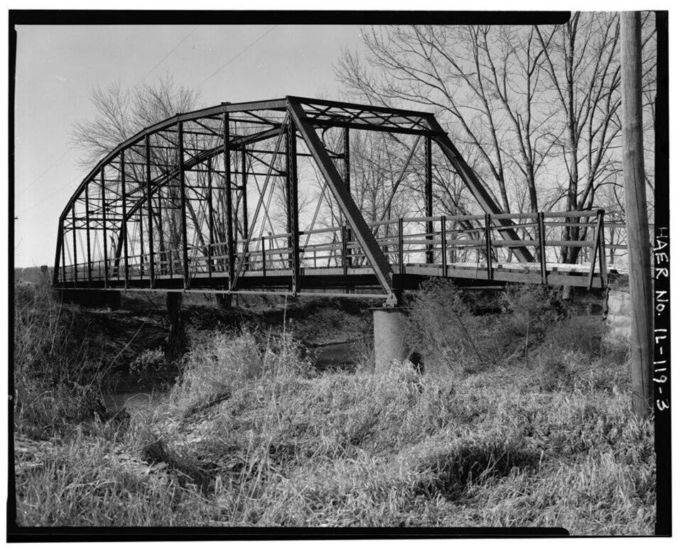
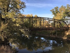
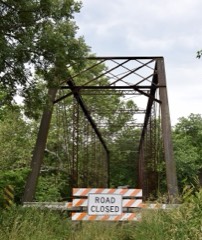
Photograph by Historic American Engineering Record, Public domain. Via
Wikimedia Commons.
Buckeye Bridge
Listed on the National Register of Historic Places in 1980.
From the record
“Buckeye Bridge also known as White's Ferry Bridge was one of nine metal highway bridges in Fulton County, Illinois once listed on the National Register of Historic Places. Buckeye is one of the five bridges that have been demolished out of nine similar bridges in the county.”
Wikipedia article Buckeye Bridge, CC BY-SA 4.0.
One of 38 National Register listings published here for Fulton County · listed in 1980 · category: Structure.
Also known as. Metal Highway Bridges of Fulton County TR
Township. Harris township
National Register reference number.80001361- the number the National Park Service assigned this property when it was listed, and the key its nomination file is catalogued under at the National Archives.
The ground it stands on
6,101 words
The chapter on Harris Township in History of Fulton County, Illinois;, published 1879 names Smithfield. This is what it says, exactly as the scans read.
Nathan Mclnfyre, a resident of Harris tp., is engaged in farming; was born in Cayuga Co., N. Y., Oct. 13, 1813; his father, in honor of whom he was named, was a native of the Empire State and of vScottish descent. Mr. Mclntyre moved to Ontario Co. in 1835, and to Illinois in 1838. He is living with his second wife. He was first united in marriage to Miss Orthy I^. Clark, July 4, 1839. She was a native of New York, and died in 1852. By her he had 7 children, 4 boys and 3 girls, 3 of whom are living and also married. He was united in marriage with Lovina McBerth Sept. 13, 1863, who is a member of the Christian Church. His son, "Waterman, enlisted in Co. G, 103d Til. Inf., and died in Washington Park Hospital, Cincinnati, O., March 27, 1865, and buried in Sj)ring Grove Cemetery. Of his daughters Mary lives in Iowa, Corlista in Smithfield, and Celinda in Irocpiois Co., 111.
Regional context, not property-specific
evidence. The
federal wildfire occurrence database
lists 4 fires within 5 miles of Buckeye Bridge
between 2019 and 2020, burning about 22 acres in total. None started naturally. None was recorded as arson.
Distance is straight-line from the map coordinates, so a fire counted
here may appear on a neighbouring settlement's page as well.
Reported cause
Fires
Debris and open burning
3
Railroad operations and maintenance
1
The most recent of
them, most recent first, with the day each was reported and the service
that recorded it.
Regional context, not property-specific
evidence. The federal mineral resources record lists
2 workings within 5 miles of Buckeye Bridge: 2 past producers.
None of them still produces. What was taken out: Sand and Gravel, Construction. Distance is straight-line from the
map coordinates, so a quarry counted here may appear on a neighbouring
settlement's page as well.
Regional context, not property-specific
evidence. The National Weather Service names
Smithfield, the town this property stands in, in 20 storm reports between 1995 and 2026: 9 thunderstorm wind, 8 hail, 2 tornado, 1 flash flood.
No death or injury is recorded in these reports. Each account below is quoted exactly as the forecast office
filed it, from the NOAA Storm Events Database, and each date
opens the federal record of that event.
A tornado touched down in a field about 1.5 miles ESE of Smithfield at 4:38pm CDT. The tornado travelled slowly southeastward, impacting one farmstead along its path. A pole barn and small shed were destroyed, with flying debris from the barn causing minor roof and siding damage to the house. The tornado continued along its path doing minor crop damage along the way before dissipating 3 miles SSW of Cuba at 4:48pm CDT.
A tornado touched down 1.2 miles northwest of Smithfield at the west end of Stevens Road in a field. The tornado then briefly lifted before touching down once again in a field near Old Miller Lane. An unoccupied 15 foot travel trailer was picked up and destroyed. The tornado then lifted and dissipated. No injuries were reported.
No historic map-sheet match is published
for this property yet. That does not mean no map exists. This record needs
a coordinate-quality review before it can be joined to a sheet boundary.
Browse the county's mapped places while that work is
pending.
Listed places nearby
4 within 8 miles
Other National Register properties close
enough to walk or drive between, ordered by distance from this one. Both
positions come from the same geocoding pass that matched these properties
to their map sheets.
Listing record. National Park Service National Register of Historic Places, listed-properties dataset, current to 2026-05-22.
Map join. Address geocoded through the United States Census geocoder, then tested against the published boundary of every sheet in the USGS Historical Topographic Map Collection.
How this page is made. Listing fields come from federal records; map-sheet coverage is a labelled coordinate-to-boundary calculation, not a source-field claim.
Wildfire. Short, Karen C. 2022. Spatial wildfire occurrence data for the United States, 1992-2020 [FPA_FOD_20221014]. 6th Edition. Fort Collins, CO: Forest Service Research Data Archive. https://doi.org/10.2737/RDS-2013-0009.6 Collected with United States Government funding and usable without additional permissions or fees.
Mines and quarries. USGS Mineral Resources Data System (MRDS) https://mrdata.usgs.gov/mrds/ A work of the United States government, no copyright under 17 U.S.C. 105.
Storms. NOAA National Centers for Environmental Information, Storm Events Database https://www.ncei.noaa.gov/stormevents/ A work of the United States government, no copyright under 17 U.S.C. 105. Narratives are quoted verbatim from the National Weather Service report and are not edited or summarised.
 Block