BlockBefore
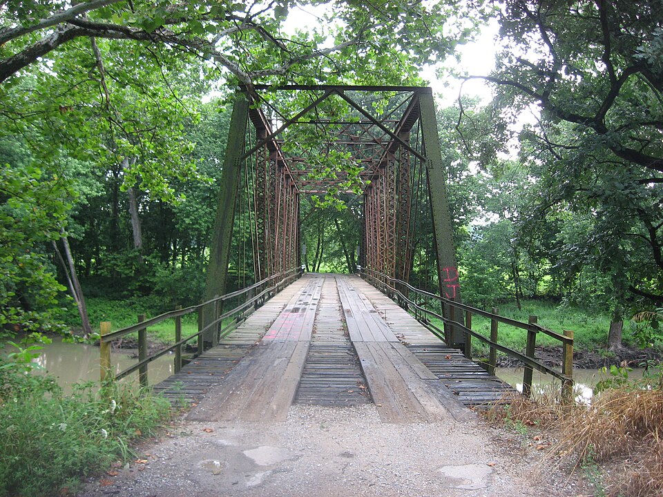
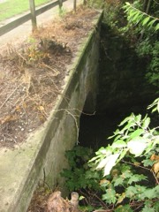
Photograph of Airtight Bridge
Photograph by Nyttend, Public domain. Via Wikimedia Commons.

Airtight Bridge

Built in 1914. Listed on the National Register of Historic Places in 1981.

From the record

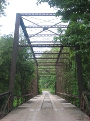
“The Airtight Bridge is a steel bridge spanning the Embarras River in Coles County, Illinois, in the United States 8 miles (13 km) north of Charleston, Illinois. The bridge is a Pratt through truss bridge with a steel structure, a wooden deck, and concrete piers.”

Wikipedia article Airtight Bridge, CC BY-SA 4.0.

One of 24 National Register listings published here for Coles County · listed in 1981 · category: Structure · built in 1914.

Sources: the Wikipedia article · the case file at the National Archives · the National Register database, National Park Service

The listing

  • What is counted as historic. The nomination lists 1 structure as contributing to the listing.
  • Address. NE of Charleston, Charleston, 61912
  • When was it listed? November 1981
  • Category. structure
  • Also known as. Coles County Highway Bridges Over the Embarras River TR
  • Township. Ashmore township
  • When was it built? 1914
  • National Register reference number. 81000211 - the number the National Park Service assigned this property when it was listed, and the key its nomination file is catalogued under at the National Archives.

The ground it stands on

2,495 words

The chapter on Ashmore Township in The History of Coles County, Illinois ... Map of Coles County; History of Illinois ... History of Northwest ... Constitution of the United States, Miscellaneous Matters, &c., &c, published 1879 names Charleston. This is what it says, exactly as the scans read.

Hebron Church, of the Old-School Presbyterians, was organized on the 19th June, 1841, by a committee appointed by Palestine Presbytery, consisting of Revs. Isaac Bennett and James Reasoner, and Ruling Elders J. Balch and William Collom. The original members who went into the organization were Robert Brooks, Mary Brooks, James H. Bovell, Jane M. Bovell, Alfred J. L. Brooks, Mary Brooks, Robert A. Brooks, Samuel Hogue, Letitia Hogue, Sarah Moflfett, James Moffett, Thomas C. Mitchell, Isabella A. Mitchell, Margarist J. Mitchell and Cynthia Moffett. The first Ruling Elders were Thomas C. Mitchell and Robert Brooks. Rev. Isaac Bennett preached occasionally for the Church for one year. He was succeeded by Rev. John McDowell, who preached twice a month for two years, beginning in May. 1842. Rev. John Steele was stated supply for the Church from 1844 to 1849, giving it one-half of his time. He was succeeded by Rev. Joseph A. Jams in February, 1849, who supplied the pulpit for two years. From 1851 to 1855, Rev. James Cameron, who lived in Charleston, preached occasionally. For the next ten years, from 1855 to 1865, various ministers were connected with the church as stated supplies, giving it a part of their time from their other charges in the following order : Revs. John McDole, A. J. Cameron, R. A. Mitchell, James A. Allison, H. I. Venable and Nathaniel Williams. In October, 1865, Rev.

Passage source: The History of Coles County, Illinois ... Map of Coles County; History of Illinois ... History of Northwest ... Constitution of the United States, Miscellaneous Matters, &c., &c, published 1879.

Machine-read from a century-old scan, so expect the errors a machine makes: misspelled names, dropped words, stray characters.

Read the whole chapter on Ashmore Township - 2,495 words on its settlement, mills, schools and churches.

Mines and quarries near this property

5 within 5 miles

Regional context, not property-specific evidence. The federal mineral resources record lists 5 workings within 5 miles of Airtight Bridge: 3 past producers, 2 producers. 2 still produce. What was taken out: Stone, Crushed/Broken, Sand and Gravel, Construction. Distance is straight-line from the map coordinates, so a quarry counted here may appear on a neighbouring settlement's page as well.

Where SiteCommodity StatusRecorded
Charleston Pit & PlantSand and Gravel, ConstructionProducer
Hood & Son S&G PitSand and Gravel, ConstructionPast Producer
Charleston QuarryStone, Crushed/BrokenProducer
Lang QuarryStone, Crushed/BrokenPast Producer
Unnamed Limestone QuarryStone, Crushed/BrokenPast Producer

Every working recorded in Coles County

Storms near this property

60 of 61 shown

Regional context, not property-specific evidence. The National Weather Service names Charleston, the town this property stands in, in 61 storm reports between 1995 and 2025: 36 thunderstorm wind, 22 hail, 2 lightning, 1 flash flood. No death or injury is recorded in these reports. Each account below is quoted exactly as the forecast office filed it, from the NOAA Storm Events Database, and each date opens the federal record of that event.

WhenEvent Place namedHarm What the report says
June 1995Thunderstorm WindCharleston$200,000Thunderstorm winds damaged two barns and blew part of the roof off of a mall, causing damage to five buisnesses. Also, several downed trees damaged two homes and numerous power lines were blown down. Numerous trees were blown down and several windows were broken by flying debris at Eastern Illinois University. Damage was estimated around $200 thousand.
June 2018LightningCharleston$100,000Lightning struck a business on the north side of Charleston, causing extensive fire and smoke damage.
July 2010Thunderstorm WindCharleston$75,000Two homes on North 6th Street sustained significant structural damage due to a large 4-foot diameter tree falling on them.
June 2019Thunderstorm WindCharleston$40,000Numerous trees and power lines were blown down.
June 2015Thunderstorm WindCharleston$40,000Numerous power lines were blown down and a few trees were snapped in half.
August 2012Thunderstorm WindCharleston$30,000Several tree limbs were blown down across Charleston. A power pole was knocked down as well.
June 2008Thunderstorm WindCharleston$30,000Numerous trees and power lines were blown down.
July 2016Thunderstorm WindCharleston$25,000Several trees were blown down.
October 2010Thunderstorm WindCharleston$18,000Three untility poles were knocked down and numerous tree branches were blown into electrical lines near Charleston.
July 2011Thunderstorm WindCharleston$15,000Several tree branches were blown down in Charleston.
October 2014Thunderstorm WindCharleston$8,000A large tree branch was blown onto a car on the Eastern Illinois University campus.
June 2019LightningCharleston$5,000Lightning struck a tree, causing it to fall onto a house in Charleston.
April 2011Thunderstorm WindCharleston$5,000Shingles were blown off a roof and an 8-inch diameter tree was knocked down.
September 2012Thunderstorm WindCharleston$4,000A tree was blown down across 14th Street in Charleston. Another tree fell onto Harrison Street.
August 2016Thunderstorm WindCharleston$3,000A tree was blown onto power lines on Harrison Street in Charleston.
May 2015Thunderstorm WindCharleston$2,000A tree was blown down.
July 2010Thunderstorm WindCharleston$2,000A large TV/Radio antenna tower was torn from a house and blown over.
March 2025Thunderstorm WindCharleston-Several power poles were blown down.
July 2025Thunderstorm WindCharleston-A large tree was blown onto a home.
August 2023Thunderstorm WindCharleston-Several large tree branches were blown down.
June 2023Thunderstorm WindCharleston-A small tree was snapped on the Eastern Illinois University campus.
June 2023Thunderstorm WindCharleston-A few trees and numerous tree branches were blown down. Several streets were closed due to debris.
June 2023Thunderstorm WindCharleston-Numerous tree branches were blown down.
May 2021Thunderstorm WindCharleston-A tree was blown down.
June 2021Thunderstorm WindCharleston-A few tree branches and a power line were blown down.
June 2019Thunderstorm WindCharleston-A large tree was blown over along County Road 1800E.
August 2019Thunderstorm WindCharleston-Broken tree branches took down power lines in numerous locations across Charleston.
August 2019Thunderstorm WindCharleston-Power lines were blown down near 13th and Jefferson.
August 2017Thunderstorm WindCharleston-A flag pole was blown down on Lincoln Highway Road about 3 miles southwest of Charleston.
June 2007Flash FloodCharleston-Several roads were closed for a few hours in Charleston due to flooding.
June 2005Thunderstorm WindCharleston-Tree blown down.
November 2005Thunderstorm WindCharleston-Large tree blown down.
May 2004Thunderstorm WindCharleston-A large tree was blown down.
May 2004Thunderstorm WindCharleston-Several large trees were uprooted in Charleston.
May 2003HailCharleston-Several rounds of hail fell between Charleston and Ashmore. The stones ranged in size from three quarters of an inch to 2 inches in diameter.
May 2003Thunderstorm WindCharleston-Numerous trees and power lines were blown down in the Charleston area.
April 2002Thunderstorm WindCharleston-The roof of a shed was blown off.
March 2024HailCharleston-no account filed
May 2020HailCharleston-no account filed
May 2018HailCharleston-no account filed
April 2015HailCharleston-no account filed
February 2011HailCharleston-no account filed
May 2011HailCharleston-no account filed
July 2010HailCharleston-no account filed
June 2006HailCharleston-no account filed
August 2005Thunderstorm WindCharleston-no account filed
September 2003HailCharleston-no account filed
April 2001HailCharleston-no account filed
May 2000Thunderstorm WindCharleston-no account filed
July 1997HailCharleston-no account filed
August 1997HailCharleston-no account filed
June 1997HailCharleston-no account filed

Every storm recorded in Coles County

Map coverage status

No historic map-sheet match is published for this property yet. That does not mean no map exists. This record needs a coordinate-quality review before it can be joined to a sheet boundary. Browse the county's mapped places while that work is pending.

Listed places nearby

6 within 8 miles

Other National Register properties close enough to walk or drive between, ordered by distance from this one. Both positions come from the same geocoding pass that matched these properties to their map sheets.

Photograph PropertyDistance Listed
Stone Quarry Bridge2.8 miles1981
Harrison St. Bridge4.6 miles1981
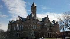
Coles County Courthouse5.7 miles1978
Sixth, Seventh, and Tenth Street Stone Arch Bridges5.8 miles2001
McFarland House6.0 miles1991
Alexander Briggs House6.2 miles1980

Sources for this property

National Archives recordThe nomination case file for reference 81000211 in Record Group 79.
Wikipedia articleCommunity-written account of this property, licensed CC BY-SA.
Coles CountyAll 24 listed properties in this county.

Provenance

  • Listing record. National Park Service National Register of Historic Places, listed-properties dataset, current to 2026-05-22.
  • Map join. Address geocoded through the United States Census geocoder, then tested against the published boundary of every sheet in the USGS Historical Topographic Map Collection.
  • How this page is made. Listing fields come from federal records; map-sheet coverage is a labelled coordinate-to-boundary calculation, not a source-field claim.
  • Mines and quarries. USGS Mineral Resources Data System (MRDS) https://mrdata.usgs.gov/mrds/ A work of the United States government, no copyright under 17 U.S.C. 105.
  • Storms. NOAA National Centers for Environmental Information, Storm Events Database https://www.ncei.noaa.gov/stormevents/ A work of the United States government, no copyright under 17 U.S.C. 105. Narratives are quoted verbatim from the National Weather Service report and are not edited or summarised.