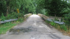
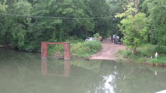
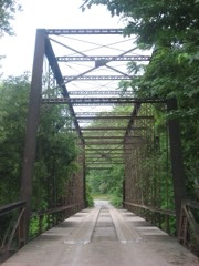
| June 2008 | Flood | Cooks Mills | 1 killed, $250,000 | Numerous roads were flooded due to heavy rain ranging from 5 to 7 inches across Coles County. Basements flooded in numerous homes throughout the county. On June 5th, a 72 year old male, drown while attempting to cross a bridge flooded by the Kaskaskia River, about 2 miles north of Cooks Mills. Coles County was declared a disaster area as a result of the extensive flooding. |
| December 1971 | Tornado (F1) | not stated | 24 hurt, $250,000 | no account filed |
| April 1986 | Thunderstorm Wind | not stated | 5 hurt | no account filed |
| March 1998 | Tornado (F2) | Mattoon | 3 hurt, $3,000,000 | A tornado touched down 1 mile southwest of Mattoon and travelled to the northeast. It damaged 4 homes in the initial touchdown area and then crossed a set of railroad tracks turning over 4 empty 30-ton coal cars. After crossing the railroad tracks, the tornado hit a self-storage facility, where six of the ten buildings in the complex were destroyed. The tin and steel girder buildings were not bolted down to the cement slabs, so they were lifted up, "wadded up" into a big pile, and deposited downstream about 200 yards. Further to the northeast, it damaged or destroyed numerous homes and businesses before lifting. It remained aloft for several blocks, then touched down again, tearing off treetops and damaging several roofs in the area. It lifted again and touched down a final time about a block away. Damage in this area was to tree tops and roofs. Overall, the tornado was on the ground for 1.5 miles and it either damaged or destroyed 120 homes and businesses. Damage is estimated between $2.5 and $3 million. Two people sustained minor injuries and one 9 year old child was seriously injured when a picture frame blew off the wall, hit her in the back, and cut her, causing her left lung to partially collapse. |
| July 1958 | Tornado (F3) | not stated | 3 hurt, $25,000 | no account filed |
| March 1986 | Thunderstorm Wind | not stated | 3 hurt | no account filed |
| August 2012 | Thunderstorm Wind | Mattoon | 2 hurt, $40,000 | Numerous trees were blown down and a few power poles were snapped along Route 16 west of Mattoon. Two people were injured when they were hit by falling tree branches as they were trying to take shelter from the storm. A semi and trailer were blown over on Route 16 2 miles west of Mattoon. Many corn fields sustained wind damage as well. |
| September 2003 | Tornado (F1) | Mattoon | 1 hurt, $10,000,000 | A tornado touched down 4 miles north northeast of Mattoon near a printing plant. It then traveled east damaging several buildings at the plant. Almost 500,000 square feet of the roof was damaged or destroyed. Contents in the buildings including electronic equipment and over 5 million pounds of paper were damaged. With over 400 employees in the plant at the time of the tornado, only one person suffered minor injuries but didn't need immediate medical attention. After hitting the plant, the tornado damaged some outbuildings at a nearby farm before lifting and dissipating. Damage to the plant was estimated around $10 million. |
| March 1974 | Tornado (F2) | not stated | 1 hurt, $250,000 | no account filed |
| July 2009 | Lightning | Mattoon | 1 hurt | An employee at WMCI radio in Mattoon was injured when lightning struck the radio station tower. The employee was indoors, working on radio transmission equipment. |
| April 1994 | Tornado (F1) | Cooks Mills | $5,000,000 | A tornado touched down three miles north of Cooks Mills and lifted five miles NE of Cooks Mills. Some farm equipment was damaged, as well as, four high voltage power lines. Damage is estimated between $620,000 and $700,000. |
| June 1999 | Flash Flood | Central Portion | $3,000,000 | no account filed |
| April 2018 | Flash Flood | Mattoon | $2,000,000 | A steady, but moderate to heavy rain, moved into the southern parts of Coles County shortly after 7 am CDT. Thunderstorms caused the rain to intensify between 9:00 and 10:00 am CDT, when nearly 2.00 inches of rain was measured. Total rainfall ranged from 4.00 to 6.00 inches in about a nine hour period. Flash flooding rapidly developed in Mattoon, Charleston and other surrounding areas, where numerous streets were flooded and had to be closed. Illinois Route 16 was closed in several spots as well as parts of I-57 between milepost 184 and 192. Five houses in Mattoon were flooded, resulting in the evacuation of 11 people, where the water was 3 to 5 feet deep, mainly due to the flooding of Kickapoo Creek. Numerous water rescues were also conducted by local officials for people trapped in vehicles. Lakeland College just south of Mattoon cancelled classes due to all of the road closures from the flooding. |
| June 2008 | Tornado (EF1) | Trilla | $275,000 | The tornado formed in an open field 2.5 miles west southwest of Lerna, and was moving to the east northeast around 45 MPH. The tornado damaged a barn and blew down several trees southwest of Lerna. As the tornado moved through Lerna, it caused roof, window and siding damage to 9 homes, and roof damage to a school. Numerous trees were also blown down in Lerna. The tornado continued across open fields and forested areas before it dissipated 2.5 miles east northeast of Lerna. The tornado was rated EF1 with highest estimated winds of 95 MPH. |
| January 2013 | Thunderstorm Wind | Ashmore | $250,000 | Strong thunderstorm winds snapped 64 power poles along Illinois Route 16 near Ashmore. 30 poles were snapped west of Ashmore and 34 east of town. The John Deere Implement Company suffered roof damage to three of its buildings on the southwest side of Ashmore. In addition, three empty grain bins and several outbuildings were damaged north of town. |
| June 2008 | Thunderstorm Wind | Mattoon | $250,000 | Widespread tree and power line damage occurred in and around Mattoon. In addition, several buildings in town sustained roof damage, a cinder block wall partly collapsed at a tire dealership, and numerous vehicles were damaged at a car dealership by flying debris. |
| May 1989 | Tornado (F1) | not stated | $250,000 | no account filed |
| November 1988 | Tornado (F1) | not stated | $250,000 | no account filed |
| May 1986 | Tornado (F1) | not stated | $250,000 | no account filed |
| April 1982 | Tornado (F1) | not stated | $250,000 | no account filed |
| June 1995 | Thunderstorm Wind | Charleston | $200,000 | Thunderstorm winds damaged two barns and blew part of the roof off of a mall, causing damage to five buisnesses. Also, several downed trees damaged two homes and numerous power lines were blown down. Numerous trees were blown down and several windows were broken by flying debris at Eastern Illinois University. Damage was estimated around $200 thousand. |
| April 1997 | Thunderstorm Wind | Lerna | $126,000 | A line of severe thunderstorms moved across Coles County causing a lot of damage. Three miles southeast of Lerna a machine shed, a small storage shed, and a grain bin were destroyed. Also, a motor home, several vehicles, and a house roof sustained minor damage. Numerous trees and tree limbs were blown down as well. At the same time in the Bushton, Fairgrange, and Charleston areas, several trees were blown down, with one causing minor damage to a building. Also, a barn roof and a grain bin were destroyed. As the storms moved further east, winds blew down numerous trees and tree limbs in the Ashmore area. One tree fell onto a house causing $1,000 in damage and several trees in the local cemetery fell, damaging some grave markers. Also, two large barns were destroyed 2 miles south of Ashmore and numerous homes and other farm buildings sustained minor damage. No injuries were reported and damage was estimated around $125,950. |
| May 2013 | Thunderstorm Wind | Mattoon | $125,000 | Numerous trees, tree branches, and power poles were blown down throughout Mattoon. |
| June 2018 | Lightning | Charleston | $100,000 | Lightning struck a business on the north side of Charleston, causing extensive fire and smoke damage. |
| April 2020 | Thunderstorm Wind | Oakland | $75,000 | Several small tree branches were blown down and shingles were blown off roofs. |
| June 2016 | Thunderstorm Wind | Mattoon | $75,000 | Empty semi trailers were pushed over and numerous trees and power lines were blown down. |
| July 2010 | Thunderstorm Wind | Charleston | $75,000 | Two homes on North 6th Street sustained significant structural damage due to a large 4-foot diameter tree falling on them. |
| May 2008 | Thunderstorm Wind | Ashmore | $70,000 | Seventeen power poles were blown down near the intersection of state highway 16 and 49. |
| August 2012 | Thunderstorm Wind | Mattoon | $65,000 | Numerous trees and power poles were blown down across Mattoon. Electricity was knocked out to many residents for about 2 hours. Power lines were blown down and blocked Lake Mattoon Road. |
| July 2016 | Thunderstorm Wind | Mattoon | $60,000 | A tree was blown onto a garage on 22nd Street and several trees and tree branches were blown down along Western Avenue. |
| May 2013 | Thunderstorm Wind | Oakland | $60,000 | A pole barn was damaged and shingles were torn off homes nearby. |
| May 1998 | Thunderstorm Wind | Countywide | $60,000 | A line of severe thunderstorms moved southeast across Coles County. It caused considerable damage. Numerous trees, power poles, and power lines were blown down throughout the county. One tree fell onto a house in Mattoon damaging the roof and front porch. Also, the thunderstorm winds peeled about a third of the roof off the high school gym in Mattoon. No injuries were reported and damage to the high school was estimated around $60,000. |
| June 2009 | Thunderstorm Wind | Mattoon | $50,000 | A substation was damaged by strong winds. |
| April 1999 | Tornado (F0) | Campbell | $50,000 | A tornado touched down on the southwest side of Janesville (Cumberland County side of town). It hopped and skipped along a northeast path through town causing scattered damage. Three homes sustained moderate damage and an above ground pool was destroyed. A front porch on one of the homes was destroyed. Several trees were blown down as well. The tornado lifted on the northeast side of town (in Coles County). No injuries were reported and damage was estimated around $100,000. |
| May 2009 | Thunderstorm Wind | Etna | $45,000 | A mobile home was blown off its foundation on the west side of Lake Mattoon. Another mobile home was damaged on the east side of Lake Mattoon and several trees were blown down in the area. |
| June 2019 | Thunderstorm Wind | Charleston | $40,000 | Numerous trees and power lines were blown down. |
| July 2016 | Thunderstorm Wind | Mattoon | $40,000 | Numerous trees were blown onto power lines near East County Road 1000N and Dole Road. |
| June 2015 | Thunderstorm Wind | Charleston | $40,000 | Numerous power lines were blown down and a few trees were snapped in half. |
| June 2008 | Thunderstorm Wind | Lerna | $40,000 | A mobile home was destroyed. |
| August 2012 | Thunderstorm Wind | Lerna | $35,000 | Numerous trees and power lines were blown down in Lerna. |
| June 2016 | Thunderstorm Wind | Mattoon | $32,000 | Several power lines were blown down just west of Mattoon. |
| August 2012 | Thunderstorm Wind | Charleston | $30,000 | Several tree limbs were blown down across Charleston. A power pole was knocked down as well. |
| May 2008 | Thunderstorm Wind | Oakland | $30,000 | Numerous trees and tree limbs were blown down. The roof was blown off an outbuilding. |
| June 2008 | Thunderstorm Wind | Oakland | $30,000 | Numerous trees, tree limbs, and power lines were blown down. |
| June 2008 | Thunderstorm Wind | Charleston | $30,000 | Numerous trees and power lines were blown down. |
| July 2008 | Thunderstorm Wind | Dorans | $30,000 | A mobile home was blown over along US-45 2 miles north of Mattoon. |
| August 2009 | Thunderstorm Wind | Lerna | $28,000 | Several trees were blown down in Lerna. One tree fell on a car, while two others fell on houses, causing roof damage. |
| July 2016 | Thunderstorm Wind | Mattoon | $25,000 | Several large tree branches were blown down in Mattoon. |
| July 2016 | Thunderstorm Wind | (Mto)Mattoon/Chrlstn | $25,000 | Power lines were blown down near the Coles County Airport. |
| July 2016 | Thunderstorm Wind | Charleston | $25,000 | Several trees were blown down. |
| September 2015 | Thunderstorm Wind | Mattoon | $25,000 | Several tree branches were blown down around Mattoon. One tree fell onto a house. |
| July 2013 | Thunderstorm Wind | Mattoon | $25,000 | Numerous tree branches and power lines were blown down on the west side of Mattoon. |
| June 2011 | Thunderstorm Wind | Mattoon | $25,000 | Several tree limbs were blown down in Mattoon. |
| July 2008 | Thunderstorm Wind | Mattoon | $25,000 | The roof was damaged at Central Illinois Transmission in Mattoon. There were also several trees and power lines blown down in the area. |
| July 2008 | Thunderstorm Wind | Oakland | $25,000 | Numerous trees were blown down in Oakland, causing power outages from Oakland to Ashmore. |
| April 1974 | Tornado (F1) | not stated | $25,000 | no account filed |
| June 1972 | Tornado (F1) | not stated | $25,000 | no account filed |
| May 1960 | Tornado (F2) | not stated | $25,000 | no account filed |
| May 2018 | Thunderstorm Wind | Hutton | $24,000 | Powerlines were blown down. |
| June 2011 | Thunderstorm Wind | Lerna | $20,000 | Numerous tree limbs and power lines were blown down in Lerna. |
 Block