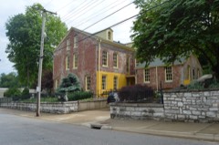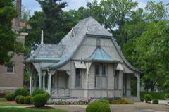
BlockBefore
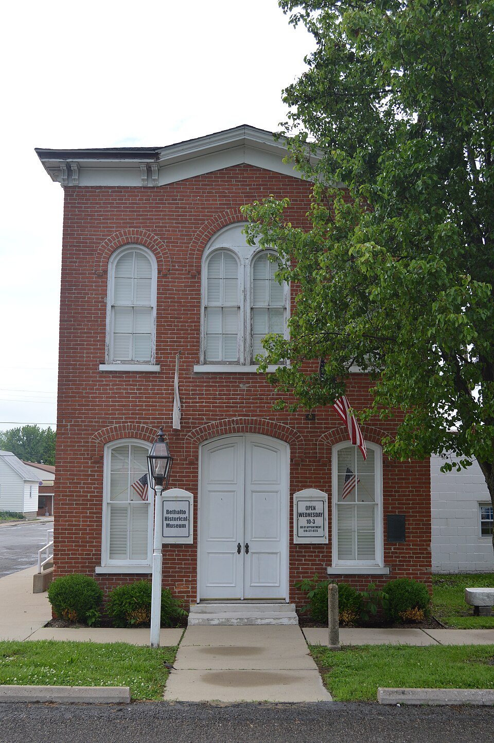
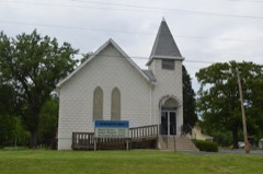
Photograph of Bethalto Village Hall
Photograph by Nyttend, Public domain. Via Wikimedia Commons.

Bethalto Village Hall

Listed on the National Register of Historic Places in 1987.

From the record

“The Bethalto Village Hall is the former center of government of Bethalto, Illinois. Built in 1873, the building is the oldest remaining city hall building in Madison County.”

Wikipedia article Bethalto Village Hall, CC BY-SA 4.0.

One of 40 National Register listings published here for Madison County · listed in 1987 · category: Building.

Sources: the Wikipedia article · the case file at the National Archives · the National Register database, National Park Service
The listing

  • What is counted as historic. The nomination lists 1 building as contributing to the listing.
  • Address. 124 Main St., Bethalto, 62010
  • When was it listed? December 1987
  • Category. building
  • Township. Wood River township
  • Architectural style. Renaissance Revival architecture
  • National Register reference number. 87002049 - the number the National Park Service assigned this property when it was listed, and the key its nomination file is catalogued under at the National Archives.

The ground it stands on

6,541 words

The chapter on Wood River Township in Centennial History of Madison County, Illinois, and Its People, 1812 to 1912, published 1912 names Bethalto. This is what it says, exactly as the scans read.

The principal industry of Bethalto for many years was milling. It is surrounded by a rich agricultural country which marketed its grain in that village. The President Mill and Ele¬ vator was established in 1859 by James Neimrich. The capacity of the mill was 100 bar- rels of flour per day. It was rebuilt and en¬ larged in 1877, by Meyer & Guye, with a capa¬ city of 500 barrels per day. In 1881 it was purchased by John W. Kaufman who in¬ creased its capacity to 600 barrels. After a prosperous career it was destroyed by fire in March, 1896. As it employed a large force of hands its destruction was a great disaster to the village. The effect was shown by the shrinkage in population. In 1890 the vil¬ lage had a population of 879; in 1900 it was 477, and in 1910, 447. After the President mill burned John Weidmer, who owned it at that time, did not rebuild it but started in the grain business, as his elevator had been saved. Shortly after Jacob and John Kauffman bought him out and operated the elevator un¬ der the name of the Kauffman Milling Com¬ pany. The Farmers' Elevator Company was formed next. This company bought out the Kauffmans but later sold out to B. C. Munday, in June, 1911, who now owns the eleva¬ tor.

Passage source: Centennial History of Madison County, Illinois, and Its People, 1812 to 1912, published 1912.

Another mill, the Bethalto Custom and Merchants Mill, was established by J. E. Ewan, in 1872. C. H. Flick was at one time a partner, the firm being Ewan & Flick. Mr. Ewan died in 1906. The mill was then pur¬ chased by Tobias Brothers who still conduct it. Bethalto has several stores and minor in¬ dustries, including coal mining, and a bank with a capital of $25,000. It was founded by B. C. Munday in 1903 and later reorganized as a State bank. The officers are : B. C. Mun¬ day, president; George Richards, vice pres¬ ident; Ed. Starkey, cashier, and Herb Starkey, assistant cashier.

Passage source: Centennial History of Madison County, Illinois, and Its People, 1812 to 1912, published 1912.

Machine-read from a century-old scan, so expect the errors a machine makes: misspelled names, dropped words, stray characters.

Read the whole chapter on Wood River Township - 6,541 words on its settlement, mills, schools and churches.

Fires near this property

1 since 2008

Regional context, not property-specific evidence. The federal wildfire occurrence database lists 1 fire within 5 miles of Bethalto Village Hall in 2008, burning about 1 acre in total. None started naturally. None was recorded as arson. Distance is straight-line from the map coordinates, so a fire counted here may appear on a neighbouring settlement's page as well.

Reported cause Fires
Missing data/not specified/undetermined1

The most recent of them, most recent first, with the day each was reported and the service that recorded it.

DateCause SizeReported by Name on the report
29 January 2008Missing data/not specified/undetermined1.0 acresIllinois Division of Forestry ResourcesRUPPERT

Every fire recorded in Madison County

Mines and quarries near this property

3 within 5 miles

Regional context, not property-specific evidence. The federal mineral resources record lists 3 workings within 5 miles of Bethalto Village Hall: 1 plant, 1 past producer, 1 producer. 2 still produce. What was taken out: Sulfur, Stone, Stone, Crushed/Broken. Distance is straight-line from the map coordinates, so a quarry counted here may appear on a neighbouring settlement's page as well.

Where SiteCommodity StatusRecorded
(Facility) Shell Oil Wood River RefinerySulfurPlant
Alton MineStone, Crushed/BrokenProducer
Wood City PitStonePast Producer

Every working recorded in Madison County

Storms near this property

16 since 1998

Regional context, not property-specific evidence. The National Weather Service names Bethalto, the town this property stands in, in 16 storm reports between 1998 and 2018: 9 thunderstorm wind, 7 hail. No death or injury is recorded in these reports. Each account below is quoted exactly as the forecast office filed it, from the NOAA Storm Events Database, and each date opens the federal record of that event.

WhenEvent Place namedHarm What the report says
July 2018Thunderstorm WindBethalto-Thunderstorm winds blew down a large tree onto a house in Bethalto causing moderate damage.
May 2008Thunderstorm WindBethalto-Storm spotters reported power lines down.
June 2007Thunderstorm WindBethalto-Storm spotters reported 1 inch hail, 1 large tree, and some large tree limbs down in Bethalto.
April 2006Thunderstorm WindBethalto-Large tree limbs and power lines were downed by thunderstorm wind gusts.
July 2006HailBethalto-A swath of large hail to the size of quarters fell from 7.5 miles northeast of Bethalto southward towards the intersection of Illinois Routes 159 and 140. Several hundred acres of corn were damaged along and west of Illinois Route 159.
June 2001Thunderstorm WindBethalto-Thunderstorm wind gusts caused scattered damage across the Bethalto area. Trees and large limbs were downed across town many of which fell on vehicles causing damage. At least one garage was heavily damaged by a downed tree. Downed electric lines knocked out power to about 1000 people.
May 2018HailBethalto-no account filed
March 2012HailBethalto-no account filed
May 2011HailBethalto-no account filed
July 2008Thunderstorm WindBethalto-no account filed
August 2008Thunderstorm WindBethalto-no account filed
May 2008HailBethalto-no account filed
March 2007HailBethalto-no account filed
June 2007HailBethalto-no account filed
June 2005Thunderstorm WindBethalto-no account filed
June 1998Thunderstorm WindBethalto-no account filed

Every storm recorded in Madison County

Map coverage status

No historic map-sheet match is published for this property yet. That does not mean no map exists. This record needs a coordinate-quality review before it can be joined to a sheet boundary. Browse the county's mapped places while that work is pending.

Listed places nearby

6 within 8 miles

Other National Register properties close enough to walk or drive between, ordered by distance from this one. Both positions come from the same geocoding pass that matched these properties to their map sheets.

Photograph PropertyDistance Listed
Upper Alton Historic District5.5 miles1978
Salem Baptist Church5.9 miles2013
Yakel House and Union Brewery6.7 miles1982
Alton National Cemetery6.7 miles2011
Haskell Playhouse7.3 miles1974
Lyman Trumbull House7.3 miles1975

Sources for this property

National Archives recordThe nomination case file for reference 87002049 in Record Group 79.
Wikipedia articleCommunity-written account of this property, licensed CC BY-SA.
Madison CountyAll 40 listed properties in this county.

Provenance

  • Listing record. National Park Service National Register of Historic Places, listed-properties dataset, current to 2026-05-22.
  • Map join. Address geocoded through the United States Census geocoder, then tested against the published boundary of every sheet in the USGS Historical Topographic Map Collection.
  • How this page is made. Listing fields come from federal records; map-sheet coverage is a labelled coordinate-to-boundary calculation, not a source-field claim.
  • Wildfire. Short, Karen C. 2022. Spatial wildfire occurrence data for the United States, 1992-2020 [FPA_FOD_20221014]. 6th Edition. Fort Collins, CO: Forest Service Research Data Archive. https://doi.org/10.2737/RDS-2013-0009.6 Collected with United States Government funding and usable without additional permissions or fees.
  • Mines and quarries. USGS Mineral Resources Data System (MRDS) https://mrdata.usgs.gov/mrds/ A work of the United States government, no copyright under 17 U.S.C. 105.
  • Storms. NOAA National Centers for Environmental Information, Storm Events Database https://www.ncei.noaa.gov/stormevents/ A work of the United States government, no copyright under 17 U.S.C. 105. Narratives are quoted verbatim from the National Weather Service report and are not edited or summarised.