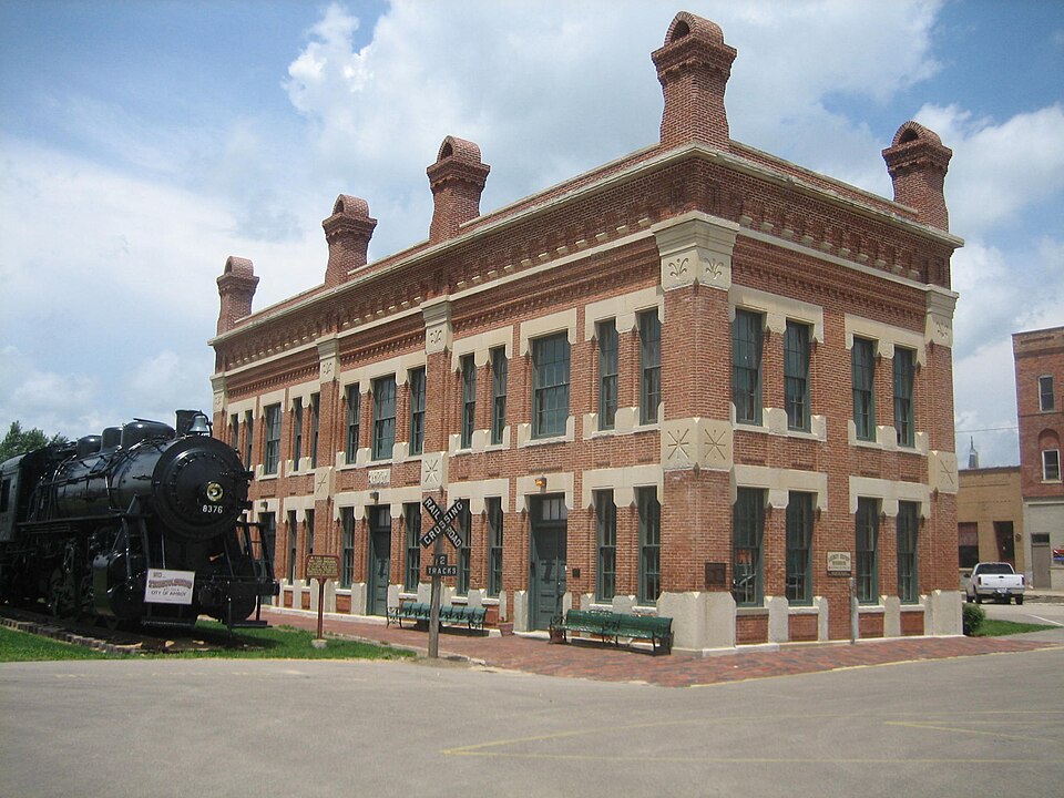
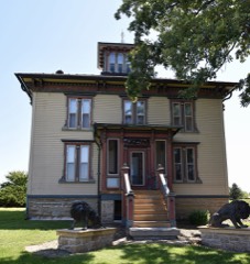
Built in 1876 (Italianate architecture). Listed on the National Register of Historic Places in 1992.
From the record
“Amboy station is a former rail station in the city of Amboy, Lee County, Illinois, United States. The building was constructed as a headquarters building for the Illinois Central Railroad as well as a public train station for the fledgling city of Amboy in 1876.”
Wikipedia article Amboy station, CC BY-SA 4.0.
One of 10 National Register listings published here for Lee County · listed in 1992 · category: Building · built in 1876, Italianate architecture.
National Register reference number.92001015- the number the National Park Service assigned this property when it was listed, and the key its nomination file is catalogued under at the National Archives.
The ground it stands on
51,232 words
The chapter on Amboy Township in History of Lee County, published 1881 names Amboy. This is what it says, exactly as the scans read.
This city is the oflspring of the Central railroad. In the early summer of 1851 the surveying parties under the chief engineer, Roswell B. Mason, took their several stations on the line and immediately began preliminary operations. T. B. Blackstone, whose name has been given to one of the streets in the original town, had charge of the squad emplo3'ed between Dixon and Bloomington. In December 1852 K. F. Booth, for several years afterward a resident of Amboy, came to this place at the head of a small party whose business was to direct the work on this part of the route. A company, distinct from the Illinois Central Railroad Company, but composed in part, if not wholly, of stockholders in the latter, purchased and owned the land for the village plats along the road. They bought the Lay farm for a depot and station two miles above here in the direction of Dixon, which was subsequently sold to a conductor named Cole. They gave out word that the company would erect machine shops at that point; a few loads of stone Were hauled there, and the place named Kepatau. If there was ever any real intention of making a station and building shops there it was of very brief duration. H. B. Judkins came down one day, and securing the company of a certain influential citizen, went to Farwell, and pretending to be a returned Californian, said he wanted to buy a stock-farm, and a bargain was forthwith made for the " Farwell slough farm," as old settlers had named it, for $13 per acre. John B. "Wyman, assistant superintendent of the road, hastened to buy out Cyrus Davis, and then Farwell was given to understand that if he had any wish to secure himself he should lose no time in doing it, and he accordingly purchased the farm from his son-in-law, Curtis Bridgman. The land company made a deed of trust to Messrs. Ketchum and Gray ; and Col. Mason, who was superintendent as well as chief engineer of road, acted as their attorney.
The year 1854 was the natal year of Amboy. In January or February a Frenchman by tiie name of Meyer, under the directions of Col. Mason, came and laid out the town, completing his survey March 24. On July 26 the first bonds for deeds were executed, John L. Skinner was the first purchaser of lots. He paid $600 for the northeast corner lot on Main street and East avenue, now occupied by the Badger building. On this he began the erection of the Orient House in the fall of 1854; in September, 1855, it was completed, and opened to the public by the Lee brothers, who wei'e proprietors one year under lease. Charles W. Bell, who had been grading on the road nearly a year, in August, 1853, came here with his family and opened a boarding-house for railroad men in a mammoth, barn-like shanty belonging to the company, and which had been erected near the spot where tlie Baptist church stands. On January 21 this caught fire and burned down, but was immediately rebuilt by the company. When Mr. Bell settled in the place Cyrus Davis had moved away ; Appleton was on the homestead ; Farwell was about to move, or had just moved to his new purchase ; Alvan H. Thompson was living at his old home where Superintendent Jacobs resides; and a transient family occupied the Davis dwelling. These comprised the population of Amboy, which, by the way, was not yet surveyed and christened, except some railroad employes who could not at that time be regarded as settlers. Isaac Edwards, who graded seven miles of the railroad, settled temporarily south of the Inlet this year.
Regional context, not property-specific
evidence. The
federal wildfire occurrence database
lists 20 fires within 5 miles of Amboy Illinois Central Depot
between 2008 and 2018, burning about 187 acres in total. None started naturally. None was recorded as arson.
Distance is straight-line from the map coordinates, so a fire counted
here may appear on a neighbouring settlement's page as well.
Reported cause
Fires
Missing data/not specified/undetermined
14
Debris and open burning
5
Other causes
1
The most recent of
them, most recent first, with the day each was reported and the service
that recorded it.
Regional context, not property-specific
evidence. The federal mineral resources record lists
7 workings within 5 miles of Amboy Illinois Central Depot: 4 past producers, 3 producers.
3 still produce. What was taken out: Stone, Crushed/Broken. Distance is straight-line from the
map coordinates, so a quarry counted here may appear on a neighbouring
settlement's page as well.
Regional context, not property-specific
evidence. The National Weather Service names
Amboy, the town this property stands in, in 45 storm reports between 1996 and 2023: 28 thunderstorm wind, 12 hail, 4 flash flood, 1 flood.
No death or injury is recorded in these reports. Each account below is quoted exactly as the forecast office
filed it, from the NOAA Storm Events Database, and each date
opens the federal record of that event.
A roof was blown off the addition of a house and into a barn. Many rows of corn were knocked down. These events occurred at Bryer Knoll and Rocky Ford.
Structural damage to a building in town. There are also a number of trees down. There are 2700 people without power in the county. Several trees and a powerpole down at the Lee County Fair Grounds.
The Green River was reported out of its banks in the Amboy area. Low areas including fields were flooded with 2 to 3 feet of standing water on the east and southeast side of Amboy.
Some residents in the western part of the county sustained to their homes as winds and large hail brokewindows. A garage was blown off its foundation and shifted. The roof of another garage was blown off.
No historic map-sheet match is published
for this property yet. That does not mean no map exists. This record needs
a coordinate-quality review before it can be joined to a sheet boundary.
Browse the county's mapped places while that work is
pending.
Listed places nearby
1 within 8 miles
Other National Register properties close
enough to walk or drive between, ordered by distance from this one. Both
positions come from the same geocoding pass that matched these properties
to their map sheets.
Listing record. National Park Service National Register of Historic Places, listed-properties dataset, current to 2026-05-22.
Map join. Address geocoded through the United States Census geocoder, then tested against the published boundary of every sheet in the USGS Historical Topographic Map Collection.
How this page is made. Listing fields come from federal records; map-sheet coverage is a labelled coordinate-to-boundary calculation, not a source-field claim.
Wildfire. Short, Karen C. 2022. Spatial wildfire occurrence data for the United States, 1992-2020 [FPA_FOD_20221014]. 6th Edition. Fort Collins, CO: Forest Service Research Data Archive. https://doi.org/10.2737/RDS-2013-0009.6 Collected with United States Government funding and usable without additional permissions or fees.
Mines and quarries. USGS Mineral Resources Data System (MRDS) https://mrdata.usgs.gov/mrds/ A work of the United States government, no copyright under 17 U.S.C. 105.
Storms. NOAA National Centers for Environmental Information, Storm Events Database https://www.ncei.noaa.gov/stormevents/ A work of the United States government, no copyright under 17 U.S.C. 105. Narratives are quoted verbatim from the National Weather Service report and are not edited or summarised.
 Block