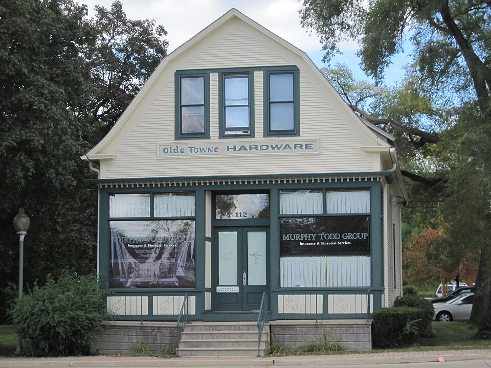
National Register reference number.94001265- the number the National Park Service assigned this property when it was listed, and the key its nomination file is catalogued under at the National Archives.
The ground it stands on
2,683 words
The chapter on Bloomingdale Township in History Of Dupage County (1857), published 1857 names Bloomingdale. This is what it says, exactly as the scans read.
The first election in this precinct was held at Elk grove, eight miles north east of Bloomingdale. Lyman Meacham was elected justice of the peace. The first path master went as far south as Warrenville, ten miles distant, to warn out the settlers on the highway to perform their road labor. The claim difficulty to which allusion has been made, occurred in this town. It is thought that no correct history of the horrid transaction has ever appeared. Thestatement of this affair, given in the life of George W. Green, the banker, who committed suicide in the Chicago jail, is very erroneous. The compilers have been at considerable pains to obtain a brief, and as they believe, an impartial account of the transaction, which is commonly known as
Bloomingdale is not excelled by any of its sister towns in healthfulness of climate, fertility of soil, beauty of scenery, variety of products, nor in attention to agriculture. Meacham's grove is in this town, and embraces about 1,200 acres of fine timber. The trail made by Gen. Scott's army, in passing from Fort Dearborn to the Mississippi, is about a mile and a half south of the grove. The trail was visible when the first settlers came, and has always been known as the army trail road. The source of the east branch of the Du Page river is from low land about half a mile south of the grove. The west branch rises in a slough, a few rods in width, situated near the north east corner of the town of Wayne. The town is well watered by springs and small streams, it having but one stream of any size. A branch of Salt creek runs in an easterly direction through the town, uniting with the main branch at Duncklee's grove, in the town of Addison. This stream furnishes water power at some seasons, and a saw mill has been erected upon it.
Regional context, not property-specific
evidence. The
federal wildfire occurrence database
lists 1 fire within 5 miles of Randecker's Hardware Store
in 2014, burning under an acre in total. None started naturally. None was recorded as arson.
Distance is straight-line from the map coordinates, so a fire counted
here may appear on a neighbouring settlement's page as well.
Reported cause
Fires
Missing data/not specified/undetermined
1
The most recent of
them, most recent first, with the day each was reported and the service
that recorded it.
Regional context, not property-specific
evidence. The federal mineral resources record lists
3 workings within 5 miles of Randecker's Hardware Store: 2 past producers, 1 producer.
1 still produces. What was taken out: Sand and Gravel, Construction. Distance is straight-line from the
map coordinates, so a quarry counted here may appear on a neighbouring
settlement's page as well.
Regional context, not property-specific
evidence. The National Weather Service names
Bloomingdale, the town this property stands in, in 15 storm reports between 1996 and 2025: 8 thunderstorm wind, 6 hail, 1 tornado.
The reports record 1 death and 1 injury. Each account below is quoted exactly as the forecast office
filed it, from the NOAA Storm Events Database, and each date
opens the federal record of that event.
A second, brief tornado touched down in Bloomingdale, near an apartment complex on Century Point Lane. There was roof and window damage at two apartment buildings. Significant damage was done to roofs of houses and to trees from Cardinal Drive east across Bloomingdale Road through Norton Lane and into the area around Sterling Drive.
No historic map-sheet match is published
for this property yet. That does not mean no map exists. This record needs
a coordinate-quality review before it can be joined to a sheet boundary.
Browse the county's mapped places while that work is
pending.
Listed places nearby
6 within 8 miles
Other National Register properties close
enough to walk or drive between, ordered by distance from this one. Both
positions come from the same geocoding pass that matched these properties
to their map sheets.
Listing record. National Park Service National Register of Historic Places, listed-properties dataset, current to 2026-05-22.
Map join. Address geocoded through the United States Census geocoder, then tested against the published boundary of every sheet in the USGS Historical Topographic Map Collection.
How this page is made. Listing fields come from federal records; map-sheet coverage is a labelled coordinate-to-boundary calculation, not a source-field claim.
Wildfire. Short, Karen C. 2022. Spatial wildfire occurrence data for the United States, 1992-2020 [FPA_FOD_20221014]. 6th Edition. Fort Collins, CO: Forest Service Research Data Archive. https://doi.org/10.2737/RDS-2013-0009.6 Collected with United States Government funding and usable without additional permissions or fees.
Mines and quarries. USGS Mineral Resources Data System (MRDS) https://mrdata.usgs.gov/mrds/ A work of the United States government, no copyright under 17 U.S.C. 105.
Storms. NOAA National Centers for Environmental Information, Storm Events Database https://www.ncei.noaa.gov/stormevents/ A work of the United States government, no copyright under 17 U.S.C. 105. Narratives are quoted verbatim from the National Weather Service report and are not edited or summarised.
 Block