BlockBefore
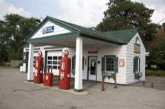
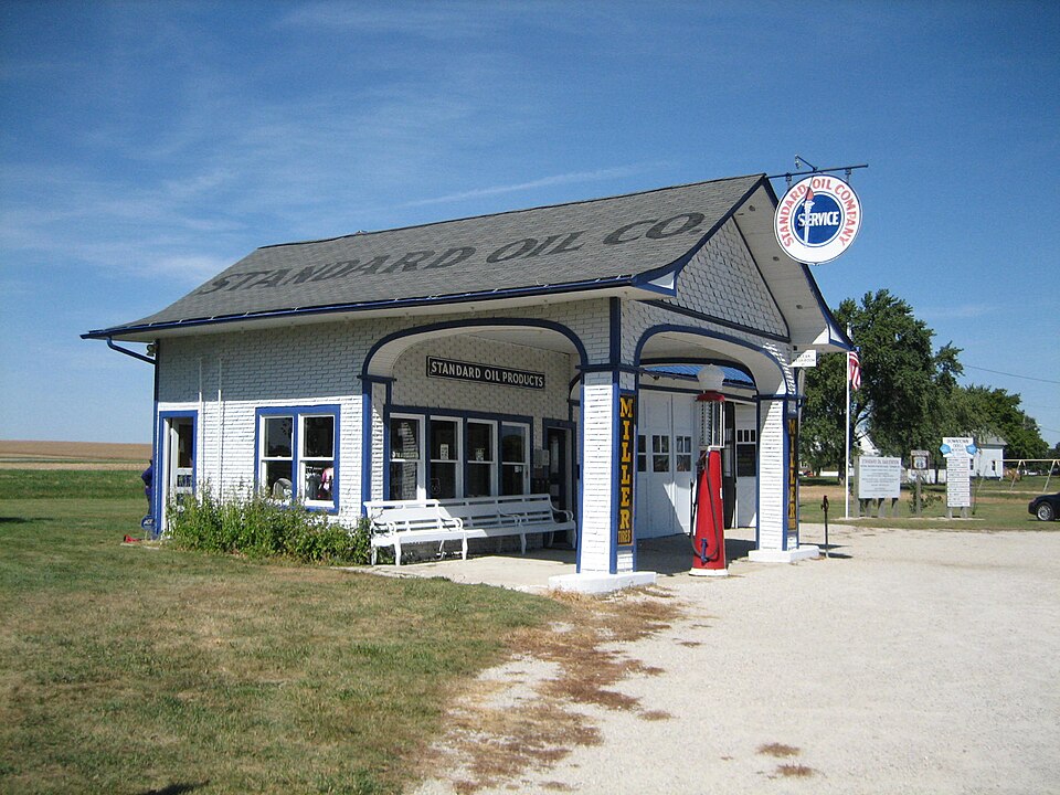
Photograph of Standard Oil Gasoline Station
Photograph by IvoShandor, CC BY 3.0 us. Via Wikimedia Commons.

Standard Oil Gasoline Station

Listed on the National Register of Historic Places in 1997.

From the record

“The Standard Oil Gasoline Station is a historic gas station in Odell, Illinois, that lies along historic U.S. Before the days of the interstate highway system the station served patrons along the highway's cross country jaunt.”

Wikipedia article Standard Oil Gasoline Station (Odell, Illinois), CC BY-SA 4.0.

One of 15 National Register listings published here for Livingston County · listed in 1997 · category: Building.

Sources: the Wikipedia article · the case file at the National Archives · the National Register database, National Park Service · the Wikipedia article
The listing

  • What is counted as historic. The nomination lists 1 building as contributing to the listing.
  • Address. 400 S. West St., Odell, 60460
  • When was it listed? November 1997
  • Category. building
  • Also known as. Route 66 through Illinois MPS
  • Township. Odell township
  • National Register reference number. 97001338 - the number the National Park Service assigned this property when it was listed, and the key its nomination file is catalogued under at the National Archives.

The ground it stands on

7,364 words

The chapter on Odell Township in The History of Livingston County, Illinois : Containing a History of the County, Its Cities, Towns, &c. .., published 1878 names Odell. This is what it says, exactly as the scans read.

The citizens of Odell justly pride themselves on their excellent schools. In the selection of teachers, they have always been very successful ; and during the eight years ending with 1873, the Odell school, with one exception, prepared more teachers than any other school in the county.

Passage source: The History of Livingston County, Illinois : Containing a History of the County, Its Cities, Towns, &c. .., published 1878.

The society of A., F. & A. M. was constituted as Odell Lodge, No. 401, Oct. 5th, 1864. The charter members were L. H. Cordry, E. G. Putnam, Z. Supplee, who were the first three principal officers. The charter was granted by Thomas J. Turner, Grand Master. The Lodge numbers at present sixty members. Odell Chapter was chartered by John M. Pearson, High Priest, Oct. 7, 1870. The charter was granted to Z. Supplee, A. E. Gammon, John E. Williams, A. B. Dunlap, A. P. Wright, J. Martin, C. H. Ellenwood, R. G. Morton, J. Ford, Charles Finefield, E. Williams, A. G. Goodspeed, J. B. Garwood, H. H. Hill and R. B. Harrington. Elisha Williams was first High Priest; Z. Supplee, King, and J. E. Williams, Scribe. The present principal officers are: R. G. Morton, High Priest; D. A. Walden, King; Joel Kidder, Scribe : J. F. Trowbridge, Secretary, and J. A. Hunter, Treasurer.

Passage source: The History of Livingston County, Illinois : Containing a History of the County, Its Cities, Towns, &c. .., published 1878.

Machine-read from a century-old scan, so expect the errors a machine makes: misspelled names, dropped words, stray characters.

Read the whole chapter on Odell Township - 7,364 words on its settlement, mills, schools and churches.

Fires near this property

1 since 2003

Regional context, not property-specific evidence. The federal wildfire occurrence database lists 1 fire within 5 miles of Standard Oil Gasoline Station in 2003, burning under an acre in total. None started naturally. None was recorded as arson. Distance is straight-line from the map coordinates, so a fire counted here may appear on a neighbouring settlement's page as well.

Reported cause Fires
Missing data/not specified/undetermined1

The most recent of them, most recent first, with the day each was reported and the service that recorded it.

DateCause SizeReported by Name on the report
7 May 2003Missing data/not specified/undeterminedunder an acreIllinois State Fire Marshal's Officenot named

Every fire recorded in Livingston County

Storms near this property

14 since 1996

Regional context, not property-specific evidence. The National Weather Service names Odell, the town this property stands in, in 14 storm reports between 1996 and 2021: 6 thunderstorm wind, 4 hail, 1 tornado, 1 lightning. No death or injury is recorded in these reports. Each account below is quoted exactly as the forecast office filed it, from the NOAA Storm Events Database, and each date opens the federal record of that event.

WhenEvent Place namedHarm What the report says
August 2016Flash FloodOdell$10,000Some roads with water on them and many yards and houses flooded. Time estimated per radar.
December 2007Thunderstorm WindOdell$10,000A roof was blown off a building.
August 2016LightningOdell$1,000Car struck by lightning on I-55 at mile marker 210.
June 2021FloodOdell-Several roads were reported flooded in eastern Livingston County, including East 2000 North Road near North 3000 East Road, where a car was reported to be in a ditch. Another car was reported in a ditch four miles north of Chatsworth.
April 2020Thunderstorm WindOdell-A large tree was snapped at its base.
June 2019Thunderstorm WindOdell-Power lines were blown down.
July 2009Thunderstorm WindOdell-Several large trees were blown down.
May 2003Thunderstorm WindOdell-no account filed
July 2003HailOdell-no account filed
May 2000HailOdell-no account filed
May 2000Tornado (F0)Odell-no account filed
May 1998HailOdell-no account filed
April 1996HailOdell-no account filed
July 1996Thunderstorm WindOdell-no account filed

Every storm recorded in Livingston County

Map coverage status

No historic map-sheet match is published for this property yet. That does not mean no map exists. This record needs a coordinate-quality review before it can be joined to a sheet boundary. Browse the county's mapped places while that work is pending.

Listed places nearby

3 within 8 miles

Other National Register properties close enough to walk or drive between, ordered by distance from this one. Both positions come from the same geocoding pass that matched these properties to their map sheets.

Photograph PropertyDistance Listed
John R. Oughton House7.8 miles1980
Dwight Chicago and Alton Railroad Depot7.8 miles1982
Ambler's Texaco Gas Station7.8 miles2001

Sources for this property

National Archives recordThe nomination case file for reference 97001338 in Record Group 79.
Wikipedia articleCommunity-written account of this property, licensed CC BY-SA.
Livingston CountyAll 15 listed properties in this county.

Provenance

  • Listing record. National Park Service National Register of Historic Places, listed-properties dataset, current to 2026-05-22.
  • Map join. Address geocoded through the United States Census geocoder, then tested against the published boundary of every sheet in the USGS Historical Topographic Map Collection.
  • How this page is made. Listing fields come from federal records; map-sheet coverage is a labelled coordinate-to-boundary calculation, not a source-field claim.
  • Wildfire. Short, Karen C. 2022. Spatial wildfire occurrence data for the United States, 1992-2020 [FPA_FOD_20221014]. 6th Edition. Fort Collins, CO: Forest Service Research Data Archive. https://doi.org/10.2737/RDS-2013-0009.6 Collected with United States Government funding and usable without additional permissions or fees.
  • Storms. NOAA National Centers for Environmental Information, Storm Events Database https://www.ncei.noaa.gov/stormevents/ A work of the United States government, no copyright under 17 U.S.C. 105. Narratives are quoted verbatim from the National Weather Service report and are not edited or summarised.