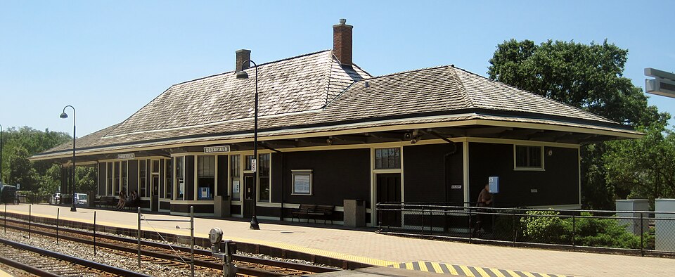
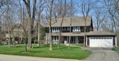
Chicago, Milwaukee and St. Paul Railway Passenger Depot
Built in 1872. Listed on the National Register of Historic Places in 1998.
From the record
“Deerfield is one of two Metra commuter railroad stations in Deerfield, Illinois along the Milwaukee District North Line. It is located at 860 Deerfield Road, 2 blocks west of Illinois State Route 43, is 24.6 miles (39.6 km) away from Chicago Union Station, the southern terminus of the line.”
Wikipedia article Deerfield station, CC BY-SA 4.0.
One of 98 National Register listings published here for Lake County · listed in 1998 · category: Building · built in 1872.
National Register reference number.98000066- the number the National Park Service assigned this property when it was listed, and the key its nomination file is catalogued under at the National Archives.
The name of Deerfield was given to this town by the Commissioners having the matter in charge, in accordance with the wishes of the inhabitants as expressed at a public meeting called for that purpose at the house of Michael Mehan, when a formal election was held to decide upon a name. Philemon Caldwell and Michael Yore were chosen Judges, and Edwin Caldwell, Clerk. There were seventeen votes for Deerfield, and thirteen for Erin. The former name was therefore declared to be the choice of the inhabitants of the town. The result being laid before the Commissioners, the name of Deerfield was adopted as the name of the town.
Jacob Caldwell and sons came west from Norfolk, N. Y., in 1835, and settled in this town at what is now Deerfield Comers, in the Spring of 1836. It has been claimed that this family were the first settlers in what is now the town of Deerfield. But by some this is disputed, claiming that Horace Lamb was the first settler, and built the first house in the town, on the land now occupied by Phillip Yedder and his son Almon, and that the house was built before 1835. When we take into account the fact that the Indians remained in possession of the lands lying in Lake County by stipulation with the Government until 1836, and that occupation by settlers was not permitted before that time, except by consent of the Indians, we cannot expect to find settlers attempting to occupy the lands much before that year. It is well understood that Capt. Daniel Wright was the only settler in what is now Lake County in 1834, except, perhaps, Amos Flint, who is claimed to have settled on Fox River the latter part of this year. There are those now living who remember of hearing Capt. Wright say that he was allowed to remain in the country as a special favor of the Indians from the regard they had for him ; that no other person was alike favored. In 1835, the time in which the Indians were to leave the country being near at hand, which they seemed more to realize, they became more indifferent as to the encroachment of the whites, whereby during this year some progress was made by settlers, as has been already related in the com¬ mencement of this history. It is possible that settlers may have entered the town of Deerfield in 1835, but it is certainly not probable that any came before that time.
Regional context, not property-specific
evidence. The
federal wildfire occurrence database
lists 2 fires within 5 miles of Chicago, Milwaukee and St. Paul Railway Passenger Depot
in 2020, burning about 23 acres in total. None started naturally. None was recorded as arson.
Distance is straight-line from the map coordinates, so a fire counted
here may appear on a neighbouring settlement's page as well.
Reported cause
Fires
Debris and open burning
1
Equipment and vehicle use
1
The most recent of
them, most recent first, with the day each was reported and the service
that recorded it.
Regional context, not property-specific
evidence. The federal mineral resources record lists
4 workings within 5 miles of Chicago, Milwaukee and St. Paul Railway Passenger Depot: 3 past producers, 1 producer.
1 still produces. What was taken out: Sand and Gravel, Construction, Stone, Stone, Crushed/Broken. Distance is straight-line from the
map coordinates, so a quarry counted here may appear on a neighbouring
settlement's page as well.
Regional context, not property-specific
evidence. The National Weather Service names
Deerfield, the town this property stands in, in 14 storm reports between 1995 and 2024: 5 thunderstorm wind, 5 hail, 1 lightning, 1 flash flood.
No death or injury is recorded in these reports. Each account below is quoted exactly as the forecast office
filed it, from the NOAA Storm Events Database, and each date
opens the federal record of that event.
Several feet of water flooded the Laurel Avenue underpass at First Street where two cars were stranded in the flood waters. Flooding was also reported at the Sheridan Road entrance to Rosewood Beach. Many other streets were flooded with standing water in Highland Park.
No historic map-sheet match is published
for this property yet. That does not mean no map exists. This record needs
a coordinate-quality review before it can be joined to a sheet boundary.
Browse the county's mapped places while that work is
pending.
Listed places nearby
6 within 8 miles
Other National Register properties close
enough to walk or drive between, ordered by distance from this one. Both
positions come from the same geocoding pass that matched these properties
to their map sheets.
Listing record. National Park Service National Register of Historic Places, listed-properties dataset, current to 2026-05-22.
Map join. Address geocoded through the United States Census geocoder, then tested against the published boundary of every sheet in the USGS Historical Topographic Map Collection.
How this page is made. Listing fields come from federal records; map-sheet coverage is a labelled coordinate-to-boundary calculation, not a source-field claim.
Wildfire. Short, Karen C. 2022. Spatial wildfire occurrence data for the United States, 1992-2020 [FPA_FOD_20221014]. 6th Edition. Fort Collins, CO: Forest Service Research Data Archive. https://doi.org/10.2737/RDS-2013-0009.6 Collected with United States Government funding and usable without additional permissions or fees.
Mines and quarries. USGS Mineral Resources Data System (MRDS) https://mrdata.usgs.gov/mrds/ A work of the United States government, no copyright under 17 U.S.C. 105.
Storms. NOAA National Centers for Environmental Information, Storm Events Database https://www.ncei.noaa.gov/stormevents/ A work of the United States government, no copyright under 17 U.S.C. 105. Narratives are quoted verbatim from the National Weather Service report and are not edited or summarised.
 Block