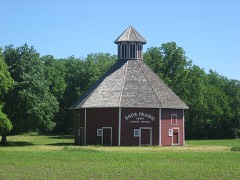
Block
From the record
34 National Register listings published here.
Sources: the county history on the Internet Archive · the National Register database, National Park Service
61 topographic sheets cover 62 settlements here, and 34 properties are on the National Register of Historic Places.
34 National Register listings published here.
Sources: the county history on the Internet Archive · the National Register database, National Park Service
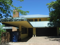
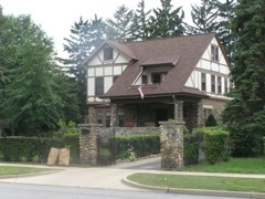
Every property in this county listed on the National Register of Historic Places, with the year it was listed and the federal nomination document.
Every wildfire the federal occurrence database records inside this county: 12 of them, burning about 7 acres. None started naturally and 2 were recorded as arson. Each settlement page carries the fires within five miles of it.
| Reported cause | Fires |
|---|---|
| Missing data/not specified/undetermined | 4 |
| Debris and open burning | 2 |
| Recreation and ceremony | 2 |
| Arson/incendiarism | 2 |
| Equipment and vehicle use | 1 |
| Fireworks | 1 |
The five largest, by the area the report gives. One of them was set deliberately.
| Date | Cause | Size | Reported by | Name on the report |
|---|---|---|---|---|
| 25 April 2008 | Missing data/not specified/undetermined | 2.0 acres | Indiana State Fire Marshal's Office | not named |
| 20 April 2008 | Debris and open burning | 2.0 acres | Indiana State Fire Marshal's Office | not named |
| 17 May 2008 | Missing data/not specified/undetermined | 1.0 acres | Indiana State Fire Marshal's Office | not named |
| 5 June 2009 | Fireworks | under an acre | Indiana Dunes National Lakeshore | BALDY |
| 28 September 2008 | Missing data/not specified/undetermined | under an acre | Indiana Dunes National Lakeshore | W. BALDY |
| 8 April 2008 | Debris and open burning | under an acre | Indiana State Fire Marshal's Office | not named |
| 27 April 2008 | Recreation and ceremony | under an acre | Indiana State Fire Marshal's Office | not named |
| 15 March 1995 | Arson/incendiarism | under an acre | Indiana Dunes National Lakeshore | BALDY |
Every settlement page carries the fires within five miles of it - see the settlement index below.
The NOAA Storm Events Database holds 423 reports for this county, causing 1 death, 23 injuries and about $32,471,000 in recorded property damage. Each settlement page carries the reports that name it.
| Kind of event | Reports |
|---|---|
| Thunderstorm Wind | 283 |
| Hail | 92 |
| Tornado | 29 |
| Flash Flood | 7 |
| Lightning | 6 |
| Flood | 4 |
| Funnel Cloud | 1 |
| Heavy Rain | 1 |
The most serious of them, by death, then injury, then recorded damage. The accounts are quoted exactly as the forecast office filed them.
| When | Event | Place named | Harm | What the report says |
|---|---|---|---|---|
| October 2001 | Tornado (F2) | Wanatah | 1 killed, $750,000 | no account filed |
| March 1976 | Tornado (F3) | not stated | 7 hurt, $250,000 | no account filed |
| September 2006 | Lightning | Westville | 7 hurt | A 15 year old boy and his grandfather were setting up a tent at the annual Pumpkin festival when lightning struck near the tent and travelled through the ground affect both of them. The boy was transported to the hospital with severe leg pain, but was alert. The boy's grandfather as well as 5 bystandards were affected by the lightning, treated at the scene and released. |
| March 1955 | Tornado (F1) | not stated | 3 hurt, $25,000 | no account filed |
| May 1958 | Tornado (F2) | not stated | 2 hurt, $25,000 | no account filed |
| April 2007 | Tornado (EF1) | Springville | 1 hurt, $40,000 | A patrol car was picked up and thrown over a fence approximately 150 feet. The officer seen the tornado, attemped to get out of the car, but winds prevented her from exiting. She suffered cuts and brusies, but no serious injuries. In addition, numerous trees were uprooted or snapped off along the path. 2 homes suffered damage in the area as well. |
| June 2001 | Thunderstorm Wind | Michigan City | 1 hurt, $15,000 | Trees fell on 3 houses causing damage. Girl sleeping in one of the homes suffered broken arm when tree fell into bedroom. |
| July 2018 | Thunderstorm Wind | Trail Creek | 1 hurt | Local media reported a tree limb fell onto a vehicle at the intersection of Greenwood and Woodland Ave in Michigan City. The impact caused a fire, with a 25 year old female driver having to be extricated. She was reported in critical condition at the time with no further details available on her condition. |
| August 2009 | Lightning | La Porte | 1 hurt | Local newspapers reported a 64 year old man was thrown across his garage when a lightning bolt struck about four feet from where he was standing. He lost consciousness for around five minutes, but awakened and was treated at a local hospital. He was released the next day some lingering speech problems and minor memory lapses. |
| April 1965 | Tornado (F3) | not stated | $25,000,000 | no account filed |
| August 2006 | Thunderstorm Wind | Michigan City | $1,500,000 | A supercell came onshore from Lake Michigan at Michigan City with winds initially above 100 mph. Wind gusts to 75 mph were reported several miles inland as the storm continued south through Westville and Wanatah. Widespread tree, power poles and lines damage was observed from the lake shore to Westville. One minor injury was reported from a cleanup worker in Westville. 2 vehicles were destroyed as a result of falling trees. A police car in Westville suffered damage from a tree falling onto it. 2 miles north of Westville a semi was blown off the Indiana Toll Road with a train suffering damage as a result of the winds. Several buildings suffered roof damage, including several factories, homes and a prison. Damage figures are not complete, but initial estimates of damage on the land are at least $1.5 million. |
| June 2010 | Thunderstorm Wind | Pine Lake | $750,000 | A survey of rather extensive damage was performed across the county. An intense microburst with a path of 2 to 3 miles and estimated 100 mph winds was surveyed from Pine Lake northeast through Rolling Prairie. The most concentrated damage occurred at the start of the event, where enumerable trees were uprooted and snapped with roof damage to numerous homes. A lack of overall structure damage, outside of falling trees, suggested that the high winds remained at tree top level, roughly 30 to 50 feet. No specific damage value was available, but given the magnitude of the damage, an estimate of $750,000 will be assigned to the event. |
| February 2018 | Flood | Michigan City | $500,000 | High water forced the closures of several roads in LaPorte county, including portions of US 20 and 35 and State Routes 8 and 212. The high water was the result of ditches, creeks, streams and rivers exceeding their capacity, causing extensive flooding that slowly increased over the span of a few days. State Route 8, between US 421 and State Route 39 suffered such severe flooding as a result of flood waters on the Yellow iver that a portion of the road will require complete reconstruction of a portion, causing it to remain closed for several months. See separate entry for damage to a levee in Starke county. Damage in excess of $500,000 was reported to mainly county roads, state highways and the water treatment plant in LaPorte. |
| October 2010 | Tornado (EF1) | Wanatah | $500,000 | A survey of damage near the town of Wanatah, plus numerous eye witness reports, confirmed a tornado rapidly touched down north of West Bailey Road and east of US 421 in an open field. A funnel cloud was tracked by emergency personnel as it approached the south side of the town before touching down. The circulation then struck several structures at the Hoosier Machinery Solutions, destroying them. The largest structure was a 50 foot by 200 foot open shelter that as destroyed and debris was carried nearly a mile northeast before being dropped in a field. A security camera recorded the destruction of the shelter. The tornado then quickly crossed US 30 east of US 421 clipping the garage of a residence and blowing the garage door in and a large portion of the roof over the garage off and into an adjacent field. In addition, the walls of a barn were pushed, causing it to lean, but not collapse. The last damage noted was some roof damage at a residence on South 900 West, north of US 30. The circulation then lifted. Maximum winds are estimated at around 90 mph. |
| September 2008 | Flood | Lake Park | $500,000 | Spotters and emergency management officials reported several road closures across the northern part of the county. The road closures included US 25 and 35. Rainfall amounts of eight to over 11 inches were recorded, with the highest amount in the Laporte area where 11.20 inches was noted. No injuries were reported. Exact damage figures were not available. |
| July 2009 | Flash Flood | Michigan City | $250,000 | Numerous reports were received of flash flooding across many parts of Michigan City. Video footage showed water flowing over many roadways, averaging at least a foot deep, causing some vehicles to stall. At one point, all lanes on US 20 between Johnson road and US 421 were closed due to flowing water over the highway. A CoCoRaHS observer southeast of Trail Creek reported a storm total of 5.64 inches of rain, with an observer on the southwest side of Michigan City reporting 4.10 inches of rain. Rainfall amounts quickly tapered south of Michigan City with locations as far south as the Kingsbury area not even seeing a quarter inch. No reports of injuries or fatalities were noted as a result of the flooding. Damage amounts in terms of washout repairs, basements flooding and other types of damage are estimated at $250,000. |
| August 1998 | Thunderstorm Wind | La Porte | $250,000 | TREES BLOWN DOWN ON ONE HOUSE AND SEVERAL CARS. |
| July 1982 | Tornado (F1) | not stated | $250,000 | no account filed |
| May 1958 | Tornado (F2) | not stated | $250,000 | no account filed |
| January 2008 | Flash Flood | Dillon | $150,000 | Heavy rain and snow melt caused the Kankakee River to go over its banks and flood mainly agricultural areas. However...10 of 15 feet of a levee that was in place along the river southeast of Kingsbury, gave way. A few residences were near the increased flooding and were sandbaged as a precaution but did not experience any problems. Numerous roads were posted with high water signs or closed for a period of time as runoff pooled in low areas and ditches, including County Road 500 South near Walkerton where a bridge was closed as a precaution due to the high water. Damage is estimated at $150,000. |
| May 2024 | Thunderstorm Wind | Union Mills | $100,000 | A transmission tower downed and a small grain silo was crumpled and blown across the road. Photo relayed by broadcast media on Facebook, near US 6 and S 400 W. |
| July 2024 | Tornado (EF1) | Waterford | $100,000 | A storm damage survey confirmed that a tornado developed south of Waterford. A private property sustained widespread and severe tree damage with several hundred|mixed hardwood and softwood trees uprooted and/or snapped on this |20 acre property. Another concentrated area of significant tree damage |was noted between Forrester Rd and Tiffany Dr. Many homes and outbuildings|sustained minor to moderate damage from tree fall along this track. This |tornado continued east but quickly weakened and ended west of Johnson Rd |as a larger scale microburst overtook the tornado. |
| May 2007 | Thunderstorm Wind | La Porte | $100,000 | Several trees and power lines down in the area, as well as a recorded 65 mph gust. Some of these trees fell onto occupied residences. Luckily no one was injured in any of these cases. However, one injury was reported when a tree split and a limb fell onto a County Deputy Coroner who was on a motorcycle. He suffered 2 broken bones in the lower part of his legs. At least $100,000 in damage is estimated from the storms. |
| March 2016 | Tornado (EF0) | Thomaston | $75,000 | A survey of damage and eyewitness reports indicate a tornado briefly touched down in a open field southwest of the intersection of County Road 1600 south and 900 West. The tornado rapidly crossed County Road 900 South and impacted a 120 foot by 80 foot pole barn, with 80 percent of the roof removed and thrown into adjacent fields. A center pivot irrigation system was not damaged to the east of the barn, suggesting the tornado quickly lifted. Eyewitnesses reported watching 2 separate funnels lowering and raising off to the west. |
| August 2007 | Thunderstorm Wind | La Porte | $50,000 | A large tree fell onto a school bus in Laporte. The 56 year old driver was not hurt and no students were on the bus at the time. A large branch fell onto a car traveling on CR-800N. The driver was struck in the head and suffered a headache but did not receive treatment. At least 2 more occupied vehicles suffered damage from falling limbs. No injuries were reported with these either. Damage was estimated at $30,000 for the cars and $20,000 for the bus. |
| July 2006 | Flash Flood | La Porte | $50,000 | Numerous roads in Michigan City were reported flooded, including US 20 and 421. Some of the streets had over 2 feet of standing or flowing water. Several cars became stranded in the high water. 2.73 inches of rain were recorded at the Michigan City Sanitary District between 545 pm and 845 pm EDT with nearly an inch of this falling in 15 minutes. Emergency personnel responded to reports of partial house-basement collapses at 2 homes in Michigan City. Damage to the structures is estimated around $50,000. |
| November 1998 | Thunderstorm Wind | Countywide | $50,000 | NUMEROUS TREES AND POWER LINES DOWN. ONE HOME SUFFERED EXTENSIVE DAMAGE WHEN A LARGE TREE FELL INTO IT COLLAPSING THE ROOF AND ONE WALL. ONE CAR WAS HEAVILY DAMAGED BY A FALLEN TREE. |
| June 1998 | Tornado (F0) | Westville | $50,000 | WEAK TORNADO TOUCHED DOWN NEAR U.S. 421 AND U.S. 30. A FEW FARMHOUSES SUFFERED SLIGHT ROOF DAMAGE. |
| April 2007 | Tornado (EF1) | Springville | $40,000 | This tornado was the first of 2 to affect northeastern Laporte county. Touchdown occurred just east of Range Road and north of US 20 in the Rangewood subdivision. A barn was destroyed with several trees snapped or uprooted in the area. Two homes sustained damage, mainly from falling trees or tree limbs. No injuries or fatalities have been reported. |
| April 2026 | Thunderstorm Wind | Mill Creek | $35,000 | Delayed report. A barn was blown down on CR-75 South just east of CR-775 East in LaPorte County. |
| May 2024 | Hail | Long Beach | $35,000 | no account filed |
| March 2025 | Thunderstorm Wind | Mill Creek | $30,000 | Numerous trees and powerlines down across the Fish Lake area. Debris on roads, some trees in houses. There are several trees that were snapped at the base or midway up. One power pole was snapped. |
| May 2024 | Hail | Trail Creek | $30,000 | Hail damage to vehicles in downtown Michigan City. Public reports hail of 2 to 3 inches in diameter. |
| June 2006 | Thunderstorm Wind | Michigan City | $30,000 | Numerous trees and power lines blown down from Michigan City to Long Beach. |
| March 2025 | Thunderstorm Wind | Tracy | $27,000 | Numerous reports of damage including trees down and a roof blown off. Metal siding is hanging from power lines in one video. Damage to a silo as well. Power is out. |
| March 2025 | Thunderstorm Wind | Trail Creek | $25,000 | Report from the 400 block of Laurel Drive has trees on top of houses. |
| August 2024 | Thunderstorm Wind | Duneland Beach | $25,000 | Several trees down across northern LaPorte county. Long Beach was the hardest hit area. |
| August 2024 | Thunderstorm Wind | Long Beach | $25,000 | Several trees and power lines down throughout Michigan City. |
| July 2024 | Thunderstorm Wind | Pinola | $25,000 | Large tree down onto a car. |
| August 2008 | Thunderstorm Wind | Pinola | $25,000 | Trained spotters reported a semi was rolled over on State route 2 west of Laporte. Also the Laporte hospital suffered some signage damage. |
| August 2008 | Thunderstorm Wind | Michigan City Arpt | $25,000 | Broadcast media sources reported that a 23 year old man was nearly home when the severe storms caused a tree to be blown over into his vehicle, killing him. The residence was located in the 6200 block of North County Road 400 West near the town of Springville. |
| August 2007 | Thunderstorm Wind | La Crosse | $25,000 | Eight power poles stretching approximately a half mile, were blown over or snapped along US 421 south of Lacrosse. One of these poles landed on a car, minor damage. Numerous trees and tree limbs were also reported down. |
| July 1981 | Tornado (F0) | not stated | $25,000 | no account filed |
| October 1979 | Tornado (F0) | not stated | $25,000 | no account filed |
| May 2024 | Thunderstorm Wind | Michigan City | $20,000 | Storm survey of the area near Town of Pines found vehicle and tree damage consistent with a microburst as well as from large hail. |
| August 2022 | Thunderstorm Wind | Trail Creek | $20,000 | The emergency manager reported that multiple trees and power lines were down within the city. |
| August 2007 | Thunderstorm Wind | Trail Creek | $20,000 | Several trees were blown down in and around Michigan City. |
| March 2025 | Thunderstorm Wind | Westville | $15,000 | Power lines down across Highway 421. |
| March 2025 | Thunderstorm Wind | Wanatah | $15,000 | Report of power lines down across 421. |
| July 2011 | Lightning | La Porte | $15,000 | The residents of a home on K street witnessed a lightning bolt strike a tree in their yard. The tree subsequently fell onto their home, damaging roughly a third of the roof. Damage is estimated at $15,000. |
| August 2006 | Thunderstorm Wind | Countywide | $15,000 | Several trees and power lines were blown down across the city of Laporte as well as northwestern parts of the county. A tree fell onto a house and adjacent car, causing a hole in the roof of the house and damaging the car. Damage is estimated at around $15,000 for the power line repairs as well as house and car damage. |
| May 2024 | Hail | Trail Creek | $15,000 | no account filed |
| May 2024 | Hail | Long Beach | $15,000 | no account filed |
| May 2024 | Hail | Duneland Beach | $15,000 | no account filed |
| March 2025 | Thunderstorm Wind | Waterford | $13,000 | Tree blown down into power lines. |
| May 2024 | Hail | Michigan City | $12,000 | no account filed |
| March 2025 | Thunderstorm Wind | Stillwell | $10,000 | Barn roof blew off, blocking SR 4 and SR 104. |
| June 2025 | Thunderstorm Wind | South Wanatah | $10,000 | Power lines down. Power is out in La Crosse, Wanatah and Union Mills. |
| June 2025 | Thunderstorm Wind | Wanatah | $10,000 | US 421 is closed between US 30 and CR 1350 South due to numerous downed powerlines and damaged utility poles in the roadway. |
| May 2024 | Thunderstorm Wind | Magee | $10,000 | A metal roof was peeled off a barn. Preliminary radar evaluation and nearby damage suggests straight line wind from a microburst, estimated at 70 to 90 mph. |
One book written about this county, cut here where the book itself is cut, at its printed chapters: 36 chapters in all. Every chapter is public domain, machine-read from the scan and reproduced complete. A chapter already given under one of the county's towns is not repeated in this list.
Named settlements recorded in the Geographic Names Information System, each with the topographic sheets covering it. Villages, hamlets and abandoned places alike. Each is shown with the nearest named watercourse or landform and the survey quadrangle it falls on.
Michigan township · 46360 · On Otter Creek · Michigan City East quadrangle
11 sheets, 1953 to 1983
Michigan township · 46360 · On Trail Creek · Michigan City West quadrangle
15 sheets, 1953 to 1994
Coolspring township · 46360 · On East Branch Trail Creek · Michigan City East quadrangle
11 sheets, 1953 to 1983
Michigan township · 46360 · On Otter Creek · Michigan City East quadrangle
11 sheets, 1953 to 1983
Michigan township · 46360 · On East Branch Trail Creek · Michigan City East quadrangle
11 sheets, 1953 to 1983
Coolspring township · 46360 · On Wolf Run · Michigan City East quadrangle
11 sheets, 1953 to 1983