 Block
Michigan City, Indiana
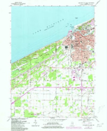
15 topographic sheets cover this place, the earliest surveyed in 1953 and the latest in 1994. It stands in Michigan Township. It lies in ZIP code area 46360. It stands on Trail Creek. The Survey maps it on the Michigan City West quadrangle. 32,075 people lived here at the 2020 count. It stands 627 feet above sea level.
Research this city
On record in Michigan City
Buildings and businesses the archive holds for this place. Each opens its own page, with the source record it came from.
On the National Register 12 of 14 shown
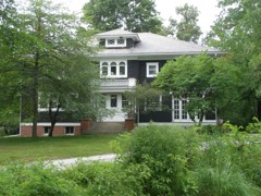 Barker Houselisted 2001
 John H. Barker Mansionlisted 1975
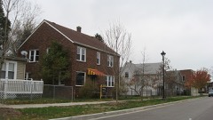 Elston Grove Historic Districtlisted 2013
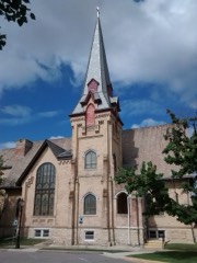 First Congregational Church of Michigan Citylisted 2001
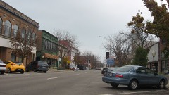 Franklin Street Commercial Historic Districtlisted 2013
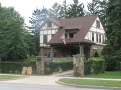 Garrettson-Baine-Bartholomew Houselisted 2001
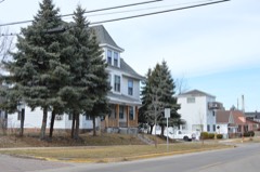 Haskell and Barker Historic Districtlisted 2014
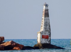 Michigan City Breakwater Lightlisted 2017
 Michigan City East Pierhead Light Tower and Elevated Walklisted 1988
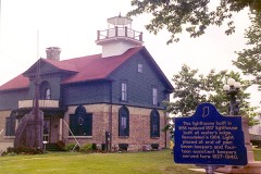 Michigan City Lighthouselisted 1974
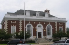 Michigan City Post Officelisted 2000
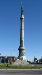 Washington Parklisted 1991
Population over time
2 figuresMichigan City grew from 31,479 to 32,075 between 2010 and 2020. These are the recorded population figures Wikidata holds for this place, reached through the Geographic Names Information System number this page is keyed on rather than by name, so they belong to this place and not to another of the same name. Most are census counts, but not all are: an early figure may be a founding or settlement estimate, and an estimate published within five years of a census is left out. The change column is computed, and is left blank where more than 20 years separate a figure from the one before it, because a gap that long is not a change between two counts.
| Year | People | Change |
|---|---|---|
| 2010 | 31,479 | |
| 2020 | 32,075 | +596 (+2%) |
Topographic sheets covering this place
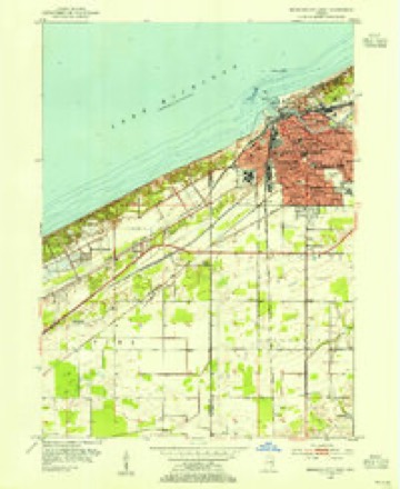
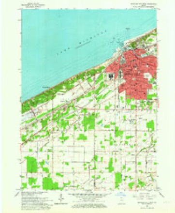
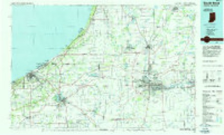
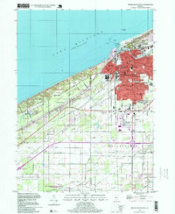
7 surveys from 15 printed sheetsMatched by testing this settlement's coordinate against the published boundary of every sheet in the United States Geological Survey's historical collection. Each opens the scanned sheet at the Survey.
- 1953 USGS Chicago quadrangle1:250000, 5 printings
- 1953 USGS Michigan City West quadrangle1:24000
- 1957 USGS Chicago quadrangle1:250000
- 1962 USGS Michigan City West quadrangle1:24000
- 1969 USGS Michigan City West quadrangle1:24000, 4 printings
- 1983 USGS South Bend quadrangle1:100000, 2 printings
- 1994 USGS Michigan City West quadrangle1:24000


Fires near this place
58 since 1992Regional context, not property-specific evidence. The federal wildfire occurrence database lists 58 fires within 5 miles of Michigan City between 1992 and 2015, burning about 8 acres in total. 5 started naturally. 5 were recorded as arson. Distance is straight-line from the map coordinates, so a fire counted here may appear on a neighbouring settlement's page as well.
| Reported cause | Fires |
|---|---|
| Missing data/not specified/undetermined | 15 |
| Recreation and ceremony | 7 |
| Debris and open burning | 7 |
| Railroad operations and maintenance | 6 |
| Arson/incendiarism | 5 |
| Equipment and vehicle use | 5 |
| Natural | 5 |
| Power generation/transmission/distribution | 4 |
| Fireworks | 2 |
| Misuse of fire by a minor | 1 |
| Other causes | 1 |
The most recent of them, most recent first, with the day each was reported and the service that recorded it.
| Date | Cause | Size | Reported by | Name on the report |
|---|---|---|---|---|
| 9 September 2013 | Natural | under an acre | Indiana Dunes National Lakeshore | ALDER |
| 30 September 2011 | Power generation/transmission/distribution | under an acre | Indiana Dunes National Lakeshore | CENTRAL POLE |
| 28 September 2008 | Missing data/not specified/undetermined | under an acre | Indiana Dunes National Lakeshore | W. BALDY |
| 17 September 1993 | Arson/incendiarism | under an acre | Indiana Dunes National Lakeshore | VALLEY |
| 16 September 1995 | Railroad operations and maintenance | under an acre | Indiana Dunes National Lakeshore | HARVEST |
| 14 September 1998 | Recreation and ceremony | under an acre | Indiana Dunes National Lakeshore | CENTRAL 5 |
| 22 August 2010 | Missing data/not specified/undetermined | under an acre | Indiana Dunes National Lakeshore | MERRIVALE FIRE |
| 21 August 1997 | Natural | under an acre | Indiana Dunes National Lakeshore | TREE 2 |
Settlements close enough to share some of these fires:
Mines and quarries near this place
4 within 5 milesRegional context, not property-specific evidence. The federal mineral resources record lists 4 workings within 5 miles of Michigan City: 3 producers, 1 past producer. 3 still produce. What was taken out: Sand and Gravel, Construction, Stone, Silica. Distance is straight-line from the map coordinates, so a quarry counted here may appear on a neighbouring settlement's page as well.
| Where | Site | Commodity | Status | Recorded |
|---|---|---|---|---|
| Michigan City Eng. | Stone | Producer | ||
| Michigan City Plant | Silica | Producer | ||
| Brown Pit | Sand and Gravel, Construction | Past Producer | ||
| Sheridan Ave Pit | Sand and Gravel, Construction | Producer |
Storms near this place
60 since 1993Regional context, not property-specific evidence. The National Weather Service names Michigan City in 60 storm reports between 1993 and 2025: 41 thunderstorm wind, 13 hail, 2 lightning, 2 flood. The reports record 1 injury. Each account below is quoted exactly as the forecast office filed it, from the NOAA Storm Events Database, and each date opens the federal record of that event.
| When | Event | Place named | Harm | What the report says |
|---|---|---|---|---|
| June 2001 | Thunderstorm Wind | Michigan City | 1 hurt, $15,000 | Trees fell on 3 houses causing damage. Girl sleeping in one of the homes suffered broken arm when tree fell into bedroom. |
| August 2006 | Thunderstorm Wind | Michigan City | $1,500,000 | A supercell came onshore from Lake Michigan at Michigan City with winds initially above 100 mph. Wind gusts to 75 mph were reported several miles inland as the storm continued south through Westville and Wanatah. Widespread tree, power poles and lines damage was observed from the lake shore to Westville. One minor injury was reported from a cleanup worker in Westville. 2 vehicles were destroyed as a result of falling trees. A police car in Westville suffered damage from a tree falling onto it. 2 miles north of Westville a semi was blown off the Indiana Toll Road with a train suffering damage as a result of the winds. Several buildings suffered roof damage, including several factories, homes and a prison. Damage figures are not complete, but initial estimates of damage on the land are at least $1.5 million. |
| February 2018 | Flood | Michigan City | $500,000 | High water forced the closures of several roads in LaPorte county, including portions of US 20 and 35 and State Routes 8 and 212. The high water was the result of ditches, creeks, streams and rivers exceeding their capacity, causing extensive flooding that slowly increased over the span of a few days. State Route 8, between US 421 and State Route 39 suffered such severe flooding as a result of flood waters on the Yellow iver that a portion of the road will require complete reconstruction of a portion, causing it to remain closed for several months. See separate entry for damage to a levee in Starke county. Damage in excess of $500,000 was reported to mainly county roads, state highways and the water treatment plant in LaPorte. |
| July 2009 | Flash Flood | Michigan City | $250,000 | Numerous reports were received of flash flooding across many parts of Michigan City. Video footage showed water flowing over many roadways, averaging at least a foot deep, causing some vehicles to stall. At one point, all lanes on US 20 between Johnson road and US 421 were closed due to flowing water over the highway. A CoCoRaHS observer southeast of Trail Creek reported a storm total of 5.64 inches of rain, with an observer on the southwest side of Michigan City reporting 4.10 inches of rain. Rainfall amounts quickly tapered south of Michigan City with locations as far south as the Kingsbury area not even seeing a quarter inch. No reports of injuries or fatalities were noted as a result of the flooding. Damage amounts in terms of washout repairs, basements flooding and other types of damage are estimated at $250,000. |
| June 2006 | Thunderstorm Wind | Michigan City | $30,000 | Numerous trees and power lines blown down from Michigan City to Long Beach. |
| May 2024 | Thunderstorm Wind | Michigan City | $20,000 | Storm survey of the area near Town of Pines found vehicle and tree damage consistent with a microburst as well as from large hail. |
| May 2024 | Hail | Michigan City | $12,000 | no account filed |
| June 2006 | Thunderstorm Wind | Michigan City | $10,000 | Numerous trees and large limbs down with some roads closed due to debris. |
| May 2000 | Thunderstorm Wind | Michigan City | $10,000 | Trees downed on cars and houses. A roof was ripped off of a gas station. |
| August 1998 | Thunderstorm Wind | Michigan City | $10,000 | TREE FELL ON CAR ON HIGHWAY 35. |
| March 2025 | Thunderstorm Wind | Michigan City | $5,000 | Trees down in Michigan City with estimated wind gusts of 60 mph. Power is out. |
| July 2023 | Thunderstorm Wind | Michigan City | $5,000 | Multiple trees are down near Ohio and Garfield streets in Michigan City. |
| May 2000 | Lightning | Michigan City | $5,000 | A house caught on fire when a pole was struck by lightning, cutting the power lines and causing them to land along the basement wall. |
| April 1994 | Thunderstorm Wind | Michigan City | $5,000 | One- to two-foot diameter trees and power lines were downed. |
| August 1993 | Thunderstorm Wind | Michigan City | $5,000 | Power lines were downed. |
| August 2021 | Thunderstorm Wind | Michigan City | - | Michigan City Lake Michigan Buoy. |
| July 2015 | Thunderstorm Wind | Michigan City | - | Trees and power lines down in Michigan City. |
| August 2015 | Thunderstorm Wind | Michigan City | - | Trained spotters reported trees and tree limbs down, with some into roadways. |
| June 2014 | Thunderstorm Wind | Michigan City | - | The public reported a two foot diameter tree being snapped at the base. |
| May 2014 | Thunderstorm Wind | Michigan City | - | Law enforcement officials reported trees down in Michigan City as well as near Westville on County Line Road. Numerous power outages were also reported. |
| May 2013 | Thunderstorm Wind | Michigan City | - | A trained spotter reported a few large tree branches were blown down by thunderstorm winds. |
| June 2013 | Flash Flood | Michigan City | - | Emergency management officials reported widespread flooding of roads and basements with numerous road closures. Reports of basement collapses were received, with at least one road washout at the intersection of Johnson and Pahs Roads. The K&M Plaza in Michigan City suffered a complete roof collapse as a result of the heavy rain. Radar and spotter reports indicated that four to six inches of rain fell from Tuesday evening into Wednesday morning (June 25th into the 26th). |
| November 2013 | Thunderstorm Wind | Michigan City | - | The public reported a two foot diameter tree was uprooted and fell onto a home. |
| June 2012 | Thunderstorm Wind | Michigan City | - | Local media reported numerous trees down throughout Michigan City. |
| July 2011 | Thunderstorm Wind | Michigan City | - | Trained spotters reported numerous trees and power lines down in Michigan City. |
| June 2010 | Hail | Michigan City | - | One inch hail was accompanied by measured 70-80 mph wind gusts. Trees downed. |
| May 2009 | Thunderstorm Wind | Michigan City | - | Law enforcement officials reported several trees down in both Michigan City and Long Beach, along US 12. |
| July 2009 | Thunderstorm Wind | Michigan City | - | Local newspapers reported trees and power lines down from Michigan City into LaPorte and Rolling Prairie. No structure damage was reported. |
| August 2006 | Hail | Michigan City | - | Hail increased in from quarter size to golf ball size over several minutes. The hail covered the ground for nearly an hour after falling. |
| June 2005 | Thunderstorm Wind | Michigan City | - | One tree and several large branches were blown down. |
| June 2004 | Thunderstorm Wind | Michigan City | - | Law enforcement reported several trees down in Michigan City. |
| May 2004 | Thunderstorm Wind | Michigan City | - | Michigan City U.S. Coast Guard reported a measured wind gust of 60 MPH. |
| July 2004 | Thunderstorm Wind | Michigan City | - | Three trees were blown down. |
| July 2004 | Thunderstorm Wind | Michigan City | - | Michigan City Lighthouse recorded a wind gust of 75 mph. |
| July 2004 | Thunderstorm Wind | Michigan City | - | Numerous trees and power lines knocked down over the northern part of the county. |
| August 2004 | Thunderstorm Wind | Michigan City | - | Great Lakes Environmental Research Laboratory observing sight at Michigan City recorded a wind gust to 65 MPH. |
| August 2004 | Thunderstorm Wind | Michigan City | - | U.S. Coast Guard reported a measured wind gust to 68 MPH at the Michigan City Light House. |
| July 2003 | Thunderstorm Wind | Michigan City | - | Law enforcement reported trees and power lines down in Michigan City. |
| July 2003 | Thunderstorm Wind | Michigan City | - | Law enforcement reported trees and power lines down in Michigan City. |
| August 2002 | Thunderstorm Wind | Michigan City | - | Newspaper reported a large tree limb and power lines down in Michigan City. |
| June 2001 | Thunderstorm Wind | Michigan City | - | Trees down in Michigan City. Ham reports 60 MPH gust. |
| July 2001 | Flood | Michigan City | - | Roads flooded in Michigan City with a few stalled vehicles. |
| August 2001 | Thunderstorm Wind | Michigan City | - | Power lines and a tree down. |
| May 2000 | Thunderstorm Wind | Michigan City | - | Numerous trees and power lines downed. |
| July 1999 | Thunderstorm Wind | Michigan City | - | Trees blown down. |
| June 1998 | Thunderstorm Wind | Michigan City | - | COAST GUARD STATION REPORT |
| June 1998 | Thunderstorm Wind | Michigan City | - | LARGE TREES BLOWN DOWN |
| May 2019 | Hail | Michigan City | - | no account filed |
| June 2013 | Thunderstorm Wind | Michigan City | - | no account filed |
| June 2005 | Hail | Michigan City | - | no account filed |
| March 2004 | Hail | Michigan City | - | no account filed |
| August 2004 | Hail | Michigan City | - | no account filed |
| August 2003 | Hail | Michigan City | - | no account filed |
| July 2003 | Hail | Michigan City | - | no account filed |
| May 2001 | Hail | Michigan City | - | no account filed |
| May 2001 | Hail | Michigan City | - | no account filed |
| May 2000 | Thunderstorm Wind | Michigan City | - | no account filed |
| July 1999 | Hail | Michigan City | - | no account filed |
| April 1996 | Hail | Michigan City | - | no account filed |
| August 1996 | Lightning | Michigan City | - | no account filed |
Nearest settlements
The eight closest, with where each one stands in the county. Distances are straight-line, computed from the Geographic Names Information System coordinates.
| Map | Place | Distance | Sheets |
|---|---|---|---|
| Pottawattamie Park | 1.8 miles | 11 | |
| Trail Creek | 2.0 miles | 11 | |
| Long Beach | 3.0 miles | 11 | |
| Orchard Highlands | 3.6 miles | 11 | |
| Waterford | 3.6 miles | 11 | |
| Davis | 3.7 miles | 11 | |
| Duneland Beach | 4.7 miles | 10 | |
| Merrick | 4.7 miles | 11 |
Elsewhere
Matched on this settlement's Geographic Names Information System number rather than its name, so it cannot be a different place of the same name in another state.
| Wikipedia article on Michigan City | An encyclopaedic summary. Its text is share-alike, so it is linked here rather than copied. |
| Wikidata item Q989282 | The structured record the population and elevation above come from. Public domain (CC0). |
Provenance
This settlement is recorded in the Geographic Names Information System as feature 439078. The sheet list is computed by point-in-boundary test against the United States Geological Survey's historical topographic inventory. Both are works of the United States government and carry no copyright under 17 U.S.C. 105.
Wildfire. Short, Karen C. 2022. Spatial wildfire occurrence data for the United States, 1992-2020 [FPA_FOD_20221014]. 6th Edition. Fort Collins, CO: Forest Service Research Data Archive. https://doi.org/10.2737/RDS-2013-0009.6 Collected with United States Government funding and usable without additional permissions or fees.
Mines and quarries. USGS Mineral Resources Data System (MRDS) https://mrdata.usgs.gov/mrds/ A work of the United States government, no copyright under 17 U.S.C. 105.
Storms. NOAA National Centers for Environmental Information, Storm Events Database https://www.ncei.noaa.gov/stormevents/ A work of the United States government, no copyright under 17 U.S.C. 105. Narratives are quoted verbatim from the National Weather Service report and are not edited or summarised.