 Block
From the record
47 National Register listings published here, 1 of them a National Historic Landmark.
Sources: the National Register database, National Park Service
67 topographic sheets cover 61 settlements here, and 47 properties are on the National Register of Historic Places.
47 National Register listings published here, 1 of them a National Historic Landmark.
Sources: the National Register database, National Park Service
Every property in this county listed on the National Register of Historic Places, with the year it was listed and the federal nomination document.
| Photograph | Property | Type | Listed | Reference |
|---|---|---|---|---|
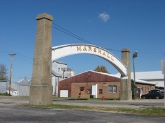 | Arch in the Town of Marshall | structure | 1985 | 85003127 |
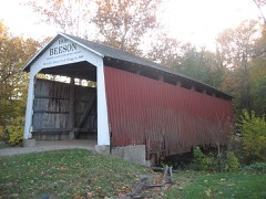 | Beeson Bridge | structure | 1978 | 78003447 |
 | Big Rocky Fork Bridge | structure | 1978 | 78000383 |
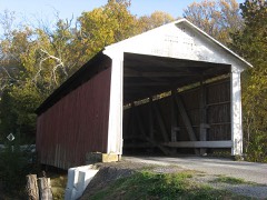 | Billie Creek Bridge | structure | 1978 | 78000384 |
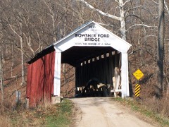 | Bowsher Ford Bridge | structure | 1978 | 78000385 |
 | Bridgeton Bridge | structure | 1978 | 78000386 |
| Bridgeton Historic District | district | 1992 | 92001167 | |
 | Catlin Bridge | structure | 1978 | 78000387 |
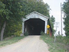 | Conley's Ford Bridge | structure | 1978 | 78000388 |
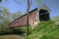 | Cox Ford Bridge | structure | 1978 | 78000390 |
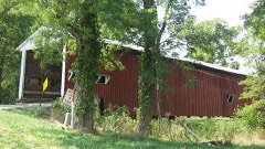 | Crooks Bridge | structure | 1978 | 78000391 |
| William E. and Carolyn Davis House | building | 2022 | 100007446 | |
 | Lancelot C. Ewbank House | building | 1988 | 88001578 |
 | Joseph Finney House | building | 2002 | 02001564 |
| William B. & Laura Guthrie House | building | 2020 | 100005041 | |
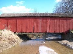 | Harry Evans Bridge | structure | 1978 | 78000392 |
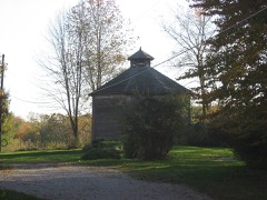 | William Hill Polygonal Barn | building | 1993 | 93000186 |
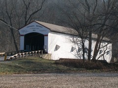 | Jackson Bridge | structure | 1978 | 78000393 |
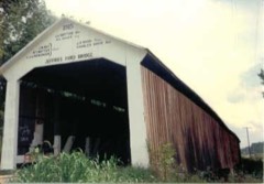 | Jeffries Ford Bridge | structure | 1978 | 78000394 |
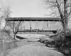 | Leatherwood Station Bridge | structure | 1978 | 78000397 |
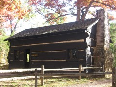 | Richard Lieber Log Cabin | building | 2001 | 01000403 |
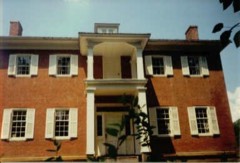 | Lusk Home and Mill Site | site | 1974 | 74000017 |
 | Mansfield Bridge | structure | 1978 | 78000399 |
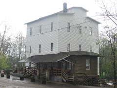 | Mansfield Roller Mill | building | 1990 | 90001788 |
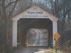 | Marshall Bridge | structure | 1978 | 78000400 |
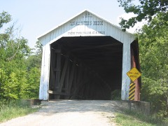 | McAllister Bridge | structure | 1978 | 78000398 |
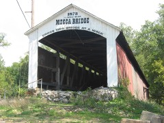 | Mecca Bridge | structure | 1978 | 78000401 |
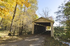 | Melcher Bridge | structure | 1978 | 78000402 |
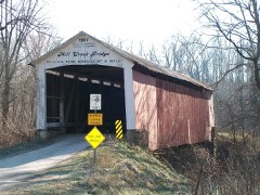 | Mill Creek Bridge | structure | 1978 | 78000403 |
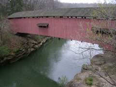 | Narrows Bridge | structure | 1978 | 78000404 |
 | Neet Bridge | structure | 1978 | 78000405 |
 | Nevins Bridge | structure | 1978 | 78000406 |
 | Phillips Bridge | structure | 1978 | 78000407 |
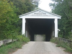 | Portland Mills Bridge | structure | 1978 | 78000408 |
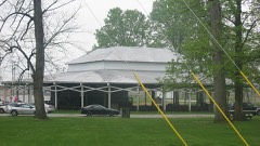 | Rockville Chautauqua Pavilion | building | 1999 | 99000301 |
 | Rockville Historic District | district | 1993 | 93000471 |
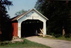 | Roseville Bridge | structure | 1978 | 78000409 |
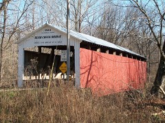 | Rush Creek Bridge | structure | 1978 | 78000410 |
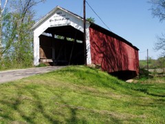 | Sim Smith Bridge | structure | 1978 | 78000411 |
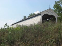 | State Sanitorium Bridge | structure | 1978 | 78000412 |
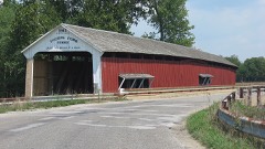 | Thorpe Ford Bridge | structure | 1978 | 78000413 |
 | Turkey Run State Park | district | 2019 | 100003505 |
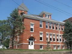 | Wabash Township Graded School | building | 1987 | 87000950 |
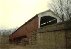 | West Union Bridge | structure | 78000414 | |
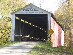 | Wilkins Mill Bridge | structure | 1978 | 78000415 |
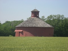 | W. H. York Round Barn | building | 1993 | 93000949 |
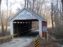 | Zacke Cox Bridge | structure | 1978 | 78000416 |
The NOAA Storm Events Database holds 266 reports for this county, causing no deaths, 4 injuries and about $3,028,530 in recorded property damage. Each settlement page carries the reports that name it.
| Kind of event | Reports |
|---|---|
| Thunderstorm Wind | 133 |
| Hail | 50 |
| Flood | 46 |
| Flash Flood | 22 |
| Tornado | 14 |
| Lightning | 1 |
The most serious of them, by death, then injury, then recorded damage. The accounts are quoted exactly as the forecast office filed them.
| When | Event | Place named | Harm | What the report says |
|---|---|---|---|---|
| August 2005 | Lightning | Annapolis | 2 hurt | Two men fishing in a canoe on Sugar Creek were struck by lightning. Both were injured, one of them seriously. The seriously injured man required cardiopulmonary resuscitation. |
| May 2005 | Thunderstorm Wind | Rosedale | 1 hurt, $10,000 | Trees were snapped off on County Road 900 South between Lyford and Rosedale. The limbs fell on a vehicle, causing damage and an injury. Damage numbers are estimated. |
| May 1989 | Thunderstorm Wind | not stated | 1 hurt | no account filed |
| July 2003 | Thunderstorm Wind | Rosedale | $1,000,000 | Newspaper reported damage to more than 400 structures. 30-40% of the homes had moderate to severe damage. |
| March 2025 | Tornado (EF1) | Mecca | $350,000 | The tornado began just west of Mecca with sporadic tree damage that continued north of West Pence Street. The tornado crossed Coxville Road before tracking mostly through rural woods and farmland west of McAdams Road. The worst damage occurred where the circulation tracked roughly parallel to McAdams Road towards County Road West 100 South where a small garage was completely destroyed and a 150 year old barn was mostly destroyed. The tornado centerline was just to the west of residences along McAdams Road. Several other residences nearby had tree and pole barn damage. The tornado then moved into farmland before dissipating just north of County Road West 100 South. Maximum winds were estimated at 110 mph. |
| April 1963 | Tornado (F3) | not stated | $250,000 | no account filed |
| April 2025 | Tornado (EF1) | Numa | $200,000 | This second tornado to impact central Indiana began in a rural field just east of the Numa community. High end EF1 damage was caused to a home and two other buildings along West County Road 900 South where tree damage also occurred. Damage was scattered to the northeast, east, and southeast. The tornado continued northeast passing south of Coxville and then south of Catlin. Only tree damage occurred across these rural areas. The funnel was likely skipping for last few miles before lifting, which confined much of the damage to tree tops. Peak wind gusts were 105 mph. |
| June 2023 | Thunderstorm Wind | Rockville | $150,000 | Numerous trees downed by thunderstorm wind gusts on roads including including US 36 and IN 59. Over 4500 power outages caused by the storm. |
| April 2026 | Thunderstorm Wind | Bridgeton | $125,000 | Thunderstorm straight line winds damaged a garage in the Bridgeton community and a small barn and large shed on Mansfield Road, with a couple trees onto houses, and Indiana Route 59 closed from downed trees and power poles. |
| April 2026 | Tornado (EF0) | Ferndale | $100,000 | A very brief EF-0 tornado dropped from locally lower ceilings within a bookend vortex embedded in the QLCS near Cecil Harden Lake, 1.3 miles southeast of the Hollandsburg community. The bookend vortex crossed the lake, spawning the weak spin-up one-quarter mile south of the lake's southeastern shoreline; along its 900-foot track, the tornado then crossed residential roads East Mallard Drive and South Ebert Drive, before ending 400 feet south of the lake's shore.||Drone imagery showed clear convergence of downed trees in a grove between Meadows Lane and Mallard Drive; 30 to 40 additional trees were either uprooted or snapped along the path. Incident structural damage was limited to minor siding loss. The tornado's damage was mainly vegetation, with peak ind gusts of 85 mph for the event. |
| March 2006 | Flood | Montezuma | $100,000 | no account filed |
| October 2001 | Thunderstorm Wind | Lodi | $100,000 | no account filed |
| April 2026 | Thunderstorm Wind | Ferndale | $50,000 | Thunderstorm locally-enhanced straight line winds occurred several miles upstream and downstream of the tornado, downing a tree and damaging a barn among other damage. |
| April 2025 | Flash Flood | Mecca | $50,000 | Several roads closed due to water flowing over them within the town of Rockville. Total rainfall was around 2.1 inches. |
| April 2011 | Tornado (EF1) | Waterman | $25,000 | An EF-1 tornado touched down at 9:10PM EDT in central Vermillion County and traveled northeast through northwest Parke, southeast Fountain, and west-central Montgomery Counties. This tornado formed 2.72 miles southwest of Cayuga and tracked northeast for approximately 4 miles before exiting Vermillion County about 2.36 miles east, southeast of Cayuga at 9:16PM EDT. The tornado continued northeast into Parke County, around 1.51 miles west of Waterman, for another 8.6 miles before leaving the county 3.53 miles northeast of Sylvania at 9:22PM EDT. The tornado continued northeast into Fountain County, around 1.69 miles east, southeast of Kingman, for another 9.3 miles before pushing into Montgomery County at 9:32PM EDT, 2.75 miles northwest of Alamo, for another 9.23 miles and dissipating about 1.89 miles northwest of Crawfordsville at 9:40PM EDT. Multiple trees and power lines were reported down along the path, as well as siding and shingles ripped off homes. A shed was destroyed in Vermillion County and another structure sustained damage in Parke County. The tornado was rated an EF-1 along most of its path, except in Montgomery County where EF-0 damage was found. The maximum width along the path was 100 yards. |
| July 2004 | Thunderstorm Wind | Montezuma | $25,000 | no account filed |
| May 2002 | Flash Flood | Bloomingdale | $25,000 | no account filed |
| March 1971 | Tornado (F0) | not stated | $25,000 | no account filed |
| March 2022 | Thunderstorm Wind | Annapolis | $20,000 | Thunderstorm winds downed trees and power lines across the northern part of Parke County. |
| April 2018 | Flash Flood | Rockville | $20,000 | Numerous roads were closed due to flooding across the county from heavy thunderstorm rainfall. Flash flooding washed out several rural roads with debris left behind. |
| January 2008 | Flood | Montezuma | $20,000 | Flooding occurred along the Wabash River in Parke County, including near Montezuma, due to heavy rain and snow melt. |
| January 2008 | Flood | Lyford | $20,000 | Flooding occurred along the Wabash River in Parke County, including west of Hudunt, due to heavy rain and snow melt. |
| June 2008 | Flash Flood | Mecca | $20,000 | Flash flooding caused damaged to roadways. The local tavern in Mecca was flooded. |
| August 2000 | Thunderstorm Wind | Rockville | $20,000 | no account filed |
| February 2008 | Flood | Montezuma | $15,000 | Flooding occurred along the Wabash River in Parke County, including near Montezuma, due to heavy rain and snow melt. |
| February 2008 | Flood | Hudnut | $15,000 | Flooding occurred along the Wabash River in southwestern Parke County due to heavy rain and snow melt. |
| March 2008 | Flood | Montezuma | $15,000 | Flooding occurred along the Wabash River in Parke County, including near Montezuma, due to heavy rain and snow melt. Flooding continued into April until the morning of April 9th at 00:30. |
| February 2008 | Flash Flood | Hudnut | $12,000 | Heavy rain in Parke County caused several road closings throughout the county, but especially near Mecca. Near Mecca a vehicle along with the occupants had to be pulled from the water on Wabash street by the fire department after attempting to cross the flooded area. |
| June 2024 | Thunderstorm Wind | Milligan | $10,000 | Thunderstorm winds downed several trees across northeastern Parke County. |
| August 2023 | Flood | Mecca | $10,000 | Thunderstorms produced 4.00 to 5.00 inches of heavy rain in less than 3 hours over a small portion of Parke County in Mecca and south-southeast towards Rosedale. Water came into the basement of a home, which had not happened before. |
| April 2015 | Flash Flood | Mecca | $10,000 | Flood damage to a couple of trailers in the town of Mecca due to thunderstorm heavy rainfall. Parke county emergency management estimated the damage at $10,000. |
| February 2011 | Thunderstorm Wind | Montezuma | $10,000 | A farmer's large sprinkler system was blown over due to damaging thunderstorm wind gusts. |
| June 2010 | Thunderstorm Wind | Annapolis | $10,000 | Scattered trees were reported down near the intersection of US Highway 41 and State Route 47. |
| May 2009 | Flash Flood | Rosedale | $10,000 | Slow moving thunderstorm produced nearly 3 inches of rain over parts of Parke County. The county highway department reported that a culvert was washed out along Rosendale-Catlin Road south of Jessup. A trained spotter reported 3 inches of rain in one hour with these storms. |
| February 2007 | Flood | Montezuma | $10,000 | The Wabash River flooded in Parke County. The river remained in flood into March. Crests were over 7 feet above flood stage. |
| March 2007 | Flood | Montezuma | $10,000 | The Wabash River in Parke County remained above flood stage from February through all of March. Crests were 10 feet above flood stage. |
| January 2007 | Flood | Montezuma | $10,000 | The Wabash River in Parke County remained high through most of January. Crests were as high as 12 feet above flood stage. |
| May 2000 | Thunderstorm Wind | Mecca | $10,000 | no account filed |
| June 2018 | Thunderstorm Wind | Marshall | $8,000 | Trees were down across roads around a neighborhood in this location due to damaging thunderstorm wind gusts. The power was out as well. |
| June 2011 | Thunderstorm Wind | Hudnut | $7,500 | Damaging thunderstorm winds gusted to near 70 mph several times during a 10 minute period. Trees and limbs were downed as well. |
| June 2009 | Thunderstorm Wind | Mecca | $7,000 | Trees and power lines were blown down due to thunderstorm wind gusts. |
| May 2019 | Thunderstorm Wind | Marshall | $6,000 | Several trees were downed on roads near Marshall due to damaging thunderstorm wind gusts. |
| December 2021 | Thunderstorm Wind | Rockville | $5,000 | Numerous trees down by thunderstorm wind gusts across Parke County. |
| July 2020 | Thunderstorm Wind | Rosedale | $5,000 | Trees downed due to thunderstorm wind gusts across the southern portions of Parke County with the majority near Rosedale. |
| July 2019 | Thunderstorm Wind | Vivalia | $5,000 | One or more trees were down and blocking a road due to damaging thunderstorm wind gusts. |
| July 2013 | Thunderstorm Wind | Mecca | $5,000 | Trees were reported down across the southern part of the county due to damaging thunderstorm wind gusts. |
| July 2013 | Thunderstorm Wind | Mecca | $5,000 | Numerous trees were reported down along Highway 41 and in the southern end of the county from Rockville southward due to damaging thunderstorm wind gusts. |
| August 2009 | Thunderstorm Wind | Catlin | $5,000 | Trees were reported down in this location due to thunderstorm wind gusts. |
| April 2008 | Flood | Montezuma | $5,000 | Flooding occurred along the Wabash River, including near Montezuma, due to heavy rain. |
| May 2008 | Flood | Montezuma | $5,000 | Flooding occurred along the Wabash River in Parke County, including near Montezuma, due to heavy rain. Flooding continued until June 16th at 0720. |
| May 2008 | Flood | Montezuma | $5,000 | Flooding occurred along the Wabash River in Parke County, including near Montezuma, due to heavy rain. |
| April 2007 | Flood | Montezuma | $5,000 | Flooding returned to the Wabash River in Parke County during late April. The crest reached two and a half feet above flood stage. |
| April 2006 | Thunderstorm Wind | Mansfield | $5,000 | The 139-year-old Mansfield Covered Bridge was damaged when straight line winds blew off 160 feet of the 247-foot span's metal roof. |
| December 2006 | Flood | Montezuma | $5,000 | The Wabash River flooded in Parke County. Water remained high into January. |
| December 2006 | Flood | Montezuma | $5,000 | The Wabash River flooded in Parke County. The river crested at over six feet above flood stage. |
| June 1998 | Thunderstorm Wind | Countywide | $5,000 | no account filed |
| May 1996 | Thunderstorm Wind | Terre Haute | $5,000 | no account filed |
| August 1993 | Thunderstorm Wind | not stated | $5,000 | no account filed |
| July 2013 | Thunderstorm Wind | Annapolis | $4,000 | Trees were reported down near the intersection of Highways 41 and 47 in northeast Parke County due to damaging thunderstorm wind gusts. |
| June 2025 | Thunderstorm Wind | Montezuma | $3,000 | Thunderstorm wind gusts downed a 10 to 15-inch diameter tree limb onto house. |
The Survey's mineral resources record lists 8 workings inside this county. 5 still produce and 3 are closed or unrecorded. Each settlement page carries the workings within five miles of it.
| Commodity | Workings |
|---|---|
| Sand and Gravel, Construction | 5 |
| Clay | 2 |
| Stone, Clay | 1 |
The least common of them first, because a county's hundredth gravel pit says nothing its first ten did not.
| Where | Site | Commodity | Status | Recorded |
|---|---|---|---|---|
| Dee Clay Pit | Stone, Clay | Producer | ||
| Dee Clay Products Company, Inc. | Clay | Producer | ||
| S.L. Turner Clay Pit | Clay | Past Producer | ||
| H & H Pit and Dredge | Sand and Gravel, Construction | Past Producer | ||
| Montezuma Gravel | Sand and Gravel, Construction | Producer | ||
| Parke Co. Hwy. Dept. | Sand and Gravel, Construction | Producer | ||
| Parke County Pit | Sand and Gravel, Construction | Past Producer | ||
| W.C. Hargis Pit | Sand and Gravel, Construction | Producer |
Named settlements recorded in the Geographic Names Information System, each with the topographic sheets covering it. Villages, hamlets and abandoned places alike. Each is shown with the nearest named watercourse or landform and the survey quadrangle it falls on.
Wabash township · 47862 · On Leatherwood Creek · Montezuma quadrangle
13 sheets, 1953 to 1986
Raccoon township · 47836 · Near Pleasant Valley · Catlin quadrangle
14 sheets, 1952 to 1986
Union township · 47872 · On Limestone Branch · Mansfield quadrangle
16 sheets, 1951 to 1986
Sugar Creek township · 47859 · On Panther Creek · Wallace quadrangle
15 sheets, 1948 to 1986
Union township · 47872 · On Troutman Branch · Bellmore quadrangle
13 sheets, 1953 to 1986
Washington township · 47872 · On Springdale Run · Rockville quadrangle
14 sheets, 1953 to 1986
Sugar Creek township · 47859 · On Wapalo Creek · Wallace quadrangle
15 sheets, 1948 to 1986
No longer a settlement
Union township · 47872 · On Troutman Branch · Mansfield quadrangle
16 sheets, 1951 to 1986
Jackson township · 47872 · On Rocky Fork Creek · Mansfield quadrangle
16 sheets, 1951 to 1986
Reserve township · 47862 · On Rocky Run · Montezuma quadrangle
13 sheets, 1953 to 1986
No longer a settlement
Washington township · 47872 · On Rays Branch · Rockville quadrangle
14 sheets, 1953 to 1986
Washington township · 47872 · On Springdale Run · Rockville quadrangle
14 sheets, 1953 to 1986
Penn township · 47832 · On Cat Creek · Montezuma quadrangle
13 sheets, 1953 to 1986
No longer a settlement
Liberty township · 47952 · On East Fork Rush Creek · Kingman quadrangle
13 sheets, 1953 to 1986
Liberty township · 47952 · On East Fork Rush Creek · Kingman quadrangle
13 sheets, 1953 to 1986
Raccoon township · On Strange Branch · Catlin quadrangle
14 sheets, 1952 to 1986
No longer a settlement
The vanished settlements of Parke County: the places named above that are no longer on the map.