 Block
Albion, Indiana
11 topographic sheets cover this place, the earliest surveyed in 1953 and the latest in 1994. It stands in Albion Township. It lies in ZIP code area 46701. The Survey maps it on the Albion quadrangle. 2,222 people lived here at the 2020 count. It stands 955 feet above sea level.
Research this city
On record in Albion
Buildings and businesses the archive holds for this place. Each opens its own page, with the source record it came from.
On the National Register 4 records
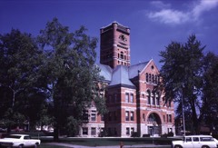 Albion Courthouse Square Historic Districtlisted 2013
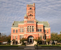 Noble County Courthouselisted 1981
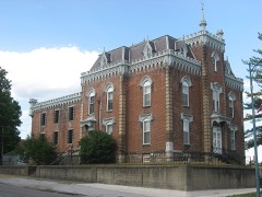 Noble County Sheriff's House and Jaillisted 1982
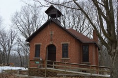 Stanley School-District No. 2listed 2014
Population over time
2 figuresAlbion fell from 2,349 to 2,222 between 2010 and 2020. These are the recorded population figures Wikidata holds for this place, reached through the Geographic Names Information System number this page is keyed on rather than by name, so they belong to this place and not to another of the same name. Most are census counts, but not all are: an early figure may be a founding or settlement estimate, and an estimate published within five years of a census is left out. The change column is computed, and is left blank where more than 20 years separate a figure from the one before it, because a gap that long is not a change between two counts.
| Year | People | Change |
|---|---|---|
| 2010 | 2,349 | |
| 2020 | 2,222 | -127 (-5%) |
Topographic sheets covering this place
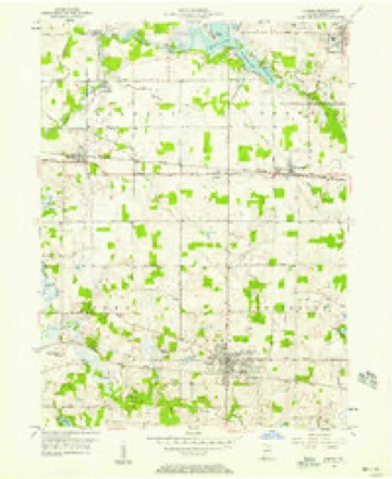
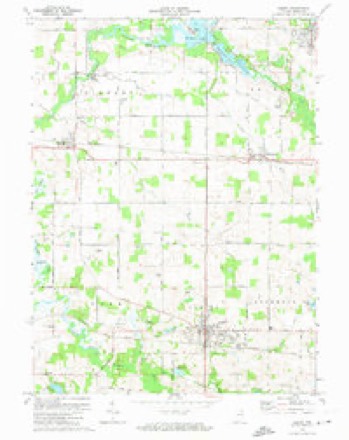
6 surveys from 11 printed sheetsMatched by testing this settlement's coordinate against the published boundary of every sheet in the United States Geological Survey's historical collection. Each opens the scanned sheet at the Survey.
- 1953 USGS Fort Wayne quadrangle1:250000, 4 printings
- 1956 USGS Albion quadrangle1:24000, 2 printings
- 1956 USGS Fort Wayne quadrangle1:250000, 2 printings
- 1973 USGS Albion quadrangle1:24000
- 1984 USGS Fort Wayne quadrangle1:100000
- 1994 USGS Fort Wayne quadrangle1:100000




In the county-history sources
2,078 words on this townshipPopular History of Noble County Capitals and Greater Albion : Growth, Resources, Surroundings, Facilities and Industrial Opportunities, Interesting Sketches and Reminiscences, with a Business and Professional Guide, published 1908 names this settlement in its chapter on Albion Township. These are the passages that mention it, exactly as the scans read.
Abstracting of land titles has undergone a great change in the last few years and instead of being a mere business it is now ranked with the professions. A man to be successful in abstract work should be a real estate lawyer, an expert accountant, a surveyor, a geographer, a historian and a student of human nature.
Passage source: Popular History of Noble County Capitals and Greater Albion : Growth, Resources, Surroundings, Facilities and Industrial Opportunities, Interesting Sketches and Reminiscences, with a Business and Professional Guide, published 1908.
Our work comprises the best structures in city and country. Our references are Albion, KimmeH and elsewhere in the rural districts. We take pleasure in referring you among many others to J. C. Cleland, whose farm residence is shown on page 66 of this book. Modern and architectural adornments, both residences and barn, put up in substantial form, at reasonable prices for first-class work.
Passage source: Popular History of Noble County Capitals and Greater Albion : Growth, Resources, Surroundings, Facilities and Industrial Opportunities, Interesting Sketches and Reminiscences, with a Business and Professional Guide, published 1908.
JAMES J. LASH came to Kendallville, Noble County, Indiana, in the year 1848, served four years in the U. S. Army during the late Rebellion, 1861-5; held the office of Postmaster at Kendall ville, three years from 1866-9, being removed for political reasons; held the County Treasurers office four years, 1871-5; was the founder and proprietor of the "Albion Democrat" five years, 1882-7; held the County Recorder's office four years, 1881-5, and has been in the Abstract business for over 25 years.
Passage source: Popular History of Noble County Capitals and Greater Albion : Growth, Resources, Surroundings, Facilities and Industrial Opportunities, Interesting Sketches and Reminiscences, with a Business and Professional Guide, published 1908.
Machine-read from a century-old scan, so expect the errors a machine makes: misspelled names, dropped words, stray characters.
Read the whole chapter on Albion Township - it names this place 12 more 12 times.
Mines and quarries near this place
1 within 5 milesRegional context, not property-specific evidence. The federal mineral resources record lists 1 working within 5 miles of Albion: 1 producer. All of them still produce. What was taken out: Sand and Gravel, Construction. Distance is straight-line from the map coordinates, so a quarry counted here may appear on a neighbouring settlement's page as well.
| Where | Site | Commodity | Status | Recorded |
|---|---|---|---|---|
| Taggert Sand & Gravel | Sand and Gravel, Construction | Producer |
Storms near this place
41 since 1996Regional context, not property-specific evidence. The National Weather Service names Albion in 41 storm reports between 1996 and 2025: 20 thunderstorm wind, 20 hail, 1 tornado. The reports record 1 injury. Each account below is quoted exactly as the forecast office filed it, from the NOAA Storm Events Database, and each date opens the federal record of that event.
| When | Event | Place named | Harm | What the report says |
|---|---|---|---|---|
| March 2025 | Thunderstorm Wind | Albion | 1 hurt, $15,000 | A mobile home was removed from its foundation. |
| May 2007 | Thunderstorm Wind | Albion | $50,000 | Numerous trees, tree limbs, power lines and poles were blown down in and around Albion. One tree branch fell onto a moving van in the HIdden Diamonds Park in Albion. The driver was not injured. |
| April 1999 | Thunderstorm Wind | Albion | $50,000 | Numerous trees were blown down starting in the town of Albion and continuing along for 5 milesjust south of highway 8. Several homes sustained minor damage. One mobile home 2 miles southeastof Albion was destroyed. Two farmsteads had their grain bins blown down and another farmstead hada barn destroyed by the high winds. |
| June 2010 | Thunderstorm Wind | Albion | $30,000 | A commercial building on the north side of Courthouse Square sustained significant roof damage. |
| March 2025 | Thunderstorm Wind | Albion | $20,000 | Siding and roof damage at the Noble County highway department. |
| June 2006 | Thunderstorm Wind | Albion | $10,000 | Numerous trees and power lines down. |
| June 2006 | Thunderstorm Wind | Albion | $10,000 | Numerous trees and power lines down. |
| May 2024 | Thunderstorm Wind | Albion | $1,000 | Large tree, estimate 1 to 2 feet in diameter, uprooted in Albion. |
| July 2023 | Thunderstorm Wind | Albion | $1,000 | A 12 inch diameter was down on SR 9. |
| March 2016 | Thunderstorm Wind | Albion | - | Emergency management officials reported trees down in Albion, with one onto a mobile home. A mobile home suffered both extensive roof damage as well as being buckled in on the southeast side of the trailer. |
| March 2016 | Tornado (EF1) | Albion | - | Indications of rotation were found on the northwest flank of a swath of microburst winds. The tornado appears to have touched down near a residence on East County Road 400 North, east of North County Road 150 East. A garage and well house suffered some damage. A barn on the northeast corner of the property suffered damage to the sides and roof, with debris being carried up to a half mile to the northeast. As the tornado crossed the road, power poles were snapped. It quickly moved over open fields until encountering a small property where 2 pine trees were snapped about half way up and the entire roof of a log cabin/cottage was picked up and thrown into a wood area to the northeast of the property. A picnic table and swing were thrown to the northwest into trees and another building. The tornado was likely in the process of lifting at this time with all debris left in the woods. No injuries were reported. |
| June 2016 | Thunderstorm Wind | Albion | - | The public reported large tree limb was blown down onto a residence, causing significant damage to a roof. |
| July 2014 | Hail | Albion | - | The public reported dime size hail and a few small tree limbs down on the office Facebook page. |
| November 2013 | Thunderstorm Wind | Albion | - | The public reported several trees down in the area, plus some damage to a local car wash. |
| July 2011 | Thunderstorm Wind | Albion | - | Emergency management officials received reports of trees and power lines down blocking several roads across the county. |
| June 2010 | Thunderstorm Wind | Albion | - | Trees downed all over Albion. One tree fell down on top of a car and trapped an occupant inside. |
| June 2010 | Thunderstorm Wind | Albion | - | Numerous reports of wind damage across the county with trees and power lines down. |
| May 2004 | Thunderstorm Wind | Albion | - | Law enforcement reported trees and power lines down near Albion. |
| June 2001 | Thunderstorm Wind | Albion | - | Trees down. |
| August 2000 | Thunderstorm Wind | Albion | - | Trees and power lines down. |
| July 1998 | Thunderstorm Wind | Albion | - | NUMEROUS TREES DOWN THROUGHOUT COUNTY. |
| May 2018 | Hail | Albion | - | no account filed |
| March 2017 | Hail | Albion | - | no account filed |
| June 2006 | Hail | Albion | - | no account filed |
| June 2006 | Hail | Albion | - | no account filed |
| March 2003 | Hail | Albion | - | no account filed |
| April 2003 | Hail | Albion | - | no account filed |
| March 2003 | Hail | Albion | - | no account filed |
| May 2003 | Hail | Albion | - | no account filed |
| May 2003 | Hail | Albion | - | no account filed |
| May 2003 | Hail | Albion | - | no account filed |
| April 2003 | Hail | Albion | - | no account filed |
| April 2003 | Hail | Albion | - | no account filed |
| August 2001 | Hail | Albion | - | no account filed |
| May 2000 | Hail | Albion | - | no account filed |
| June 2000 | Hail | Albion | - | no account filed |
| April 1999 | Hail | Albion | - | no account filed |
| June 1998 | Hail | Albion | - | no account filed |
| May 1998 | Hail | Albion | - | no account filed |
| May 1998 | Hail | Albion | - | no account filed |
| October 1996 | Thunderstorm Wind | Albion | - | no account filed |
Nearest settlements
The eight closest, with where each one stands in the county. Distances are straight-line, computed from the Geographic Names Information System coordinates.
| Map | Place | Distance | Sheets |
|---|---|---|---|
| Port Mitchell | 2.4 miles | 11 | |
| Bakertown | 4.1 miles | 12 | |
| Brimfield | 4.3 miles | 11 | |
| Burr Oak | 5.0 miles | 11 | |
| Wawaka | 5.2 miles | 11 | |
| Egans Point | 5.3 miles | 12 | |
| Wolflake | 5.6 miles | 11 | |
| Cosperville | 6.4 miles | 11 |
Elsewhere
Matched on this settlement's Geographic Names Information System number rather than its name, so it cannot be a different place of the same name in another state.
| Wikipedia article on Albion | An encyclopaedic summary. Its text is share-alike, so it is linked here rather than copied. |
| Wikidata item Q2278271 | The structured record the population and elevation above come from. Public domain (CC0). |
Provenance
This settlement is recorded in the Geographic Names Information System as feature 430044. The sheet list is computed by point-in-boundary test against the United States Geological Survey's historical topographic inventory. Both are works of the United States government and carry no copyright under 17 U.S.C. 105.
Mines and quarries. USGS Mineral Resources Data System (MRDS) https://mrdata.usgs.gov/mrds/ A work of the United States government, no copyright under 17 U.S.C. 105.
Storms. NOAA National Centers for Environmental Information, Storm Events Database https://www.ncei.noaa.gov/stormevents/ A work of the United States government, no copyright under 17 U.S.C. 105. Narratives are quoted verbatim from the National Weather Service report and are not edited or summarised.