 Block
Alto, Indiana
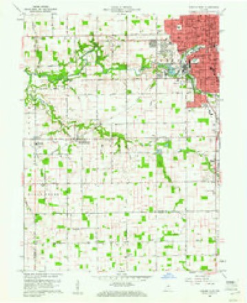
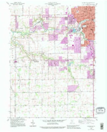
11 topographic sheets cover this place, the earliest surveyed in 1953 and the latest in 1992. It stands in Harrison Township. It lies in ZIP code area 46902. It stands on East Fork Little Wildcat Creek. The Survey maps it on the Kokomo West quadrangle. It stands 840 feet above sea level.
Topographic sheets covering this place
6 surveys from 11 printed sheetsMatched by testing this settlement's coordinate against the published boundary of every sheet in the United States Geological Survey's historical collection. Each opens the scanned sheet at the Survey.
- 1953 USGS Danville quadrangle1:250000, 3 printings
- 1955 USGS Danville quadrangle1:250000
- 1956 USGS Danville quadrangle1:250000
- 1960 USGS Kokomo West quadrangle1:24000, 3 printings
- 1984 USGS Lafayette quadrangle1:100000, 2 printings
- 1992 USGS Kokomo West quadrangle1:24000




In the county-history sources
7,363 words on this townshipCounties of Howard and Tipton, Indiana. Historical and Biographical.., published 1883 names this settlement in its chapter on Harrison Township. These are the passages that mention it, exactly as the scans read.
Harrison Township is situated in the southwestern part of Howard -County, and contains nearly twenty -one and a half sections of land. The surface is somewhat undulating, especially through the central and northern part. Of the Little Wild Cat Creek, the West Fork begins near the Tipton County line in Section 26, flows through Sections 23 and 15 in a northwesterly direction to a point near Greeson's saw mill, south of Alto, where it meets with the East Fork that flows north of west through Sections 24, 13 and 14 to the conjunction. Thence the creek flows north of west through Sections 15, 16, 17, 8 and 7. Along on each side are frequent affluents of small spring branches. The Big Wild Cat forms a part of the northern boundary, flowing in a westward direction in a very irregular manner through Sections 4, 5 and 6. This portion of the " Reserve" was once covered with a very fine growth of maple, white oak, poplar and black walnut, but the woodman's ax has made great inroads in the rich forests. Along the streams there are large deposits of gravel and sand ; and in the southern part of the township a clay forms a subsoil for a rich black loam, thus making it one of the best tracts in Howard County for agricultural purposes. The history of this section extends back over a period of forty-four years, while the organization 6f the township will date back to 1846. It is probable that no histories of this section extend farther back and are any more interesting than those of Judge T. A. Long and James Brooks.
Passage source: Counties of Howard and Tipton, Indiana. Historical and Biographical.., published 1883.
The first saw mill in this township was built in 1846 by John Test on the banks of the Little Wild Cat, on the place formerly owned by A. C. RatcliflF. The mill was afterward owned by the Rels Bros. & Bates, and in 1848 was purchased by Jonathan and Samuel Stratton and Richard Bates, and was traded in 1852 to Isaac Hollingsworth. The Strattons then purchased a small mill down the creek, which had- been recently erected, and this they ran some four years. In 1856, Mr. Samuel Stratton purchased the former site and erected a grist mill in connection with the saw mill. In 1848, Stephen Brooks built a small corn-cracker and wheat mill south of Alto. A part of the frame is yet to be seen ; the bolting box is now being used by Mr. George Greeson as a grain bin. In 1853, the Fred Bros, built a mill on the creek, near where George Greeson's house stands.
Passage source: Counties of Howard and Tipton, Indiana. Historical and Biographical.., published 1883.
Most all the families who settled in the Reserve were those who tenaciously held to the religious dogmas of some sect, and they early felt the need of a place of worship. The pioneers living in the vicinity of Twin Springs started to work at building a large log church house, each member agreeing to furnish so many logs on the ground. When the walls were up ready for the roof, the project was abandoned and a large log church house was erected in Alto, and here the people met for some time and sang their psalms in common meter, unmolested by the savage warwhoop of the dusky denizen of the forest. But a short time after the church at Alto was built, one was erected by the Baptists and Methodists in the west end of the township on Martin Crist's place.
Passage source: Counties of Howard and Tipton, Indiana. Historical and Biographical.., published 1883.
Machine-read from a century-old scan, so expect the errors a machine makes: misspelled names, dropped words, stray characters.
Read the whole chapter on Harrison Township - it names this place 8 more 8 times.
Mines and quarries near this place
5 within 5 milesRegional context, not property-specific evidence. The federal mineral resources record lists 5 workings within 5 miles of Alto: 5 producers. All of them still produce. What was taken out: Sand and Gravel, Construction, Stone, Stone, Crushed/Broken, Fire Clay (Refractory). Distance is straight-line from the map coordinates, so a quarry counted here may appear on a neighbouring settlement's page as well.
| Where | Site | Commodity | Status | Recorded |
|---|---|---|---|---|
| American Standard Plant | Fire Clay (Refractory) | Producer | ||
| Howard Co. Hwy. Dept. | Stone | Producer | ||
| Yeoman Stone Quarry | Stone, Crushed/Broken | Producer | ||
| Kokomo Sand & Gravel | Sand and Gravel, Construction | Producer | ||
| Kyle Gravel Pit | Sand and Gravel, Construction | Producer |
Storms near this place
4 since 2011Regional context, not property-specific evidence. The National Weather Service names Alto in 4 storm reports between 2011 and 2025: 1 hail, 1 tornado, 1 thunderstorm wind, 1 flash flood. No death or injury is recorded in these reports. Each account below is quoted exactly as the forecast office filed it, from the NOAA Storm Events Database, and each date opens the federal record of that event.
| When | Event | Place named | Harm | What the report says |
|---|---|---|---|---|
| June 2025 | Flash Flood | Alto | $150,000 | Flash flooding occurring at multiple points near Wildcat Creek on the southwest side of Kokomo. Several pictures showed standing water up to 3 feet deep near residences along the south side of Kokomo. Total rainfall was as high as 6 inches. |
| August 2016 | Tornado (EF0) | Alto | $15,500 | This EF-0 tornado, with maximum wind speeds of 80 mph, bent a road sign, damaged a billboard, and damaged trees. |
| June 2020 | Thunderstorm Wind | Alto | $250 | A 2 inch tree limb snapped and fell over the road. No other thunderstorm wind damage was noted across the county. |
| June 2011 | Hail | Alto | - | One inch hail was observed in southwest Kokomo at the intersection of Lincoln and Dixon Roads. |
Nearest settlements
The eight closest, with where each one stands in the county. Distances are straight-line, computed from the Geographic Names Information System coordinates.
| Map | Place | Distance | Sheets |
|---|---|---|---|
| Indian Heights | 2.3 miles | 11 | |
| West Middleton | 2.7 miles | 11 | |
| Shambaugh Siding | 3.0 miles | 11 | |
| Oakford | 3.6 miles | 10 | |
| Kokomo | 3.6 miles | 11 | |
| Darrough Chapel | 4.6 miles | 10 | |
| Center | 5.6 miles | 10 | |
| New London | 5.6 miles | 10 |
Elsewhere
Matched on this settlement's Geographic Names Information System number rather than its name, so it cannot be a different place of the same name in another state.
| Wikipedia article on Alto | An encyclopaedic summary. Its text is share-alike, so it is linked here rather than copied. |
| Wikidata item Q4736766 | The structured record the population and elevation above come from. Public domain (CC0). |
Provenance
This settlement is recorded in the Geographic Names Information System as feature 430122. The sheet list is computed by point-in-boundary test against the United States Geological Survey's historical topographic inventory. Both are works of the United States government and carry no copyright under 17 U.S.C. 105.
Mines and quarries. USGS Mineral Resources Data System (MRDS) https://mrdata.usgs.gov/mrds/ A work of the United States government, no copyright under 17 U.S.C. 105.
Storms. NOAA National Centers for Environmental Information, Storm Events Database https://www.ncei.noaa.gov/stormevents/ A work of the United States government, no copyright under 17 U.S.C. 105. Narratives are quoted verbatim from the National Weather Service report and are not edited or summarised.